My Store
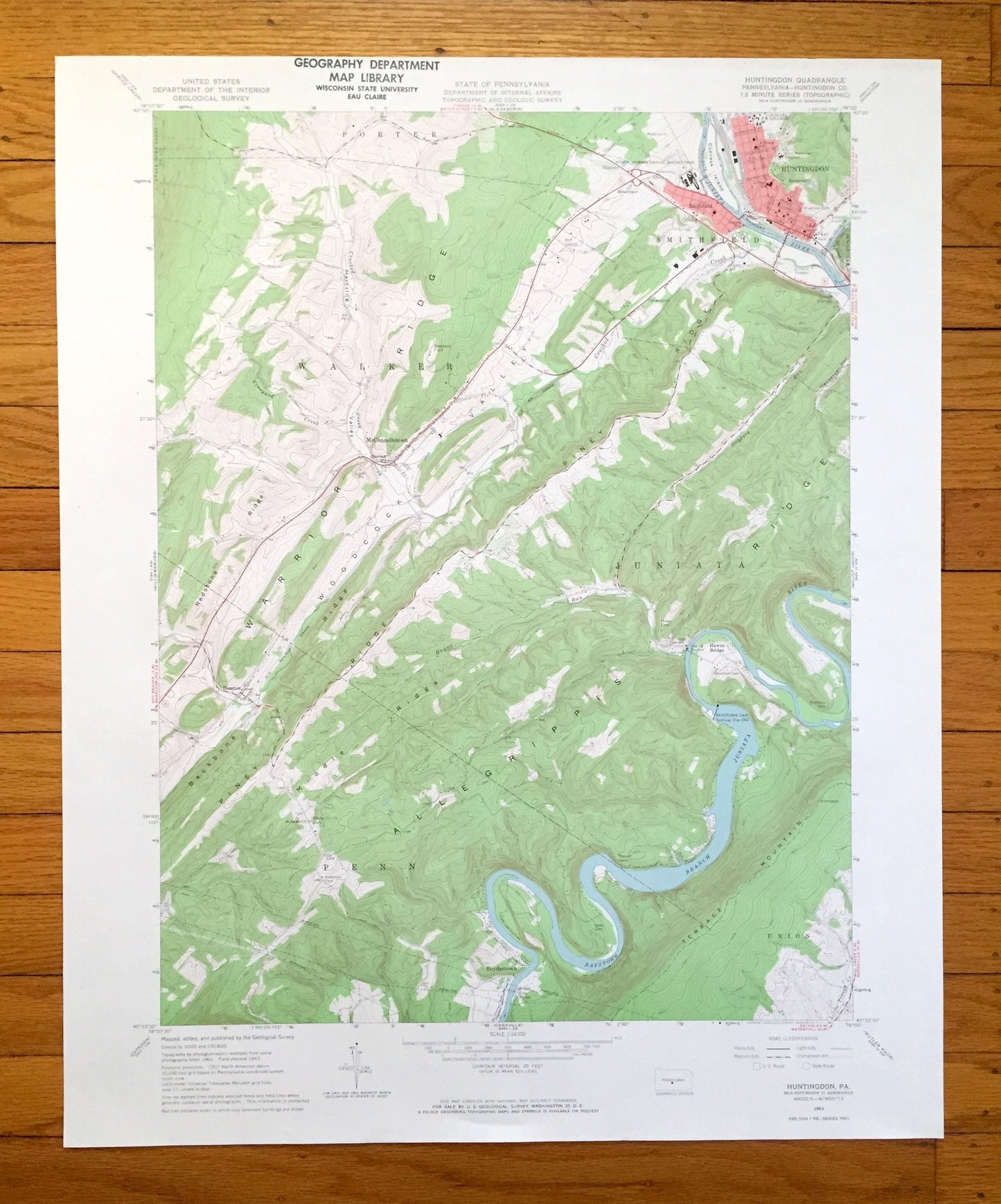
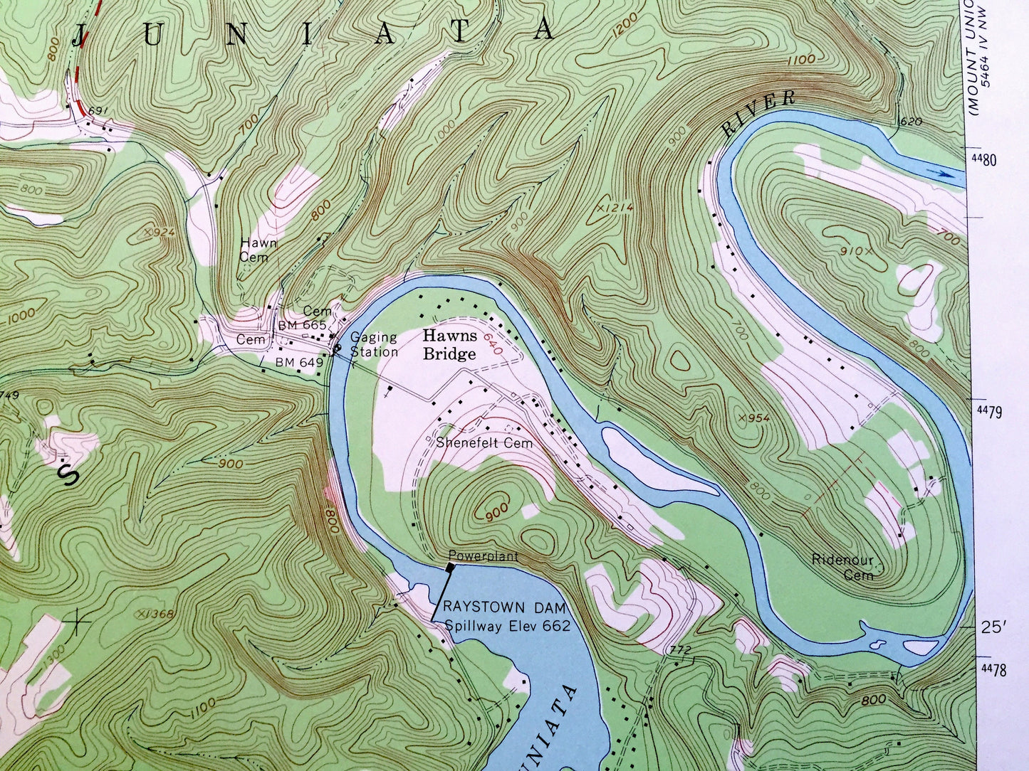
Antique Huntingdon, Pennsylvania 1963 US Geological Survey Topographic Map - Huntingdon County, Porter, Walker, Smithfield, Juniata, PA
Antique Huntingdon, Pennsylvania 1963 US Geological Survey Topographic Map - Huntingdon County, Porter, Walker, Smithfield, Juniata, PA
Beautiful, antique map of Huntingdon, Pennsylvania and surrounding Huntingdon County area. This is an authentic 1963 edition, 1965 print from the U.S. Geological Survey and NOT a computer reproduction.
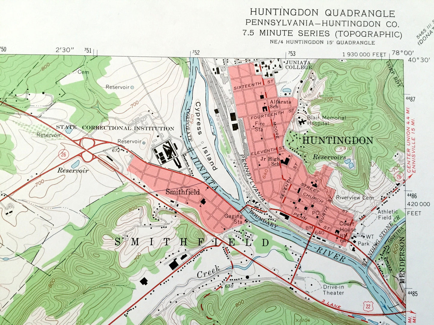
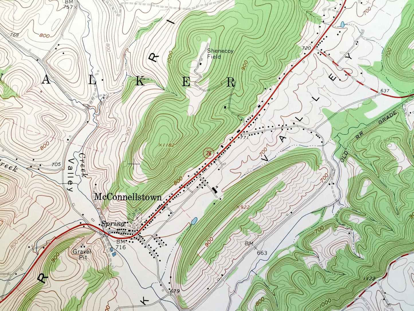
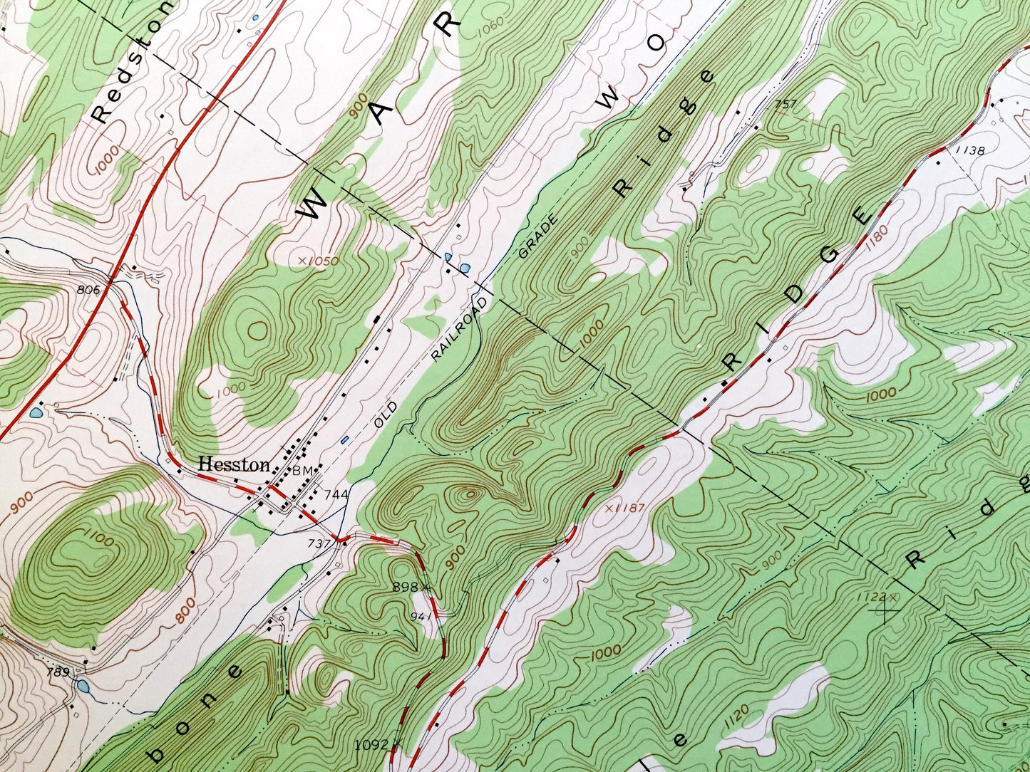
See what Pennsylvania looked like over 55 years ago. Lots of intricate details and geological contours. Map even has little squares for every house that existed at the time. The USGS cartographers were very thorough back then!
Perfect for the historian, map-lover, the curious or just as a conversation starter. Wonderful and rare. Vintage maps such as these make great gifts.
Edition of 1963, printed 1965
Dimensions: 22" width x 27" height
----
Features
Cities & Towns: Porter, Walker, Smithfield, Juniata, Penn, Union, McConnellstown, Hesston, Snydertown, Hawns Bridge, Henderson.
Points of Interest: Juniata College, State Correctional Institution, Blair Memorial Hospital, Shenecoy Field, Raystown Dam, Warrior Ridge, Woodcock Valley, Backbone Ridge, Piney Ridge, Middle Ridge, Allegrippis Ridge, Terrace Mountain, Crooked Creek, Vineyard Creek, Juniata River, Raystown Branch, Juniata River, and many more hills, streams, ponds, houses, schools, railroads, churches and roads.
Condition: Very Good Vintage condition, commensurate with age. This map is in great shape for being over 55 years old. Has light edge-wear but will read as character when framed.
----
We will happily adjust shipping price for multiple purchases. Maps are rolled up and shipped in sturdy mailing tubes, never folded.
Couldn't load pickup availability
Share