My Store
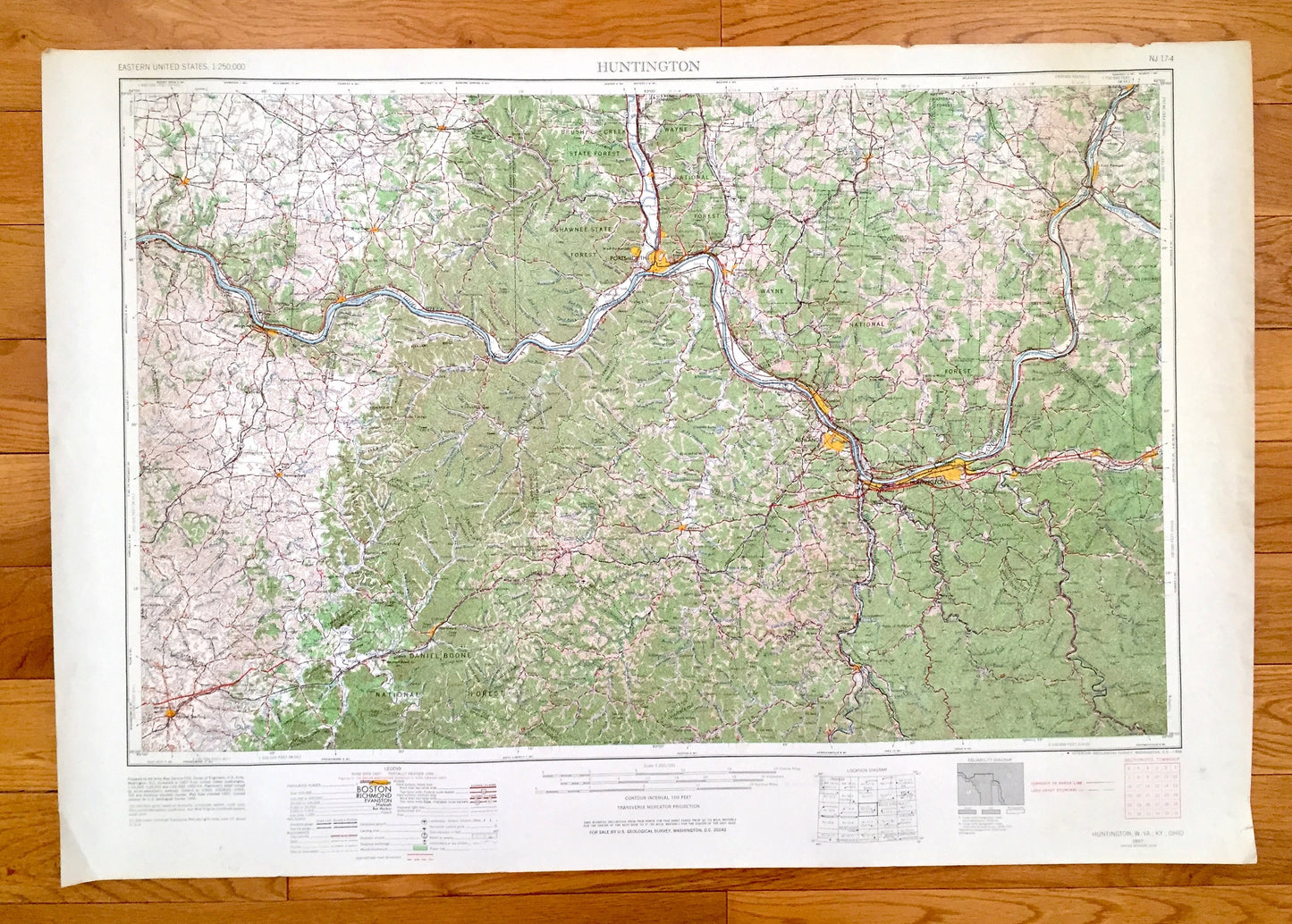
Antique Huntington, West Virginia 1957 US Geological Survey Topographic Map – Barboursville, Kenova, Cerede, Milton, Hurricane Chesapeake WV
Antique Huntington, West Virginia 1957 US Geological Survey Topographic Map – Barboursville, Kenova, Cerede, Milton, Hurricane Chesapeake WV
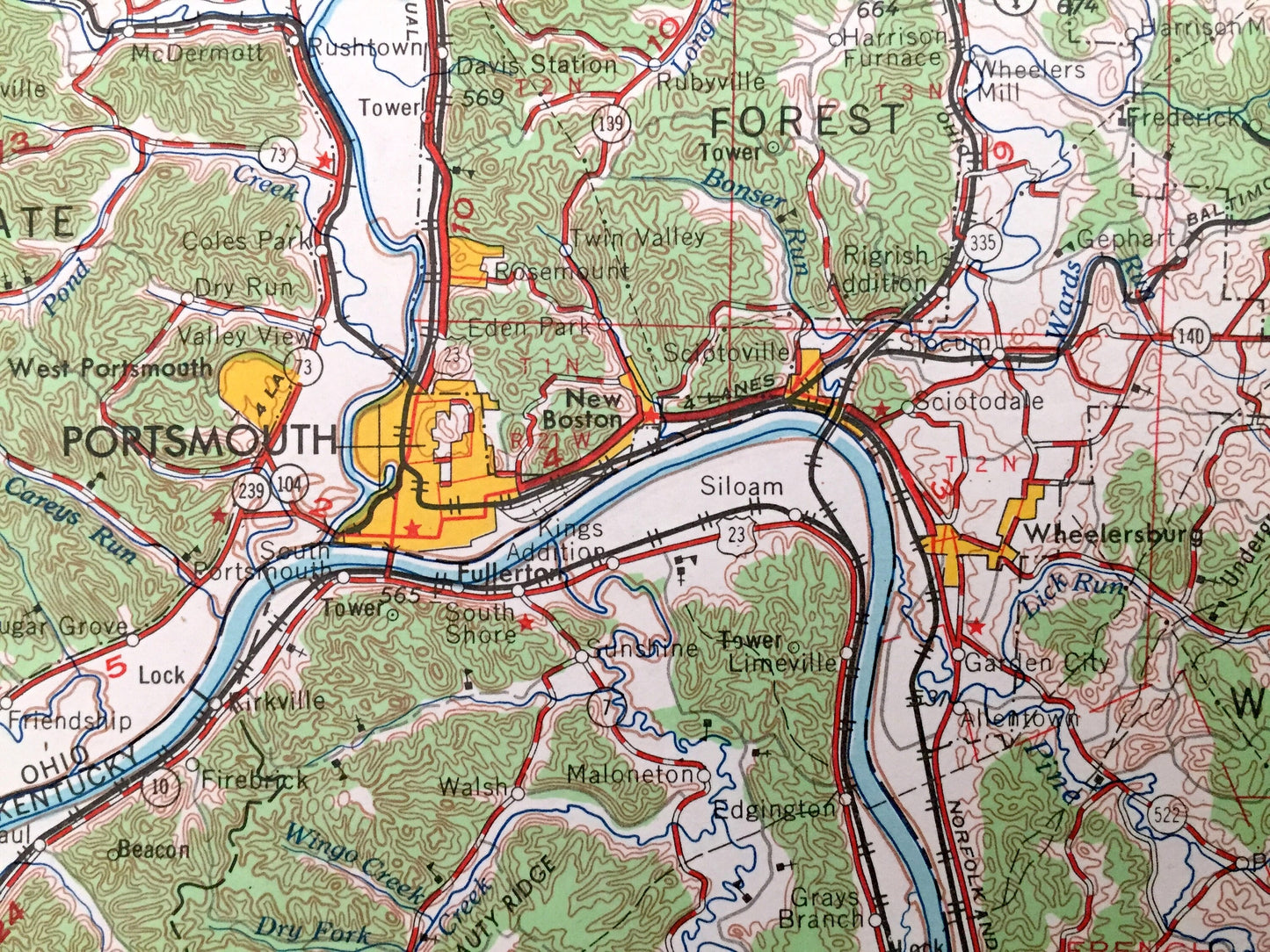
Beautiful, antique map of Huntington, West Virginia and surrounding Kentucky and Ohio areas. This is an authentic 1957 edition, 1966 print from the U.S. Geological Survey and NOT a computer reproduction.
See what West Virginia, Kentucky and Ohio looked like over 60 years ago. Lots of intricate details and geological contours. Map is incredibly large and in the grand 1:250,000 scale. Lots of intricate details and geological contours. The USGS cartographers were very thorough back then!
Perfect for the historian, map-lover, the curious or just as a conversation starter. Wonderful and rare. Vintage maps such as these make great gifts.
Edition of 1957, printed 1966
Dimensions: 32" width x 22 1/2" height
----
Features
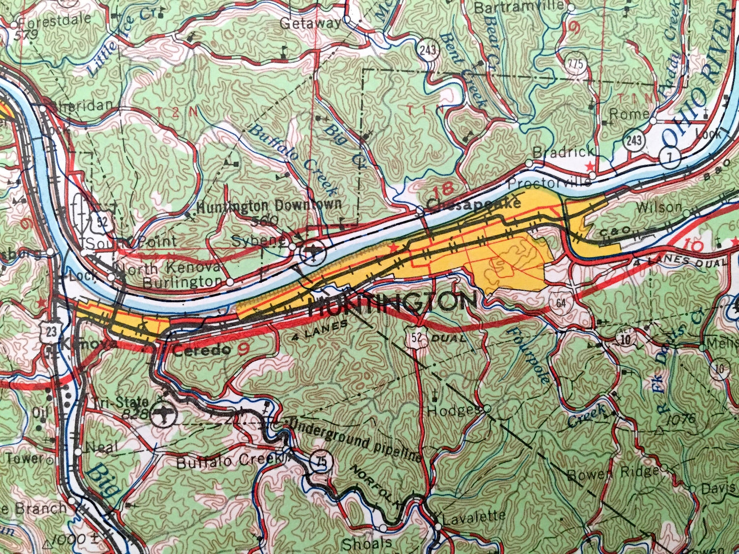
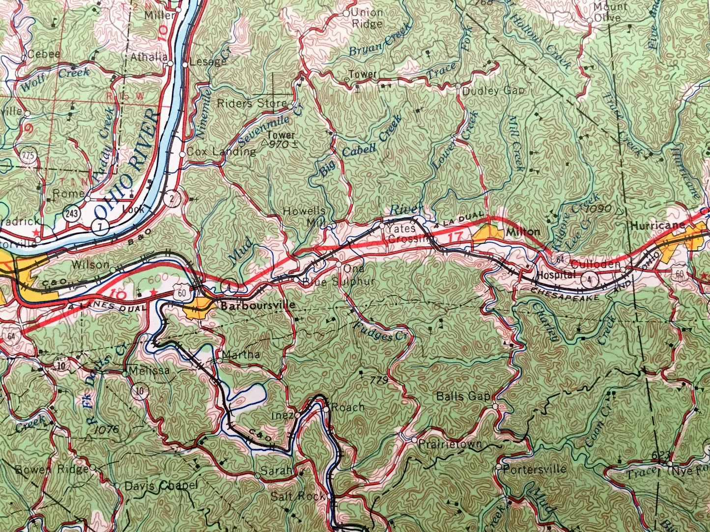
Cities & Towns: WEST VIRGINIA - Huntington, Point Pleasant, Wilson, West Columbia, Crown City, Culloden, Barboursville, Kenova, Cerede, Milton, Hurricane, Chesapeake.
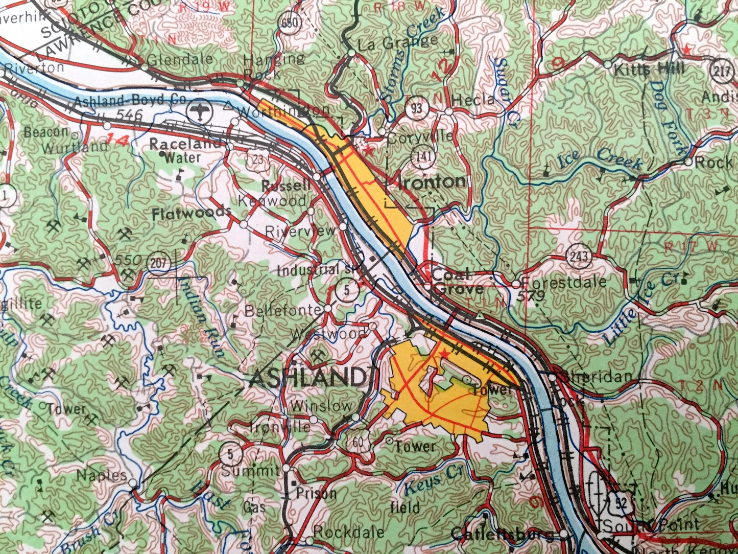
KENTUCKY - Ashland, Flatwoods, Louisa, Maysville, Flemingsburg, Morehead, Mount Sterling, Grayson, Raceland, Russell.
OHIO - Portsmouth, West Portsmouth, Manchester, Georgetown, Peebles, Lucasville, New Boston, Wheelersburg, Ironton, Oak Hill, Gallipolis, Middleport.
Points of Interest: WEST VIRGINIA - Ohio River, Big Sandy River, Guyandotte River, Kanawha River, Mud River, Chief Cornstalk Hunting Ground and lots more hills, mountains, rivers, lakes, creeks, roads, highways and railroads.
KENTUCKY - Ohio River, Big Sandy River, Cumberland National Forest, Pleasant Ridge, Kentucky Ridge, Oldtown Creek and lots more hills, mountains, rivers, lakes, creeks, roads, highways and railroads.
OHIO - Ohio River, Scioto River, Wayne National Forest, Brush Creek State Forest, Shawnee State Forest, Eagle Creek and lots more hills, mountains, rivers, lakes, creeks, roads, highways and railroads.
Condition: Very Good condition, commensurate with age. This map is in incredible shape for being over 50 years old. Has light edge-wear and tears, all of which will read as vintage character when framed.
----
We will happily adjust shipping price for multiple purchases. Maps are rolled up and shipped in sturdy mailing tubes, never folded.
Couldn't load pickup availability
Share