My Store
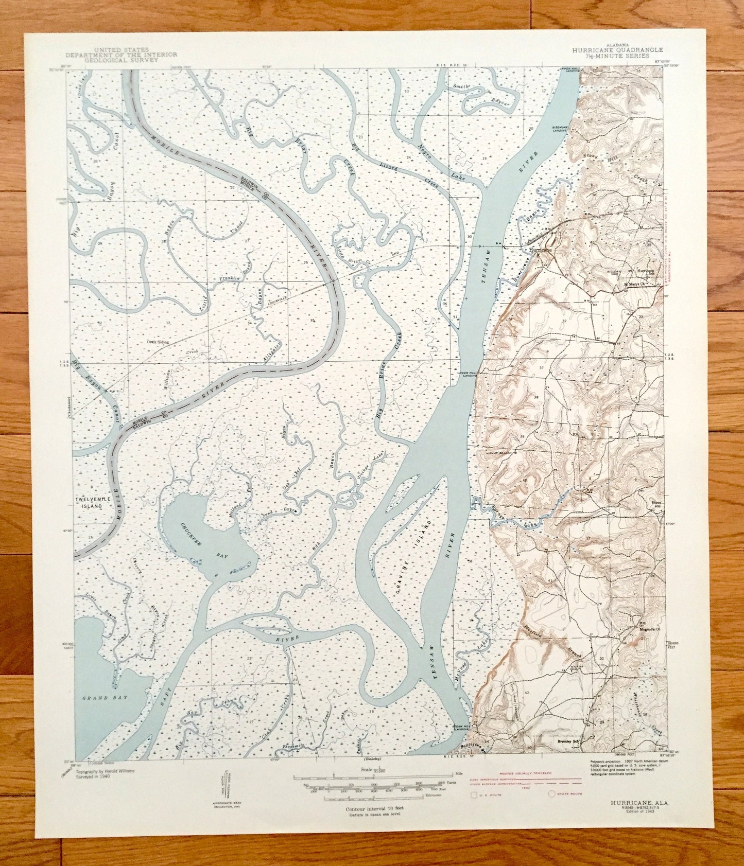
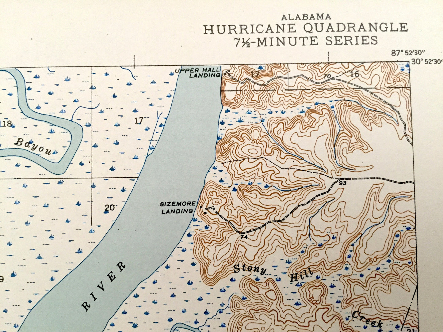
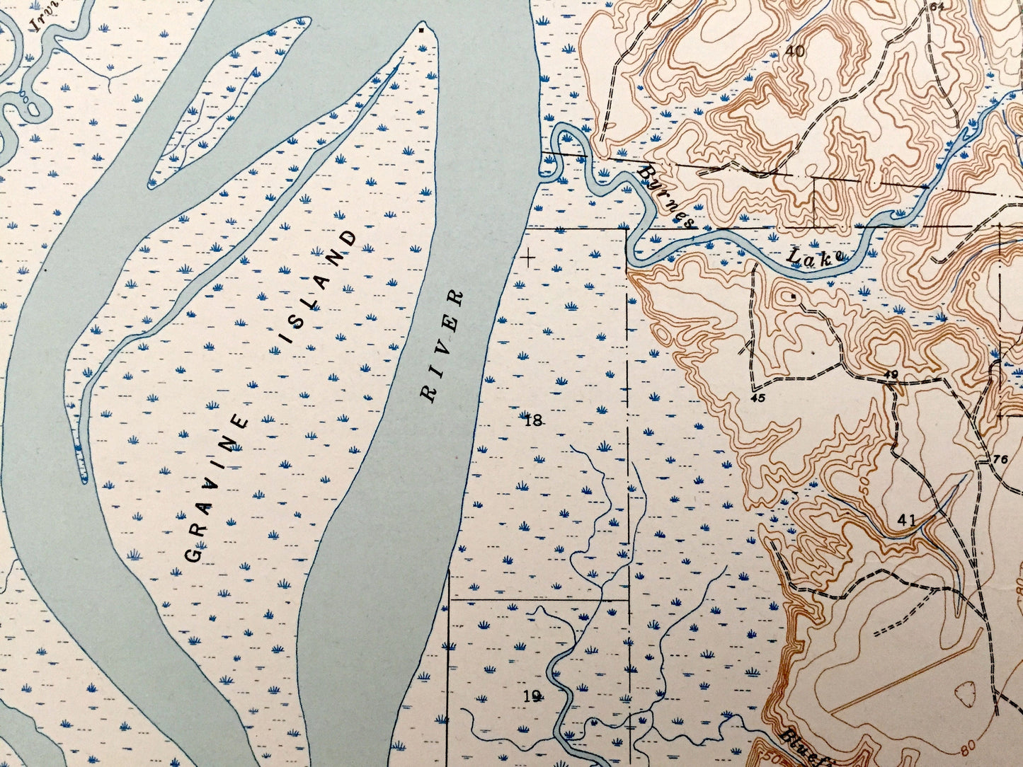
Antique Hurricane, Alabama 1943 US Geological Survey Topographic Map – Baldwin County, Tensaw River, Chuckfee Bay, Mobile River, Grand Bay
Antique Hurricane, Alabama 1943 US Geological Survey Topographic Map – Baldwin County, Tensaw River, Chuckfee Bay, Mobile River, Grand Bay
Beautiful, antique map of Hurricane, Alabama and surrounding Baldwin and Mobile County area. This is an authentic 1943 print from the U.S. Geological Survey and NOT a computer reproduction.
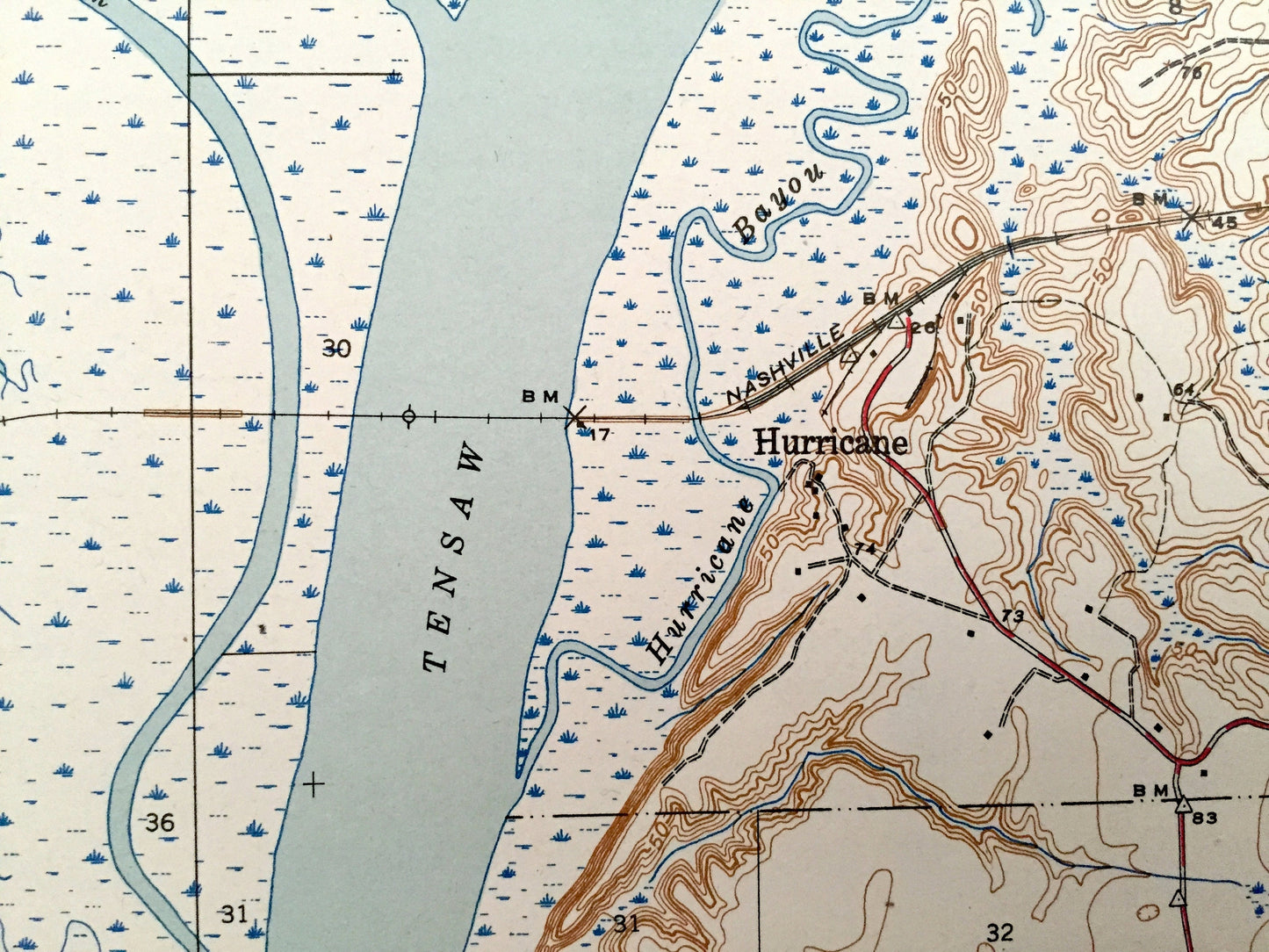
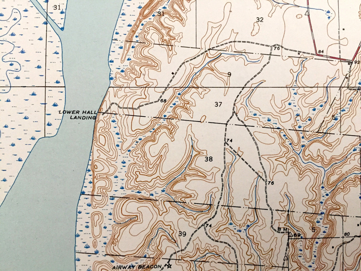
See what Alabama looked like over 80 years ago. Lots of intricate details and geological contours. Map even has little squares for every house that existed at the time. The USGS cartographers were very thorough back then! On the back is a description of topographic symbols and map guide.
Perfect for the historian, map-lover, the curious or just as a conversation starter. Wonderful and rare. Vintage maps such as these make great gifts.
Edition of 1943, printed 1943
Dimensions: 17" width x 20" height
----
Features
Cities & Towns: Hurricane.
Points of Interest: Tensaw River, Twelvemile Island, Mobile River, Big Lizard Creek, Raft River, Chuckfee Bay, Big Bayou Canot, Grand Bay, Big Briar Creek, Gravine Island, Louisville & Nashville Railroad, Stony Hill, Alligator Bayou, Hurricane Bayou, Oak Leaf Bayou, and lots more hills, mountains, creeks, towns, roads and train tracks.
Condition: Very Good Vintage condition, commensurate with age. This map is in great shape for being 80 years old.
----
We will happily adjust shipping price for multiple purchases. Maps are rolled up and shipped in sturdy mailing tubes, never folded.
Couldn't load pickup availability
Share