My Store
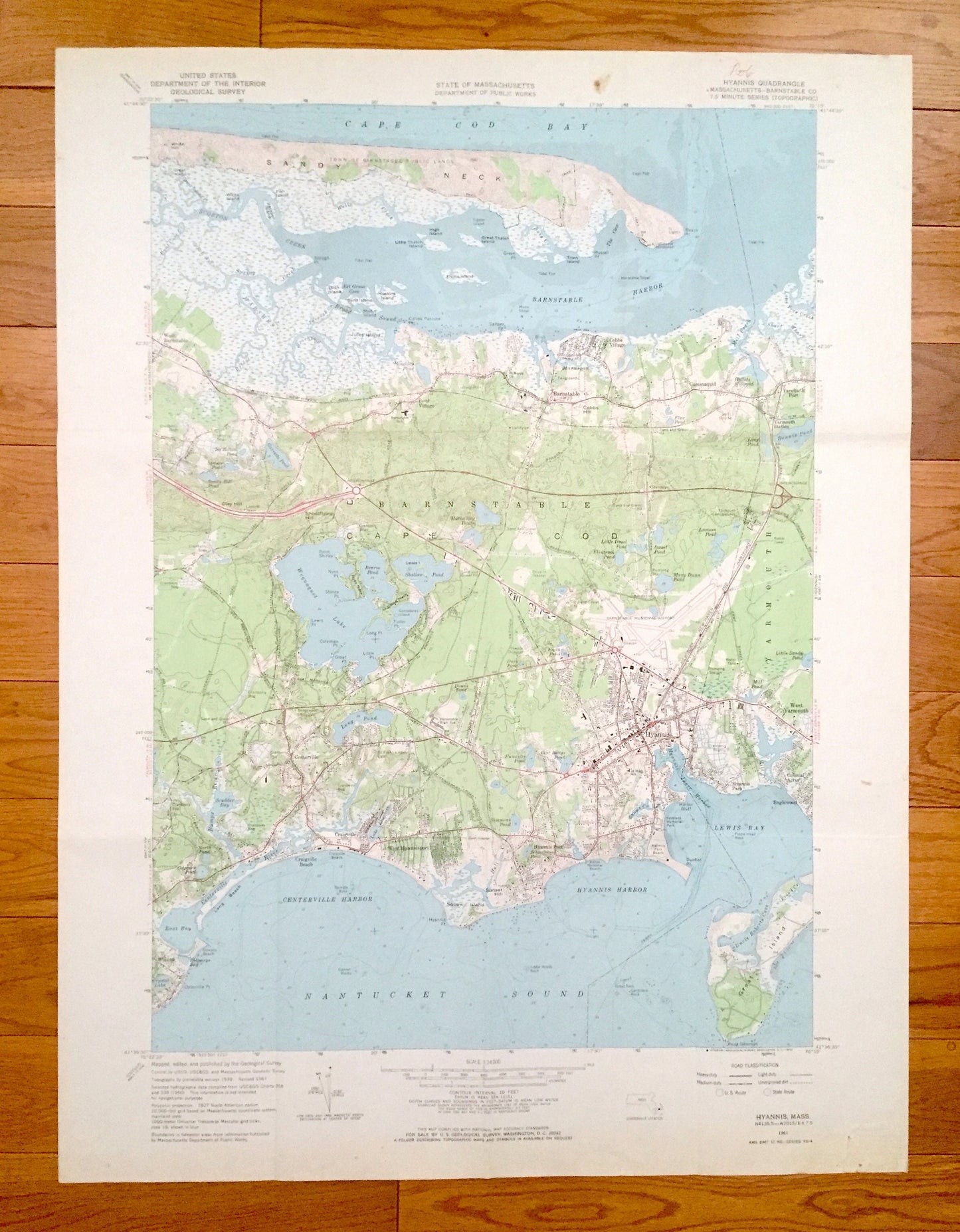
Antique Hyannis, Massachusetts 1961 US Geological Survey Topographic Map – Barnstable County, Cape Cod, Yarmouth, Cummaquid, Englewood, MA
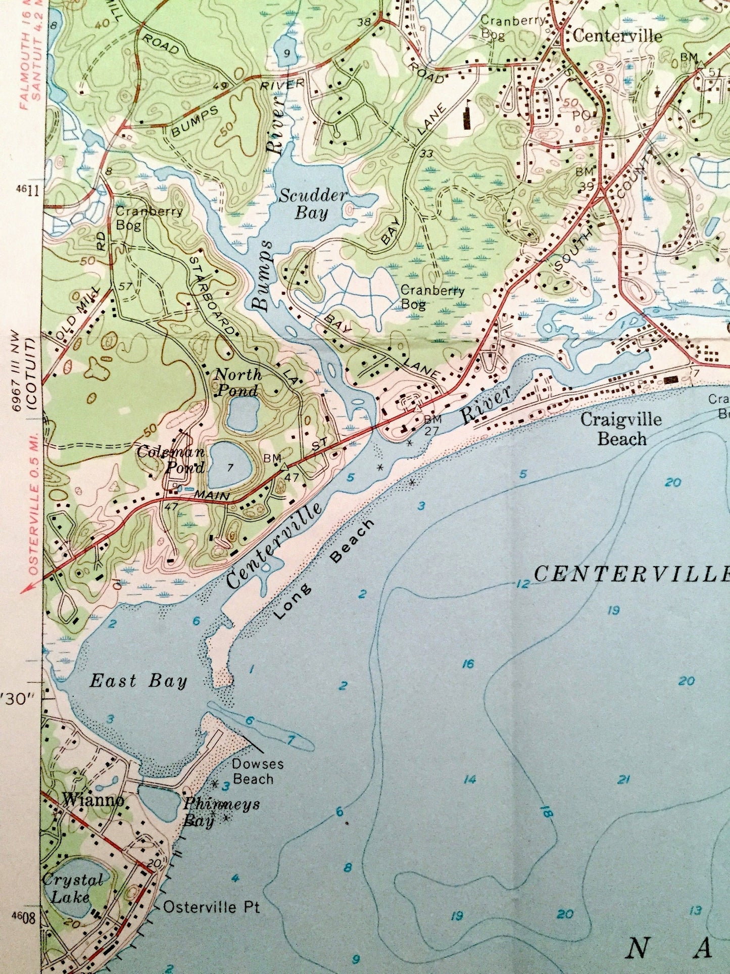
Antique Hyannis, Massachusetts 1961 US Geological Survey Topographic Map – Barnstable County, Cape Cod, Yarmouth, Cummaquid, Englewood, MA
Beautiful, antique map of Hyannis, Massachusetts and surrounding Barnstable County area. This is an authentic 1961 edition, 1969 print from the U.S. Geological Survey and NOT a computer reproduction.
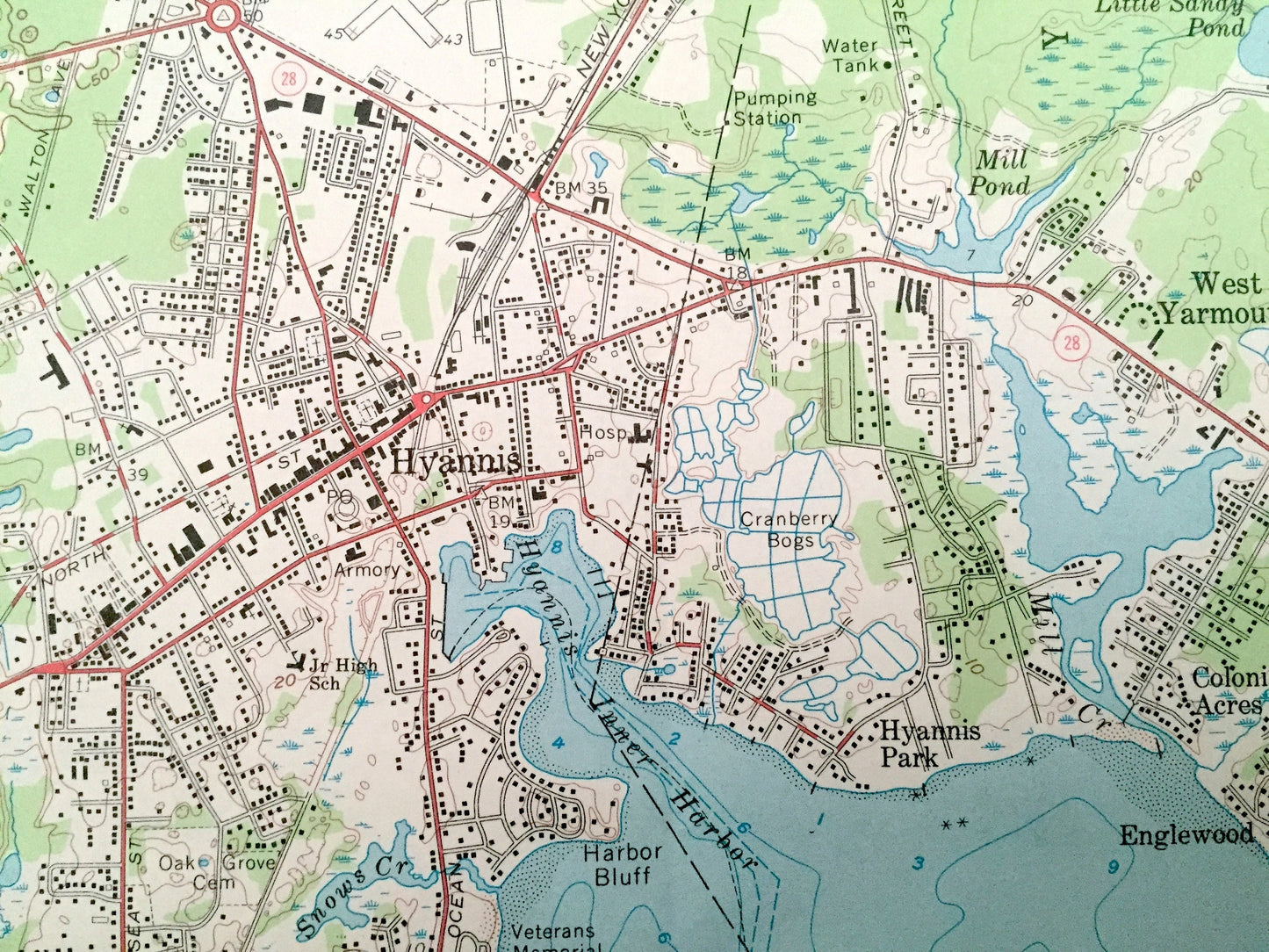
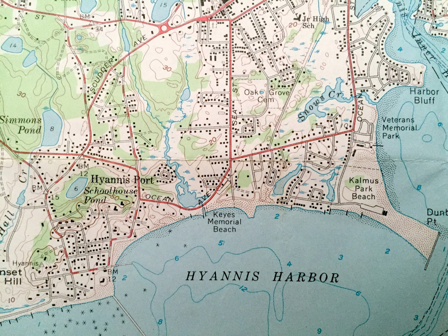
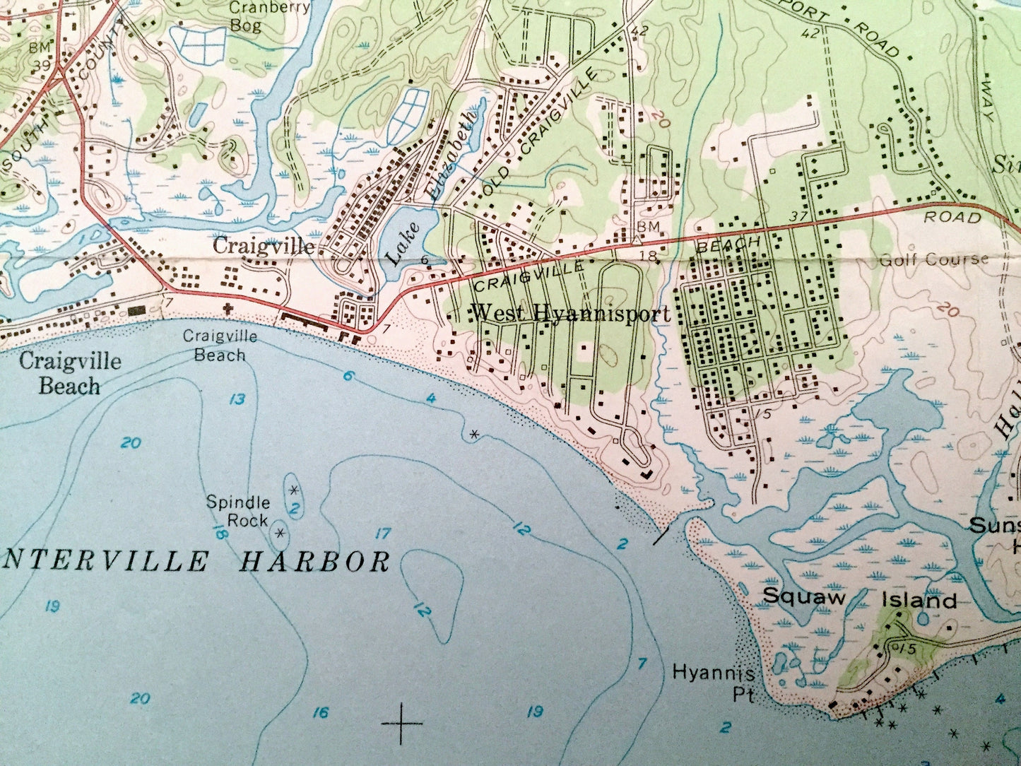
See what Massachusetts looked like almost 60 years ago. Lots of intricate details and geological contours. Map even has little squares for every house that existed at the time. The USGS cartographers were very thorough back then!
Perfect for the historian, map-lover, the curious or just as a conversation starter. Wonderful and rare. Vintage maps such as these make great gifts.
Edition of 1961, printed 1969
Dimensions: 22" width x 29" height
----
Features
Cities & Towns: Hyannis, Colonial Acres, Englewood, Hyannis Park, Hyannis Port, West Hyannisport, Craigville, Craigville Beach, Wianno, Centerville, West Yarmouth, Yarmouth Station, Yarmouth Port, Cummaquid, Cobbs Village, Barnstable, Pond Village, West Barnstable.
Points of Interest: Cape Cod, Nantucket Sound, Centerville Harbor, Hyannis Harbor, Lewis Bay, Great Island, Barnstable Municipal Airport, Wequaquet Lake, New York New Haven and Hartford Railroad, Long Beach, Barnstable Harbor, Scorton Creek, Sandy Neck, Cape Cod Bay, and many more hills, streams, ponds, houses, schools, churches and roads.
Condition: Good Vintage condition, commensurate with age. This map is in great shape for being over 50 years old. Has some edge-wear, foxing, toning, tape in bottom margin, light writing in upper margin and folds as-issued, but these will flatten easily and all will read as vintage character when framed.
----
We will happily adjust shipping price for multiple purchases. Maps are rolled up and shipped in sturdy mailing tubes, never folded.
Couldn't load pickup availability
Share