My Store
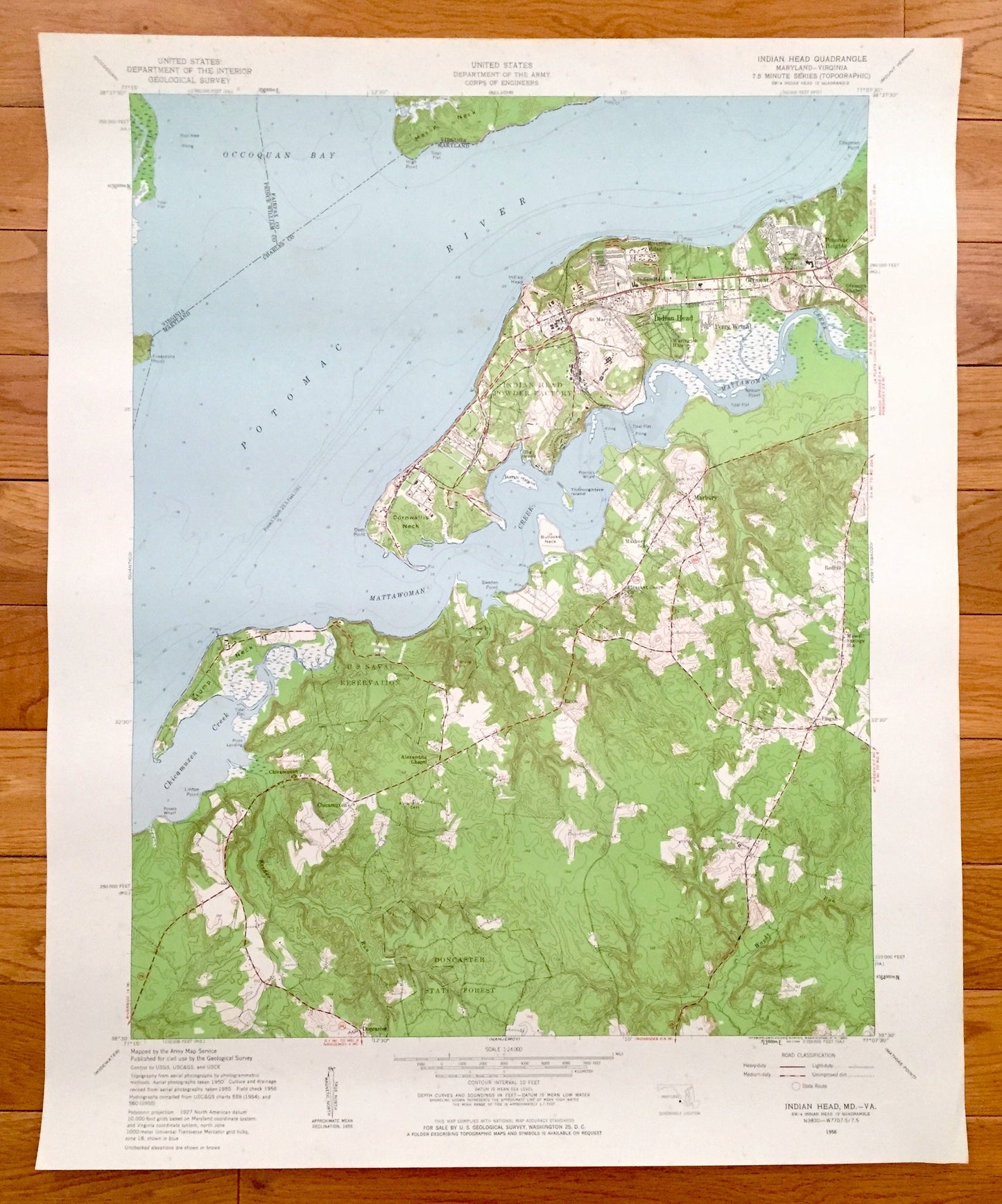
Antique Indian Head, Maryland & VA 1956 US Geological Survey Topographic Map – Charles County, Potomac Heights, Marbury Glymont Doncaster MD
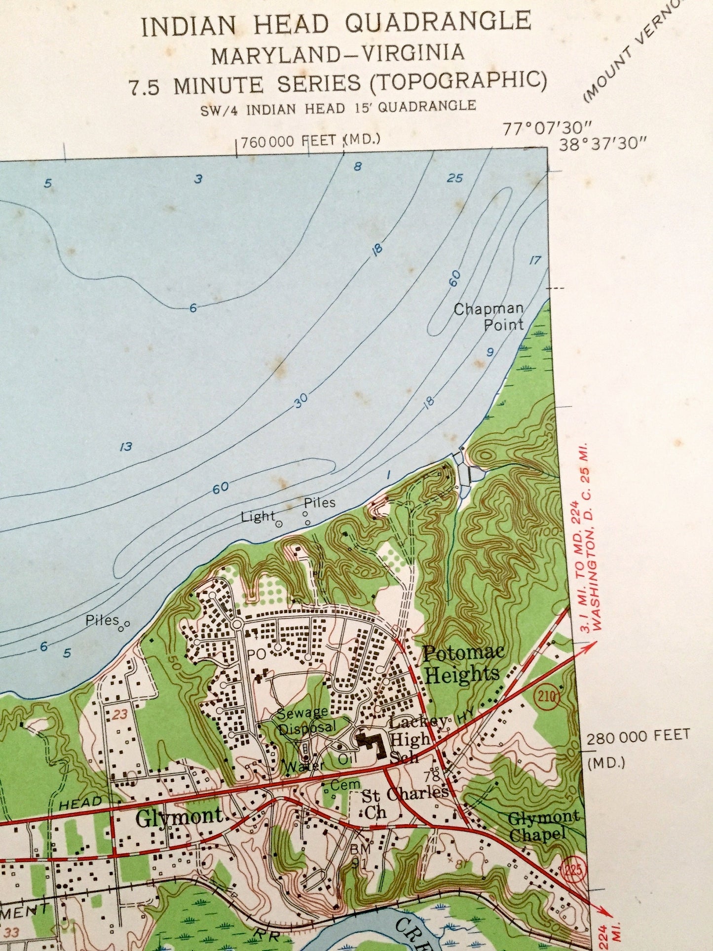
Antique Indian Head, Maryland & VA 1956 US Geological Survey Topographic Map – Charles County, Potomac Heights, Marbury Glymont Doncaster MD
Beautiful, antique map of Indian Head, Maryland and surrounding Virginia and Charles County area. This is an authentic 1956 print from the U.S. Geological Survey and NOT a computer reproduction.
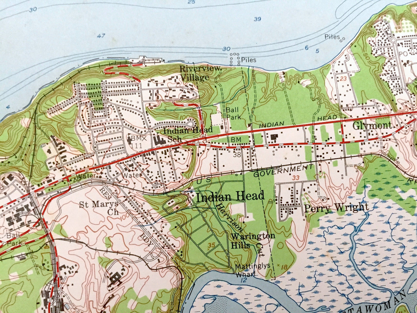
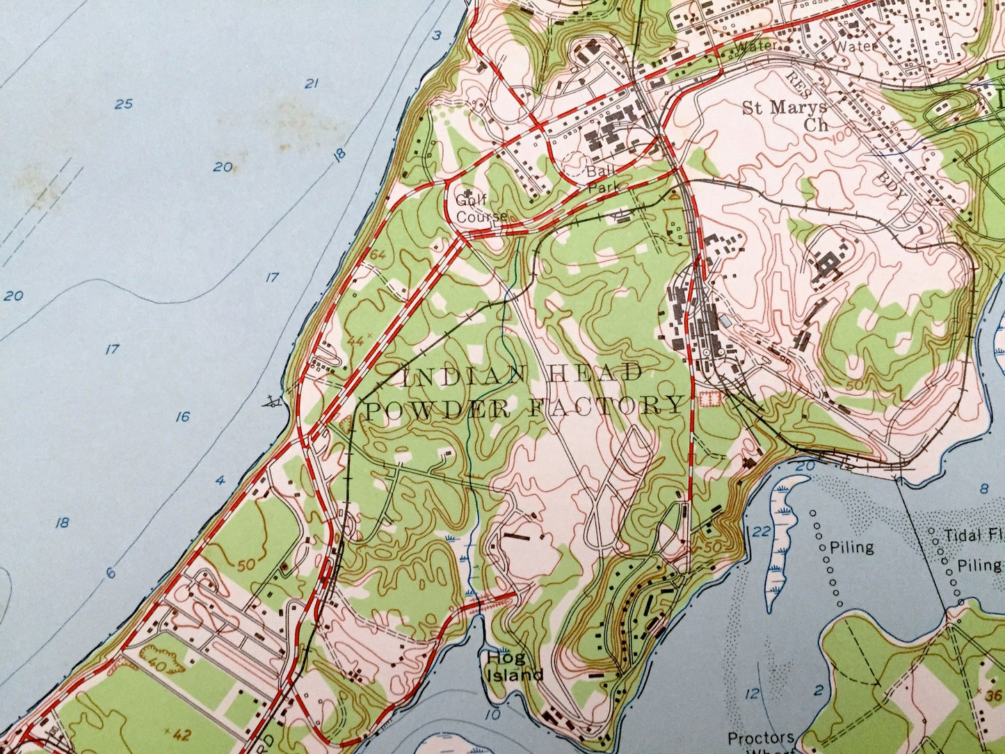
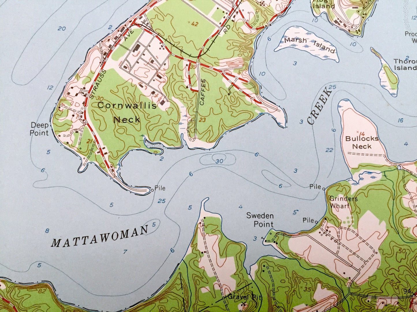
See what Maryland looked like over 60 years ago. Lots of intricate details and geological contours. Map even has little squares for every house that existed at the time. The USGS cartographers were very thorough back then!
Perfect for the historian, map-lover, the curious or just as a conversation starter. Wonderful and rare. Vintage maps such as these make great gifts.
Edition of 1956, printed 1956
Dimensions: 22" width x 27" height
----
Features
Cities & Towns: Indian Head, Riverview Village, Warington Hills, Perry Wright, Glymont, Potomac Heights, Marbury, Redhill, Pisgah, Chicamuxen, Doncaster.
Points of Interest: Potomac River, Mason Neck, Stump Neck, Chicamuxen Creek, Mattawoman Creek, Thoroughfare Island, Marsh Island, Bullocks Neck, US Naval Reservation, Doncaster State Forest, and many more hills, streams, ponds, houses, schools, churches and roads.
Condition: Very Good Vintage condition, commensurate with age. This map is in incredible shape for being over 60 years old. Has light edge-wear but this will add to vintage character when framed.
----
We will happily adjust shipping price for multiple purchases. Maps are rolled up and shipped in sturdy mailing tubes, never folded.
Couldn't load pickup availability
Share