My Store
Antique Indian Lake & West Canada Lakes, New York 1920's US Geological Survey Topographic Map – Adirondacks, Pleasant, Arieta Cedar River NY
Antique Indian Lake & West Canada Lakes, New York 1920's US Geological Survey Topographic Map – Adirondacks, Pleasant, Arieta Cedar River NY
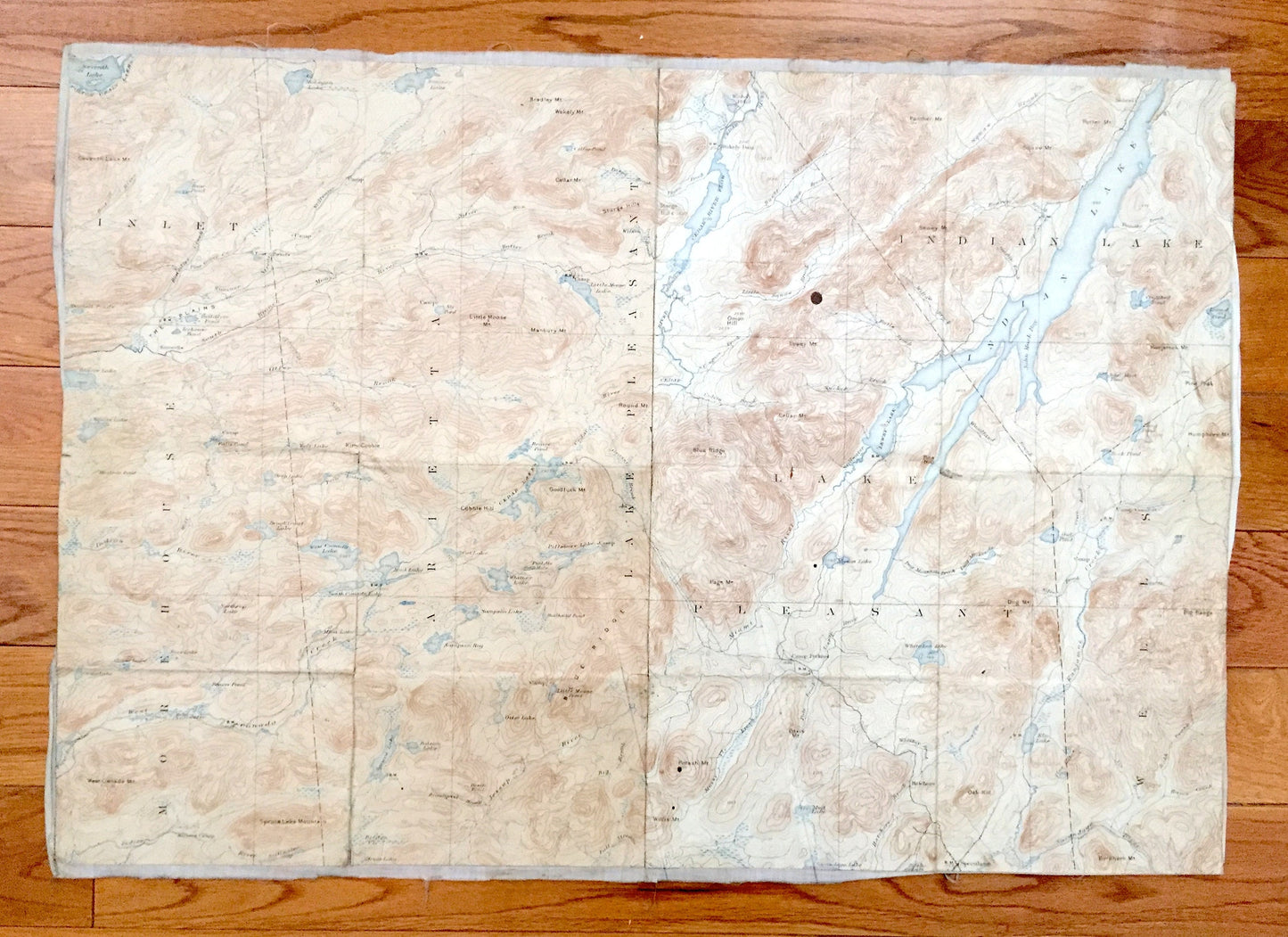
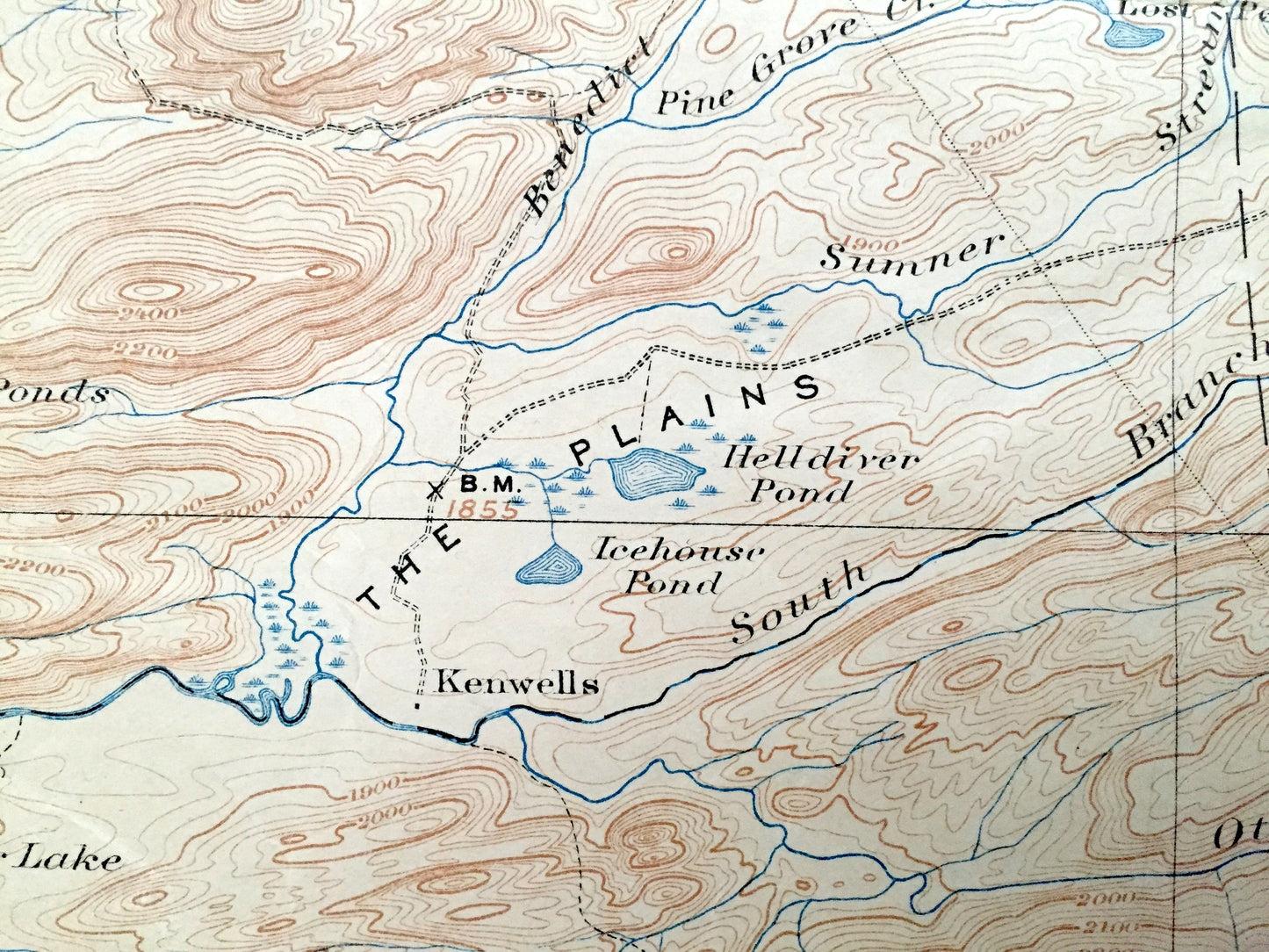
Beautiful, antique composite map of the Adirondacks: Indian Lake and West Canada Lakes, New York quadrangles and surrounding Hamilton County area. This is an authentic 1910's & 20's print from the U.S. Geological Survey and NOT a computer reproduction. At some time in the past, someone combined the two maps and backed them with canvas. Was most likely used in the field and is one-of-a-kind unique.
See what The Adirondacks looked like 100 years ago. Lots of intricate details and geological contours. Map even has little squares for every house that existed at the time. The USGS cartographers were very thorough back then!
Perfect for the historian, map-lover, the curious or just as a conversation starter. Wonderful and rare. Vintage maps such as this make great gifts.
Edition of circa 1910s, printed circa 1920s
Dimensions: 25 1/2" width x 17 1/2" height
----
Features
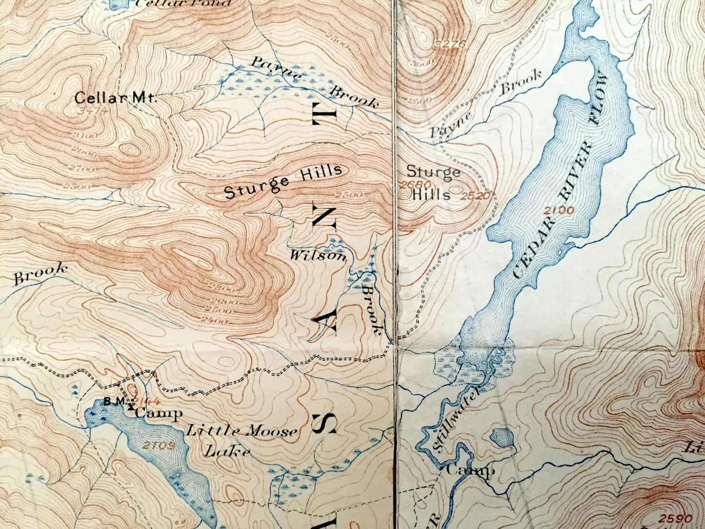
Left quadrangle, West Canada Lakes (1919):
Cities & Towns: Inlet, Morehouse, Long Lake, Arietta, Lake Pleasant.
Points of Interest: Hamilton County, The Adirondacks, Fulton Chain Lakes, Mohegan Lake, Lake Kora, West Canada Lakes, West Lake, South Lake, Mud Lake, Cedar Lakes, Spruce Lake, Moose River, Spruce Lake Mountain, Blue Ridge, Noisey Ridge, Lamphere Ridge, Wakely Mountain, Kamp Kill Kare, The Plains, Indian River, Wolf Creek, Jimmy Pond, Kitty Cobble and many more lakes, ponds, islands, coves, hills, mountains, houses, train tracks, roads.
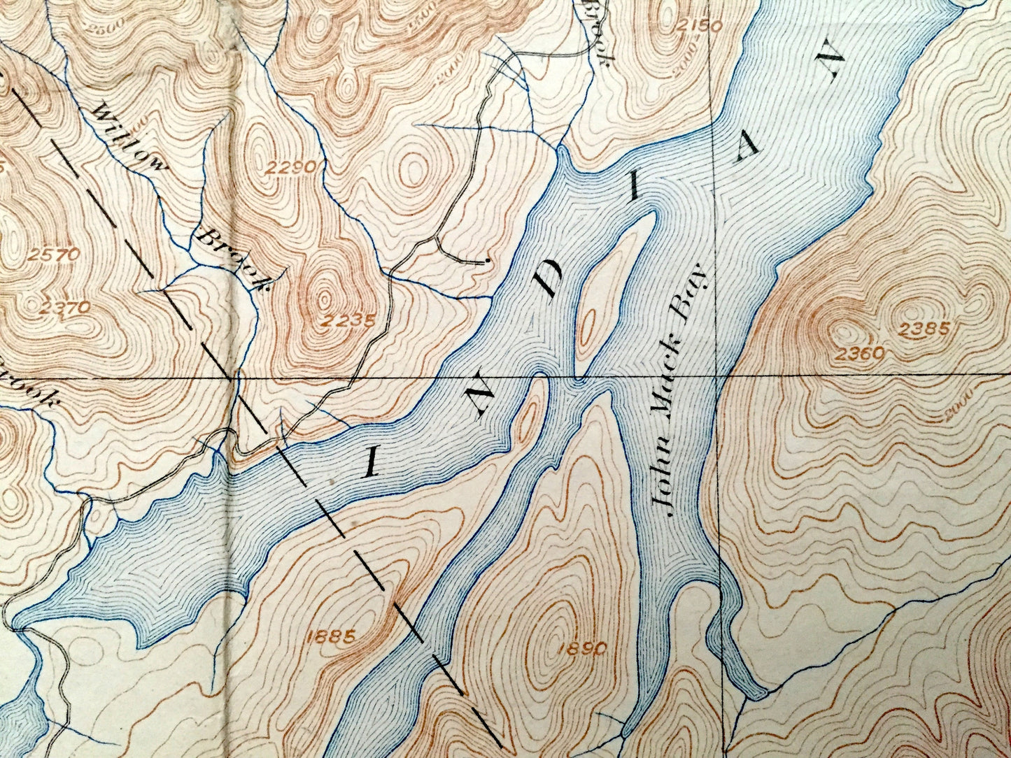
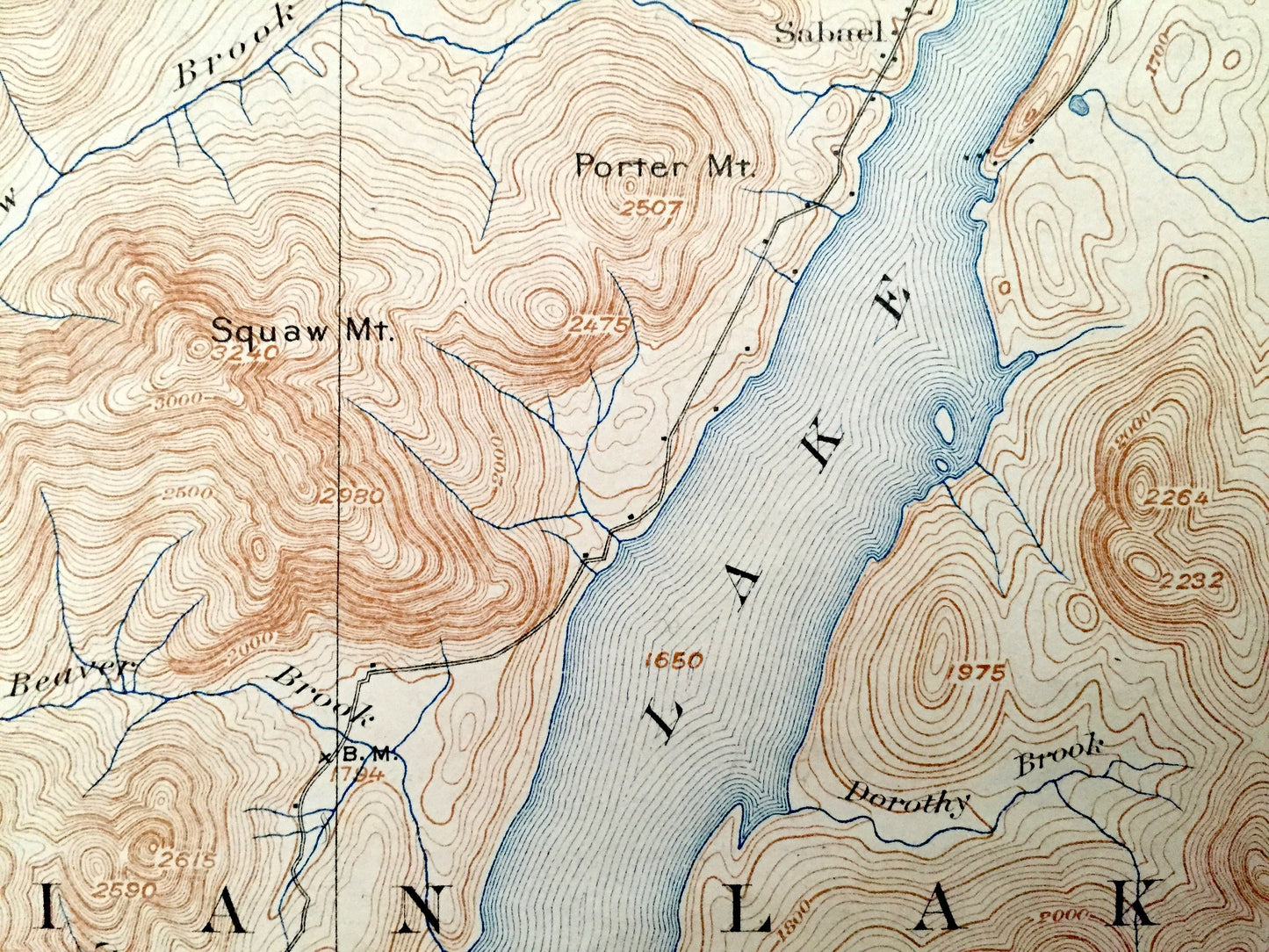
Right quadrangle, Indian Lake (1928):
Cities & Towns: Indian Lake, Lake Pleasant, Wells, Sabael, Perkins Clearing, Speculator.
Points of Interest: Hamilton County, Adirondacks, Indian Lake, Lewey Lake, Cedar River Flow, Whitaker Lake, Elm Lake, Sacandaga River, Sacandaga Lake, Cedar River, John Mack Bay, The Narrows, Lewey Mountain, Blue Ridge, Moose Mountain, Kunjamuk Mountain, Floodwood Mountain, Dug Mountain, Potash Mountain, Cross Mountain, Sturges Hill, and many more lakes, ponds, islands, coves, hills, mountains, houses, train tracks, roads.
Condition: Good Vintage condition, commensurate with age. This map is in incredible shape for being about 100 years old. Has light wear, fold marks and occasional spots, but this will all read as vintage character when framed.
----
We will happily adjust shipping price for multiple purchases. Maps are rolled up and shipped in sturdy mailing tubes, never folded.
Couldn't load pickup availability
Share