My Store
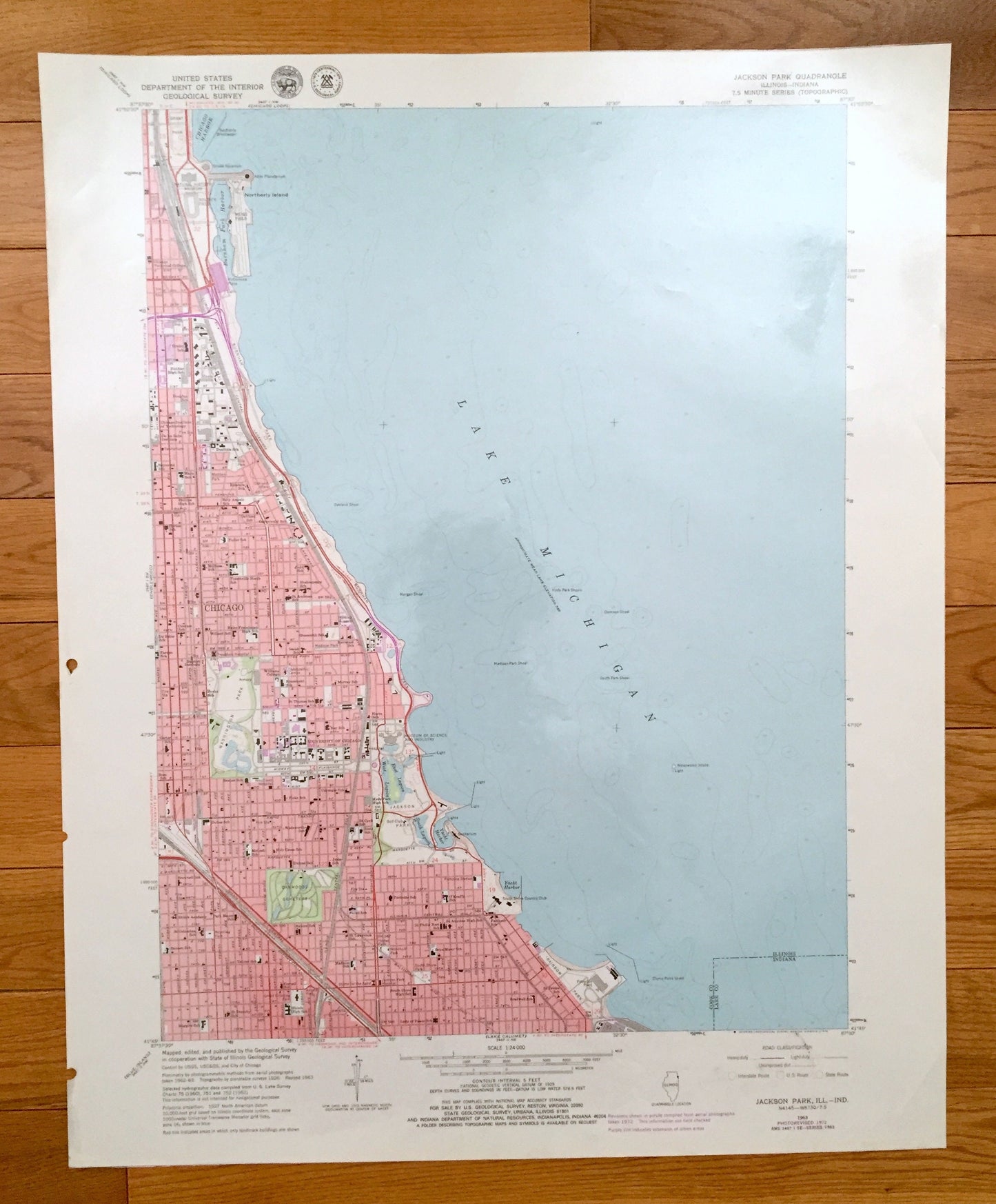
Antique Jackson Park, Illinois 1963 US Geological Survey Topographic Map – Cook County, Chicago, Lake Michigan, Northerly Island, Indiana IL
Antique Jackson Park, Illinois 1963 US Geological Survey Topographic Map – Cook County, Chicago, Lake Michigan, Northerly Island, Indiana IL
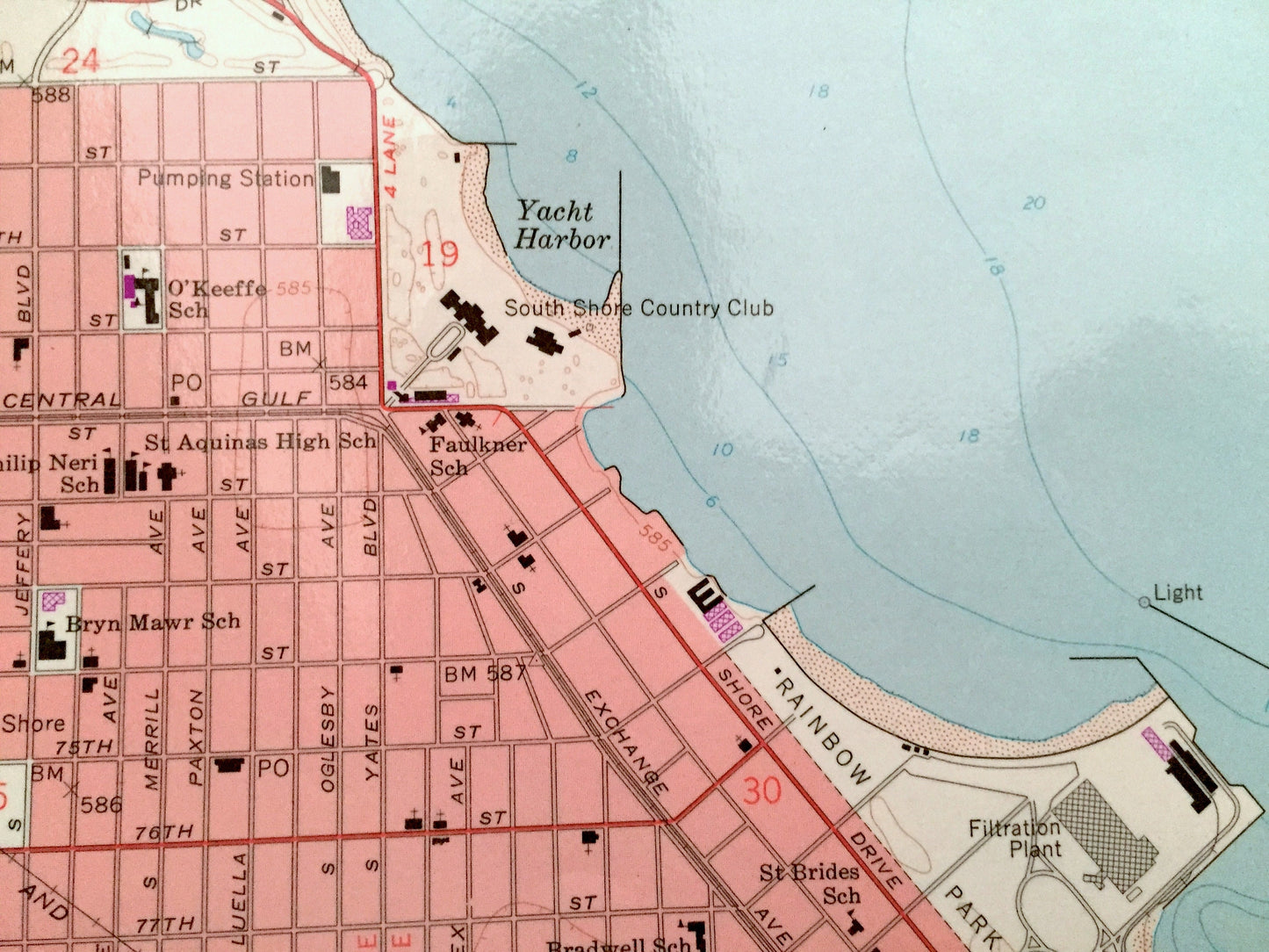
Beautiful, antique map of the Jackson Park area of Chicago, Illinois on Lake Michigan. This is an authentic 1963 edition, 1979 print from the U.S. Geological Survey and NOT a computer reproduction.
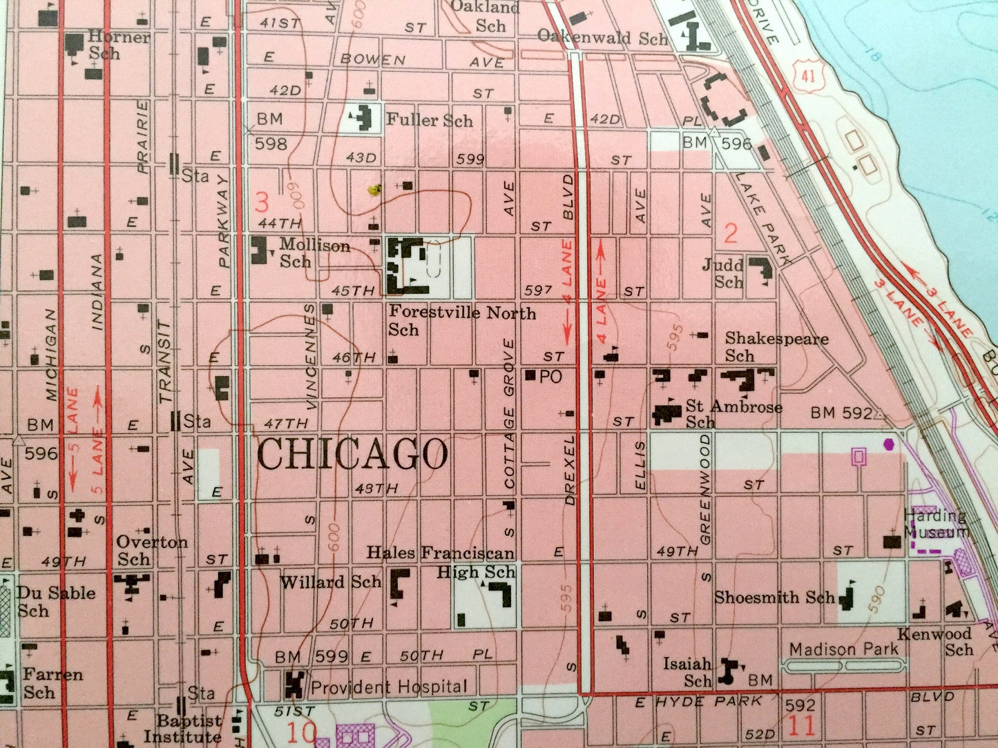
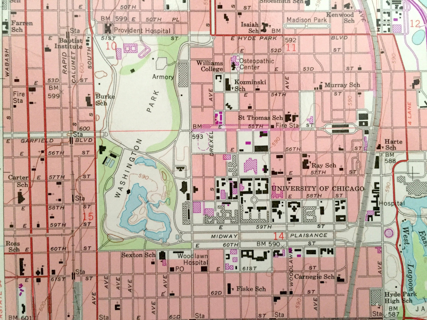
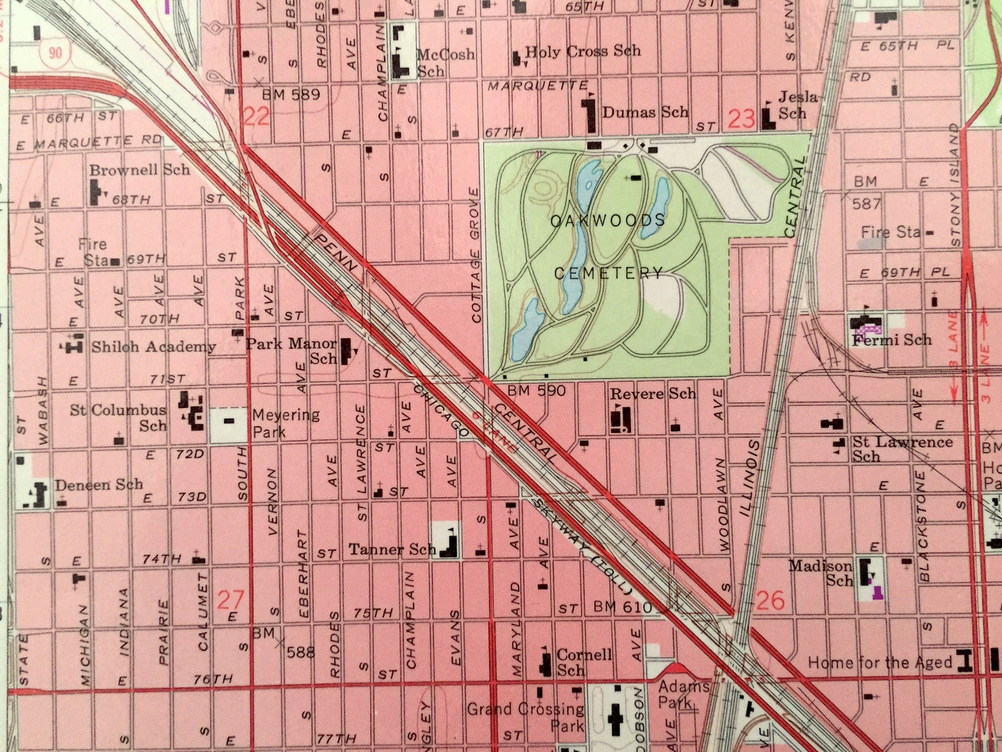
See what Illinois and Indiana looked like over 55 years ago. Lots of intricate details and geological contours. This map is laminated and even has little squares for every house that existed at the time. The USGS cartographers were very thorough back then!
Perfect for the historian, map-lover, the curious or just as a conversation starter. Wonderful and rare. Vintage maps such as these make great gifts.
Edition of 1963, printed 1979
Dimensions: 22" width x 27" height
----
Features
Cities & Towns: Chicago.
Points of Interest: Cook County, Jackson Park, Lake Michigan, Northerly Island, Chicago Harbor, Burnham Park Harbor, Washington Park, Rainbow Park, Museum of Science and Industry, East Lagoon, West Lagoon and Lake County, Indiana and lots more hills, mountains, streams, ponds, lakes, rivers, schools, churches, houses, and roads.
Condition: Very Good condition, commensurate with age. This map is in incredible shape for being 40 years old. Has some light edge-wear and small hole punches on left hand side, all of which will read as vintage character when framed.
----
We will happily adjust shipping price for multiple purchases. Maps are rolled up and shipped in sturdy mailing tubes, never folded.
Couldn't load pickup availability
Share