My Store
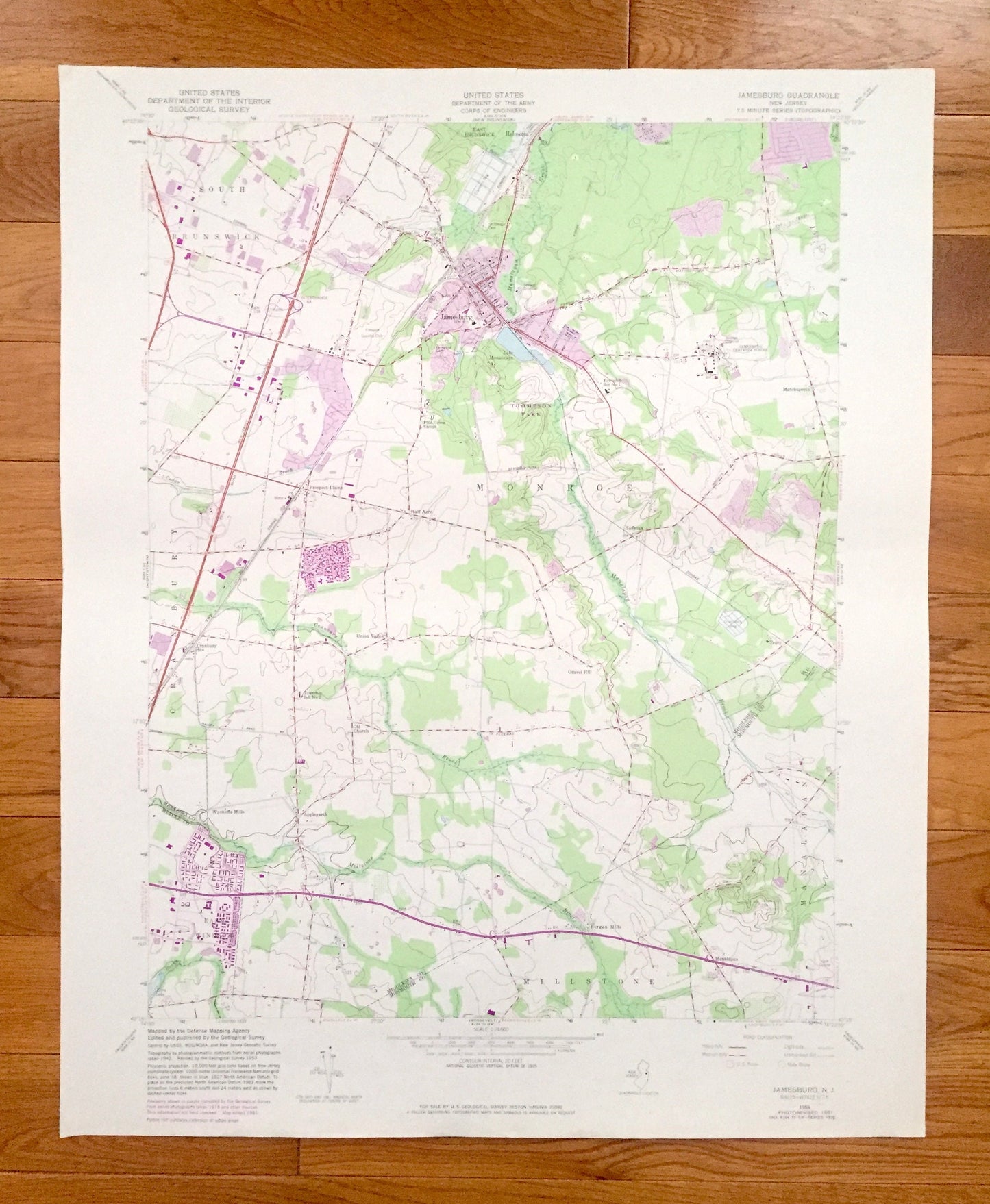
Antique Jamesburg, New Jersey 1953 US Geological Survey Topographic Map – Middlesex, Monmouth County, South Brunswick, Monroe, Millstone, NJ
Antique Jamesburg, New Jersey 1953 US Geological Survey Topographic Map – Middlesex, Monmouth County, South Brunswick, Monroe, Millstone, NJ
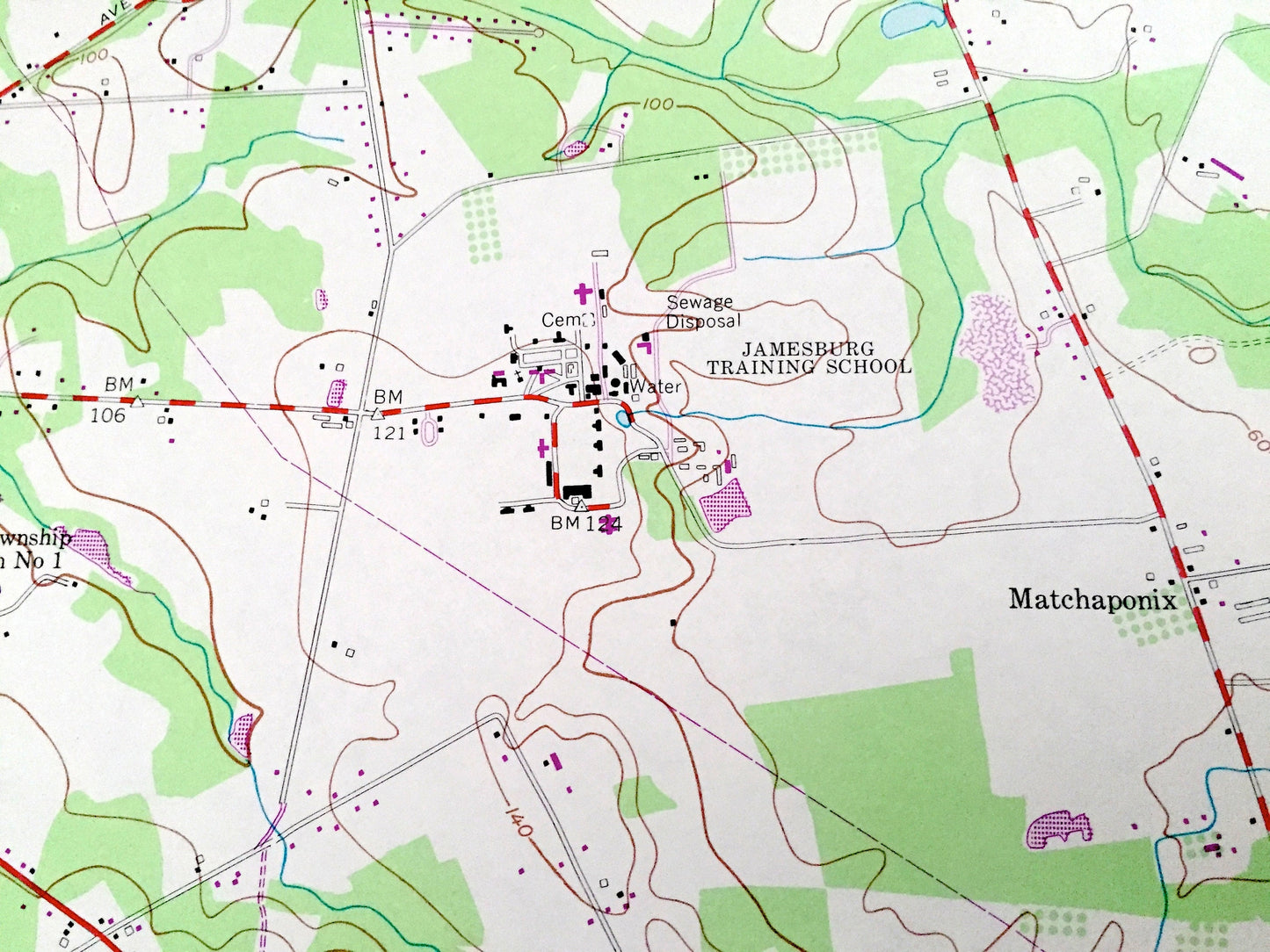
Beautiful, antique map of Jamesburg, New Jersey and surrounding Middlesex, Mercer & Monmouth County areas. This is an authentic 1953 edition, 1982 print from the U.S. Geological Survey and NOT a computer reproduction.
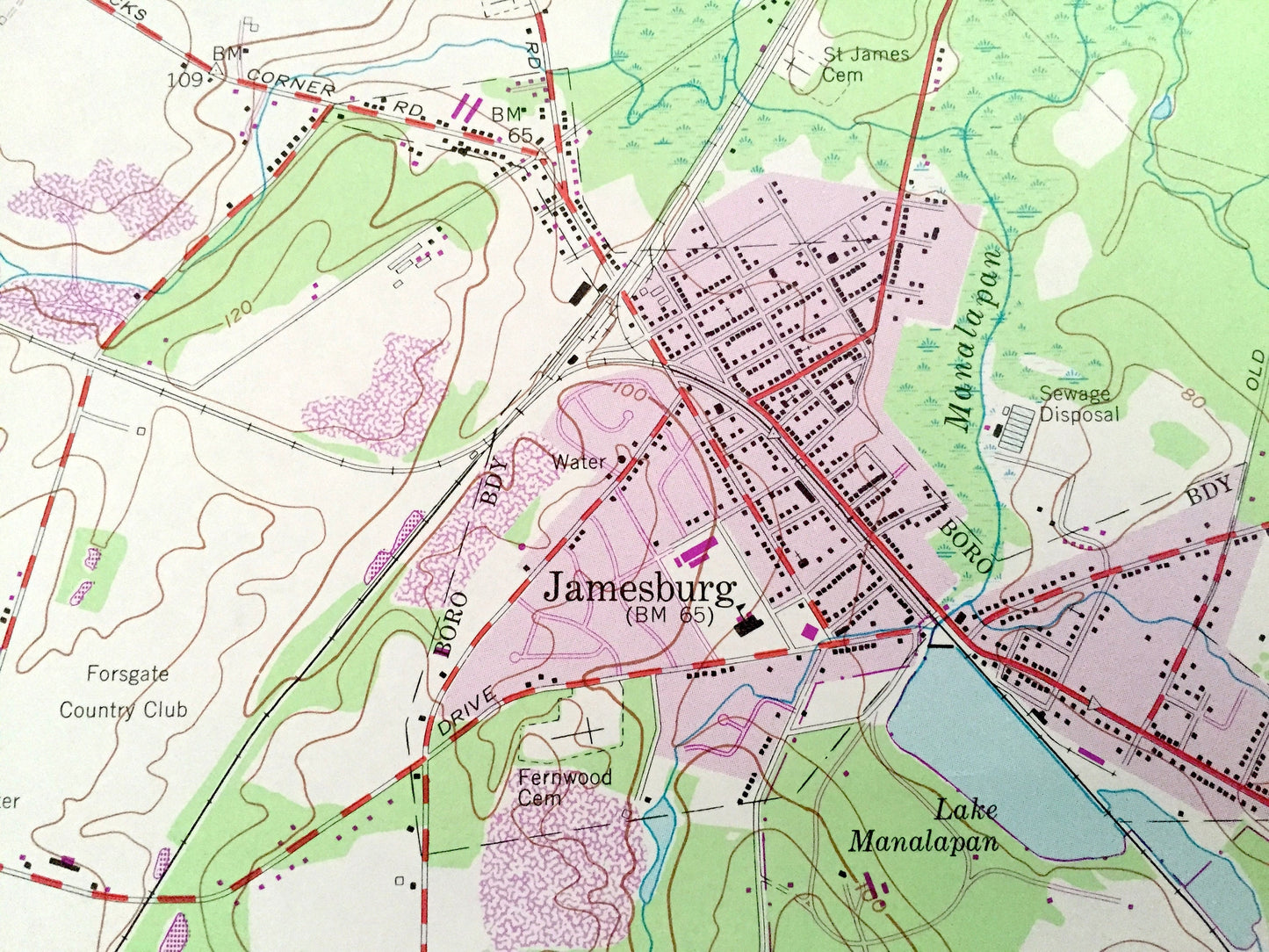
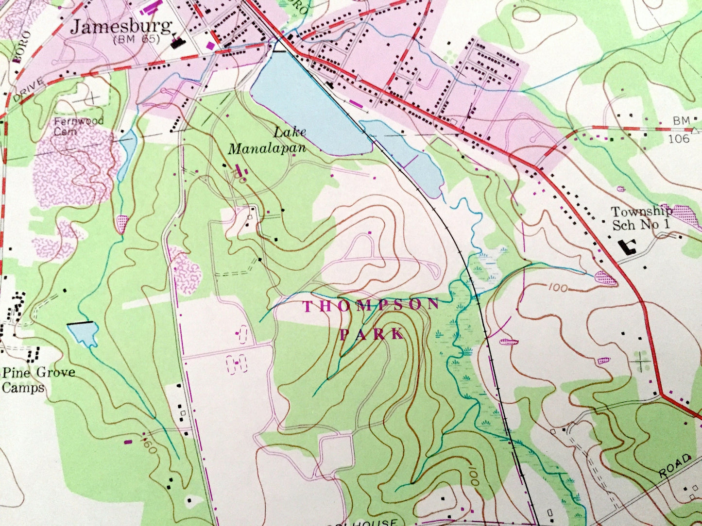
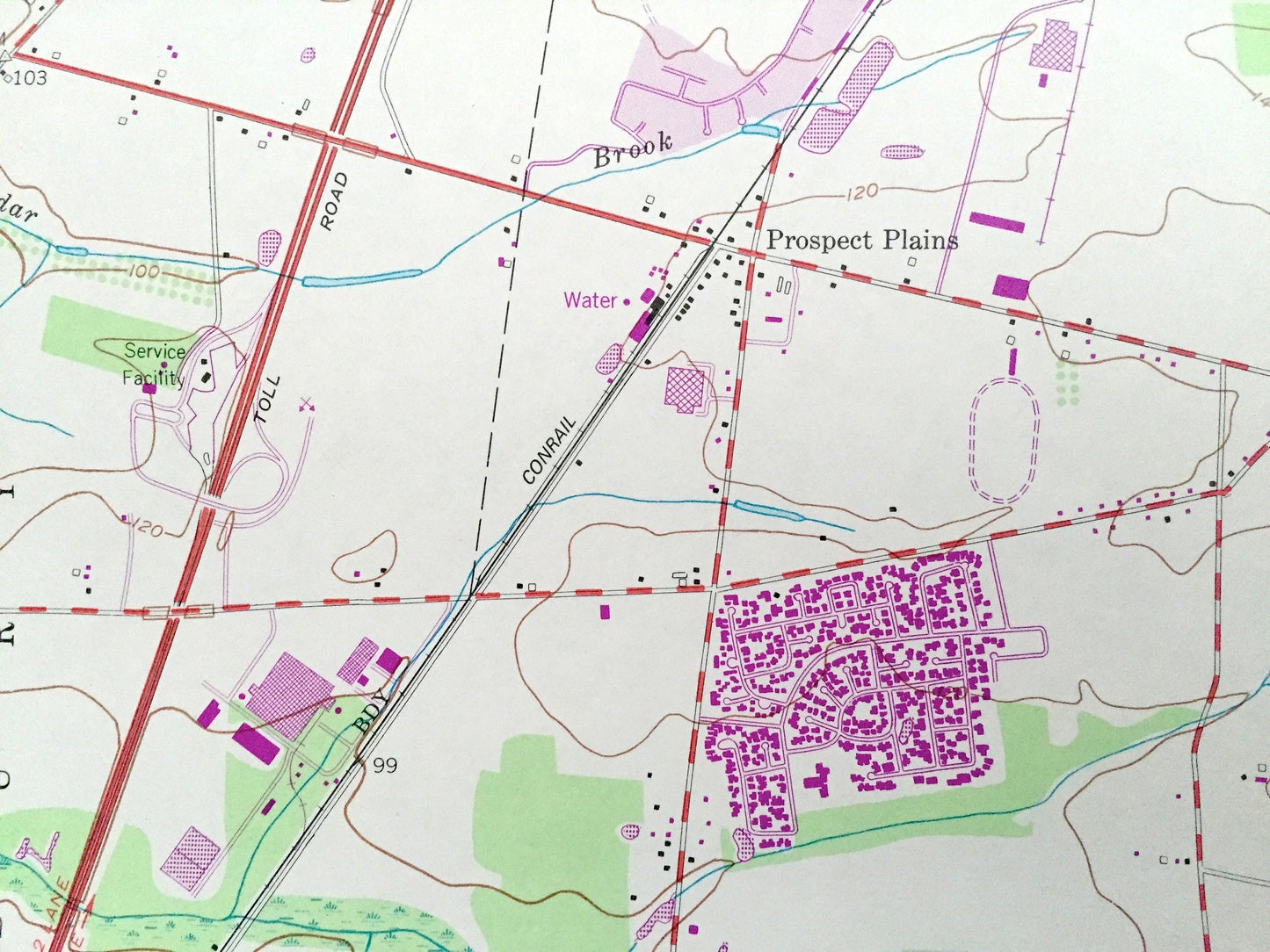
See what New Jersey looked like over 65 years ago. Lots of intricate details and geological contours. Map even has little squares for every house that existed at the time. The USGS cartographers were very thorough back then!
Perfect for the historian, map-lover, the curious or just as a conversation starter. Wonderful and rare. Vintage maps such as these make great gifts.
Edition of 1953, printed 1982
Dimensions: 22" width x 27" height
----
Features
Cities & Towns: East Brunswick, Helmetta, Prospect Plains, Cranbury, Union Valley, Half Acre, Old Church, Wyckoffs Mills, East Windsor, Applegarth, Bergen Mills, Manalapan, Gravel Hill, Tracy, Hoffman, Matchaponix, Outcalt.
Points of Interest: Thompson Park, Jamesburg Training School, Township Schools, Pine Grove Camps, Forsgate Country Club, Locust Hill, Gravel Pit, Cedar Brook, Cranbury Brook, Millstone River, Rocky Brook, Etra Lake, Manalapan Brook, Lake Manalapan, Cemeteries, Cranberry Bogs, and many more hills, streams, ponds, houses, schools, churches and roads.
Condition: Very Good Vintage condition, commensurate with age. This map is in great shape for being over 35 years old. Small tears on the top edge but these will add to vintage character when framed.
----
We will happily adjust shipping price for multiple purchases. Maps are rolled up and shipped in sturdy mailing tubes, never folded.
Couldn't load pickup availability
Share