My Store
Antique Jamestown, North Dakota 1896 US Geological Survey Topographic Map – Stutsman, Lamoure County, Atwill, Alfred, Adrian, Sharlow ND
Antique Jamestown, North Dakota 1896 US Geological Survey Topographic Map – Stutsman, Lamoure County, Atwill, Alfred, Adrian, Sharlow ND
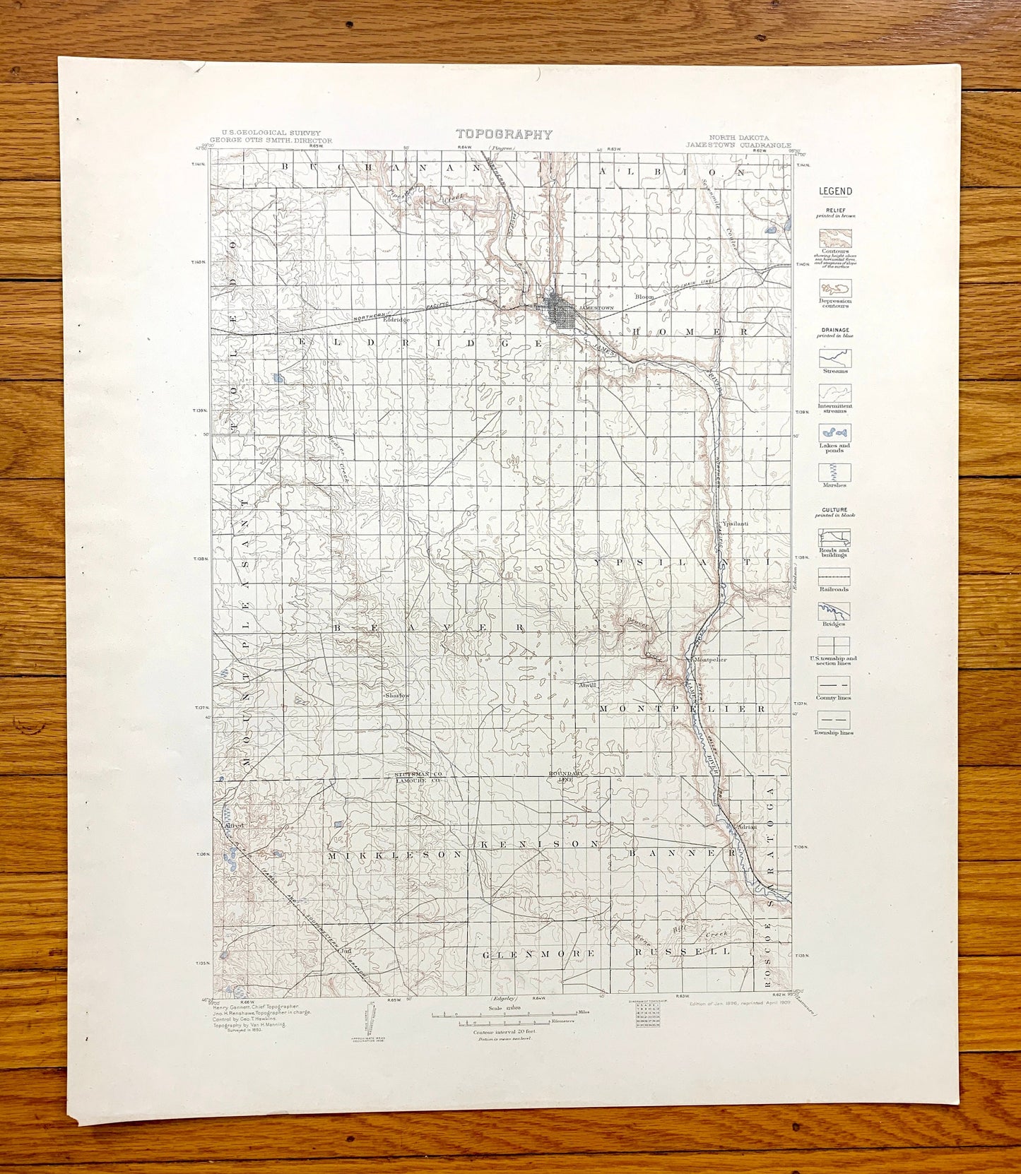
Beautiful, antique map of Jamestown, North Dakota and surrounding Stutsman County and Lamoure County area. This is an authentic 1896 edition, 1909 print from the U.S. Geological Survey and NOT a computer reproduction.
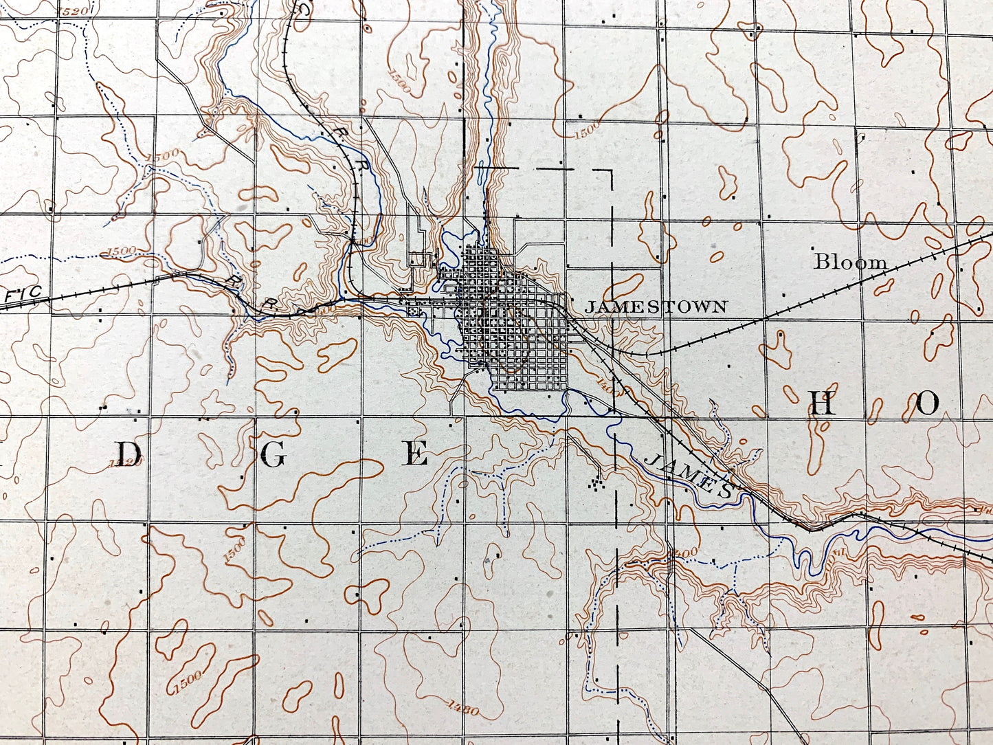
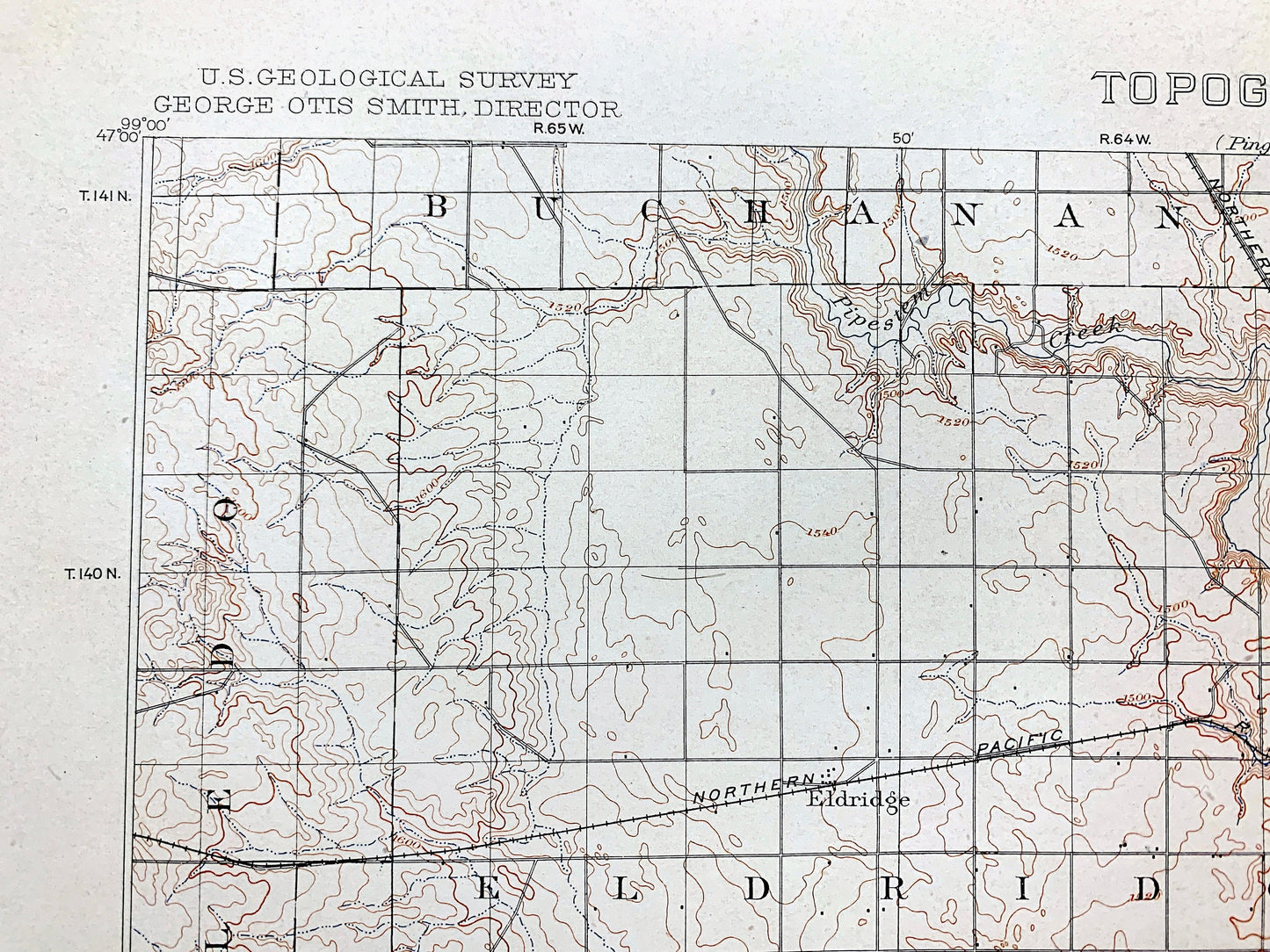
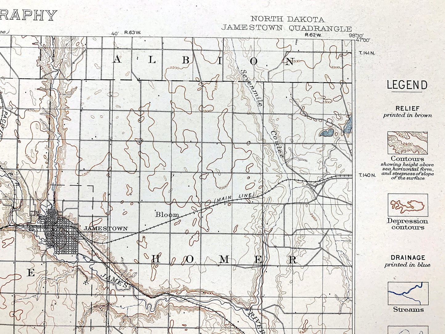
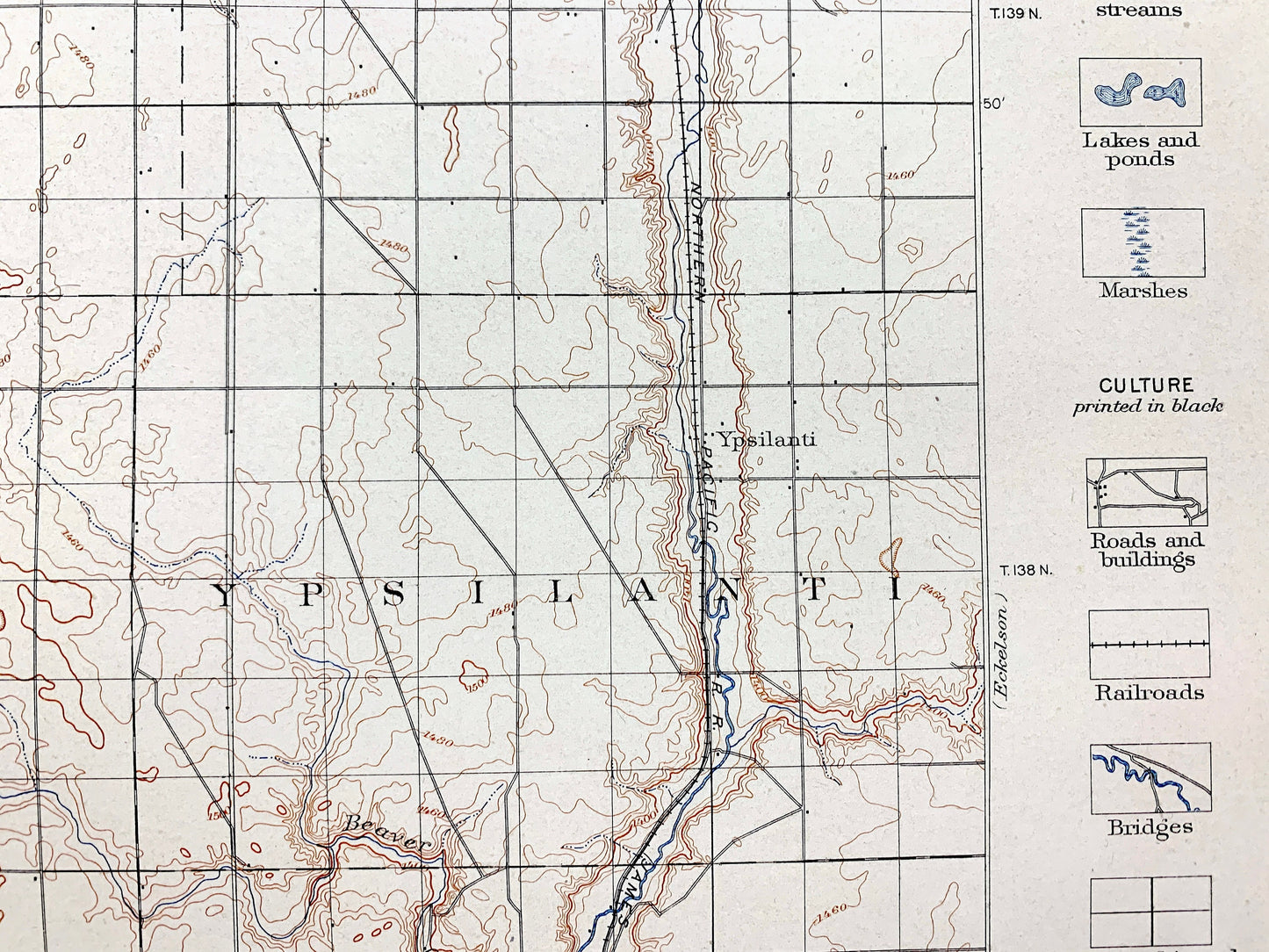
See what North Dakota looked like over 130 years ago. Lots of intricate details and geological contours. Map has lots of intricate details and geological contours—even little squares for every house that existed at the time. The USGS cartographers were very thorough back then! This is also one of the rare maps that has the map legend on the front.
Perfect for the historian, map-lover, the curious or just as a conversation starter. Wonderful and rare. Vintage maps such as these make great gifts.
Edition of 1896, printed 1909
Dimensions: 18 1/2" width x 22 1/2" height
----
Features
Cities & Towns: Jamestown, Alfred, Afrian, Atwill, Montpelier, Sharlow, Ypsilanti, Bloom, Eldridge, Sharlow, Russell, Glenmoore, Mikkelson, Kenison, Banner, Roscoe, Saratoga, Beaver, Mount Pleasant, Toledo, Homer, Buchanan.
Points of Interest: James River, Pipestem Creek, Bone Hill Creek, Stutsman County, Lamoure County, and lots more hills, mountains, lakes, rivers, creeks, roads, highways and railroads.
Condition: Very Good Vintage condition, commensurate with age. This map is in incredible shape for being over 110 years old. Has light edge-wear and staple holes in the margin, all of which will read as vintage character when framed.
----
We will happily adjust shipping price for multiple purchases. Maps are rolled up and shipped in sturdy mailing tubes, never folded.
Couldn't load pickup availability
Share