My Store
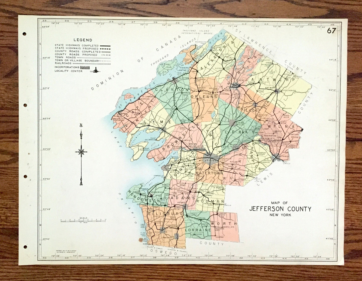
Antique Jefferson County, New York 1941 Historical Atlas Map – Watertown, Sackett's Harbor, Alexandria Bay, Clayton, Chaumont, Carthage, NY
Antique Jefferson County, New York 1941 Historical Atlas Map – Watertown, Sackett's Harbor, Alexandria Bay, Clayton, Chaumont, Carthage, NY
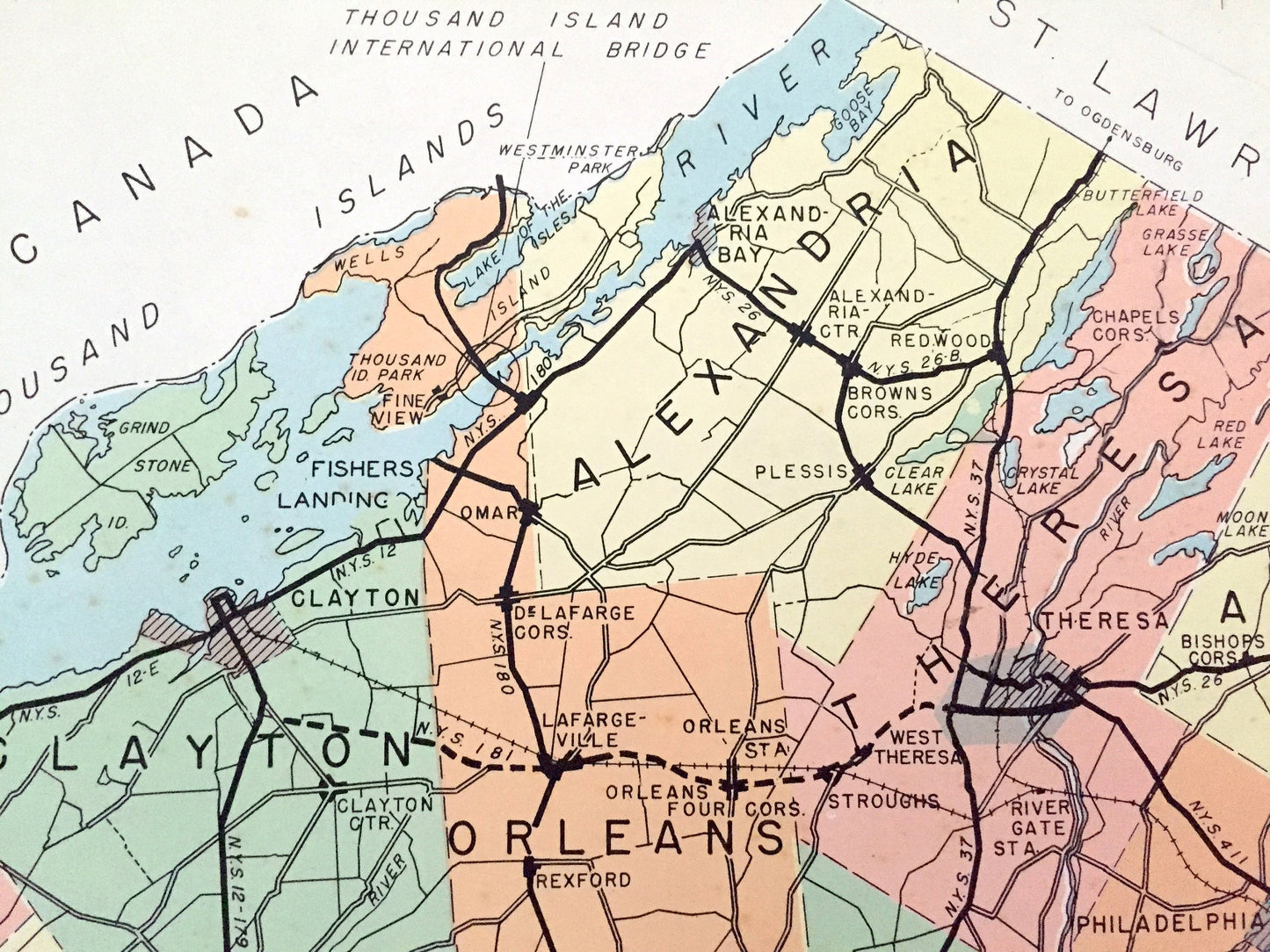
Beautiful, antique map of Jefferson County, New York, including Watertown, Sackett's Harbor, Alexandria Bay, Clayton, Chaumont & Carthage. This is an authentic map taken from the rare "Historical Atlas of New York State" by William P. Munger, published by Frank E. Richards Co. in 1941, and is NOT a computer reproduction.
See what Jefferson County looked like more than 80 years ago. Lots of charming details and contours, major cities, towns and roads, as well as geographical points of interest. It is a large, colorful print and will be a showpiece wherever it is presented. Reverse side has an informative history of the county.
Perfect for the historian, map-lover, the curious or just as a conversation starter. Wonderful and rare. Vintage maps such as these make great gifts.
Edition of 1941, printed 1941
Dimensions: 22" width x 16 1/2" height
----
Features
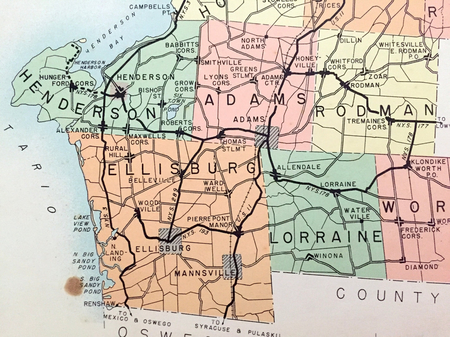
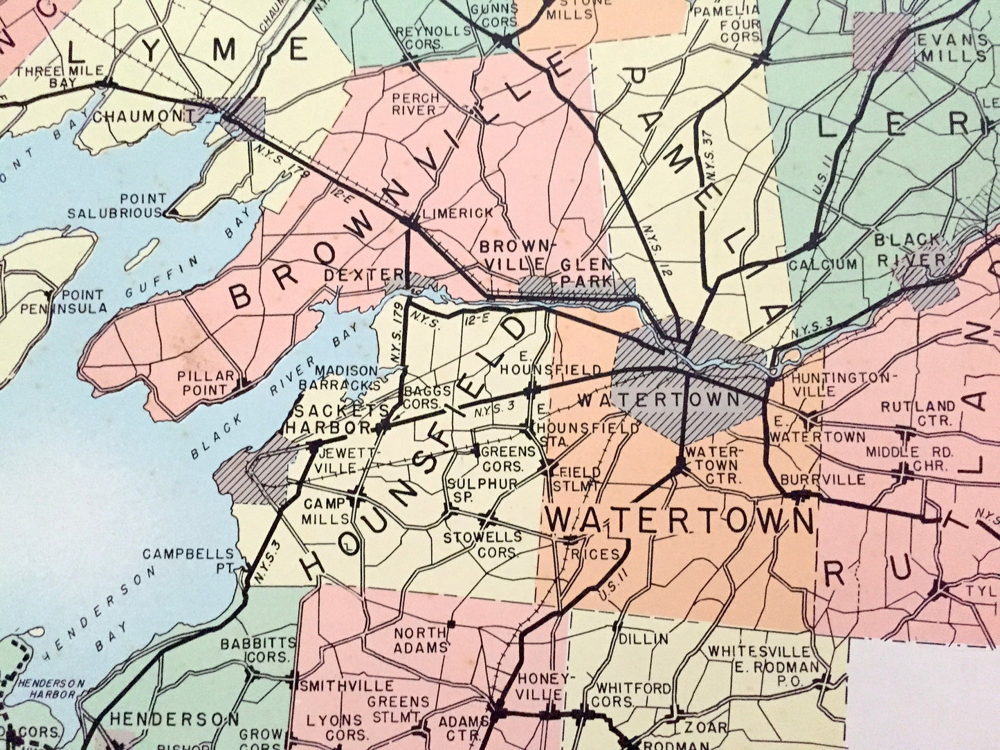
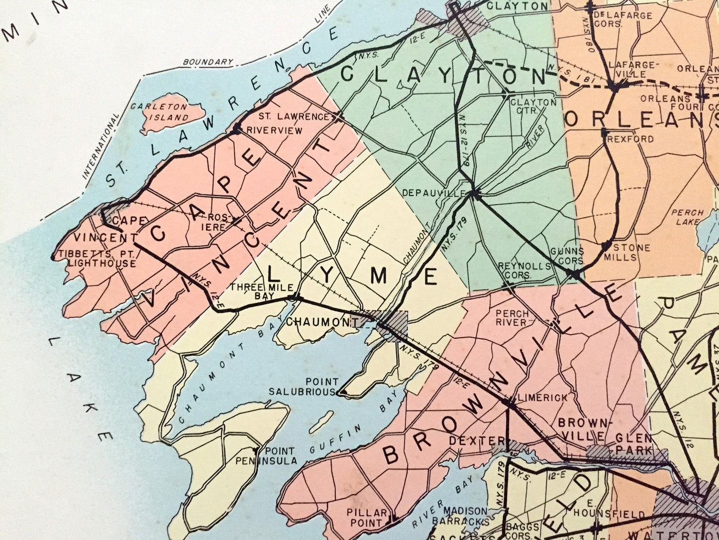
Cities & Towns: Alexandria, Theresa, Antwerp, Philadelphia, Orleans, Clayton, Pamelia, Leray, Wilnot, Champion, Cape Vincent, Lyme, Brownville, Hounsfield, Watertown, Rutland, Henderson, Adams, Rodman, Wllisburg, Lorraine, Worth, Westminster Park, Alexandria Bay, Redwood, St. Lawrence Park, Rivergate, Spragueville, Nauvoo, Thousand Islan Park, Gananoque, Murray Isle, Orenell, Fineview, Fishers Landing, Omar, Prospect Park, Port Metcalf, Strough, Lafargeville, Carthage, Great Bend, Limerick, Dexter, Riverview, Point Peninsula, Pillar Point, Glen Park, Tylerville, Alverson, Sackett's Harbor, Belleville, Mannsville, Winona, more
Points of Interest: Lake Ontario, St. Lawrence River, The Thousand Islands, Chaumont Bay, Guffin Bay, Black River Bay, Henderson Bay, Galloo Island, Stony Island, Grindstone Island, Wells Island, Black River, Indian River, Butterfield Lake, Muscalonge Lake, Carthage & Sackett's Harbor Railroad and many more ponds, lakes, creeks, rivers, roads, highways, railroads, school houses and elevations.
----
Condition: Good Vintage condition, commensurate with age. This map is in great shape for being over 80 years old. Has light edge-wear, toning, and holes in margin where the print was removed from atlas, but this will all add to vintage character when framed.
(Images of atlas cover and frontispiece for information only and not included.)
----
We will happily adjust shipping price for multiple purchases. Maps are rolled up and shipped in sturdy mailing tubes, never folded.
Couldn't load pickup availability
Share