My Store
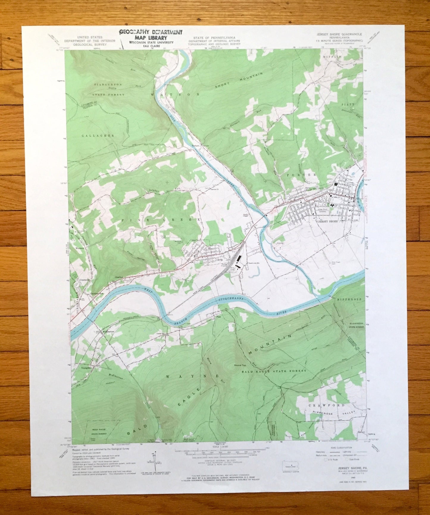
Antique Jersey Shore, Pennsylvania 1965 US Geological Survey Topographic Map – Lycoming, Clinton County, Watson, Gallagher, Pine Creek, PA
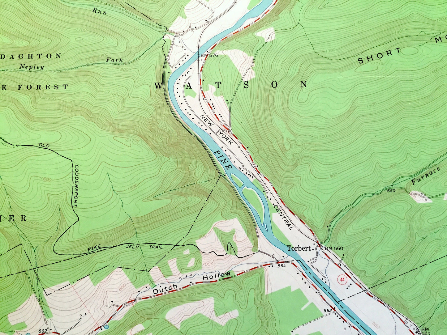
Antique Jersey Shore, Pennsylvania 1965 US Geological Survey Topographic Map – Lycoming, Clinton County, Watson, Gallagher, Pine Creek, PA
Beautiful, antique map of Jersey Shore, Pennsylvania and surrounding Lycoming County and Clinton County areas. This is an authentic 1965 edition, 1967 print of survey data from the U.S. Geological Survey and NOT a computer reproduction.
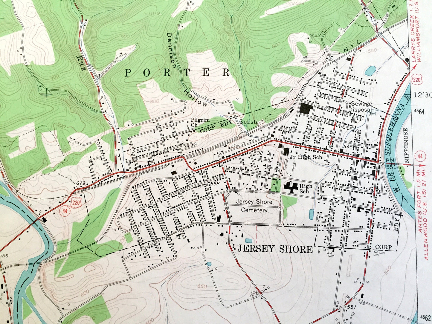
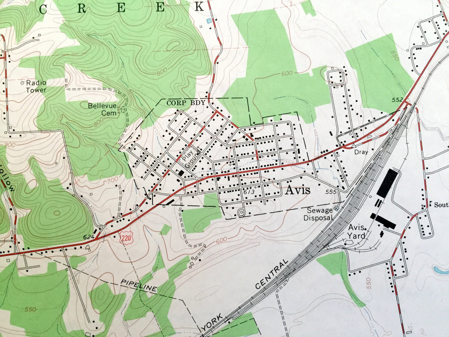
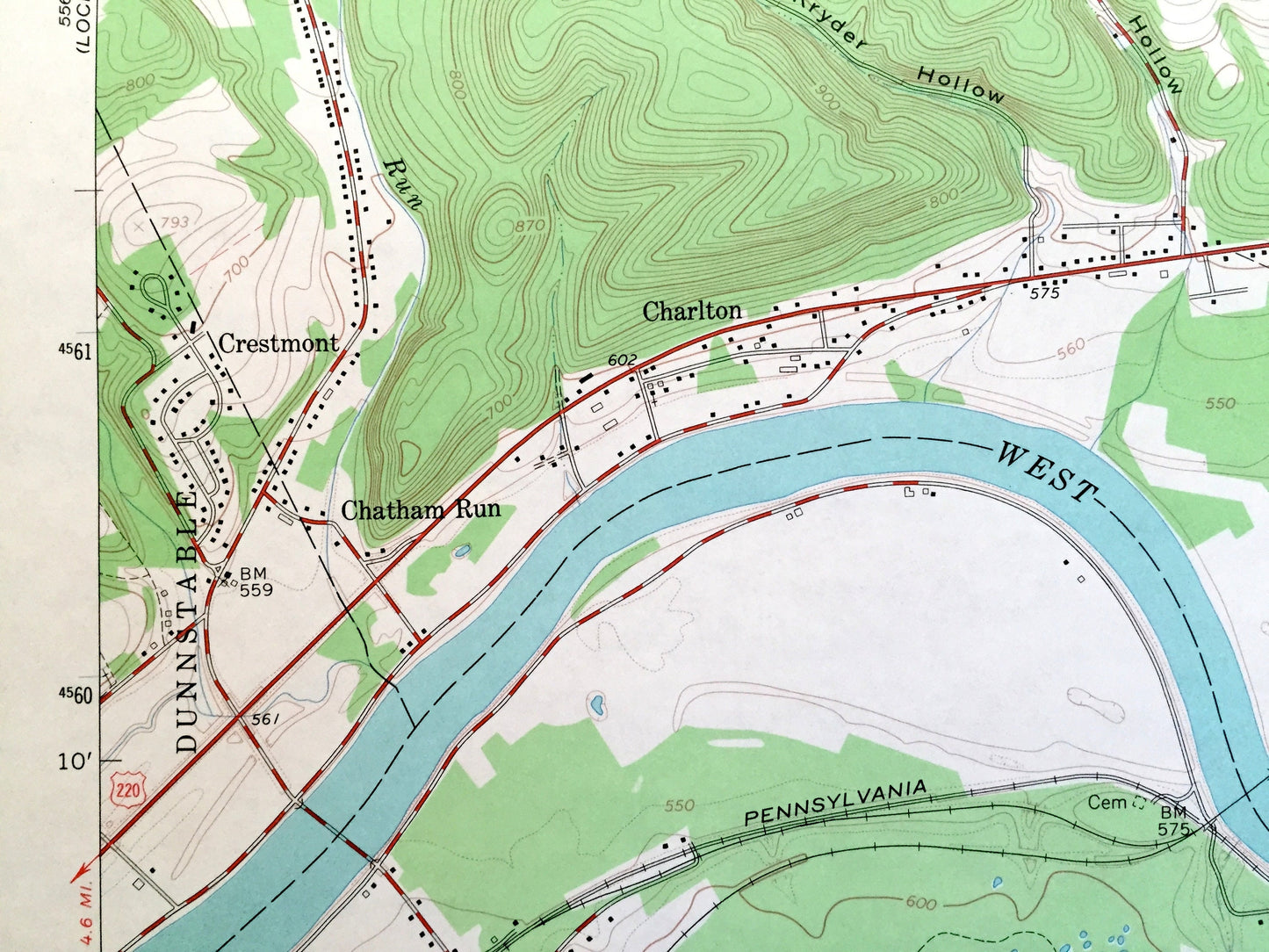
See what Pennsylvania looked like over 55 years ago. Lots of intricate details and geological contours. Map even has little squares for every house that existed at the time. The USGS cartographers were very thorough back then!
Perfect for the historian, map-lover, the curious or just as a conversation starter. Wonderful and rare. Vintage maps such as these make great gifts.
Edition of 1965, printed 1967
Dimensions: 22" width x 27" height
----
Features
Cities & Towns: Watson, Gallagher, Pine Creek, Mifflin, Piatt, Porter, Dunnstable, Wayne, Nippenose, Crawford, Torbert, Woolrich, Crestmont, Charlton, Chatham Run, McElhattan, Pine, Avis, Youngdale.
Points of Interest: Tiadaghton State Forest, Bald Eagle State Forest, Short Mountain, Bald Eagle Mountain, Pine Creek, West Branch Susquehanna River, Sulpher Run, Furnace Run, Nichols Run, Stewards Run, McElhattan Creek, Aughanbaugh Run, Canoe Run, and many more hills, streams, ponds, houses, schools, railroads, churches and roads.
Condition: Very Good Vintage condition, commensurate with age. This map is in great shape for being over 55 years old.
----
We will happily adjust shipping price for multiple purchases. Maps are rolled up and shipped in sturdy mailing tubes, never folded.
Couldn't load pickup availability
Share