My Store
Antique John H Kerr Dam, Virginia 1968 US Geological Survey Topographic Map – Mecklenburg County, Warren, Vance, North Carolina, NC VA
Antique John H Kerr Dam, Virginia 1968 US Geological Survey Topographic Map – Mecklenburg County, Warren, Vance, North Carolina, NC VA
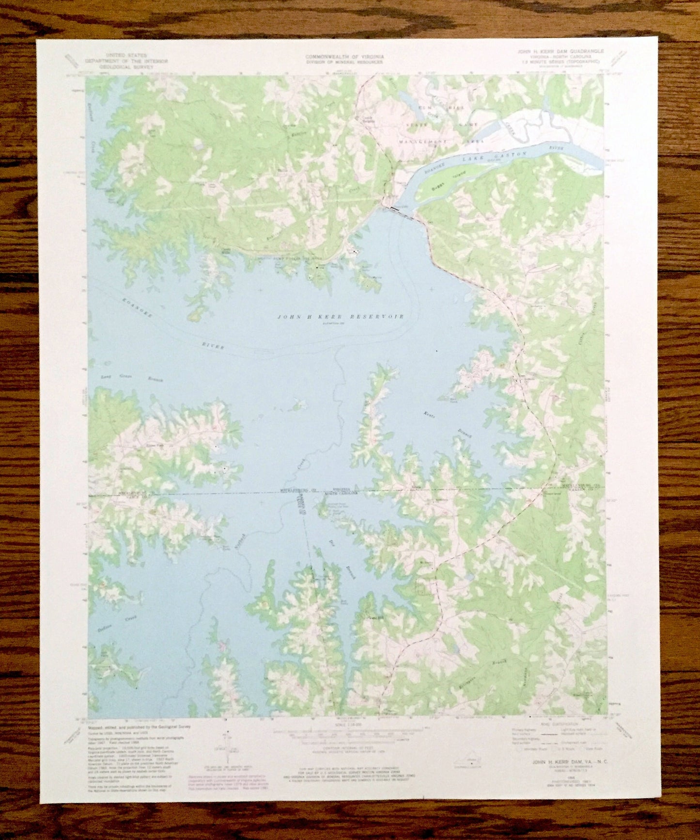
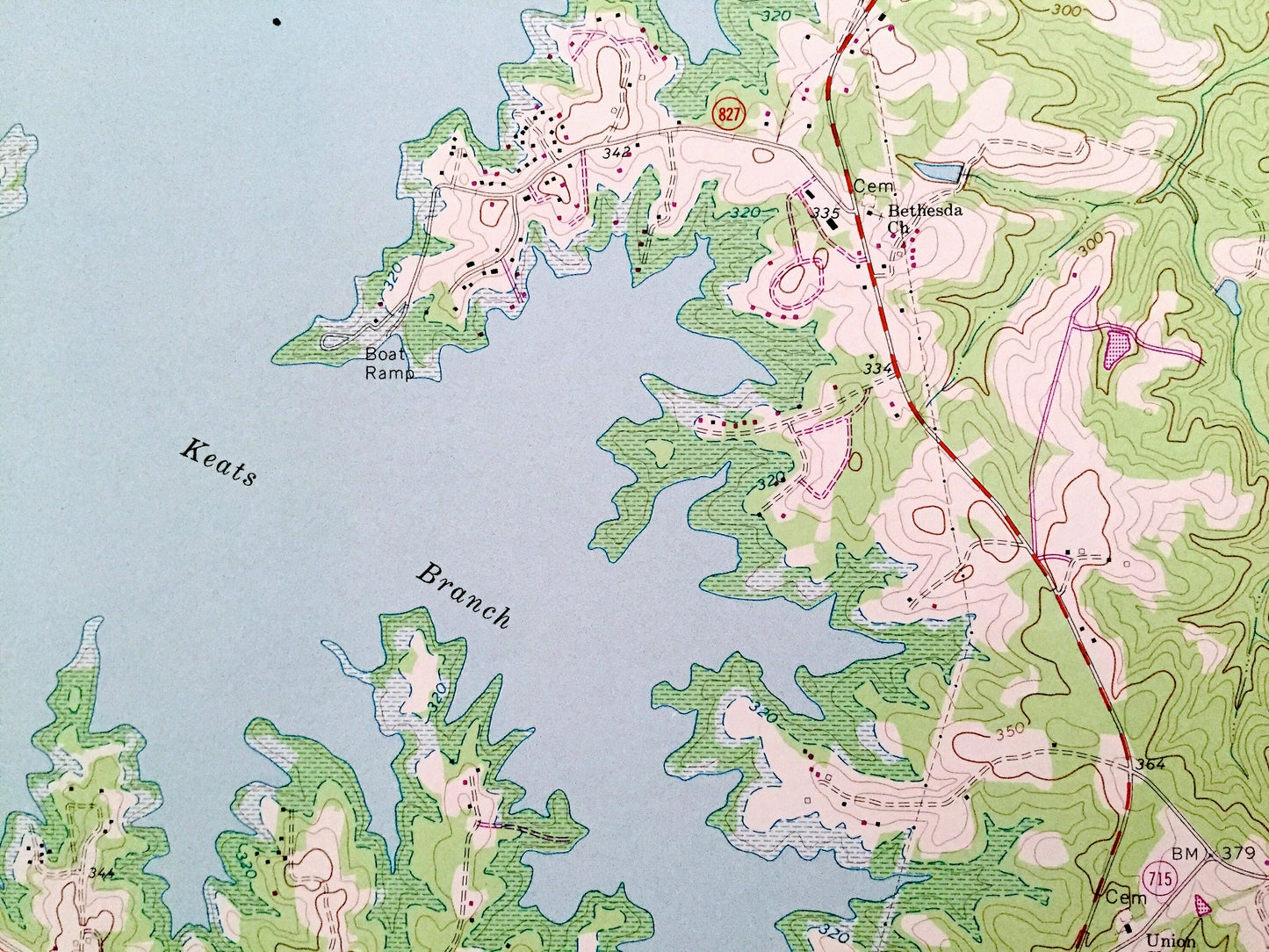
Beautiful, antique map of John H Kerr Dam, Virginia and surrounding Mecklenburg County & Warren County and Vance County, North Carolina area on John H Kerr Reservoir. This is an authentic 1968 edition, 1981 print from the U.S. Geological Survey and NOT a computer reproduction.
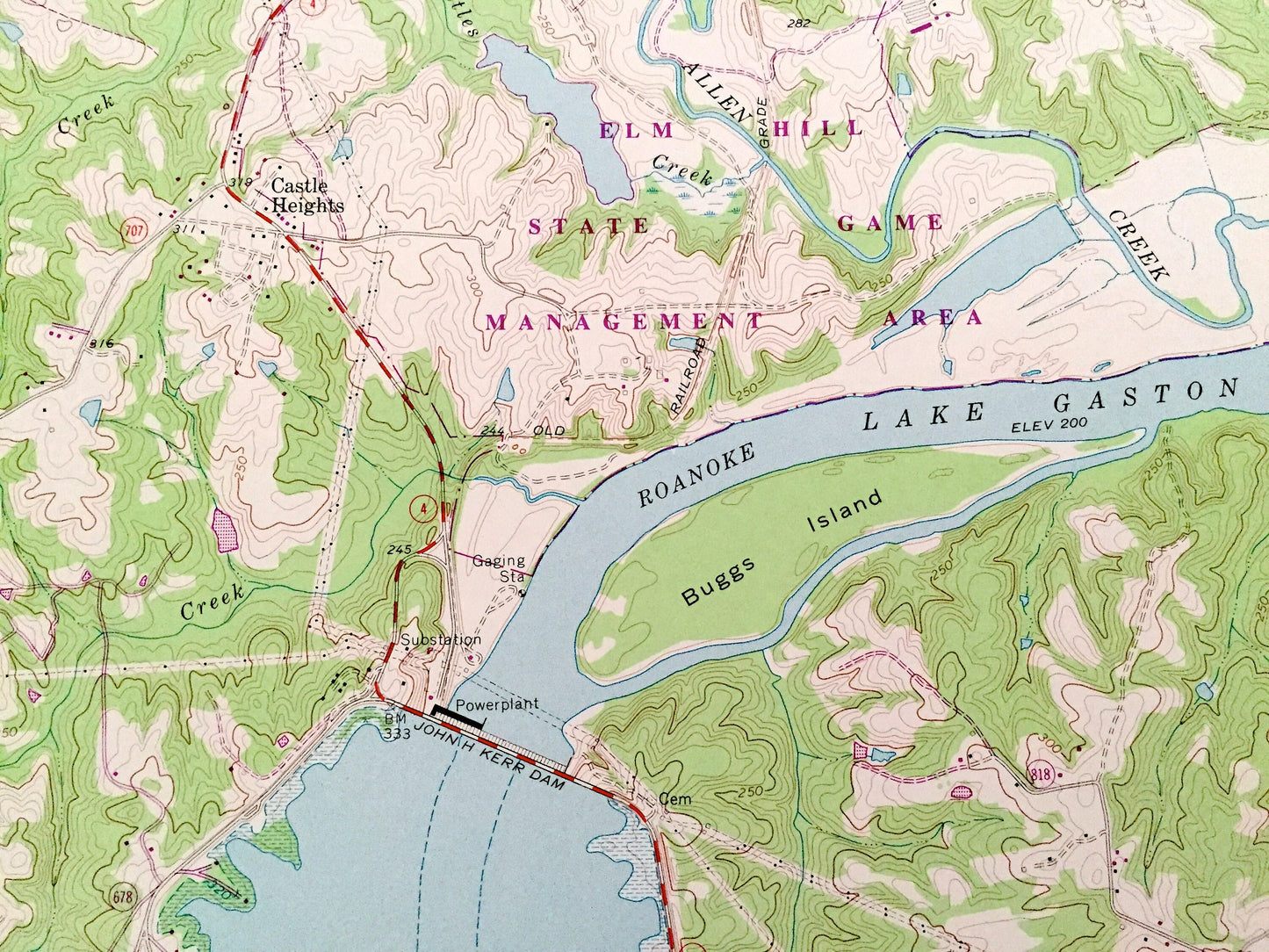
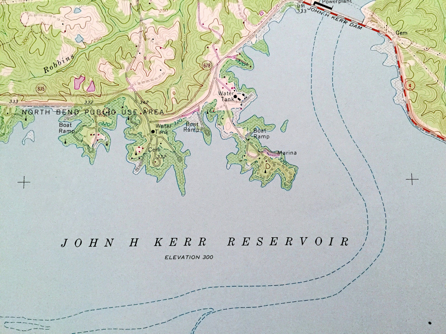
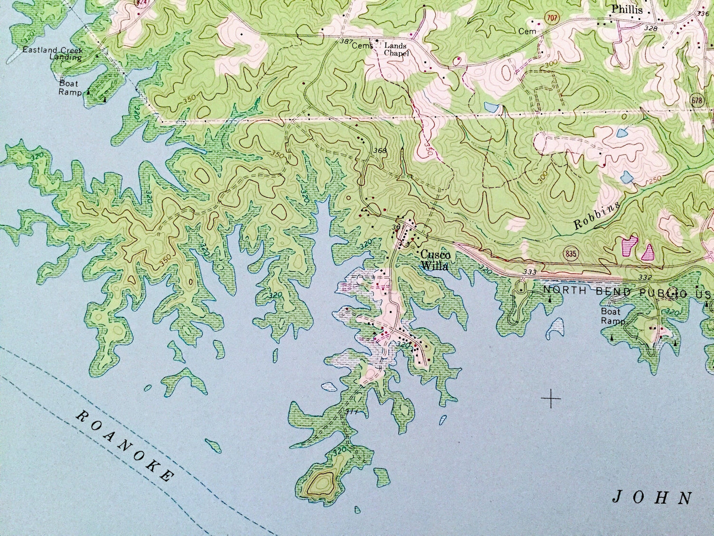
See what Virginia and North Carolina looked like over 50 years ago. Lots of intricate details and geological contours. Map even has little squares for every house that existed at the time. The USGS cartographers were very thorough back then!
Perfect for the historian, map-lover, the curious or just as a conversation starter. Wonderful and rare. Vintage maps such as these make great gifts.
Edition of 1968, printed 1981
Dimensions: 22" width x 27" height
----
Features
Cities & Towns: VIRGINIA: Cusco Villa, Castle Heights, Phillis, Eppes Fork.
NORTH CAROLINA: Rose Hill.
Points of Interest: Mecklenburg County, Warren County, Vance County, John H Kerr Reservoir, Lake Gaston, Roanoke River, Elm Hill State Game Management Area, (Dick Cross Wildlife Management Area), North Bend Park and Campground, Buggs Island, Eastland Creek, Keats Branch, Kimball Point, Palmer Point Park, Keats Peninsula, Dodson Creek, Nutbush Creek, Henderson Point, and many more hills, streams, ponds, houses, schools, churches and roads.
Condition: Good Vintage condition, commensurate with age. This map is in great shape for being over 40 years old. Has light edge-wear, but this will add to vintage character when framed.
----
We will happily adjust shipping price for multiple purchases. Maps are rolled up and shipped in sturdy mailing tubes, never folded.
Couldn't load pickup availability
Share