My Store
Antique Johnstown, Pennsylvania 1901 US Geological Survey Map – Westmoreland, Cambria County, Westmont, Morrellville, Ehrefeld, Conemaugh PA
Antique Johnstown, Pennsylvania 1901 US Geological Survey Map – Westmoreland, Cambria County, Westmont, Morrellville, Ehrefeld, Conemaugh PA
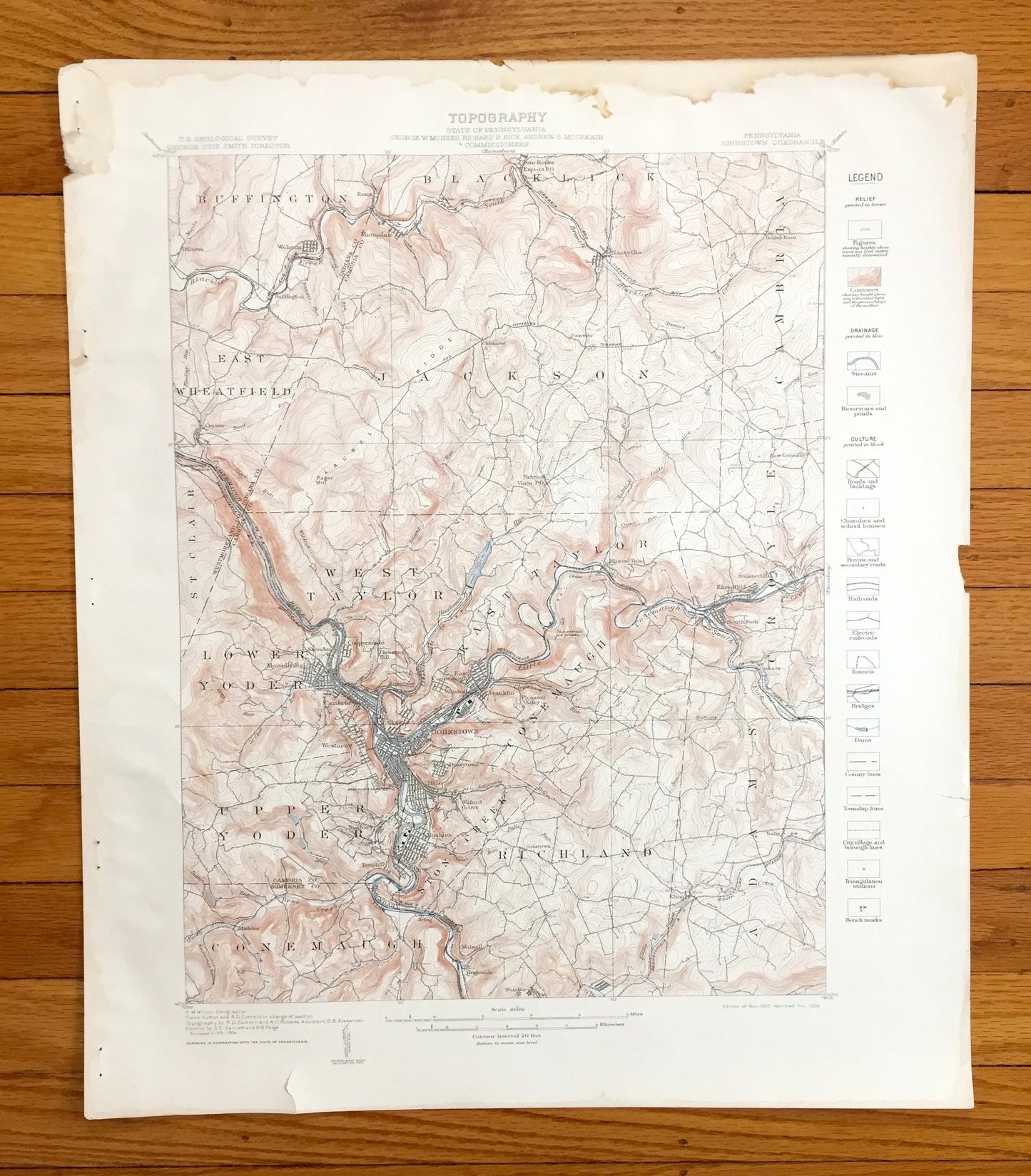
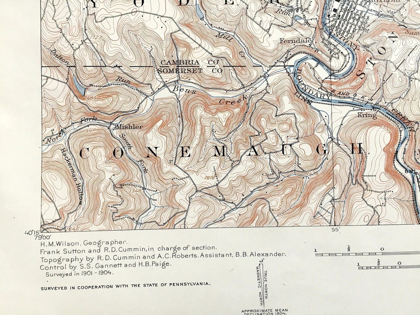
Beautiful, antique map of Johnstown, Pennsylvania and surrounding Cambria County area east of Pittsburgh. This is an authentic 1901 edition, 1909 print from the U.S. Geological Survey and NOT a computer reproduction. It is from a Geologic Atlas folio.
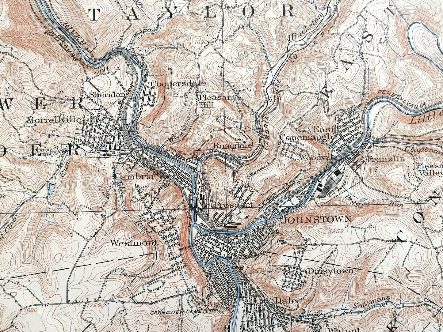
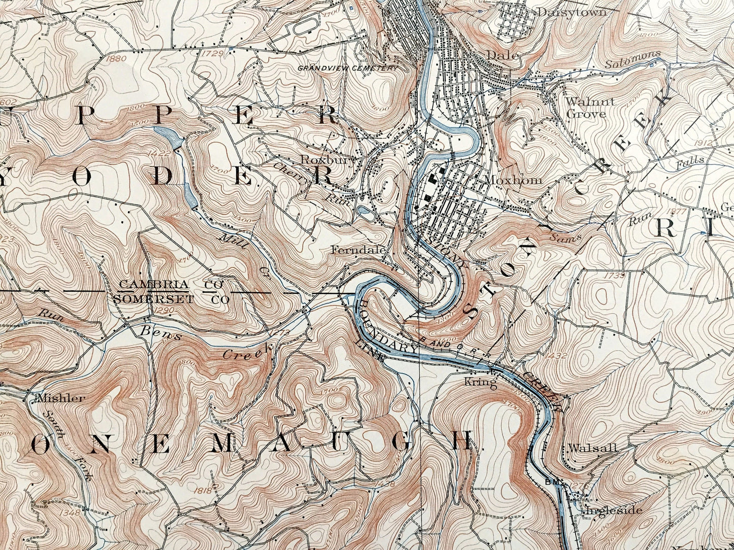
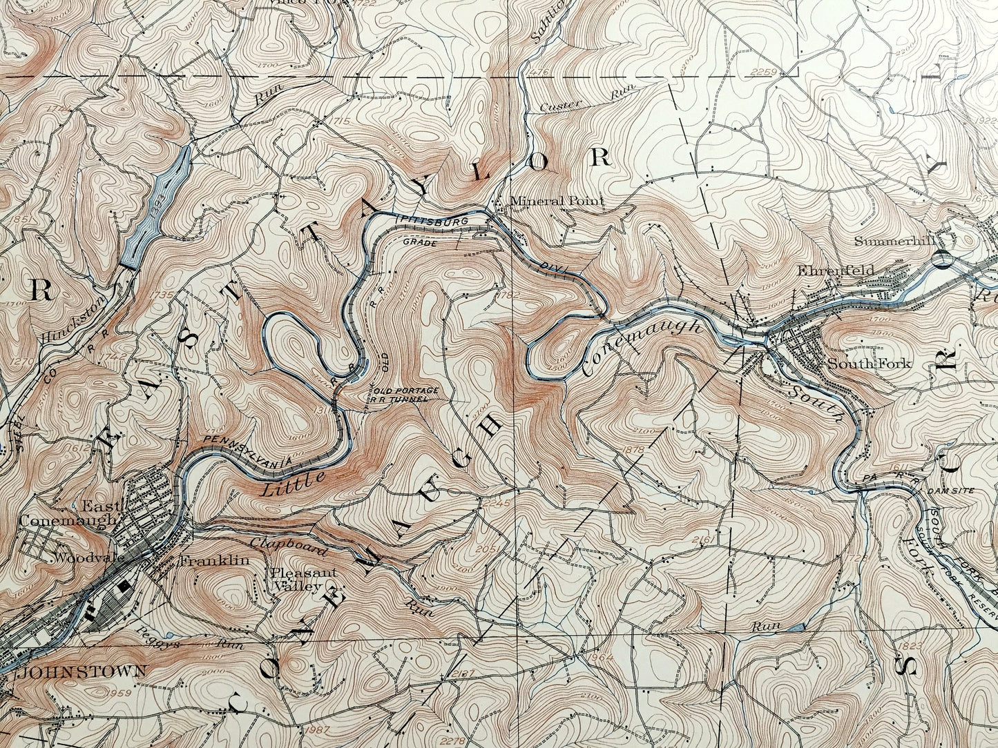
See what Pennsylvania looked like over 120 years ago. Lots of intricate details and geological contours. Map even has little squares for every house that existed at the time. The USGS cartographers were very thorough back then! This is one of the rare maps where the topographic symbols and map guide are on the front.
Perfect for the historian, map-lover, the curious or just as a conversation starter. Wonderful and rare. Vintage maps such as these make great gifts.
Edition of 1901, printed 1909
Dimensions: 18 1/2" width x 22" height
----
Features
Cities & Towns: Buffington, Blacklick, Cambria, East Wheatfield, Jackson, St. Clair, West Taylor, East Taylor, Croyle, Lower Yoder, Conemaugh, Upper Yoder, Conemaugh, Stony Creek, Richland, Adams, Dilltown, Wehrum, Cramer, Vintondale, Rexis, Weber, Twin Rocks, Chickaree, Dearmin, Nanty Glo, Morrellville, Sheridan, Coopersdale, Pleasant Hill, Rosedale, Prospect, East Conemaugh, Woodvale, Franklin, Pleasant Valley, Mineral Point, Ehrefeld, Summerhill, South Fork, Westmont, Roxbury, Ferndale, Johnstown, Daisytown, Dale, Walnut Grove, Moxham, Kring, Walsall, Ingleside, Number 37, Elton, Salix, Geistown.
Points of Interest: Future home of University of Pittsburgh at Johnstown, Westmoreland County, Cambria County, Conemaugh River, Stony Creek, Blacklick Creek, Pittsburgh Turnpike, Saltlick Run, Pennsylvania Railroad and lots more hills, mountains, creeks, towns, schools, churches, roads and railroads.
Condition: Good Vintage condition, commensurate with age. This map is in great shape for being over 110 years old. Has some staple holes in margin, foxing, toning, stain in upper margin, and edge wear but will all read as vintage character when framed.
----
We will happily adjust shipping price for multiple purchases. Maps are rolled up and shipped in sturdy mailing tubes, never folded.
Couldn't load pickup availability
Share