My Store
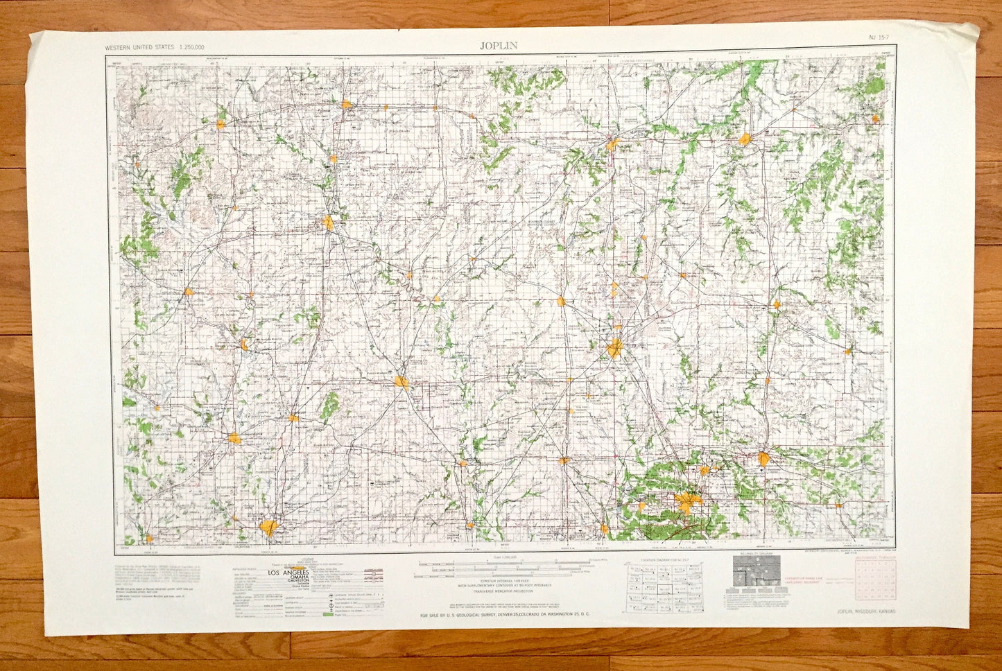
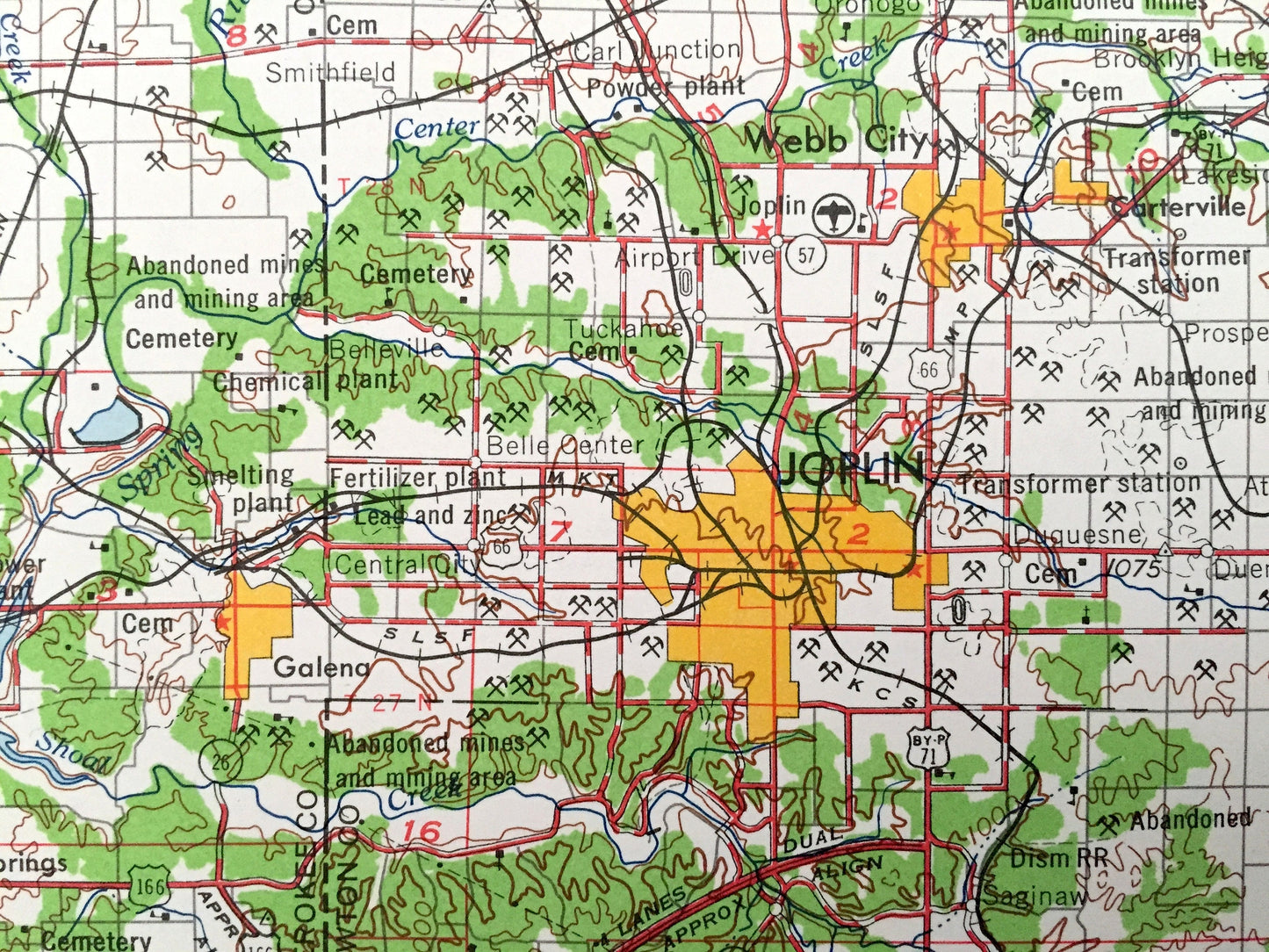
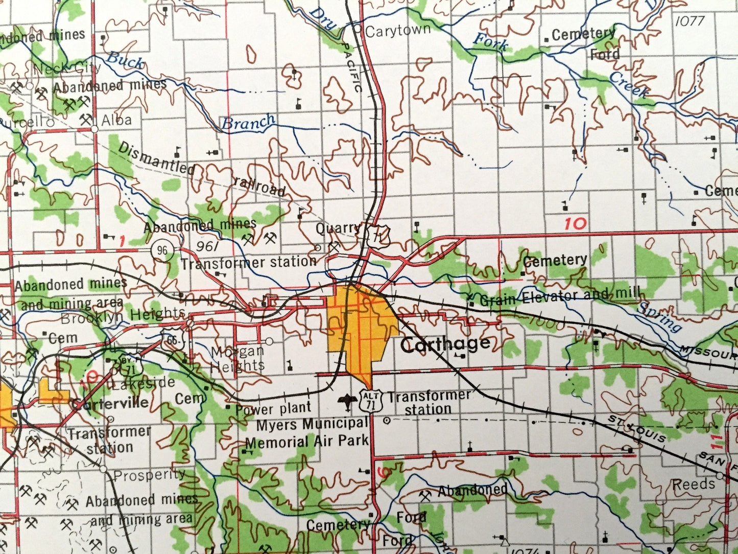
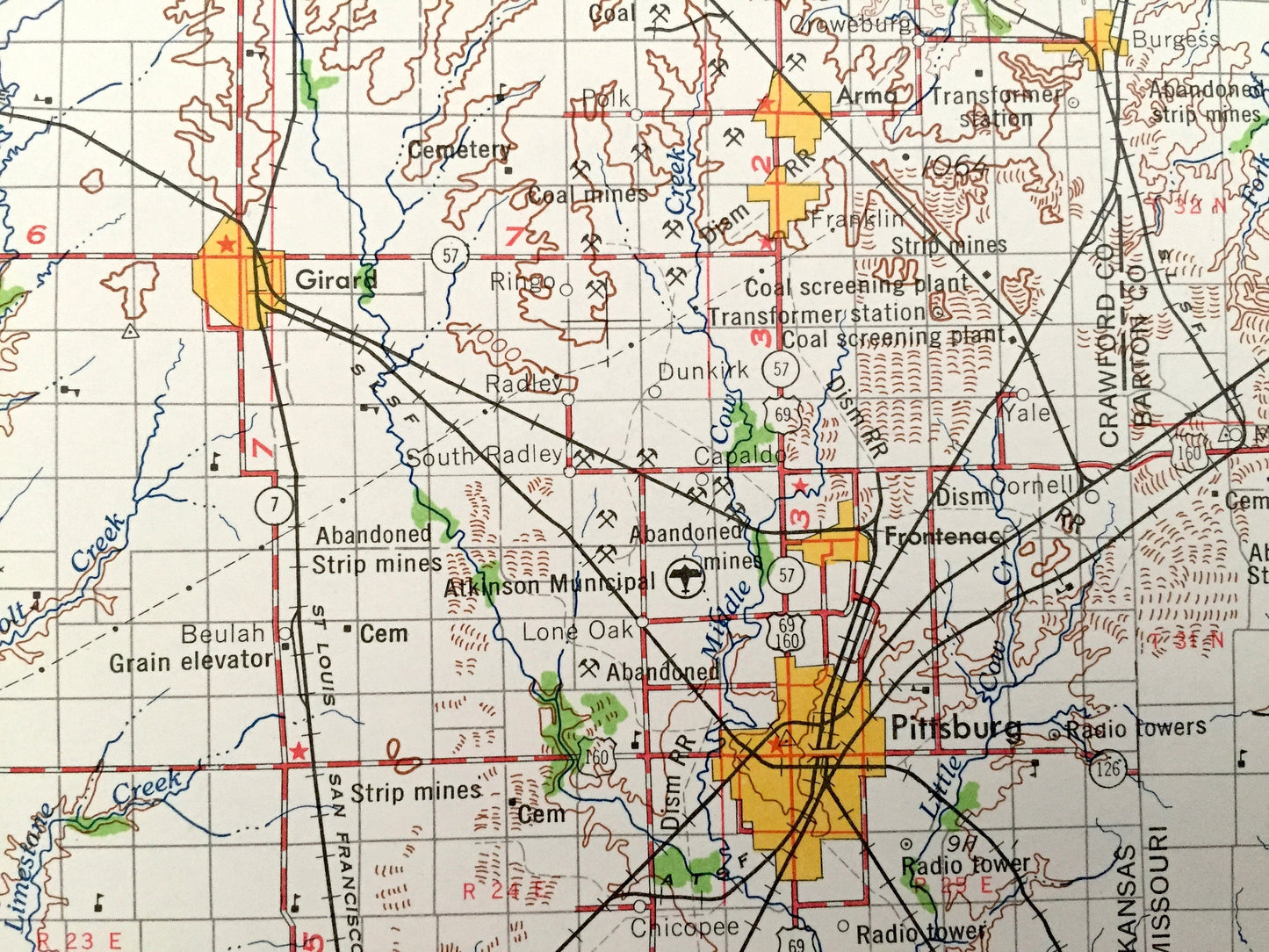
Antique Joplin, Missouri 1959 US Geological Survey Topographic Map – Webb City, Carthage, Sarcoxie, Jasper, Golden City Lamar Carterville MO
Antique Joplin, Missouri 1959 US Geological Survey Topographic Map – Webb City, Carthage, Sarcoxie, Jasper, Golden City Lamar Carterville MO
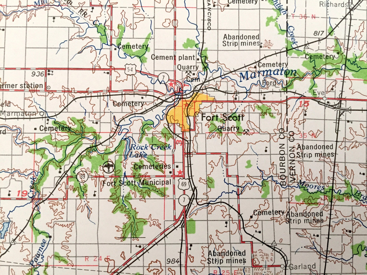
Beautiful, antique map of Joplin, Missouri and surrounding Kansas areas. This is an authentic 1959 edition, 1959 print from the U.S. Geological Survey and NOT a computer reproduction.
See what Missouri and Kansas looked like over 60 years ago. Lots of intricate details and geological contours. Map is incredibly large and in the grand 1:250,000 scale. The USGS cartographers were very thorough back then!
Perfect for the historian, map-lover, the curious or just as a conversation starter. Wonderful and rare. Vintage maps such as these make great gifts.
Edition of 1959, printed 1959
Dimensions: 32" width x 22 1/2" height
----
Features
Cities & Towns: Missouri - Joplin, Nevada, Eldorado Springs, Webb City, Carthage, Sarcoxie, Jasper, Golden City, Lamar, Carterville.
Kansas - Galena, Baxter Springs, Columbus, Pittsburg, Girard, Frontenac, Fort Scott, Parsons, Oswego, Chetopa, Coffeyville, Independence, Cherryvale, Caney, Neodesha, Fredonia, Chanute, Yates Center.
Points of Interest: Missouri - Muddy River, Marmaton River, Cottonwood Lake, Muddy Creek, North Fork Creek and lots more hills, mountains, lakes, creeks, highways, railroads.
Kansas - Marmaton River, Neosho River, Verdigris River, East Buffalo Creek, Walnut Creek, Lake McKinley and lots more hills, mountains, lakes, creeks, highways, railroads.
Condition: Very Good Vintage condition, commensurate with age. This map is in great shape for being over 60 years old. Has light edge-wear, all of which will read as vintage character when framed.
----
We will happily adjust shipping price for multiple purchases. Maps are rolled up and shipped in sturdy mailing tubes, never folded.
Couldn't load pickup availability
Share