My Store
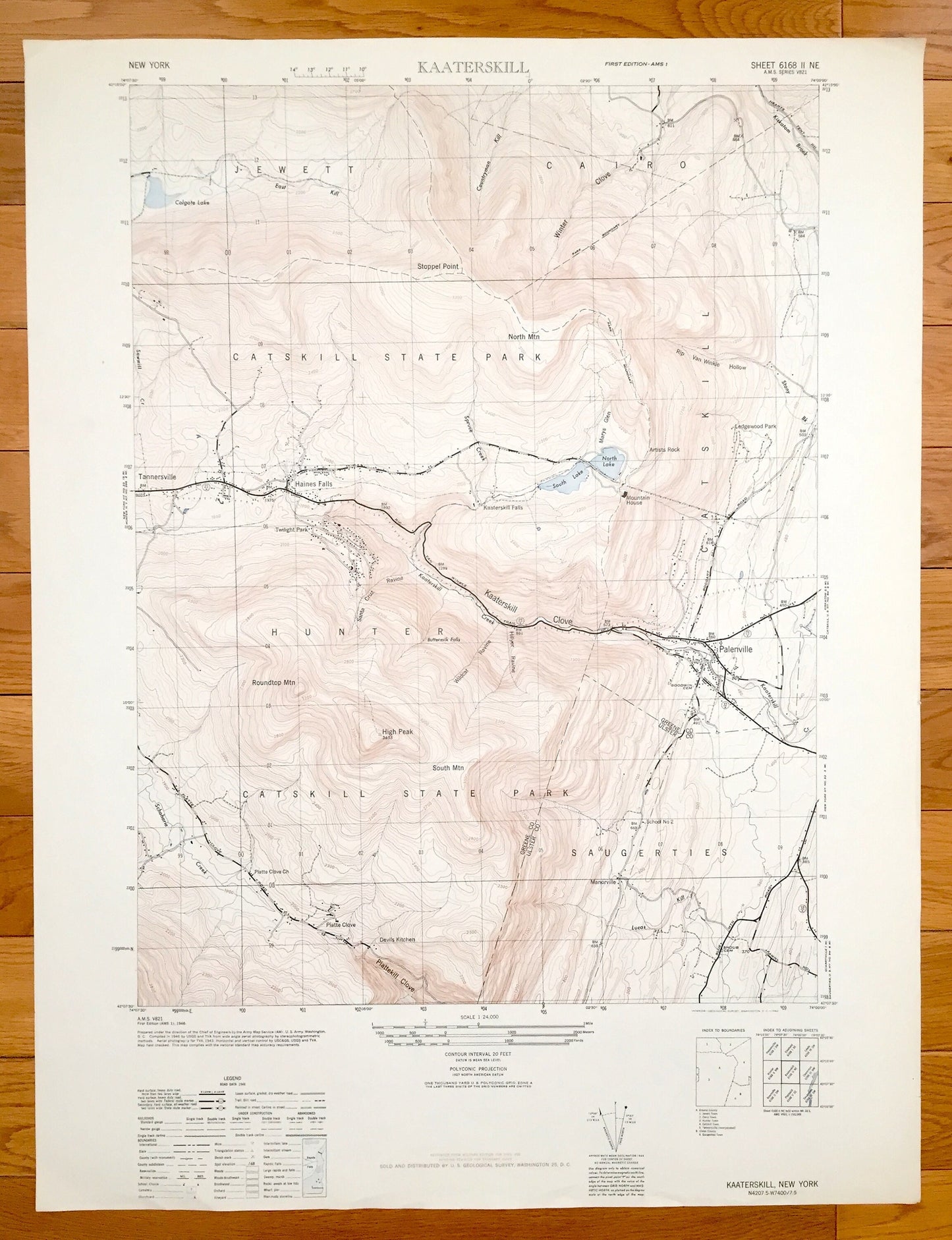
Antique Kaaterskill, New York 1946 US Geological Survey Topographic Map – Greene County, Cairo, Saugerties, Tannersville Hunter Catskills NY
Antique Kaaterskill, New York 1946 US Geological Survey Topographic Map – Greene County, Cairo, Saugerties, Tannersville Hunter Catskills NY
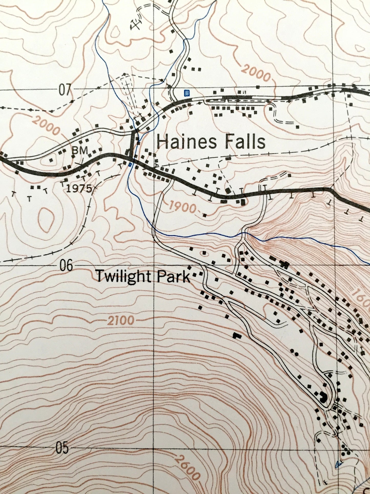
Beautiful, antique map of Kaaterskill, New York and surrounding Greene & Ulster County area. This is an authentic edition of 1946 print from the U.S. Geological Survey and NOT a computer reproduction.
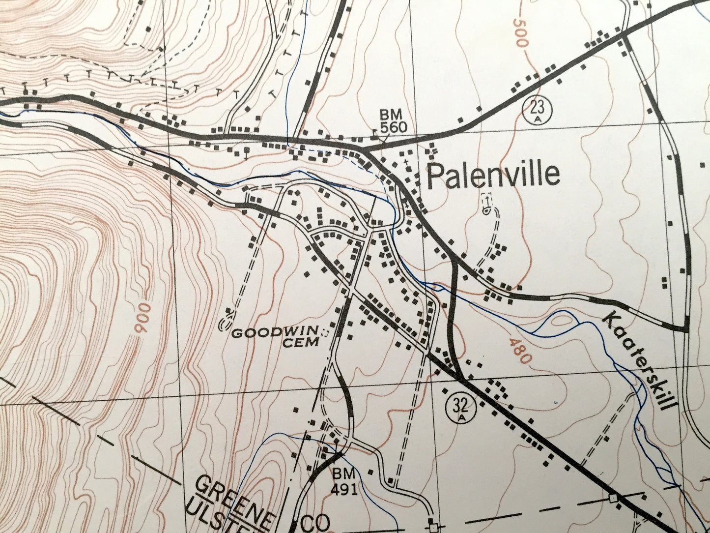
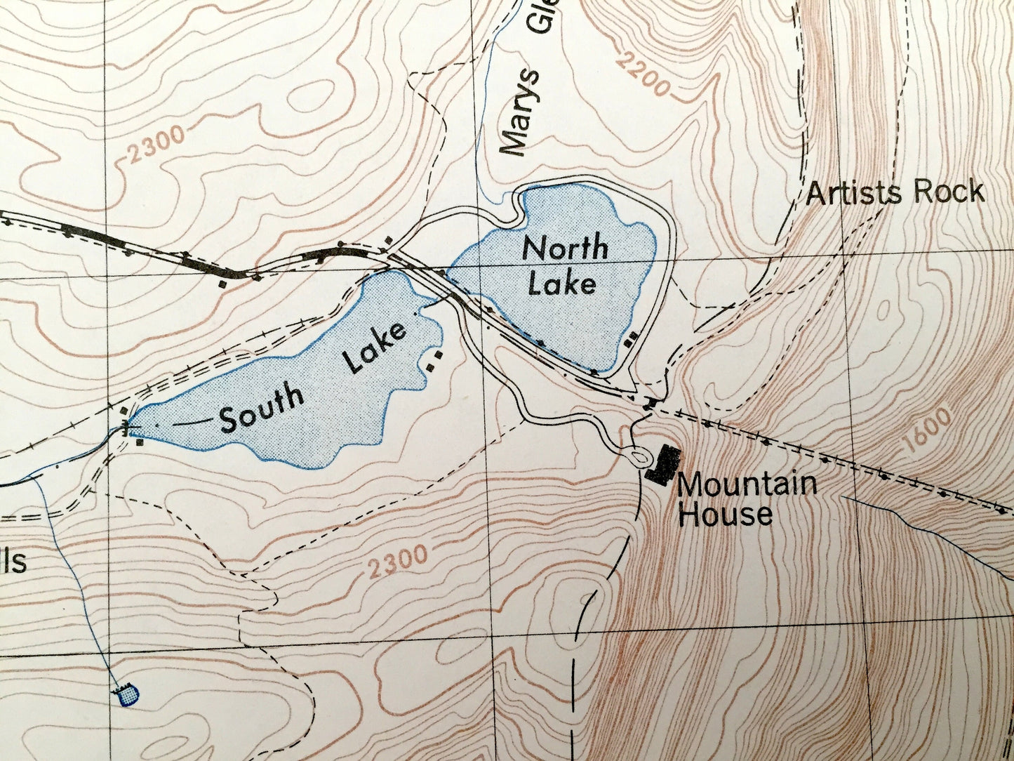
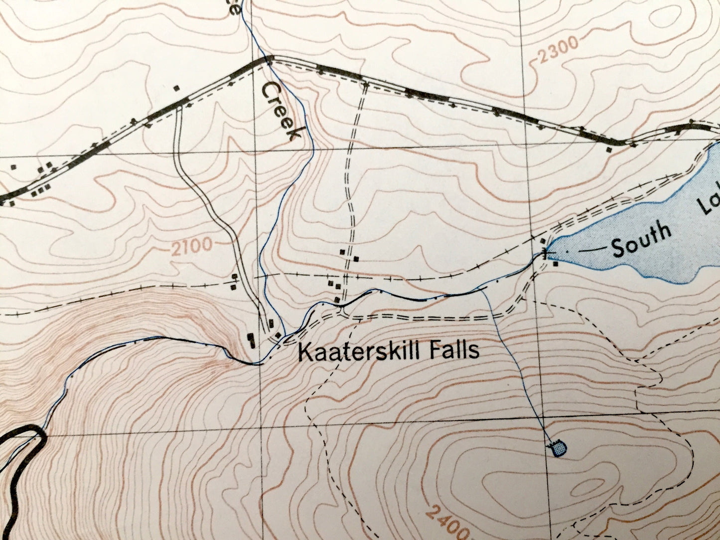
See what New York looked like over 75 years ago. Lots of intricate details and geological contours. Map even has little squares for every house that existed at the time. The USGS cartographers were very thorough back then!
Perfect for the historian, map-lover, the curious or just as a conversation starter. Wonderful and rare. Vintage maps such as these make great gifts.
Edition of 1946, printed 1946
Dimensions: 22" width x 29" height
----
Features
Cities & Towns: Cairo, Jewett, Ledgewood Park, Palenville, Haines Falls, Twilight Park, Tannersville, Hunter, Saugerties, Manorville.
Points of Interest: Kaaterskill Falls, Kaaterskill Clove, Catskill State Park, Colgate Lake, Stoppel Point, Winter Clove, Rip Van Winkle Hollow, Roundtop Mountain, Kaaterskill Creek, Mary's Glen, Platte Clove, Artists Rock, and many more roads, houses, reservoirs, ponds, and hills.
Condition: Very Good Vintage condition, commensurate with age. This map is in great shape for being over 75 years old.
----
We will happily adjust shipping price for multiple purchases. Maps are rolled up and shipped in sturdy mailing tubes, never folded.
Couldn't load pickup availability
Share