My Store
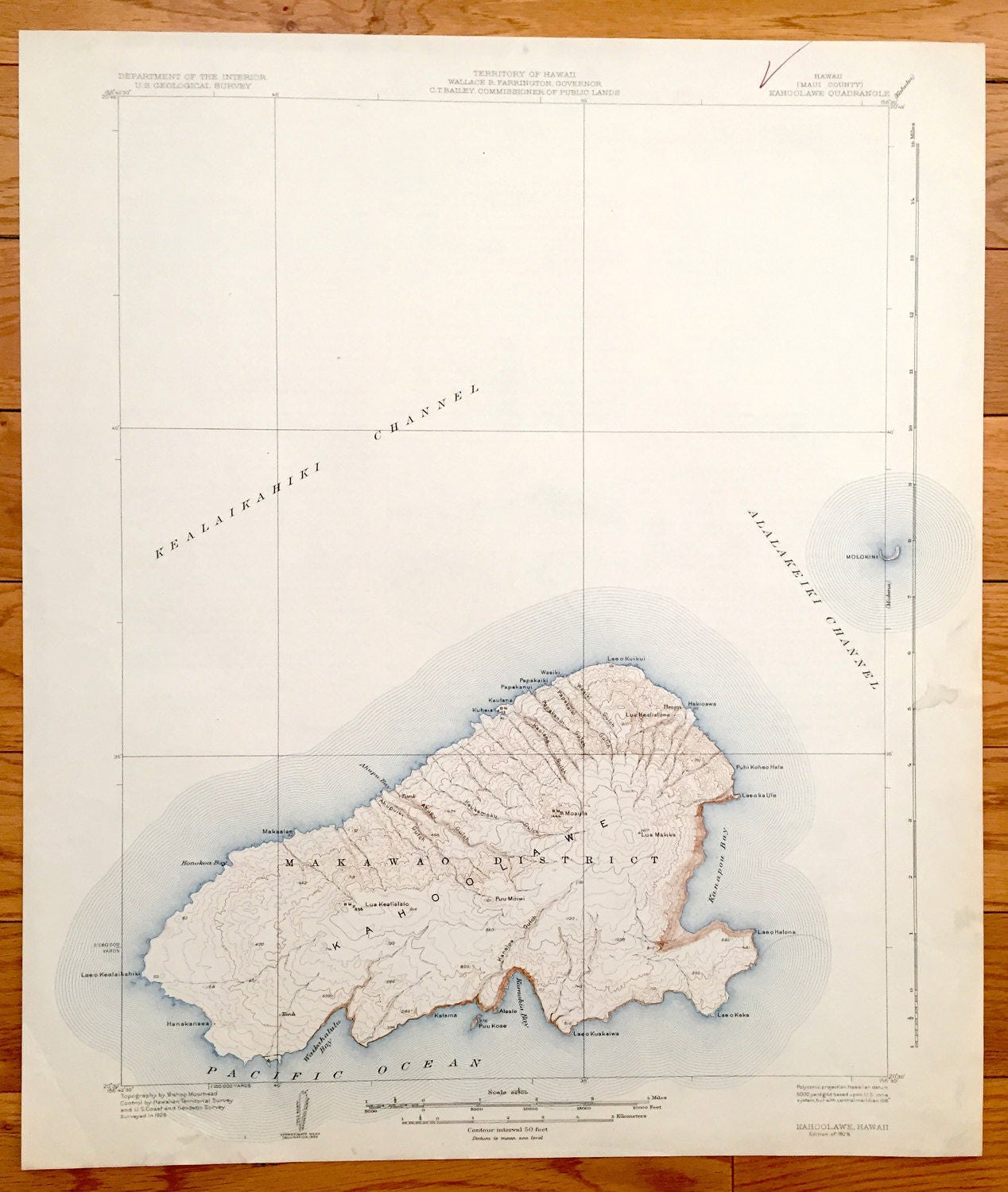
Antique Kahoolawe, Hawaii 1929 US Geological Survey Topographic Map – Makawao District, Heiau, Molokini, Kealaikahiki Kanapou Honokoa Bay HI
Antique Kahoolawe, Hawaii 1929 US Geological Survey Topographic Map – Makawao District, Heiau, Molokini, Kealaikahiki Kanapou Honokoa Bay HI
Beautiful, antique map of Kaho'olawe, Hawaii, smallest of the eight major Hawaiian Islands. This is an authentic 1929 print from the U.S. Geological Survey and NOT a computer reproduction.
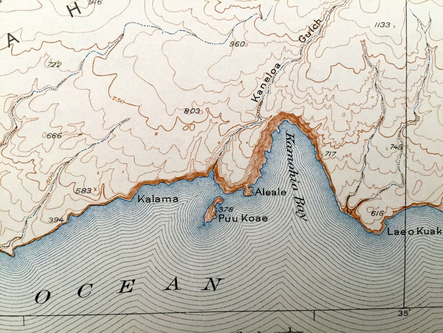
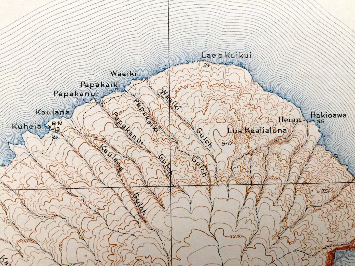
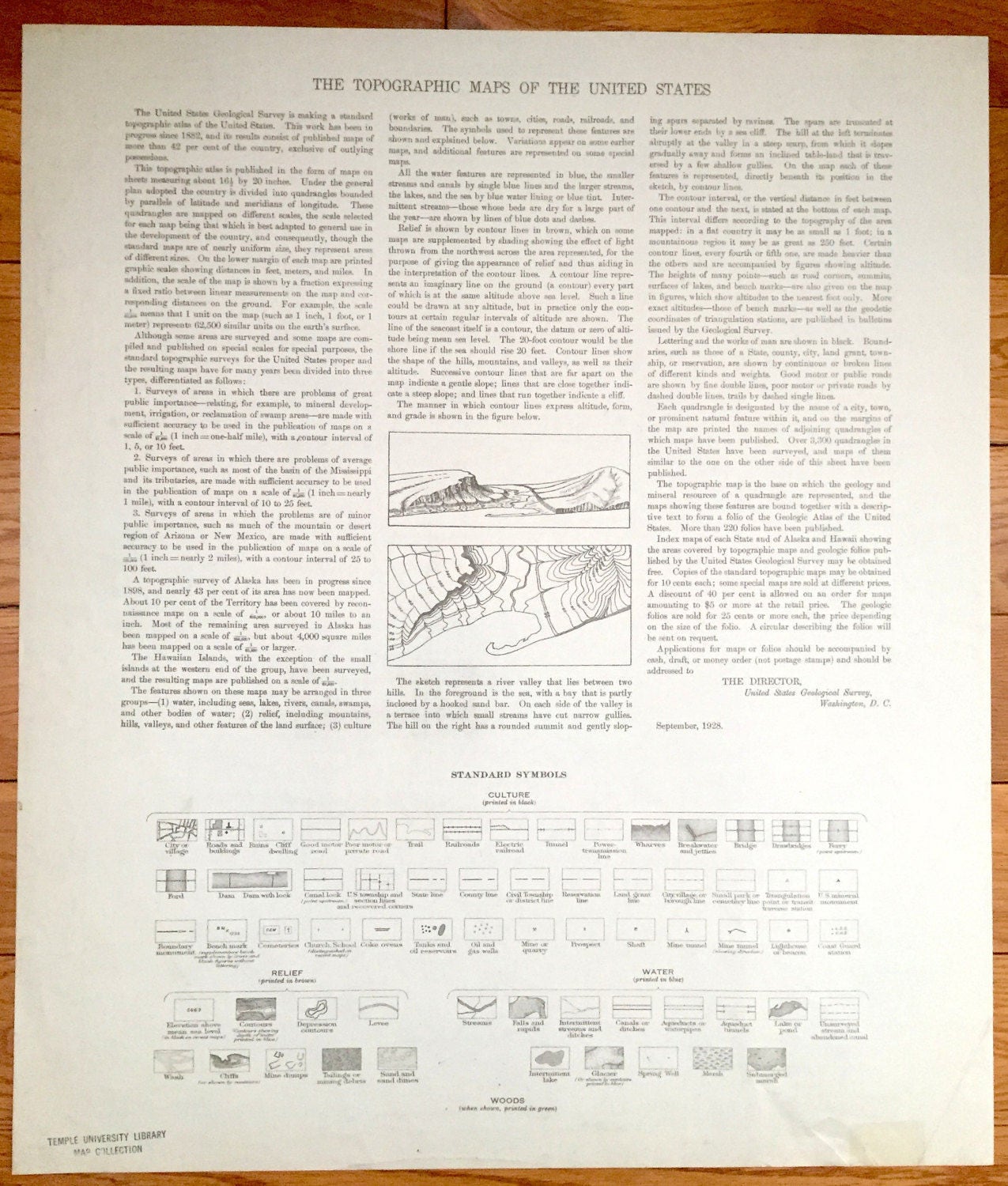
See what Kahoolawe looked like over 100 years ago. Lots of intricate details and geological contours. Map even has little squares for every building that existed at the time. The USGS cartographers were very thorough back then! On the back is a description of topographic symbols and map guide.
Perfect for the historian, map-lover, the curious or just as a conversation starter. Wonderful and rare. Vintage maps such as these make great gifts.
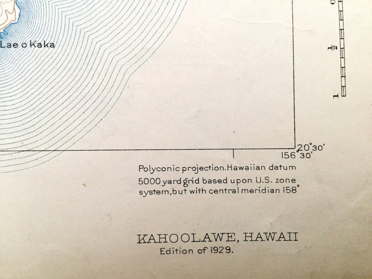
Edition of 1929, printed 1929
Dimensions: 17" width x 20" height
----
Features
Cities, Towns & Districts: Makawao District, Heiau.
Points of Interest: Pacific Ocean, Kealaikahiki Channel, Alalakeiki Channel, Laeo Kealaikahiki, Hanakaneaea, Waikahalulu Bay, Ahupu Bay, Makaalae, Puu Koae, Kamohia Bay, Kanapou Bay, Lae o Kaka, Laeo Kuakaiwa, Laeo Halona, Puhi Kohea Hala, Hakiowa, Molokini Island, Lua Makika, Lua Kealialalo, Puu Moiwi, Kaneloa Gulch and many more, inlets, points, valleys, gulches, mountains and streams.
Condition: Good Vintage condition, commensurate with age. This map is in great shape for being over 90 years old.
----
We will happily adjust shipping price for multiple purchases. Maps are rolled up and shipped in sturdy mailing tubes, never folded.
Couldn't load pickup availability
Share