My Store
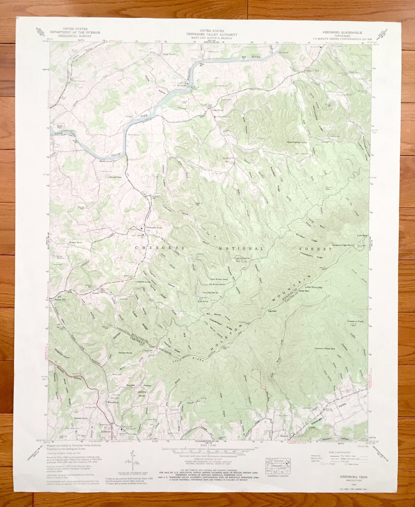
Antique Keenburg, Tennessee 1960 US Geological Survey Topographic Map – Cherokee National Forest, Sullivan, Carter County, Holston River, TN
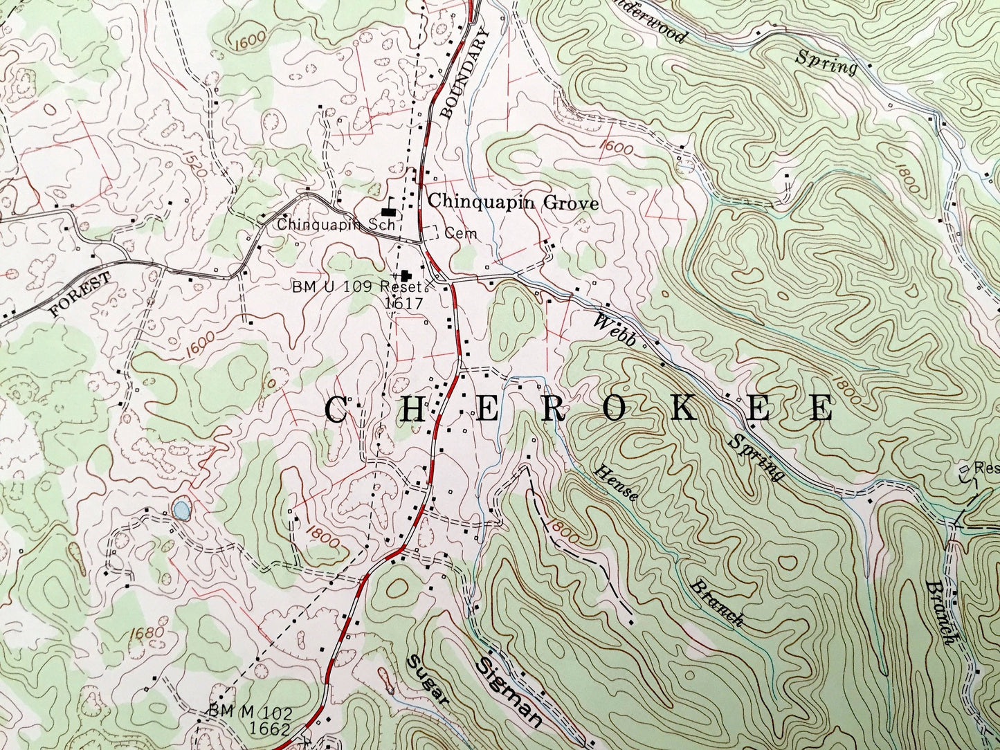
Antique Keenburg, Tennessee 1960 US Geological Survey Topographic Map – Cherokee National Forest, Sullivan, Carter County, Holston River, TN
Beautiful, antique map of Keenburg, Tennessee and surrounding Carter & Sullivan County areas. This is an authentic 1960 edition, 1988 print from the U.S. Geological Survey and NOT a computer reproduction.
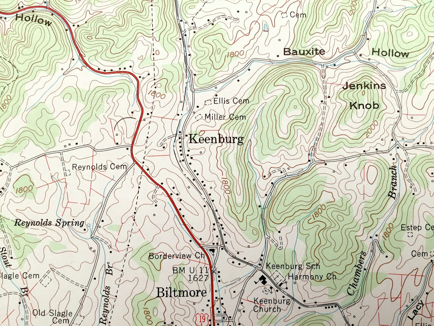
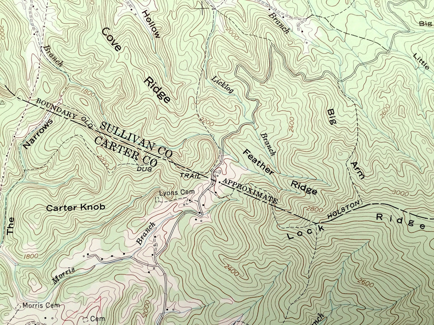
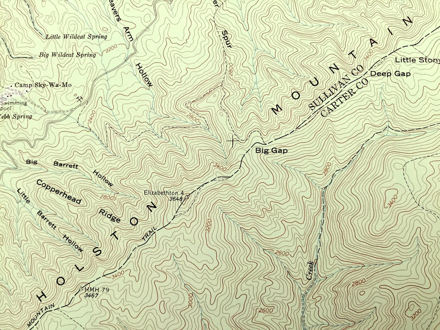
See what Tennessee looked like over 60 years ago. Lots of intricate details and geological contours. Map even has little squares for every house that existed at the time. The USGS cartographers were very thorough back then!
Perfect for the historian, map-lover, the curious or just as a conversation starter. Wonderful and rare. Vintage maps such as these make great gifts.
Edition of 1960, printed 1988
Dimensions: 22" width x 27" height
----
Features
Cities & Towns: Keenburg, Island Park, Riverside, Hickory Tree, Cedar Grove, Walnut Grove, Chinquapin Grove, Biltmore, Hunter.
Points of Interest: Carter County, Sullivan County, Cherokee National Forest, Holston River, Holston Mountain, Boone Lake, Grandfather Knob, Morrell Cave, Weavers Arm Hollow, Little Stony Gap, Cannon Place Gap, Chestnut Flats, Watauga Valley, and lots more hills, mountains, creeks, ponds, brooks, towns, schools, churches, roads and railroads.
Condition: Good Vintage condition, commensurate with age. This map is in great shape for being 30 years old. Has light wear and foxing but this will all add to vintage character when framed.
----
We will happily adjust shipping price for multiple purchases. Maps are rolled up and shipped in sturdy mailing tubes, never folded.
Couldn't load pickup availability
Share