My Store
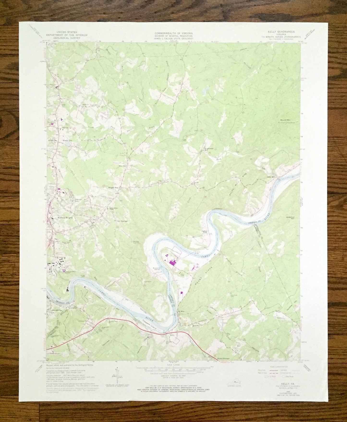
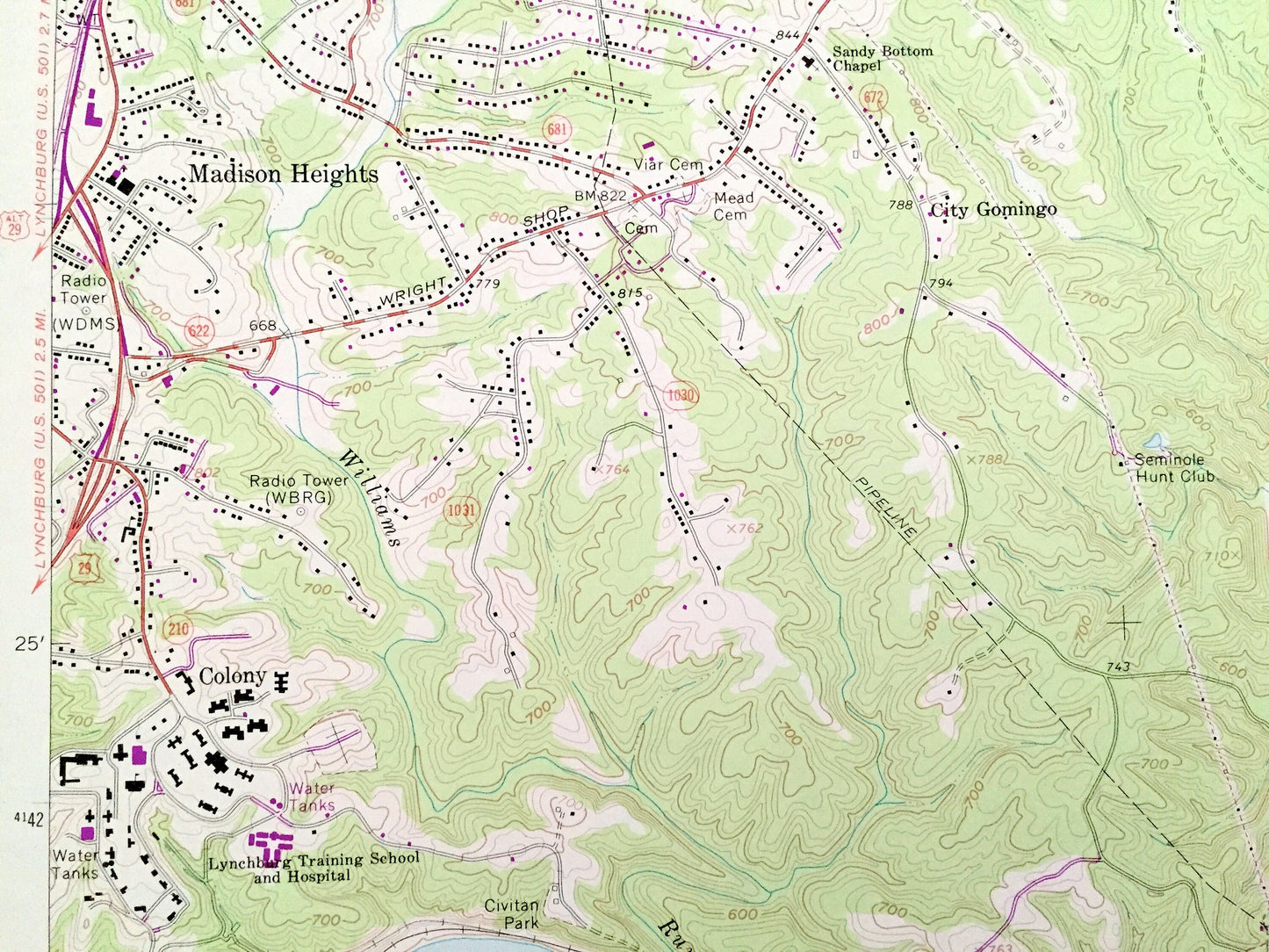
Antique Kelly, Virginia 1963 US Geological Survey Topographic Map – Amherst, Campbell County, Appomattox, Lynchburg, Madison Heights, VA
Antique Kelly, Virginia 1963 US Geological Survey Topographic Map – Amherst, Campbell County, Appomattox, Lynchburg, Madison Heights, VA
Beautiful, antique map of Kelly, Virginia and surrounding Amherst & Campbell County area. This is an authentic 1963 edition, 1971 print from the U.S. Geological Survey and NOT a computer reproduction.
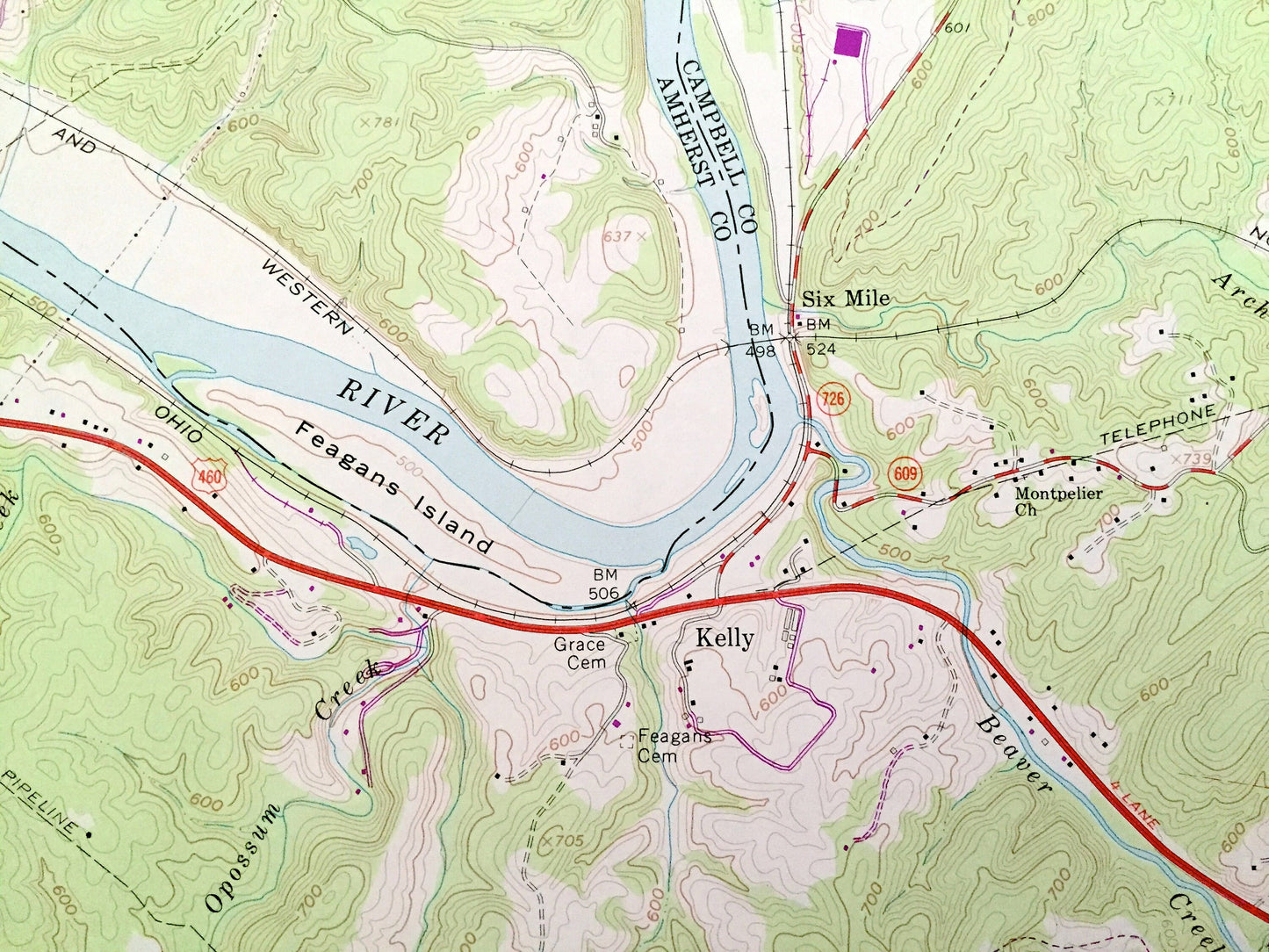
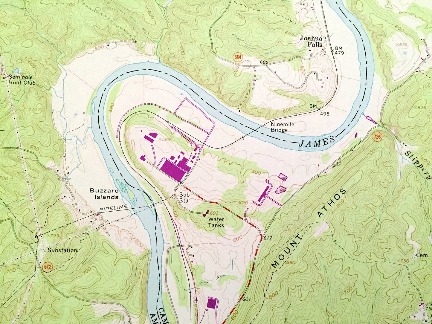
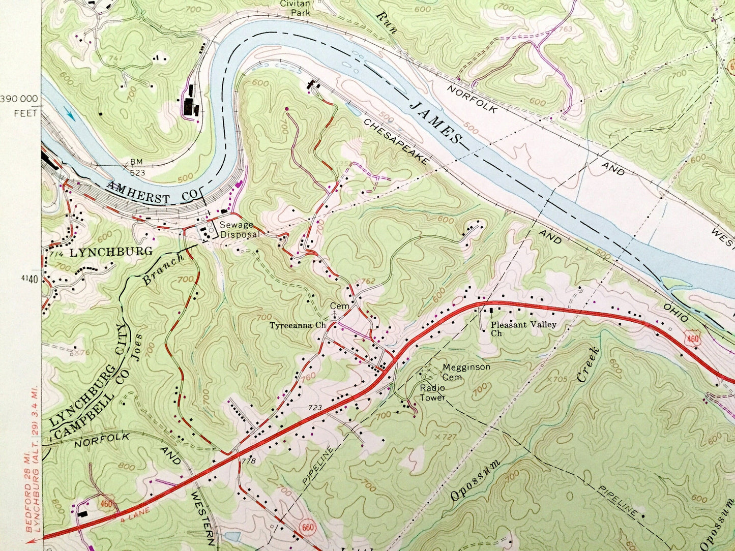
See what Virginia looked like 60 years ago. Lots of intricate details and geological contours. Map even has little squares for every house that existed at the time. The USGS cartographers were very thorough back then!
Perfect for the historian, map-lover, the curious or just as a conversation starter. Wonderful and rare. Vintage maps such as these make great gifts.
Edition of 1963, printed 1971
Dimensions: 22" width x 27" height
----
Features
Cities & Towns: Kelly, Madison Heights, Lynchburg, Wright Shop, Brightwell Mill, City Gomingo, Colony, Galts Mill, Joshua Falls. Tyreeana, Winston Ridge.
Points of Interest: Augusta County, Campbell County, Appomattox County, James River, Round Mountain, Galts Mill Mountain, Chestnut Mountain, Mount Athos, Buzzard Island, Feagans Island, Archer Creek, Paradise Hill, Opossum Creek, Slippery Branch, Woody Lake, Seminole Hunt Club, Seaboard Coast Railroad Line, Seat Island Branch, Civitan Park, and many more creeks, hills, houses and roads.
Condition: Good Vintage condition, commensurate with age. This map is in great shape for being over 50 years old. Has light wear, but this will read as vintage character when framed.
----
We will happily adjust shipping price for multiple purchases. Maps are rolled up and shipped in sturdy mailing tubes, never folded.
Couldn't load pickup availability
Share