My Store
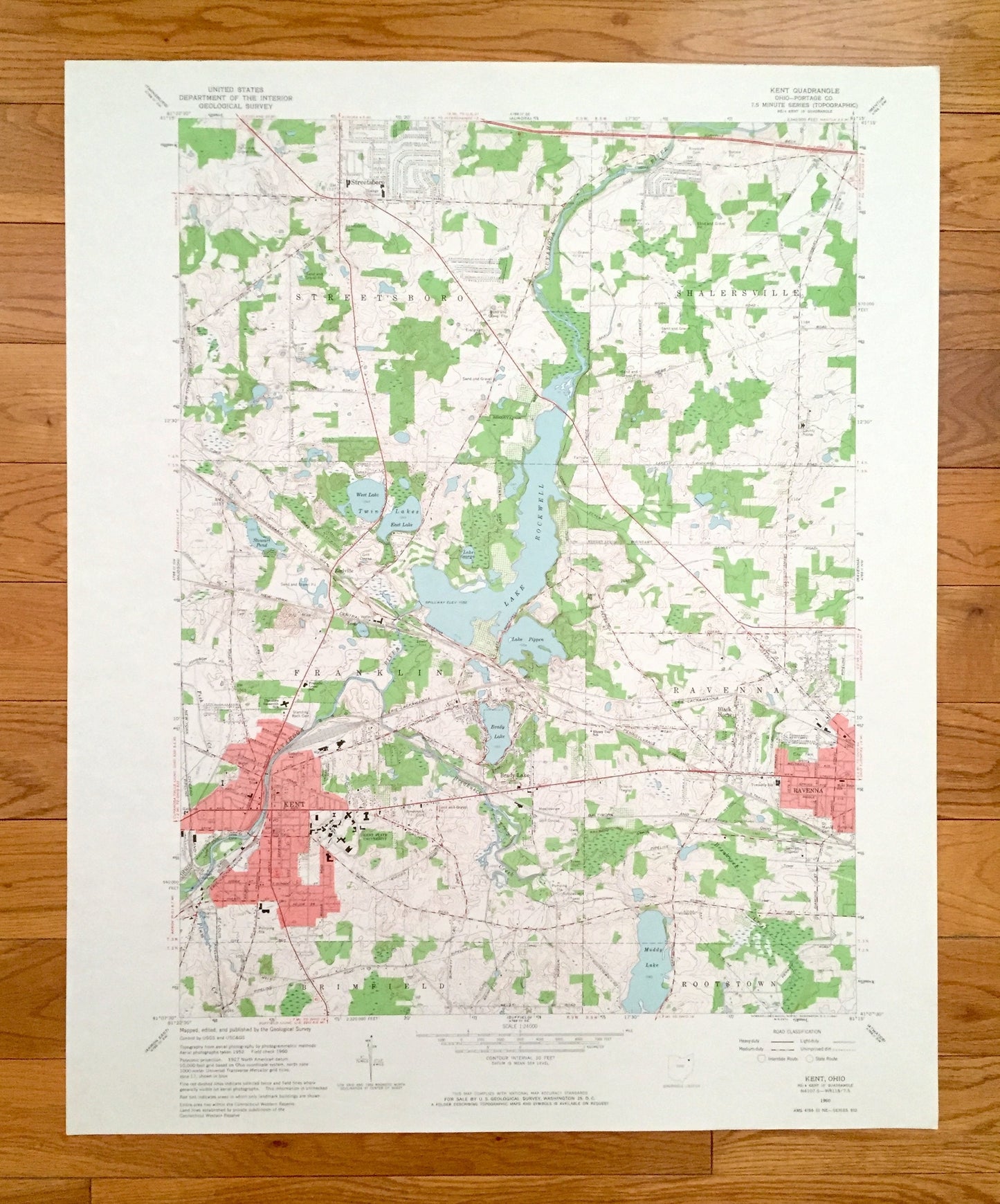
Antique Kent, Ohio 1960 US Geological Survey Topographic Map – Portage County, Streetsboro, Shalersville, Franklin, Ravenna, Brimfield, OH
Antique Kent, Ohio 1960 US Geological Survey Topographic Map – Portage County, Streetsboro, Shalersville, Franklin, Ravenna, Brimfield, OH
Beautiful, antique map of Kent, Ohio and surrounding Portage County areas. This is an authentic 1960 edition, 1964 print from the U.S. Geological Survey and NOT a computer reprint.
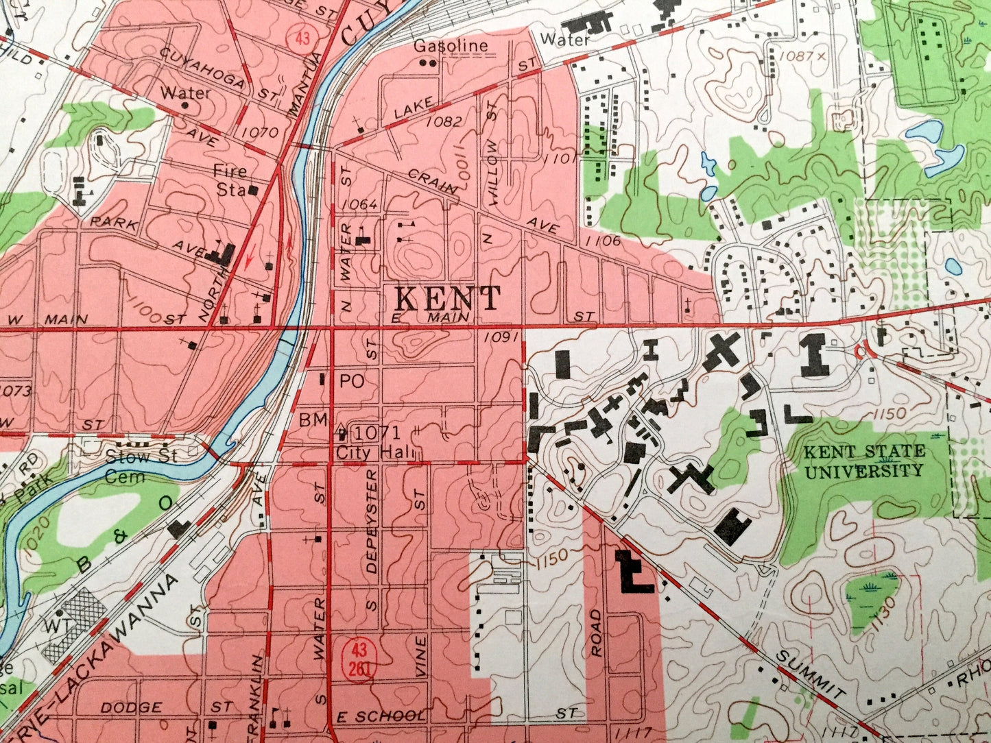
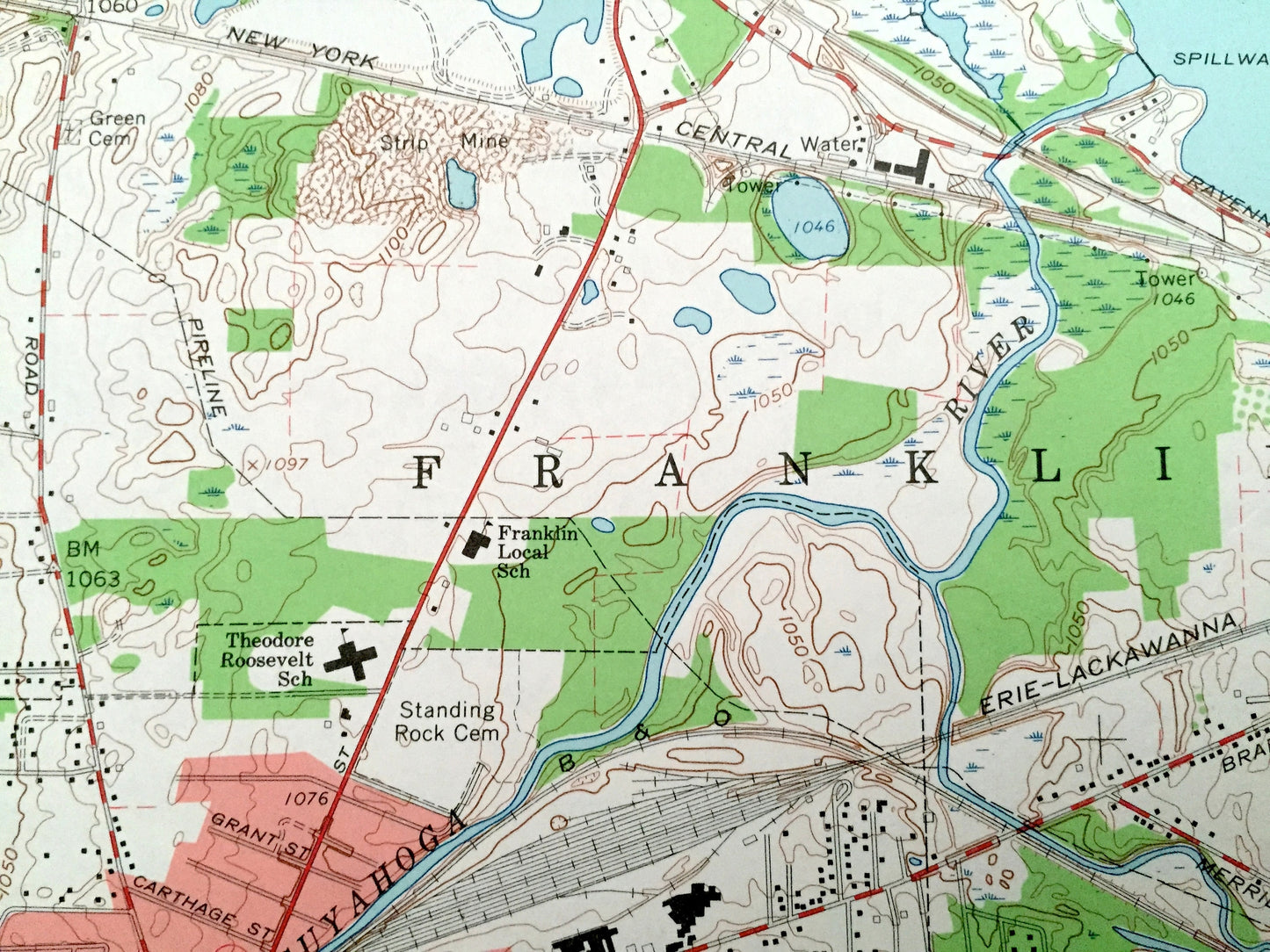
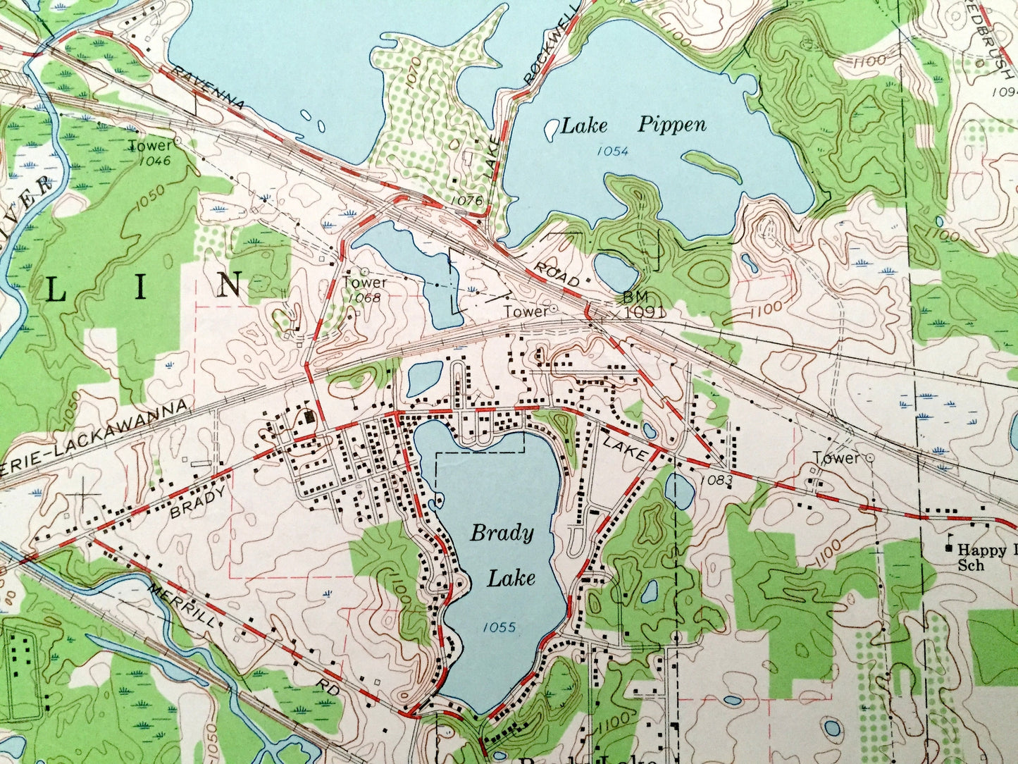
See what Ohio looked like over 60 years ago. Lots of intricate details and geological contours. Map even has little squares for every house that existed. The USGS cartographers were very thorough back then!
Perfect for the historian, map-lover, the curious or just as a conversation starter. Wonderful and rare. Vintage maps such as these make great gifts.
Edition of 1960, printed 1964
Dimensions: 22" width x 27" height
----
Features
Cities & Towns: Rootstown, Earlville, Brady Lake, Black Horse.
Points of Interest: Lake Rockwell, Kent State University, Theodore Roosevelt School, Happy Day School, Twin Lakes (East Lake and West Lake), Lake Pippen, Brady Lake, Muddy Lake, Plum Creek, Cuyahoga River, Breakneck Creek, Fish Creek, city park, drive-in theatre, and many more hills, ditches, streams, creeks, ponds, houses, schools, railroads, churches and roads.
Condition: Very Good Vintage condition, commensurate with age. This map is in great shape for being over 55 years old. Has light edge-wear, all of which will add character when framed.
----
We will happily adjust shipping price for multiple purchases. Maps are rolled up and shipped in sturdy mailing tubes, never folded.
Couldn't load pickup availability
Share