My Store
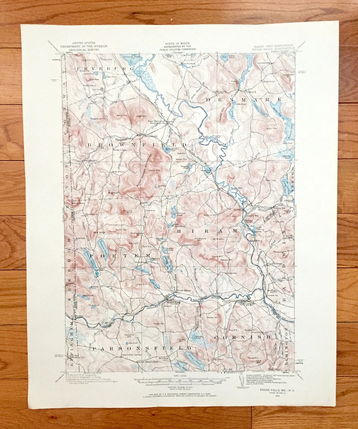
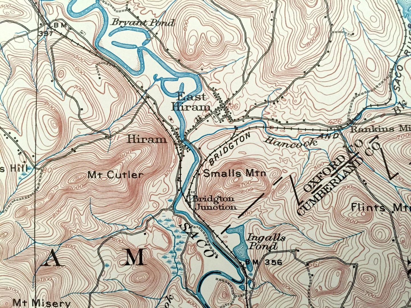
Antique Kezar Falls, Maine 1910 US Geological Survey Topographic Map – Parsonfield, Porter, Hiram, Cornish, Brownfield, Denmark, Baldwin, ME
Antique Kezar Falls, Maine 1910 US Geological Survey Topographic Map – Parsonfield, Porter, Hiram, Cornish, Brownfield, Denmark, Baldwin, ME
Beautiful, antique map of Kezar Falls, Maine and surrounding Oxford County & York County area on the New Hampshire border. This is an authentic 1910 edition, 1970 print from the U.S. Geological Survey and not a computer reprint.
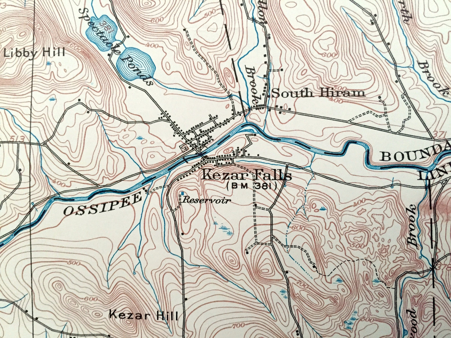
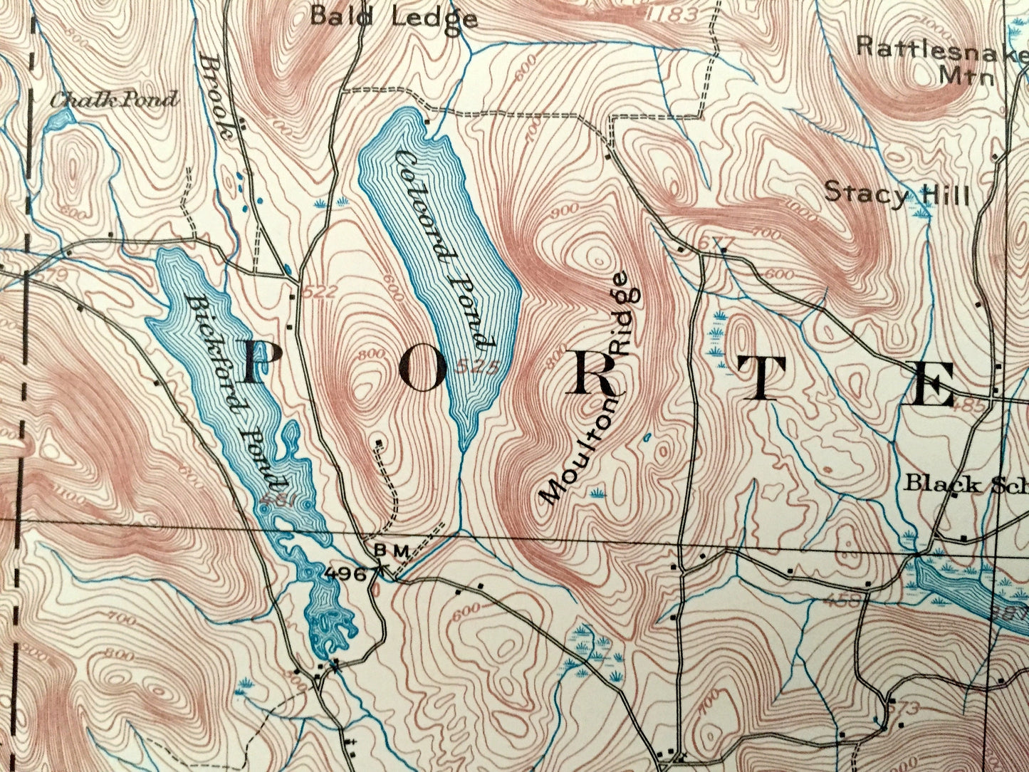
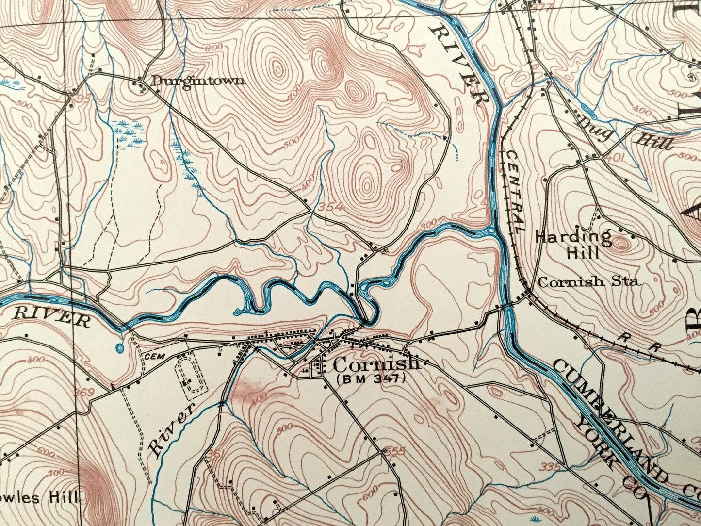
See what Parsonfield, Porter, Hiram, Cornish, Brownfield, Denmark, Baldwin & Fryeburg looked like more than 110 years ago. Lots of intricate details and geological contours. Map even has little squares for every house that existed. The USGS cartographers were very thorough back then!
Perfect for the historian, map-lover, the curious or just as a conversation starter. Wonderful and rare. Vintage maps such as these make great gifts.
Edition of 1910, printed 1970
Dimensions: 17" width x 21" height
----
Features
Towns: MAINE: Fryeburg, Brownfield, Denmark, Porter, Hiram, Sebago, Parsonfield, Cornish, Baldwin, Limington, East Brownfield, West Denmark, Porterfield, East Hiram, Rankins Mill, Bridgton Junction, West Baldwin, Kezar Falls, South Hiram, North Parsonfield, Durgintown.
NEW HAMPSHIRE: Conway, Eaton, Freedom, Effingham, Lords Hill.
Points of Interest: Saco River, Ossipee River, Lovewell Pond, Dragon Brook, Moose Pond Brook, Moose Pond, Beaver Pond, Burnt Meadow Pond, Rattlesnake Pond, Hancock Pond, Sand Pond, Granger Pond, Little Pond, Barker Pond, Bickford Pond, Colcord Pond, Trafton Pond, Spectacle Ponds, Ingalls Pond, Long Pond, West Pond, Tibbetts Mountain, Peary Mountain, Frost Mountain, Burnt Meadow Mountains, Boston Hills, Allen Mountain, Tear Cap, Stone Mountain, Moulton Ridge, Libby Hill, Mount Misery, Saddleback Hills, Lombard Hill, Gould Mountain, Peaked Mountain, Kezar Hill, Collomy Hill, Pease Mountain, Clark Mountain, Great Falls, Saco River Railroad, Maine Central Railroad and lots more smaller ponds and streams, bogs, houses, schools, roads, churches, railroads.
Condition: Very Good Vintage condition, commensurate with age. This map is in great shape for being 50 years old. Has light edge-wear but this will add to vintage character when framed.
----
We will happily adjust shipping price for multiple purchases. Maps are rolled up and shipped in sturdy mailing tubes, never folded.
Couldn't load pickup availability
Share