My Store
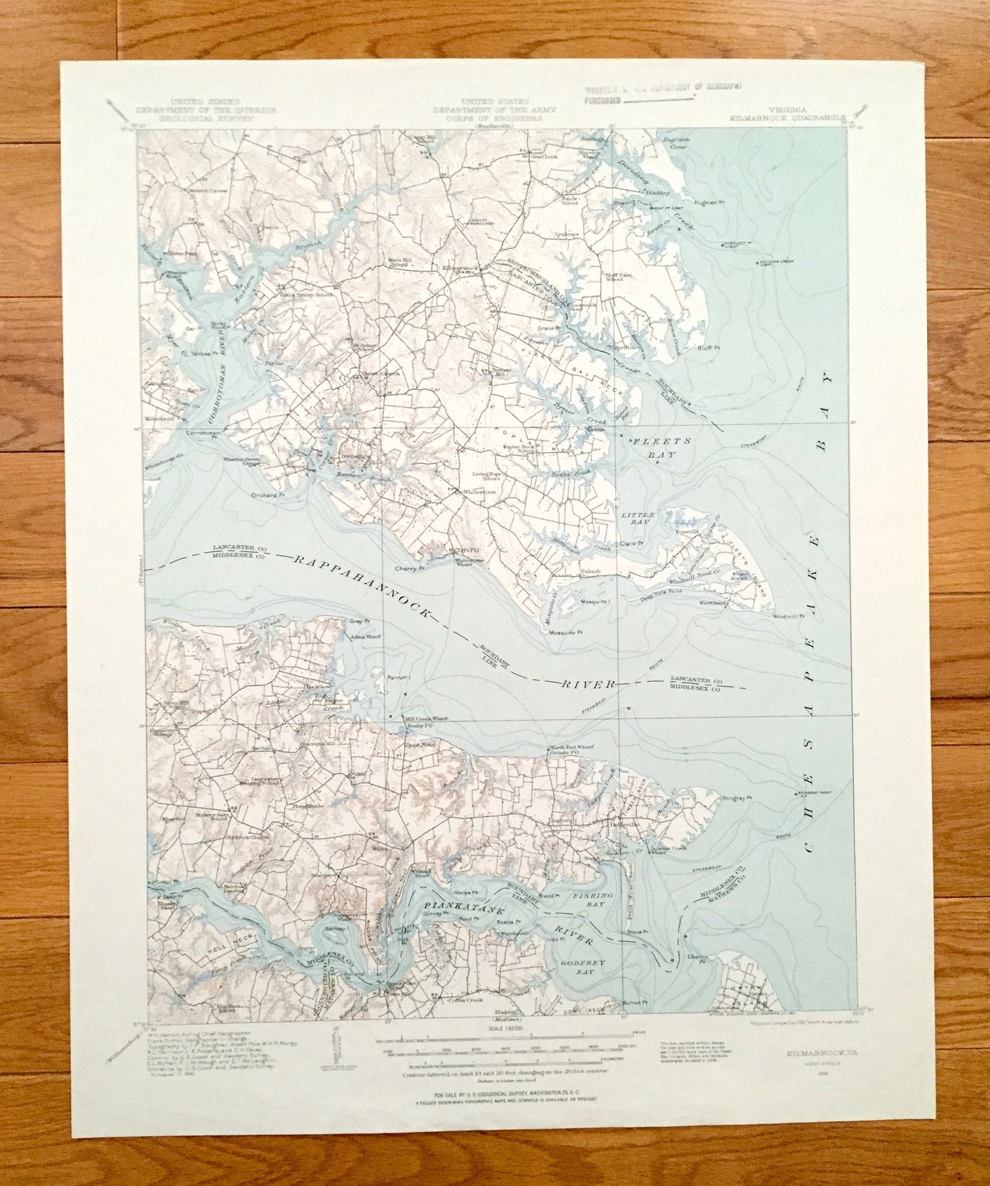
Antique Kilmarnock, Virginia 1916 US Geological Survey Topographic Map – Irvington, Whitestone, Deltaville, Rappahannock, Chesapeake Bay, VA
Antique Kilmarnock, Virginia 1916 US Geological Survey Topographic Map – Irvington, Whitestone, Deltaville, Rappahannock, Chesapeake Bay, VA
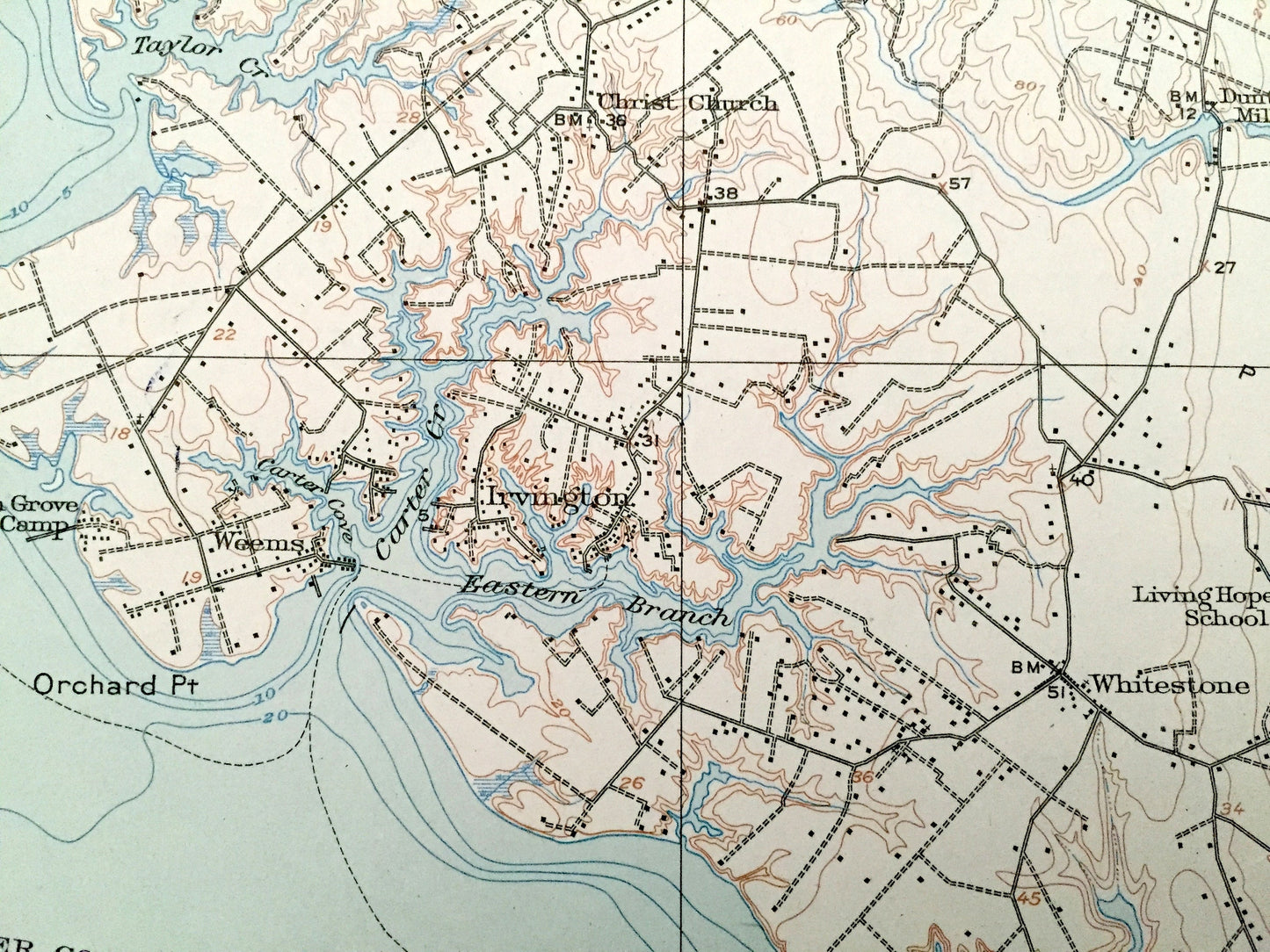
Beautiful, antique map of the mouth of the Rappahannock River as it flows into Chesapeake Bay. This is an authentic 1916 edition, 1956 print from the U.S. Geological Survey and NOT a computer reproduction.
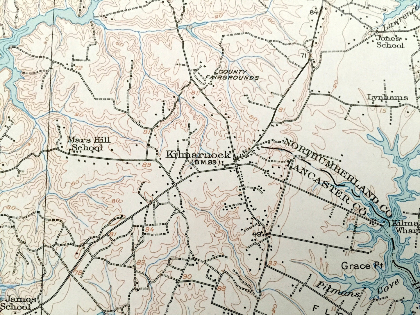
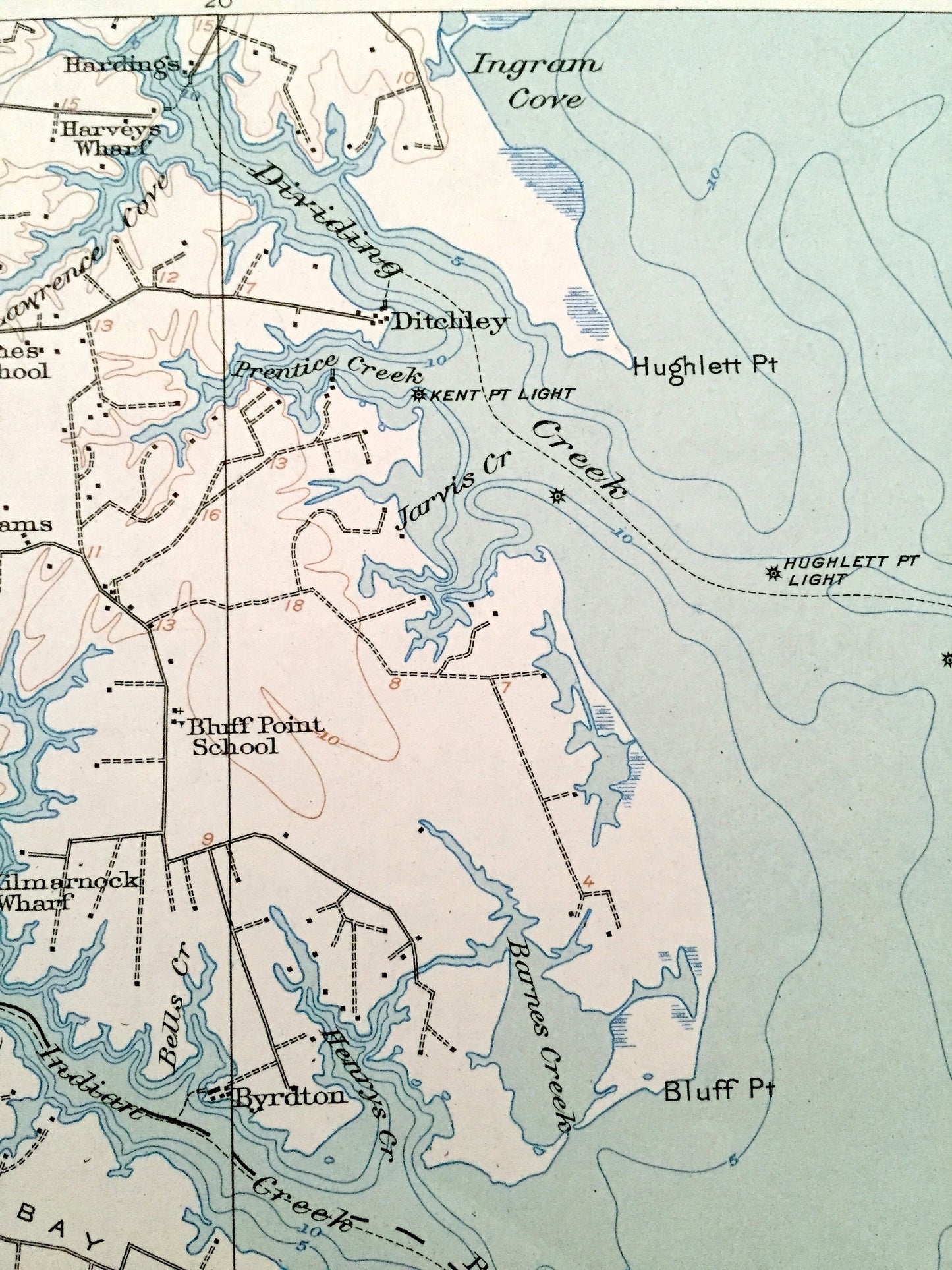
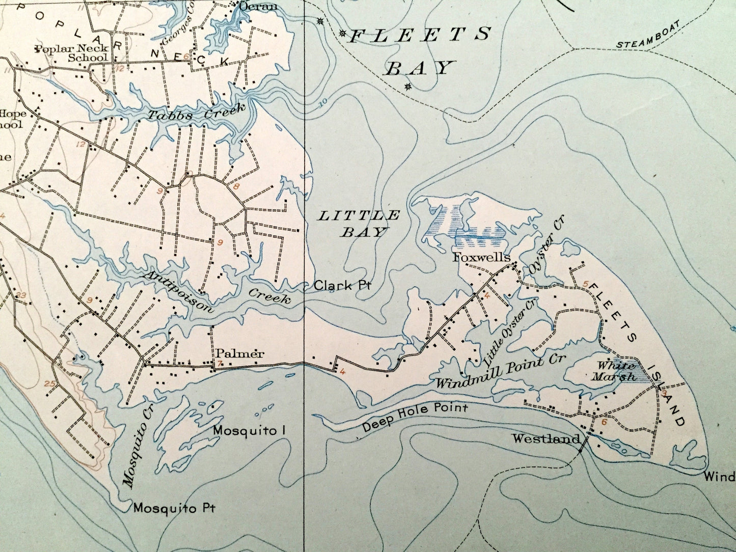
See what Lancaster & Middlesex County of Virginia looked like over 100 years ago. Lots of intricate details and geological contours. Map even has little squares for every house that existed at the time. The cartographers were very thorough back then!
Perfect for the historian, map-lover, the curious or just as a conversation starter. Wonderful and rare. Maps such as these make great gifts.
Edition of 1916, printed 1956
Dimensions: 17" width x 21" height
----
Features
Cities & Towns: Slaters Corner, Slabtown, Millenbeck, Good Luck, Hardings, Harveys Wharf, Kilmarnock, Lynhams, Dunton Mill, Byrdton, Weems, Irvington, Topping, Adam Wharf, Locklies, Regent, Whitestone, Taft, Oeran, Palmer, Fisherman, Westland, Harmony Village, Syringa, Barretts Mill, Wake, Cheaden, Free Shade, Blands Wharf, Fairfield Landing, Stampers, Stampers Landing, Bushy, Mill Creek, Grinels, Conrad Wharf, Amburg, Ruark, Deltaville, Dixie, Cobbs Creek, Warehouse, Gwynn.
Points of Interest: Chesapeake Bay, Rappahannock River, Lancaster County, Middlesex County, Gloucester County, Matthews County, Southumberland County, Corrotoman River, Fleets Bay, Piankatank River, Godfrey Bay, Fishing Bay, Little Bay, Dividing Creek, Ingrain Cove, Fleets Island, Poplar Neck, County Fairgrounds, Hughlett Point Light, Deep Hole Point, Windmill Point Creek, Antipoison Creek, Mill Creek, Stove Point Neck, Hell Neck, Gwynn Island, and lots more hills, streams, islands, creeks, marshes, houses, churches and roads.
Condition: Good Vintage condition, commensurate with age. This map is in great shape for being over 65 years old. Light wear and ex-libris stamp in margin but this will add to vintage character when framed.
----
We will happily adjust shipping price for multiple purchases.
Couldn't load pickup availability
Share