My Store
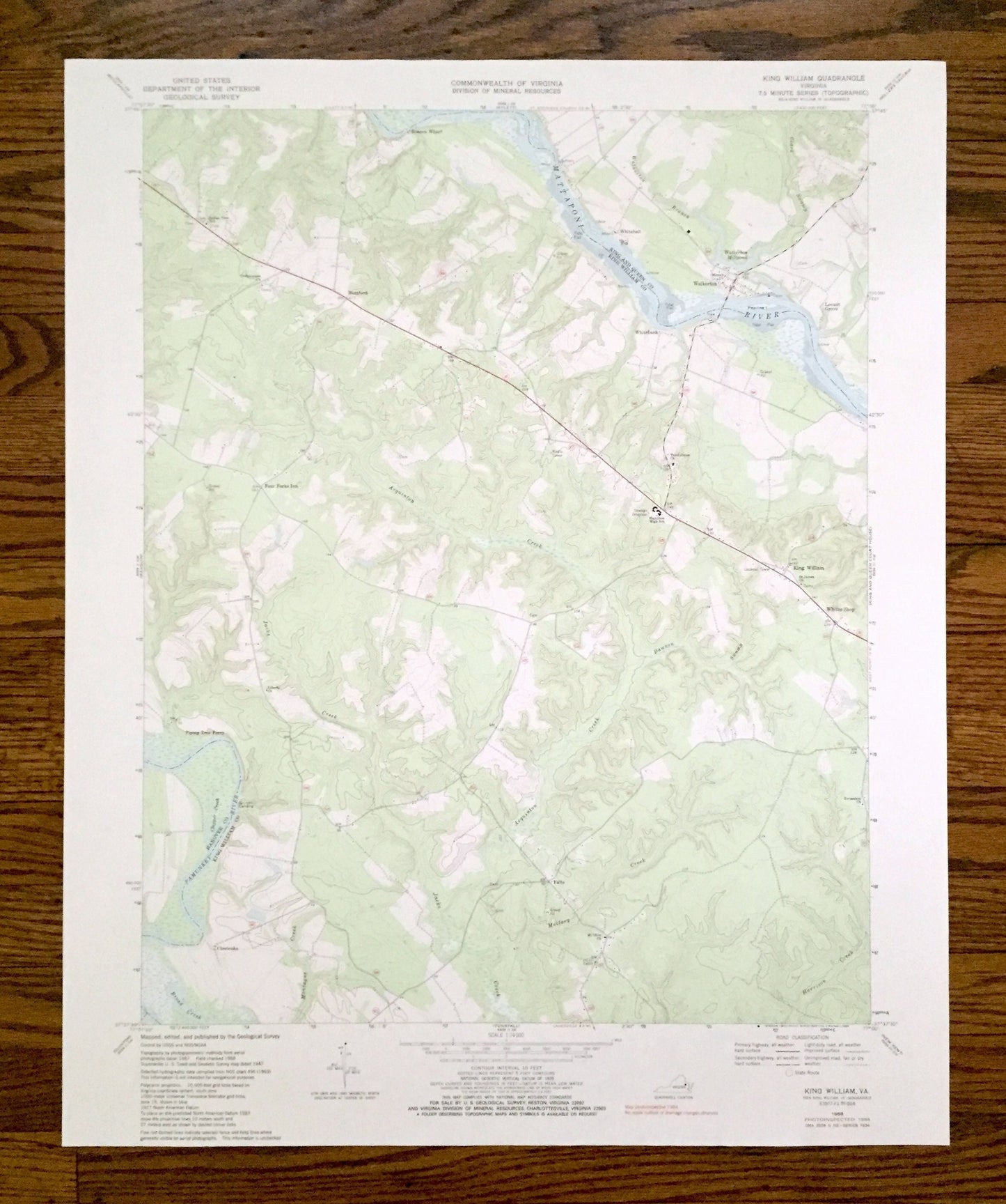
Antique King William, Virginia 1968 US Geological Survey Topographic Map – King and Queen, Hanover County, Mattaponi, Pamunkey River, VA
Antique King William, Virginia 1968 US Geological Survey Topographic Map – King and Queen, Hanover County, Mattaponi, Pamunkey River, VA
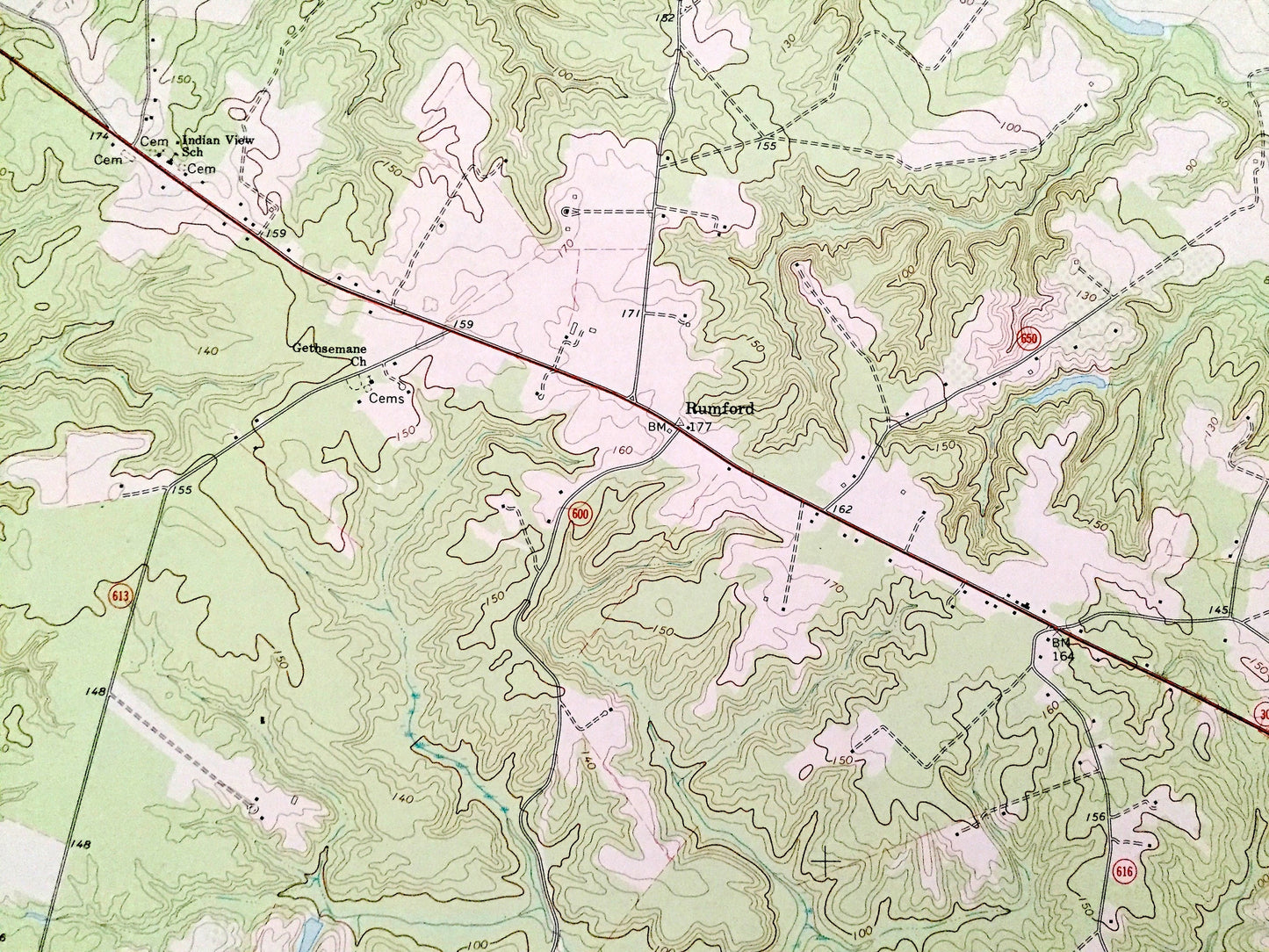
Beautiful, antique map of King William, Virginia and surrounding King William, King and Queen & Hanover County area. This is an authentic 1968 edition, 1986 print from the U.S. Geological Survey and NOT a computer reproduction.
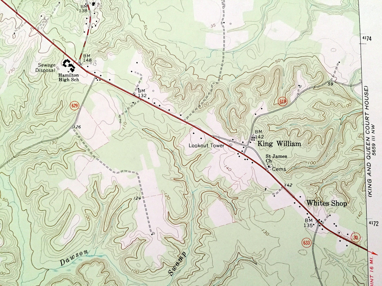
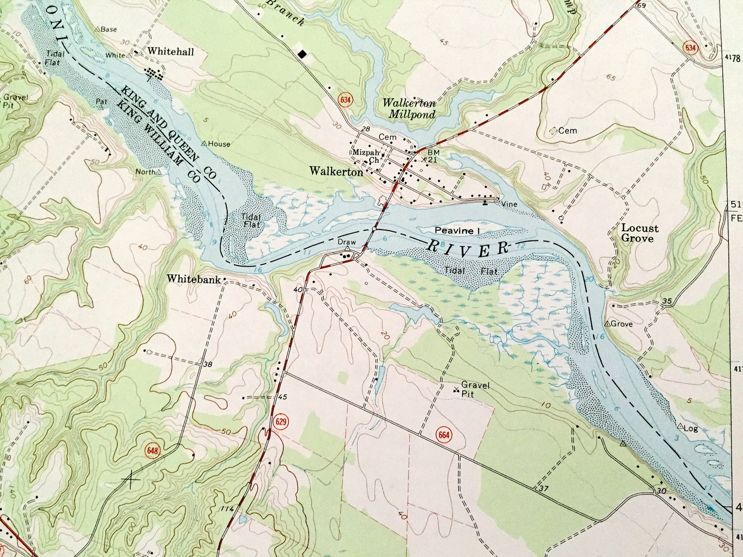
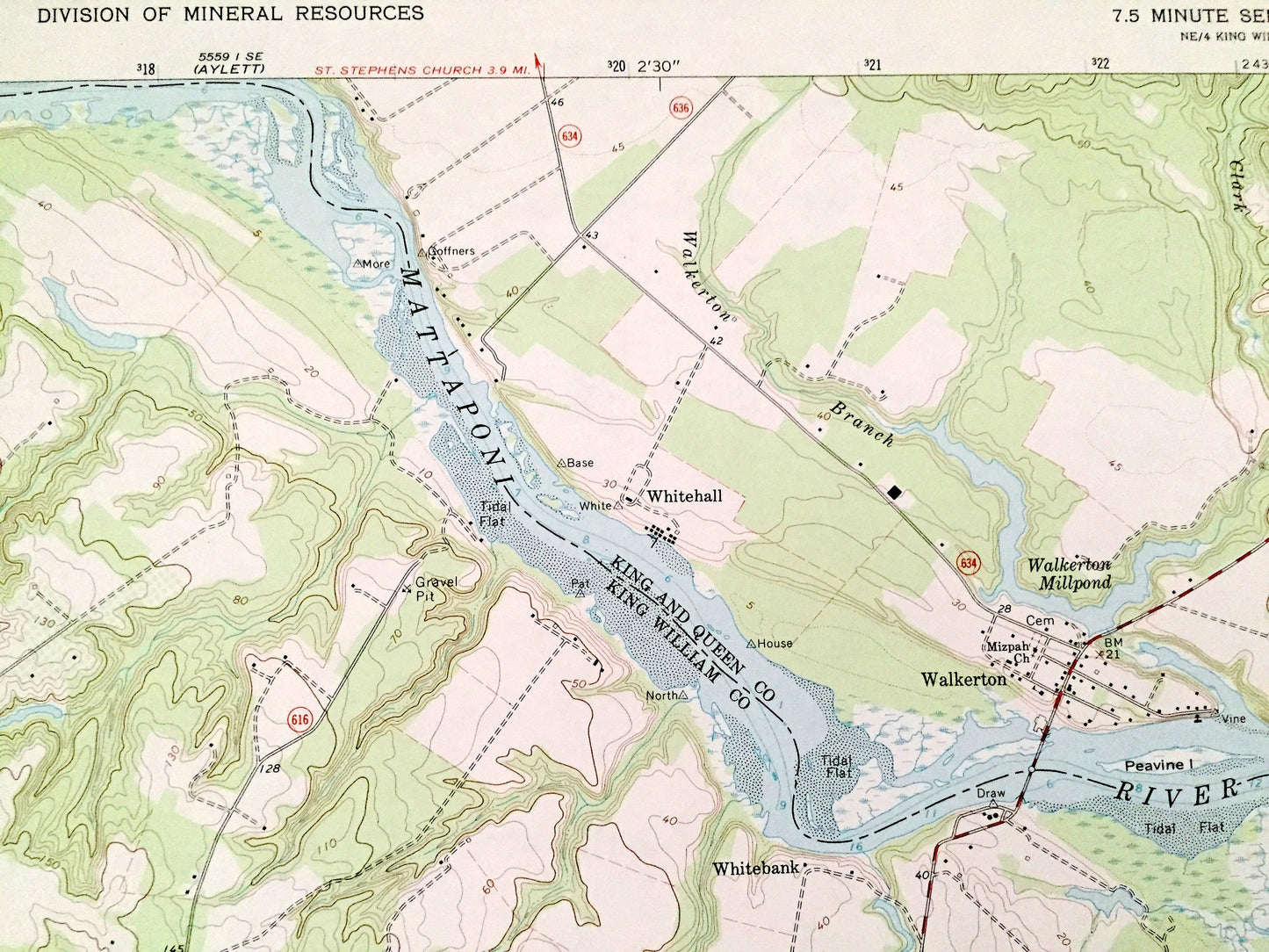
See what Virginia looked like over 50 years ago. Lots of intricate details and geological contours. Map even has little squares for every house that existed at the time. The USGS cartographers were very thorough back then!
Perfect for the historian, map-lover, the curious or just as a conversation starter. Wonderful and rare. Vintage maps such as these make great gifts.
Edition of 1968, printed 1986
Dimensions: 22" width x 27" height
----
Features
Cities & Towns: King William, Rumford, Walkerton, Whitebank, Locust Grove, Whites Shop, Chericoke, Falls.
Points of Interest: King William County, King and Queen County, Hanover County, Mattaponi River, Pamunkey River, Walkerton Mill Pond, Roanes Wharf, Four Forks Inn, Acquinton Creek, Dawson Swamp, Mallory Creek, Broad Creek, Jacks Creek, Clark Swamp, Piping Tree Ferry, and many more hills, creeks, ponds, houses, schools, churches and roads.
Condition: Good Vintage condition, commensurate with age. This map is in great shape for being over 35 years old. Some edge-wear, but this will add to vintage character when framed.
----
We will happily adjust shipping price for multiple purchases. Maps are rolled up and shipped in sturdy mailing tubes, never folded.
Couldn't load pickup availability
Share