My Store
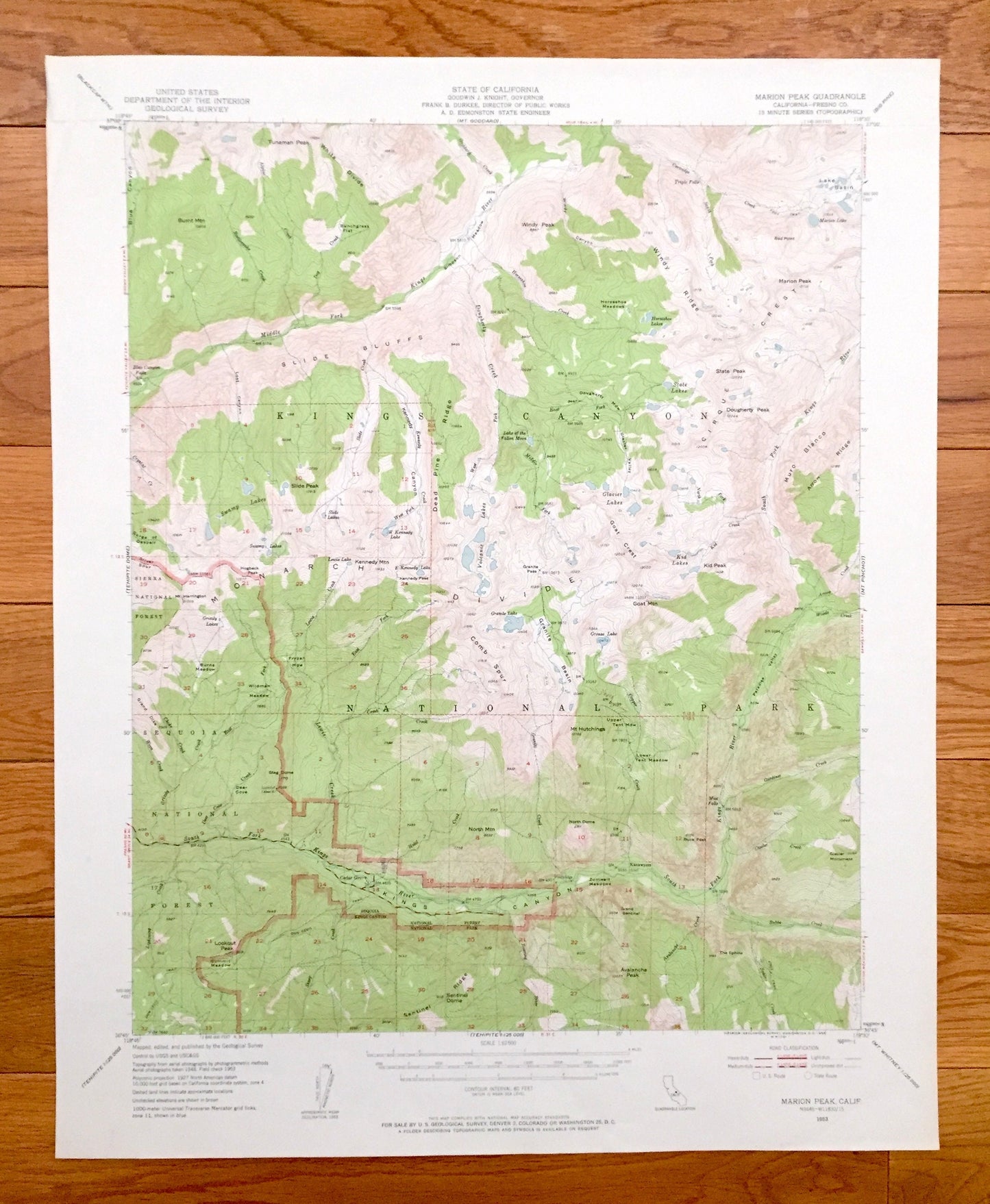
Antique Kings Canyon, California 1953 US Geological Survey Topographic Map – Marion Peak, National Park, Fresno County, Sequoia Forest, CA
Antique Kings Canyon, California 1953 US Geological Survey Topographic Map – Marion Peak, National Park, Fresno County, Sequoia Forest, CA
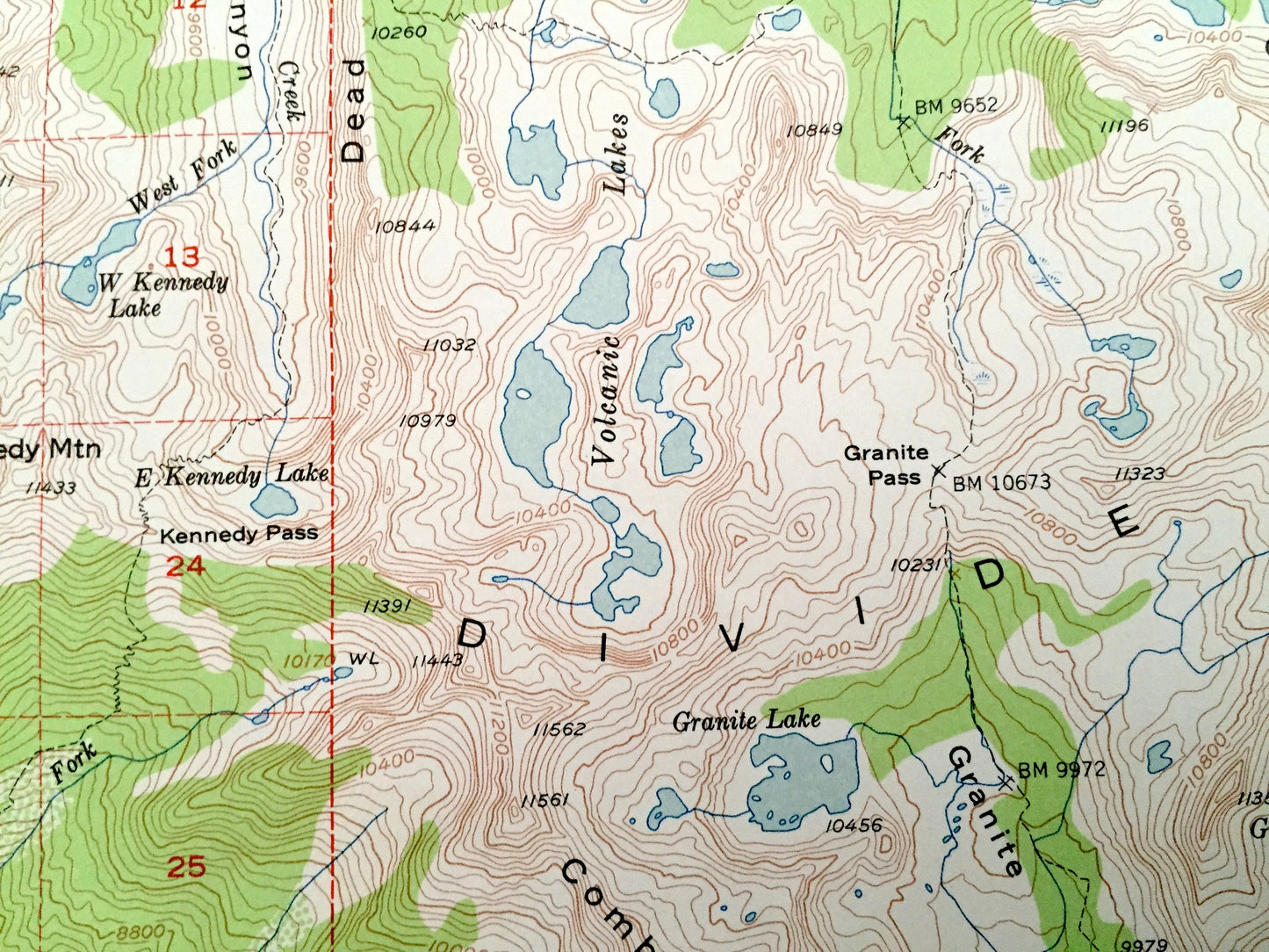
Beautiful, antique map of Kings Canyon, California and surrounding Fresno County, Kings Canyon National Park & Sequoia National Forest area, including Marion Peak. This is an authentic 1953 edition, 1958 print from the U.S. Geological Survey and NOT a computer reproduction.
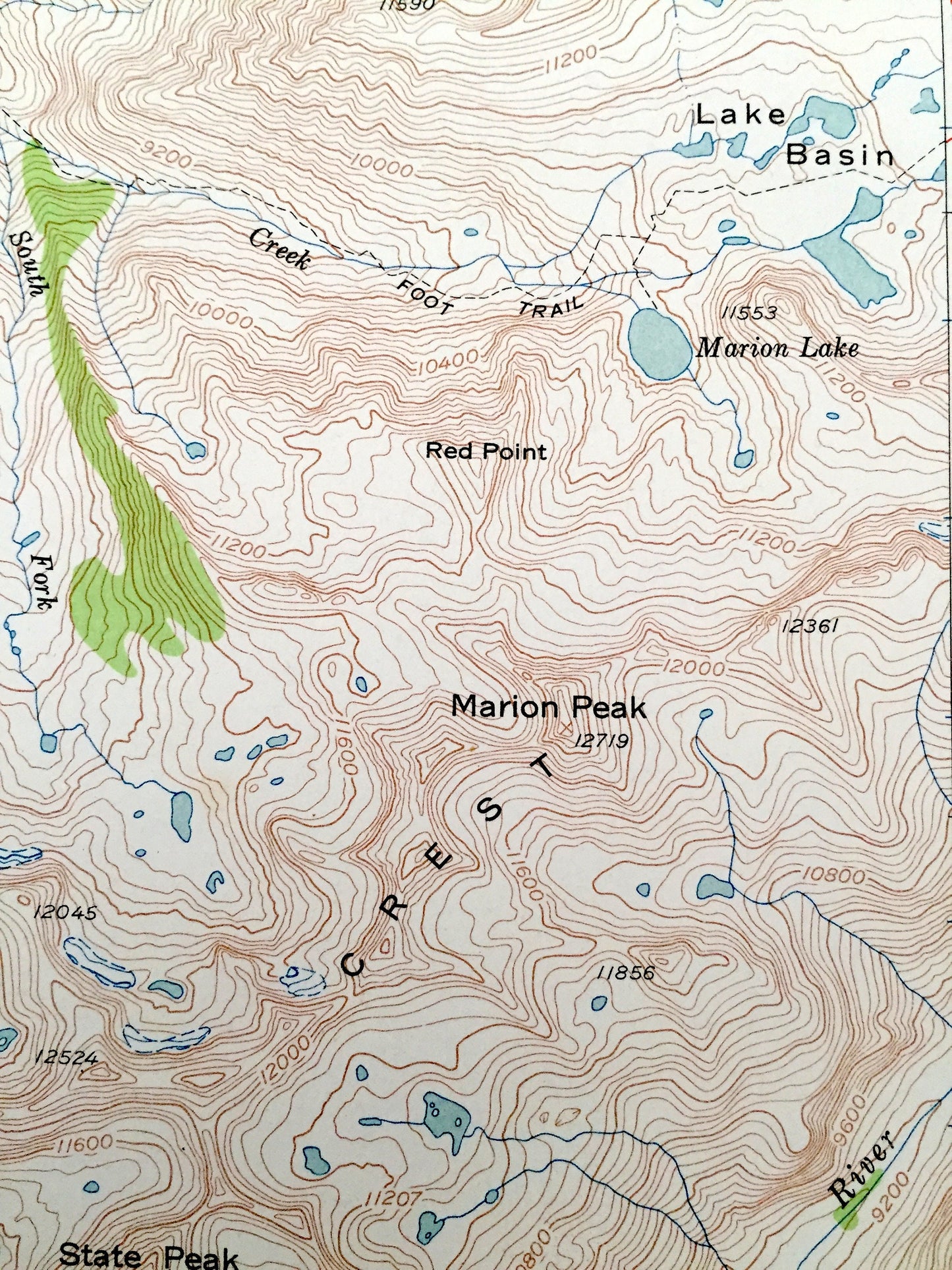
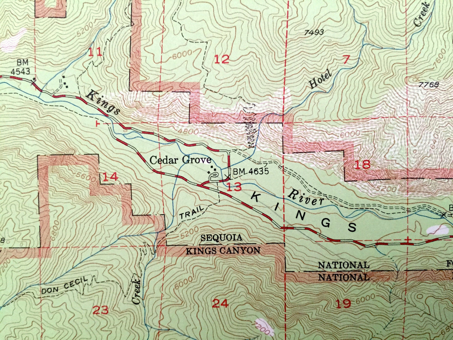
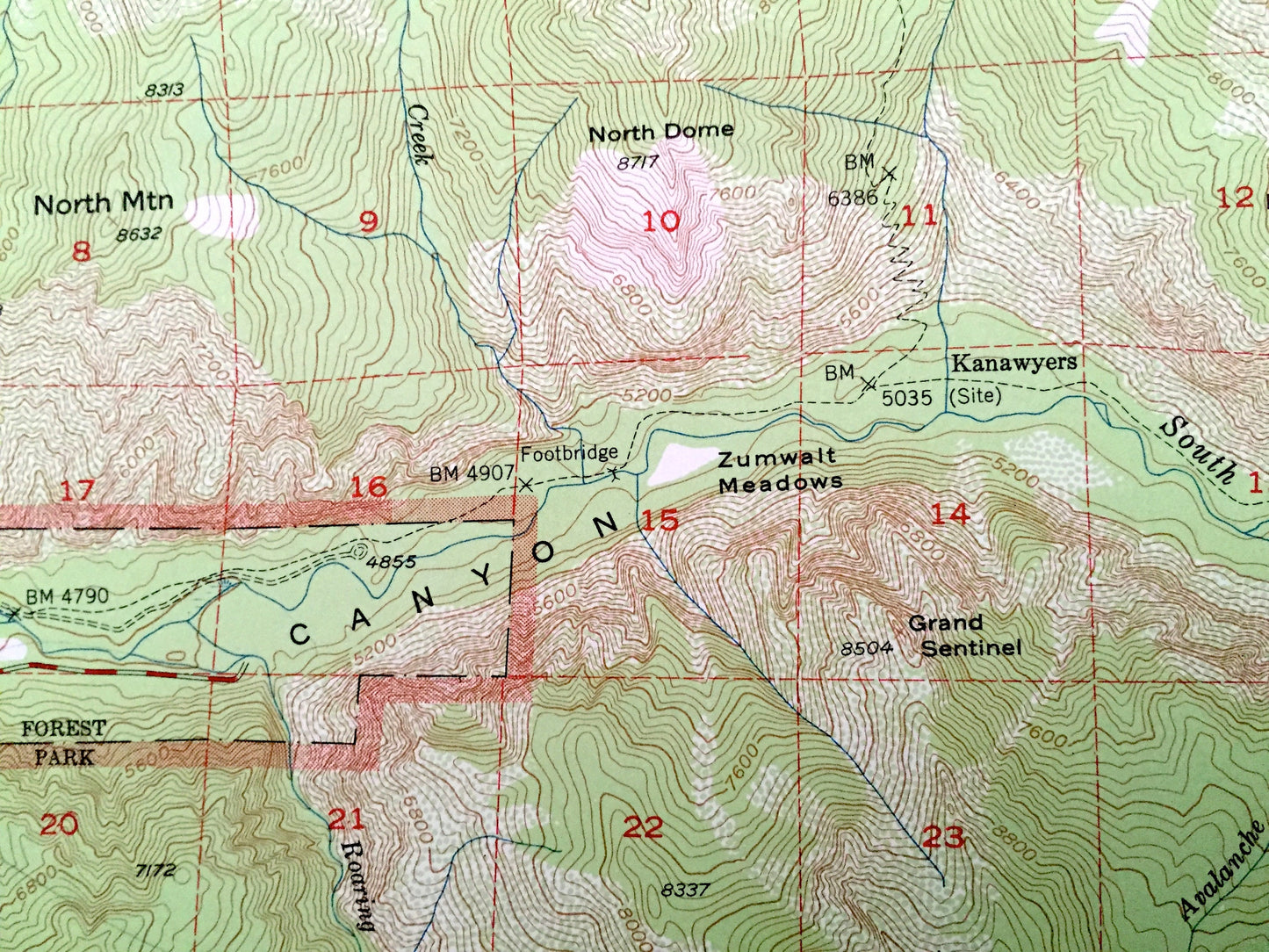
See what California looked like over 65 years ago. Lots of intricate details and geological contours. Map even has little squares for every house that existed at the time. The USGS cartographers were very thorough back then!
Perfect for the historian, map-lover, the curious or just as a conversation starter. Wonderful and rare. Vintage maps such as these make great gifts.
Edition of 1953, printed 1958
Dimensions: 17" width x 21" height
----
Features
Cities & Towns: Cedar Grove, Kanawyers.
Points of Interest: Fresno County, Kings Canyon National Park, Sequoia National Forest, Sierra National Forest, Kings Canyon, Slide Bluffs, Cirque Crest, Monarch Divide, Sentinel Dome, Avalanche Peak, Lookout Peak, Mt Hutchings, Comb Spur, Daed Pine Ridge, State Peak, Marion Peak, Lake Basin, Windy Ridge, Zumwalt Meadows, Kennedy Mountain, Kings River, The Sphinx, and many more hills, mountains, canyons, creeks, houses, roads, ranches and camps.
Condition: Very Good condition, commensurate with age. This map is in incredible shape for being over 60 years old. Has light wear but this will read as vintage character when framed.
----
We will happily adjust shipping price for multiple purchases. Maps are rolled up and shipped in sturdy mailing tubes, never folded.
Couldn't load pickup availability
Share