My Store
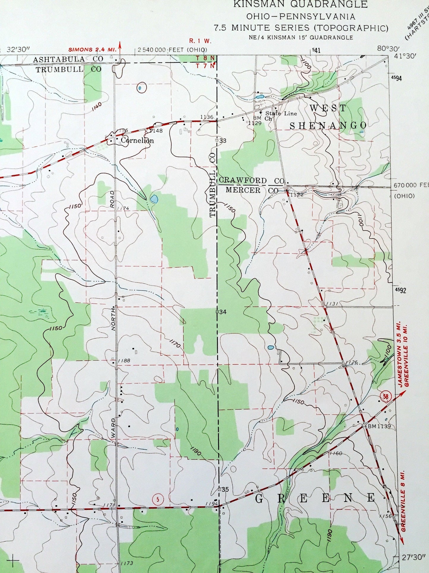
Antique Kinsman, Ohio 1961 US Geological Survey Topographic Map — Ashtabula, Trumbull County, Gustavus, OH, Mercer, Crawford County, PA
Antique Kinsman, Ohio 1961 US Geological Survey Topographic Map — Ashtabula, Trumbull County, Gustavus, OH, Mercer, Crawford County, PA
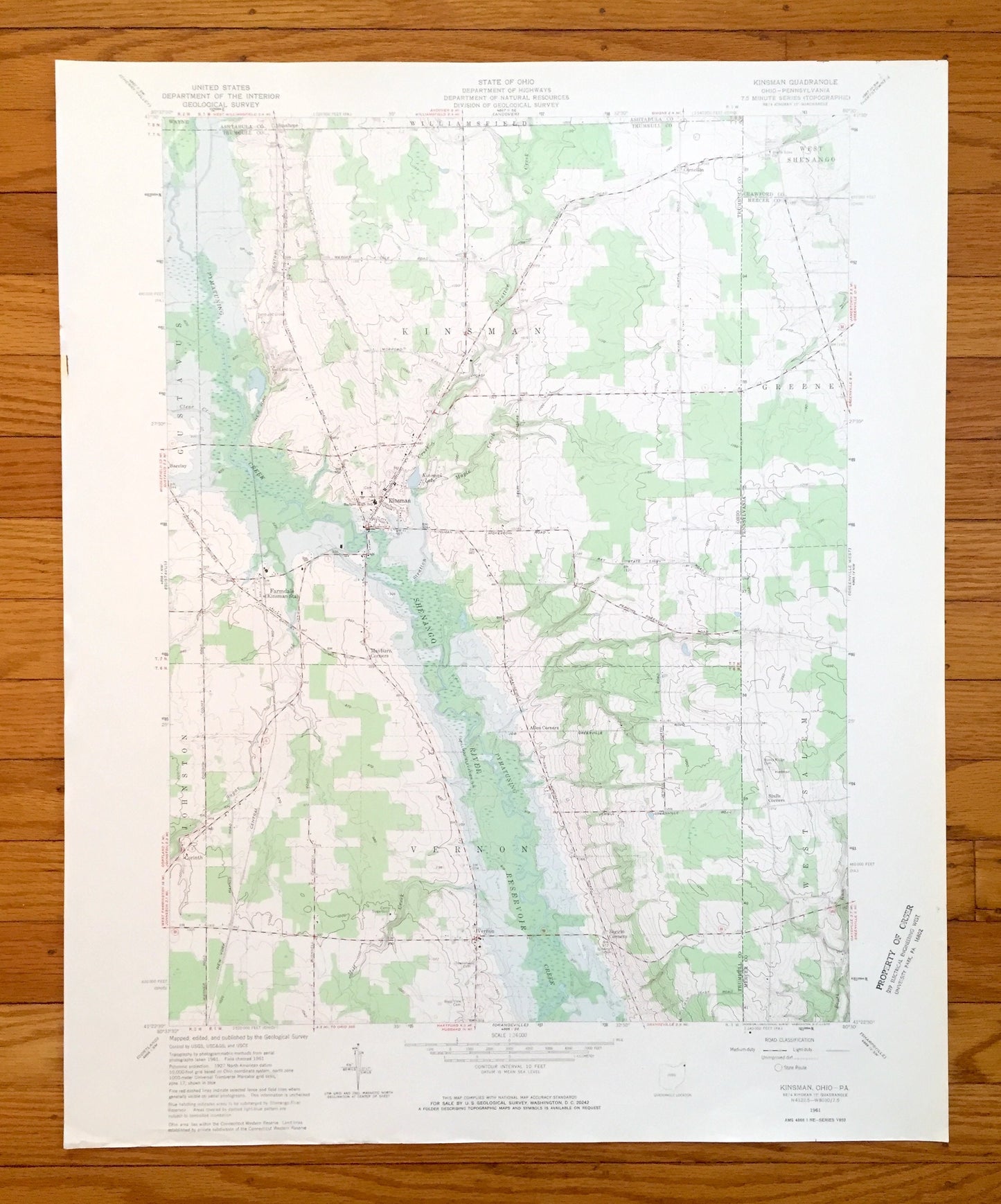
Beautiful, antique map of Kinsman, Ohio and surrounding Ashtabula County and Trumbull County areas, including Pennsylvania’s Mercer County and Crawford County. This is an authentic 1961 edition, 1970 print from the U.S. Geological Survey and NOT a computer reproduction.
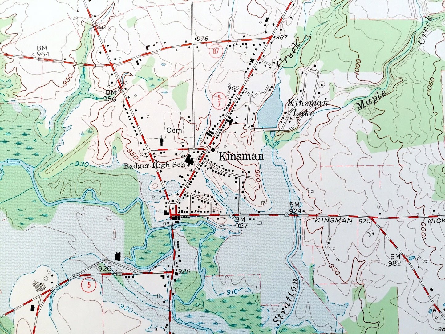
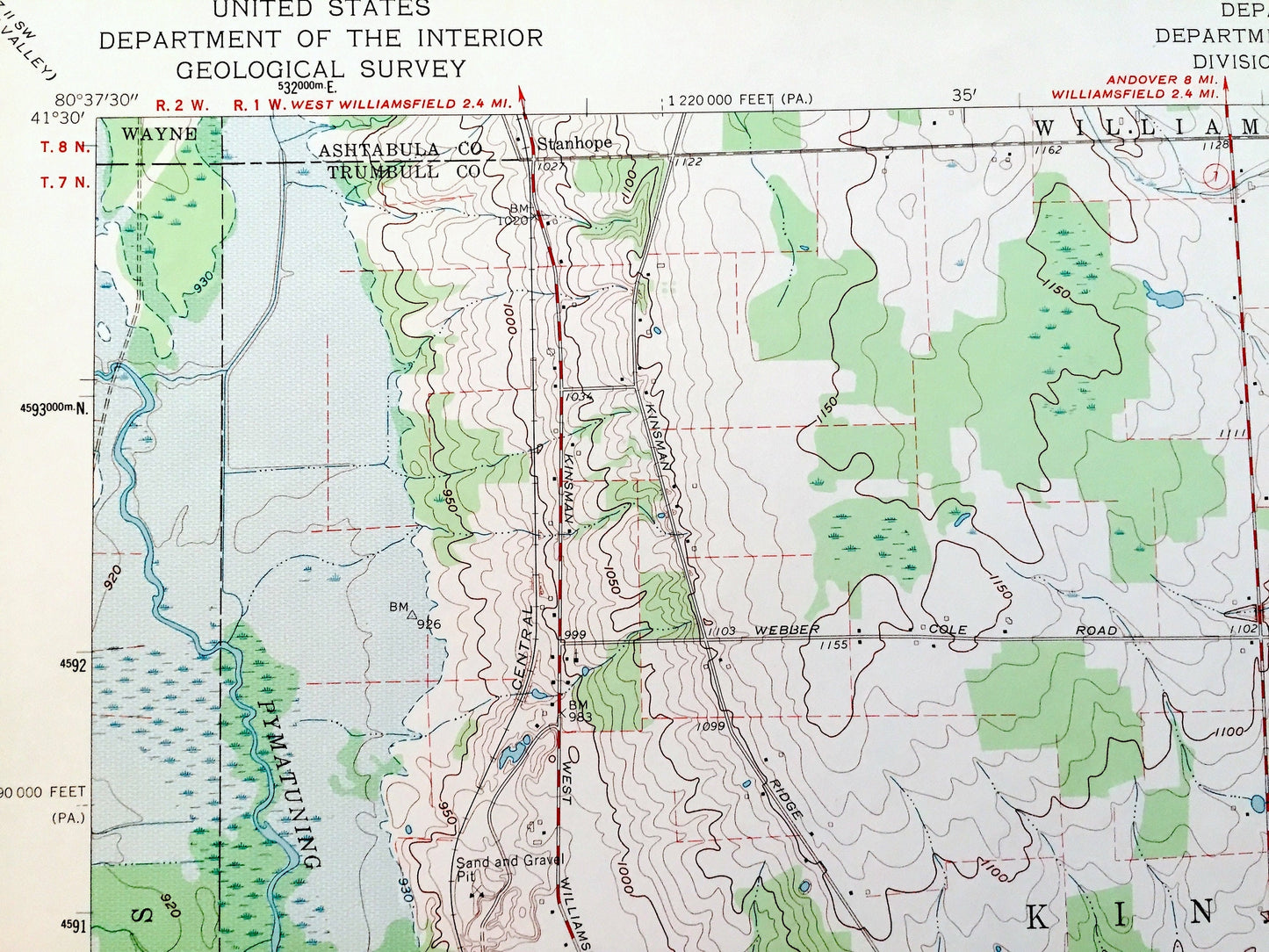
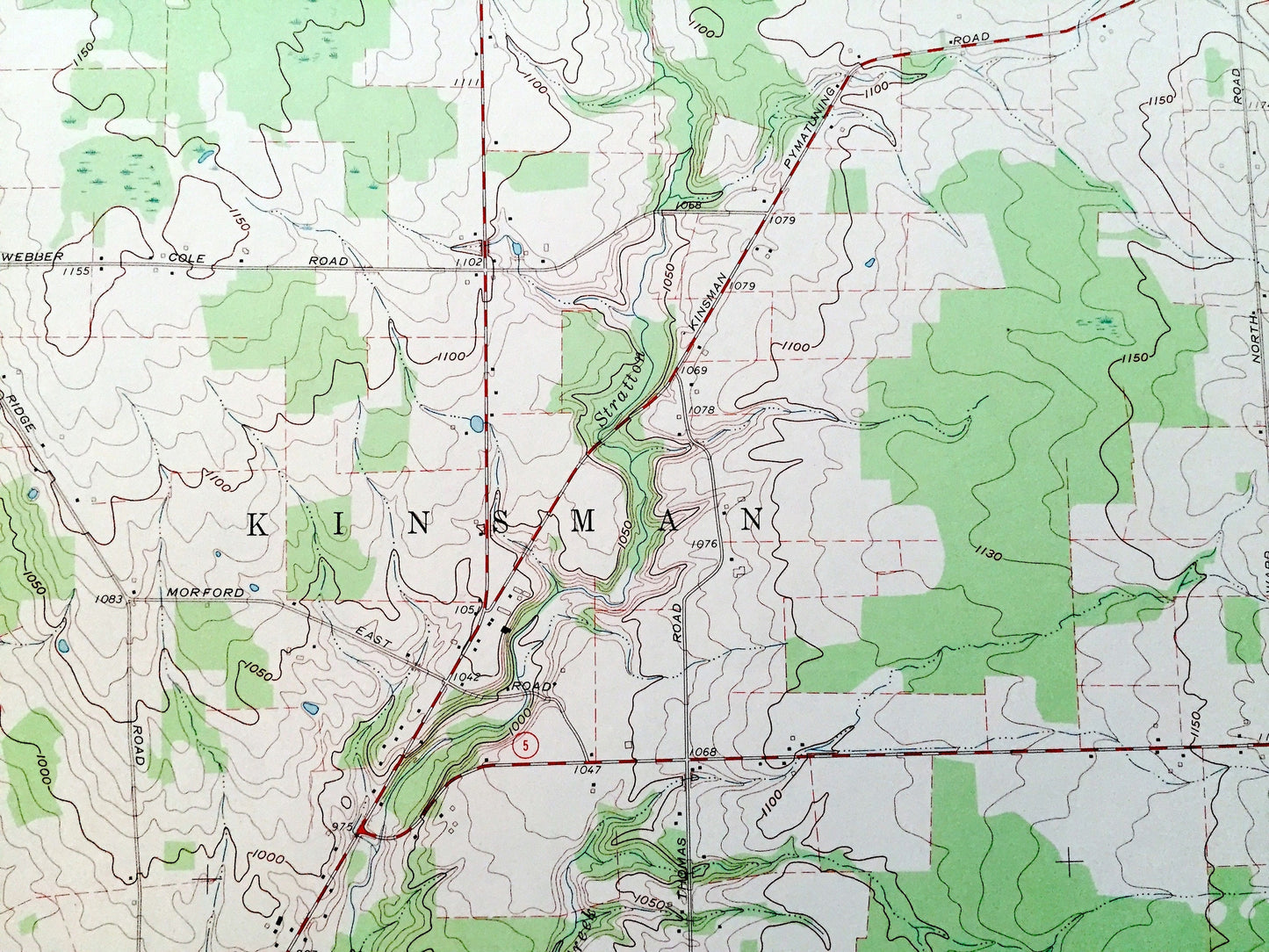
See what Ohio and Pennsylvania looked like over 60 years ago. Lots of intricate details and geological contours. Map even has little squares for every house that existed at the time. The USGS cartographers were very thorough back then!
Perfect for the historian, map-lover, the curious or just as a conversation starter. Wonderful and rare. Vintage maps such as these make great gifts.
Edition of 1961, printed 1970
Dimensions: 22" width x 27" height
----
Features
Cities & Towns:
OHIO: Williamsfield, Wayne, Gustavus, Johnston, Vernon, Stanhope, Cornelion, Barclay, Farmdale, Mayburn Corners, Corinth, Allen Corners, Biggin Corners.
PENNSYLVANIA: Greene, West Salem, West Shenago, Stulls Corners.
Points of Interest: Pymatuning Creek, Shenango River, Kinsman Lake, Stratton Creek, Clear Creek, Maple Creek, Sugar Creek, Mill Creek, Booth Run, and many more hills, streams, ponds, houses, schools, railroads, churches and roads.
Condition: Very Good Vintage condition, commensurate with age. This map is in great shape for being over 50 years old. Has some edge-wear including a few small tears on the left edge, all of which will read as character when framed.
----
We will happily adjust shipping price for multiple purchases. Maps are rolled up and shipped in sturdy mailing tubes, never folded.
Couldn't load pickup availability
Share