My Store
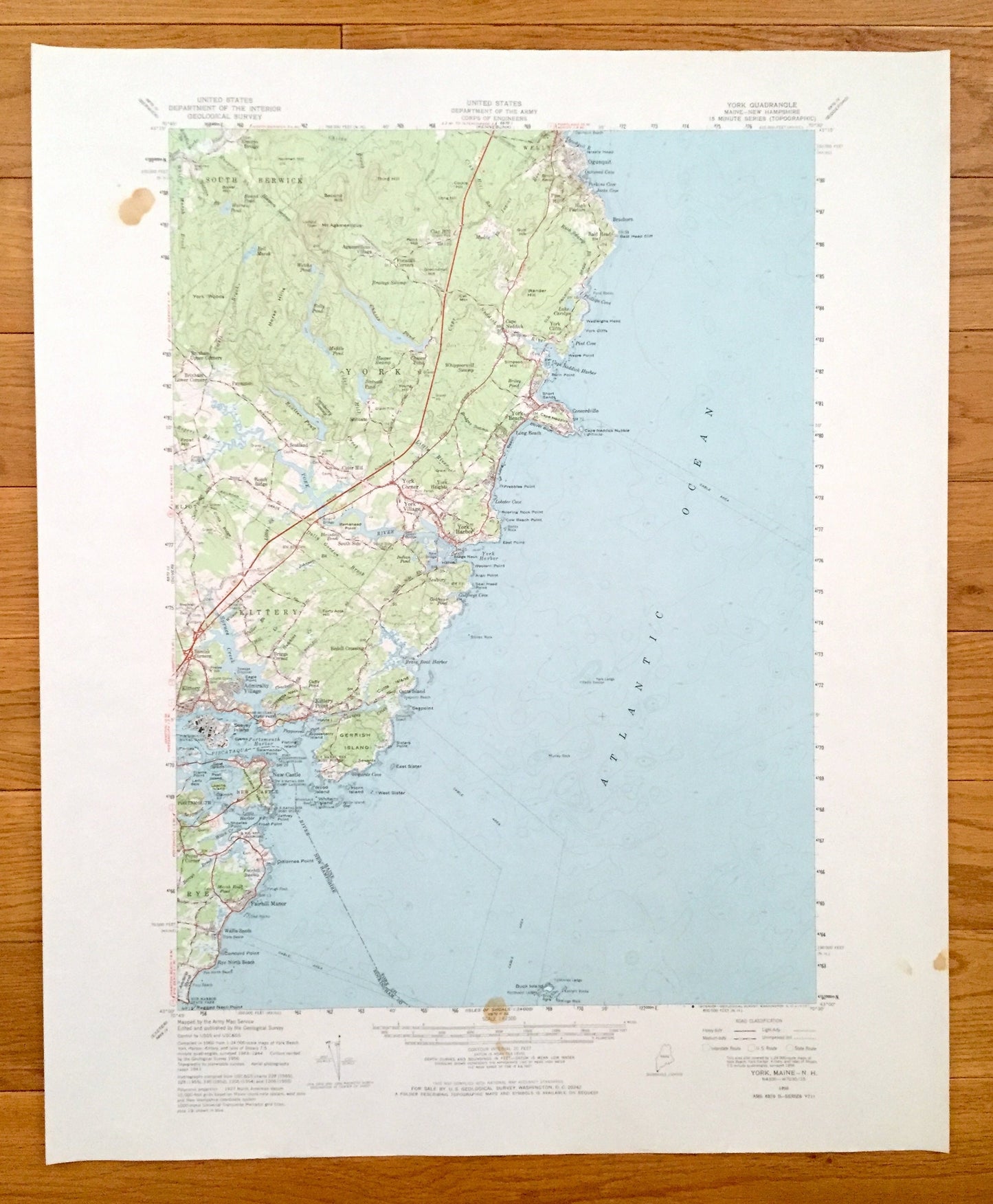
Antique Kittery, Maine 1956 US Geological Survey Topographic Map – York County, Seabury, Rye, New Castle, Admiralty Village, Portsmouth, NH
Antique Kittery, Maine 1956 US Geological Survey Topographic Map – York County, Seabury, Rye, New Castle, Admiralty Village, Portsmouth, NH
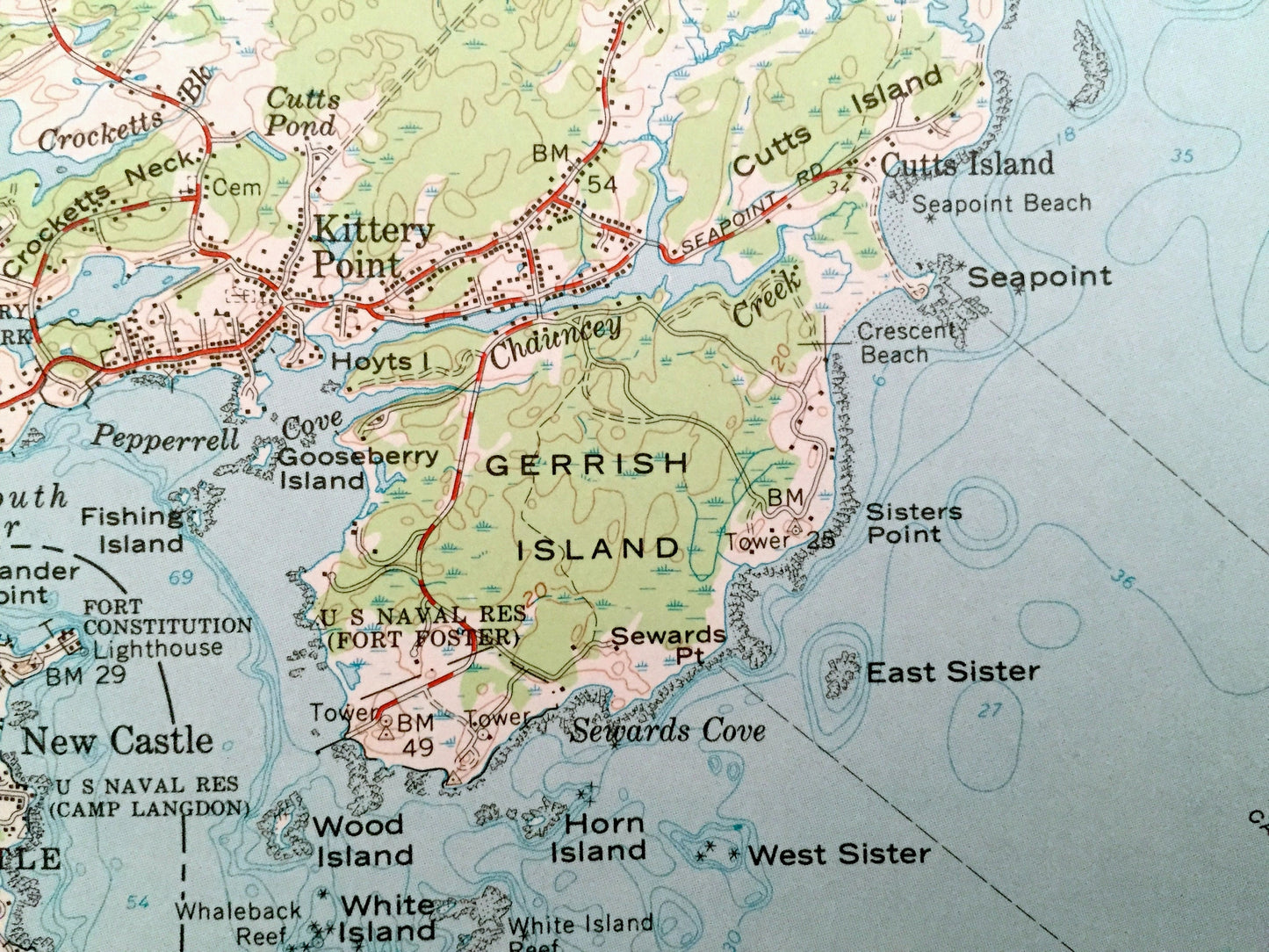
Beautiful, antique map of Kittery, Maine and surrounding New Hampshire and York and Rockingham County area. This is an authentic 1956 edition, 1973 print from the U.S. Geological Survey and NOT a computer reprint.
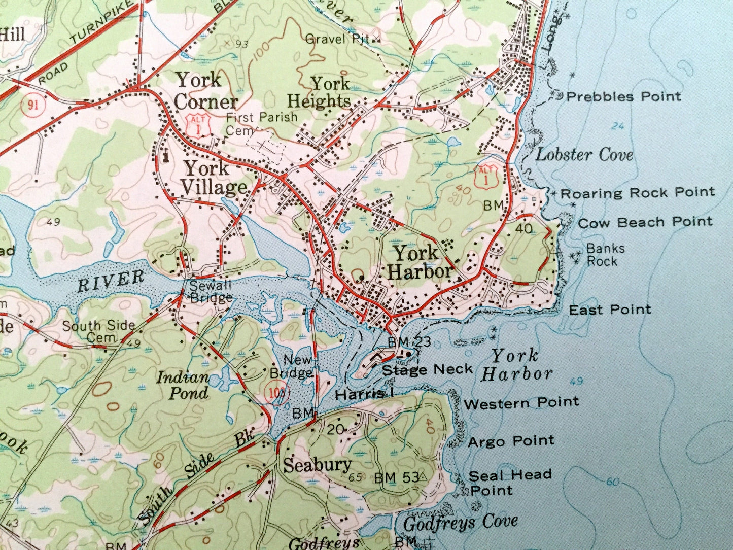
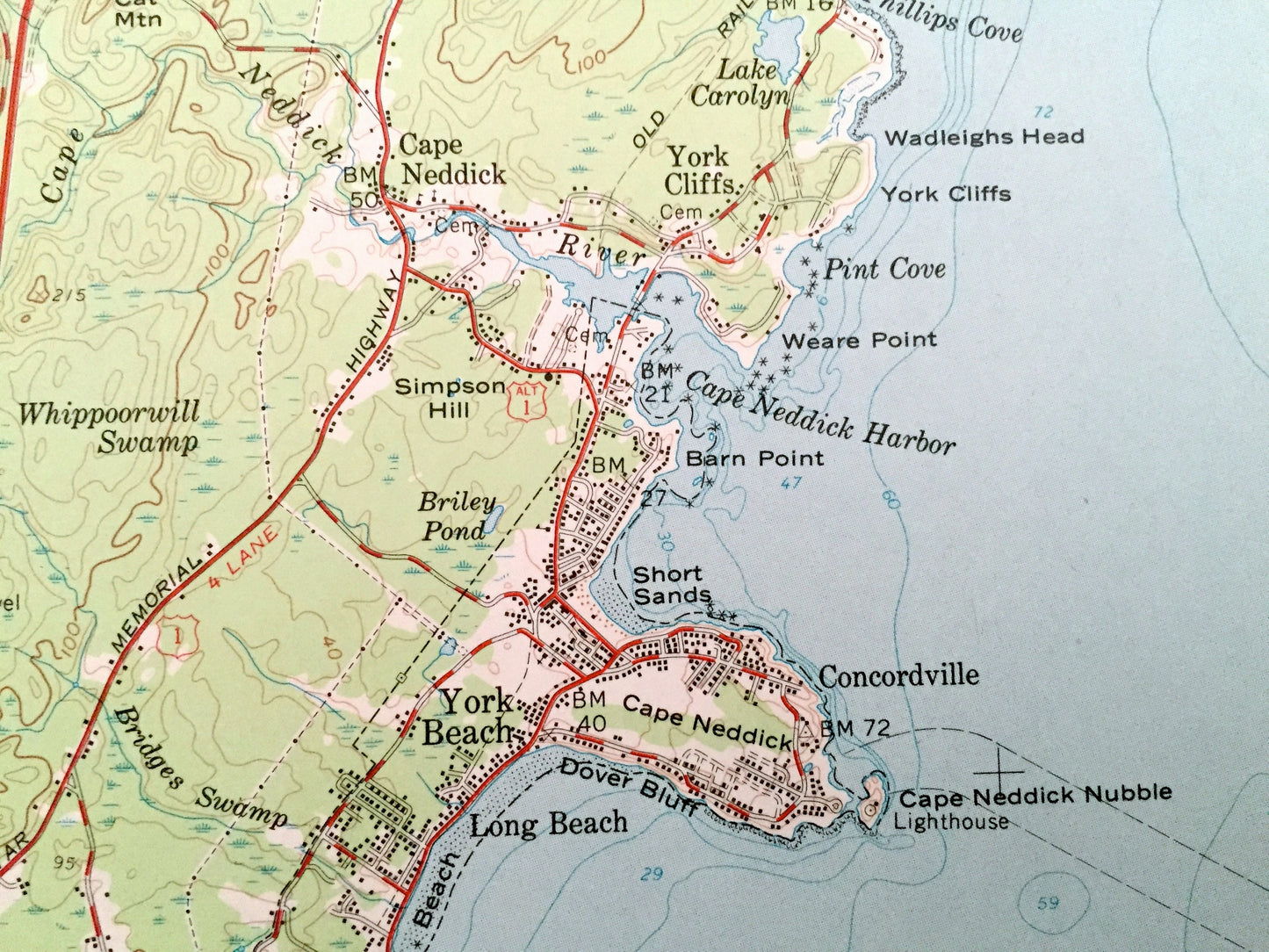
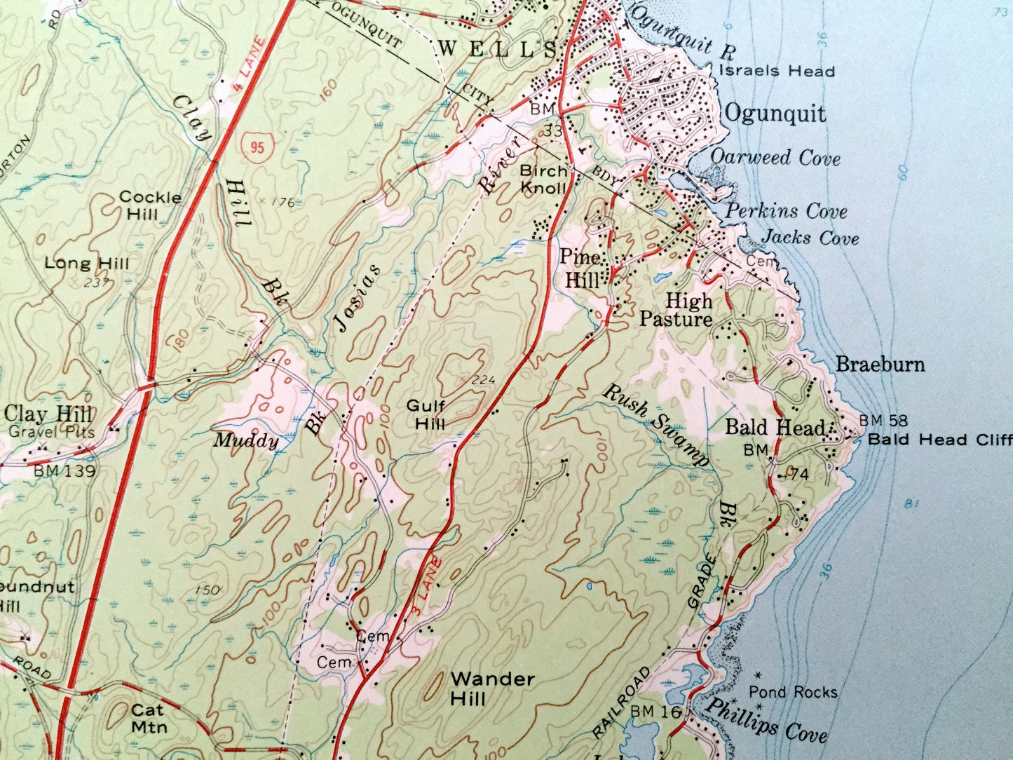
See what Maine looked like over 60 years ago. Lots of intricate details and geological contours. Map even has little squares for every house that existed. The USGS cartographers were very thorough back then!
Perfect for the historian, map-lover, the curious or just as a conversation starter. Wonderful and rare. Vintage maps such as these make great gifts.
Edition of 1956, printed 1973
Dimensions: 18" width x 22" height
----
Features
Cities & Towns: Kittery, Remick Corners, Admiralty Village, Kittery Foreside, York, Seabury, Bedell Crossing, Cutts Island, Briggs Corner, Kittery Point, New Castle, Portsmouth, Rye, Foyes Corner, Fairhill Manor, Wallis Sands, Rye North Beach.
Points of Interest: Atlantic Ocean, Piscataqua River, Gerrish Island, Spruce Creek, Little Harbor, Forty Acre Hill, Rye Harbor State Park, Witch Creek, US Naval Reservation (Fort Foster), Cutts Island, Brave Boat Harbor, and many more smaller lakes, creeks, mountains, valleys, houses, schools, roads, churches and train tracks.
Condition: Very Good Vintage condition, commensurate with age. This map is in great shape for being almost 50 years old. Has light edge-wear and small stains or discolorations in margin area, but this will all add to vintage character when framed.
----
We will happily adjust shipping price for multiple purchases. Maps are rolled up and shipped in sturdy mailing tubes, never folded.
Couldn't load pickup availability
Share