My Store
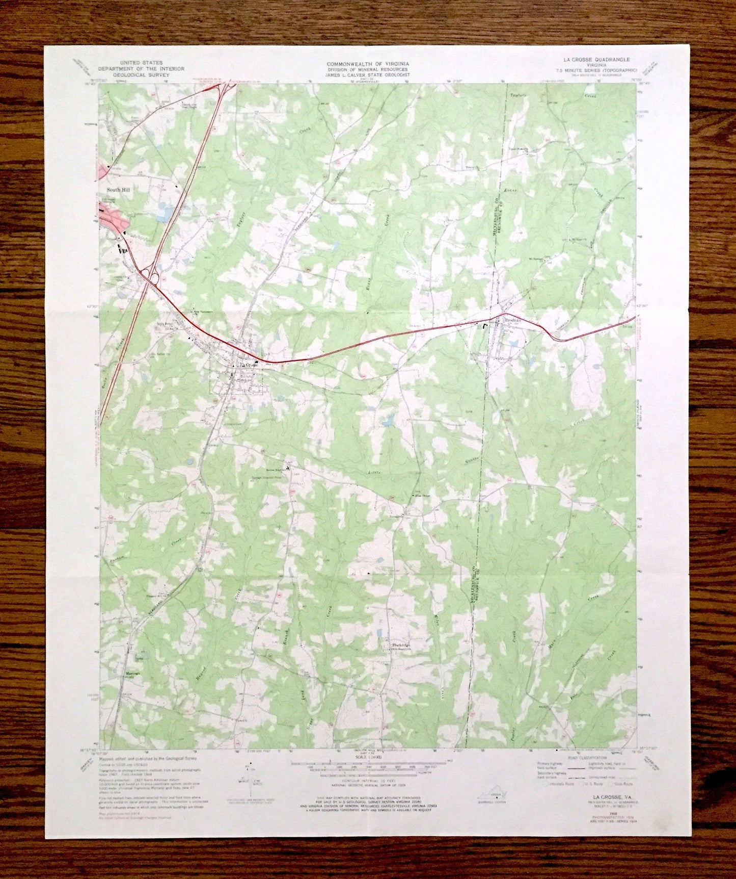
Antique La Crosse, Virginia 1968 US Geological Survey Topographic Map – Mecklenburg, Brunswick County, Brodnax, South Hill, Blackridge, VA
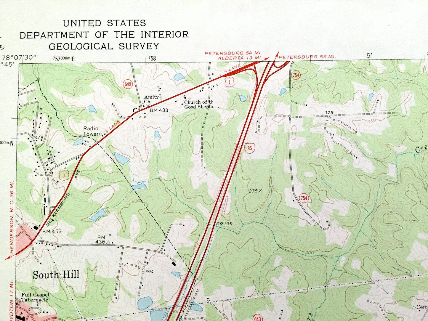
Antique La Crosse, Virginia 1968 US Geological Survey Topographic Map – Mecklenburg, Brunswick County, Brodnax, South Hill, Blackridge, VA
Beautiful, antique map of La Cross, Virginia and surrounding Mecklenburg & Brunswick County area. This is an authentic 1968 edition, 1977 print from the U.S. Geological Survey and NOT a computer reproduction.
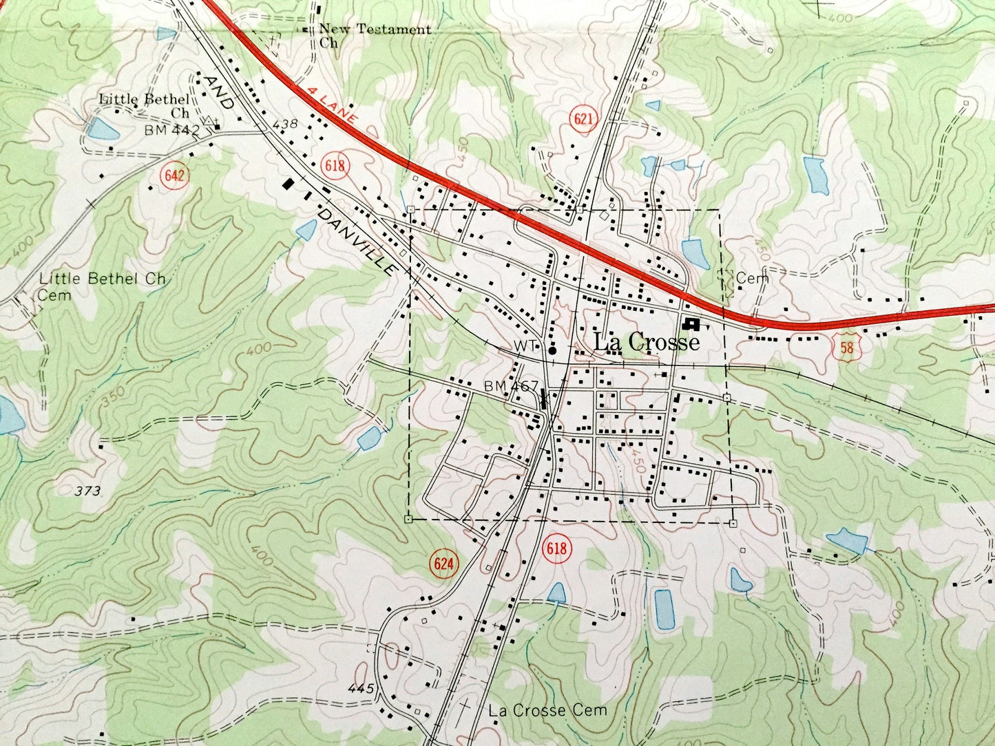
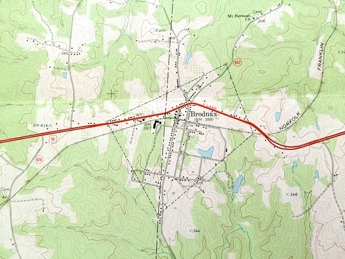
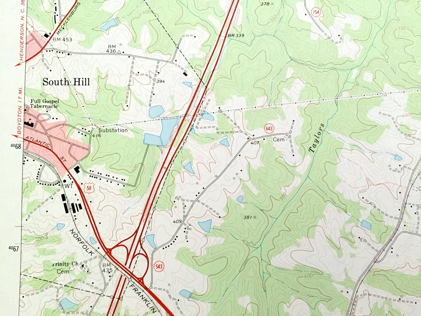
See what Virginia looked like over 50 years ago. Lots of intricate details and geological contours. Map even has little squares for every house that existed at the time. The USGS cartographers were very thorough back then!
Perfect for the historian, map-lover, the curious or just as a conversation starter. Wonderful and rare. Vintage maps such as these make great gifts.
Edition of 1968, printed 1977
Dimensions: 22" width x 27" height
----
Features
Cities & Towns: La Crosse, South Hill, Brodnax, Marengo, Blackridge.
Points of Interest: Mecklenburg County, Brunswick County, Taylors Creek, Little Genito Creek, Hagood Creek, Seaboard Coast Railroad Line, Norfolk Franklin Danville Railroad Line, Evans Creek, Main Creek, Pole Creek, site of Mecklenburg-Brunswick Regl-AVC Airport, and many more hills, creeks, ponds, houses, schools, churches and roads.
Condition: Good Vintage condition, commensurate with age. This map is in great shape for being over 45 years old. Has light edge-wear and old folds as-issued, but these will flatten easily and all will add to vintage character when framed.
----
We will happily adjust shipping price for multiple purchases. Maps are rolled up and shipped in sturdy mailing tubes, never folded.
Couldn't load pickup availability
Share