My Store
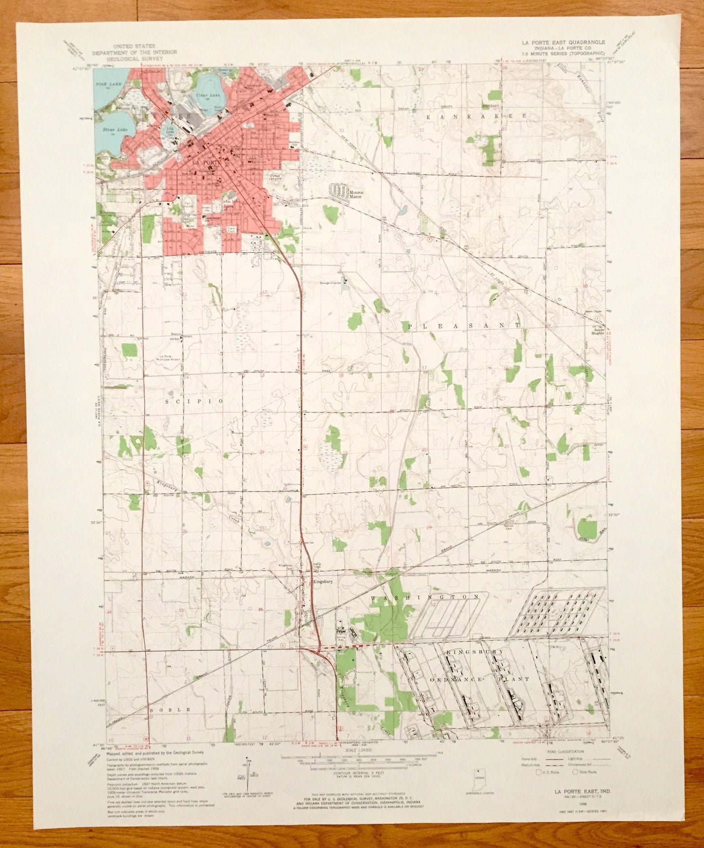
Antique La Porte, Indiana 1958 US Geological Survey Topographic Map – Kankakee, Scipio, Pleasant, Noble, Washington, Kingsbury Ordnance, IN
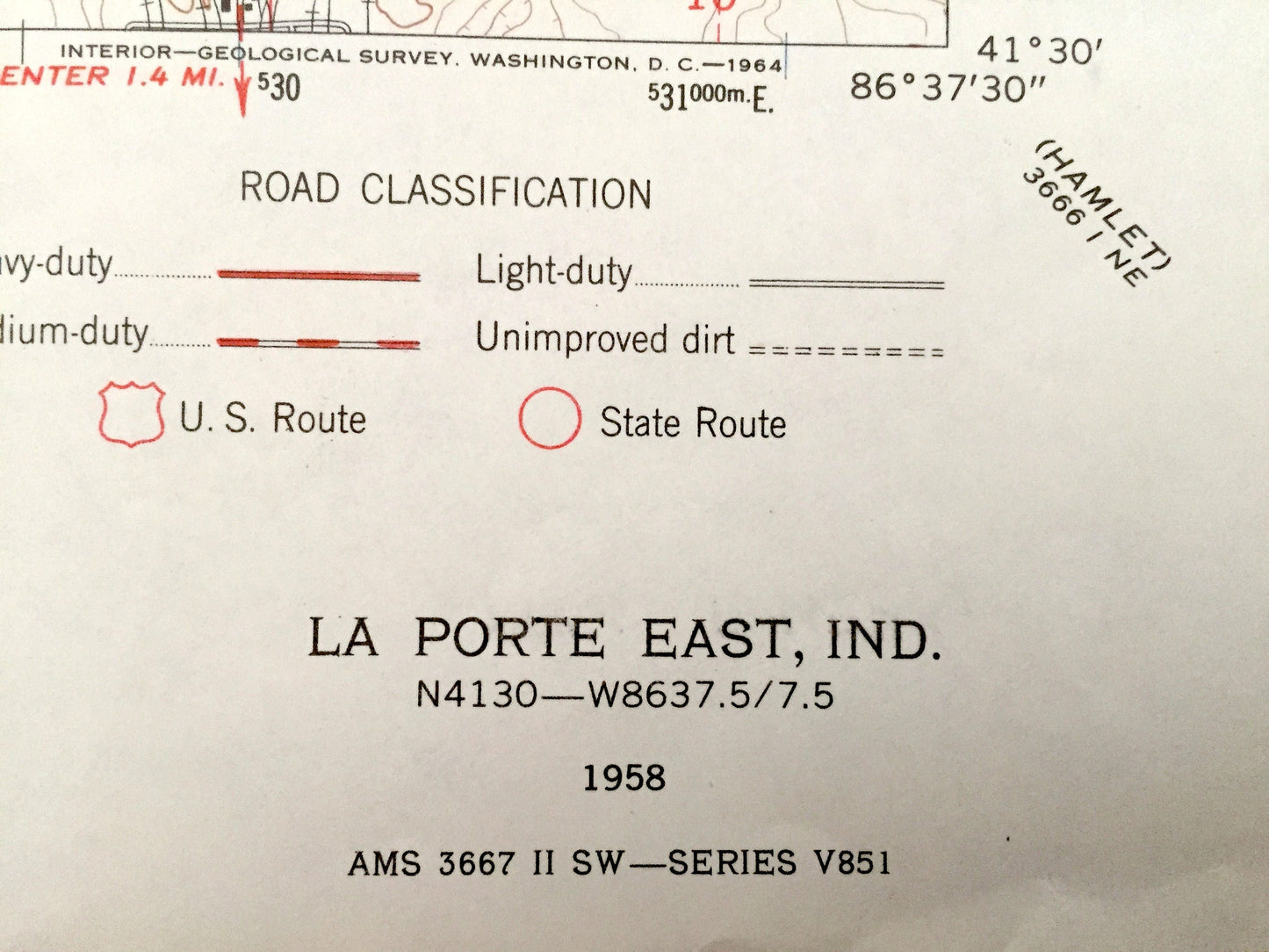
Antique La Porte, Indiana 1958 US Geological Survey Topographic Map – Kankakee, Scipio, Pleasant, Noble, Washington, Kingsbury Ordnance, IN
Beautiful, antique map of La Porte, Scipio, Kankakee, Pleasant & Washington, Indiana and surrounding La Porte County area. This is an authentic 1958 print from the U.S. Geological Survey and NOT a computer reproduction.
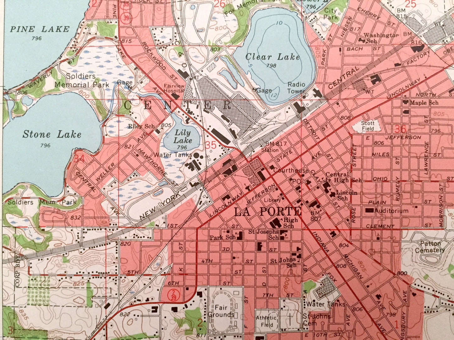
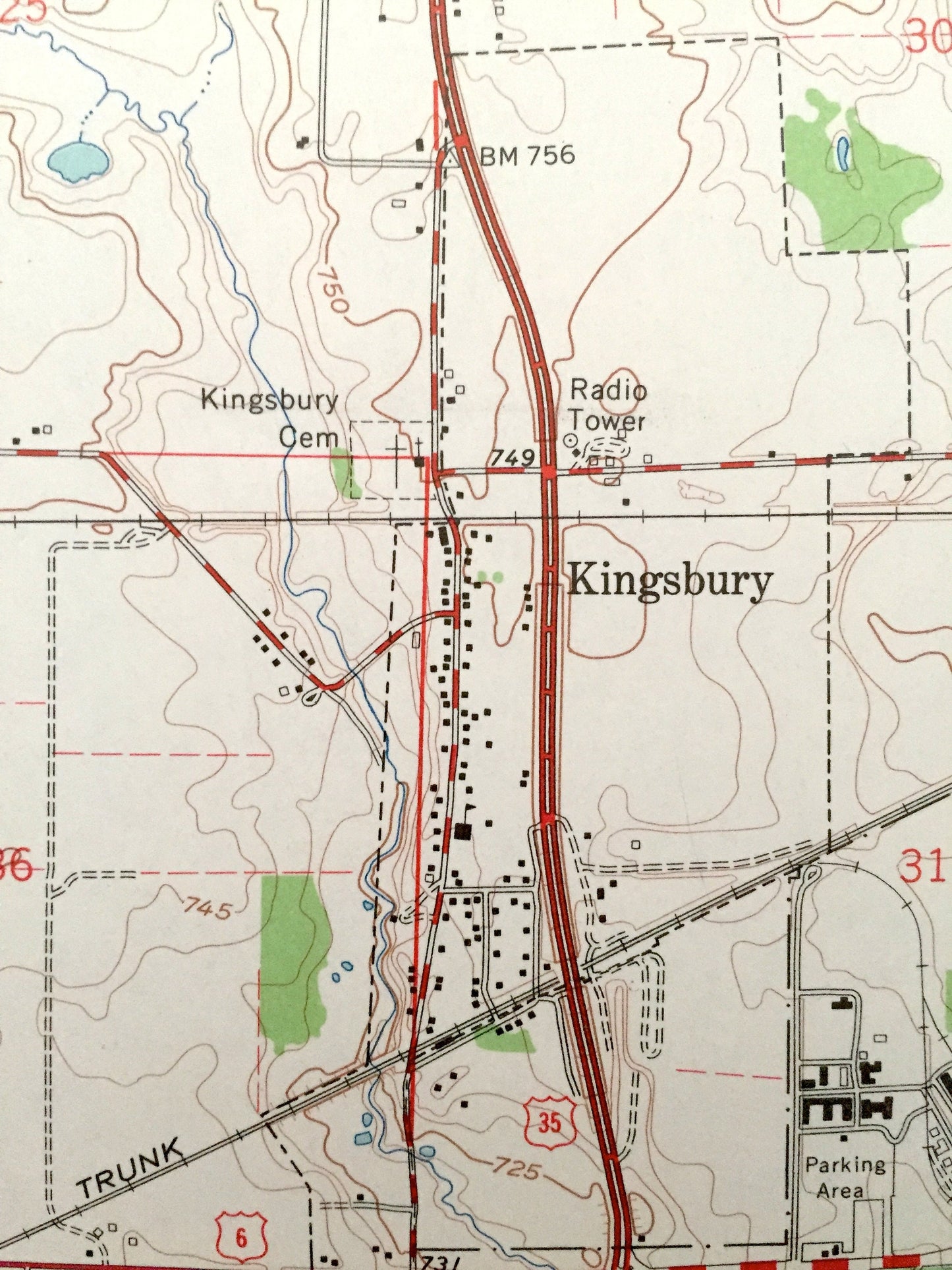
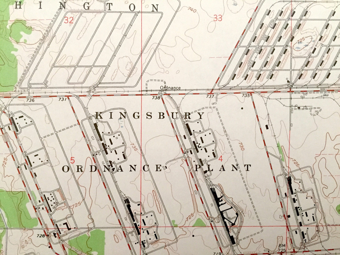
See what Indiana looked like over 60 years ago. Lots of intricate details and geological contours. Map even has little squares for every house that existed at the time. The USGS cartographers were very thorough back then!
Perfect for the historian, map-lover, the curious or just as a conversation starter. Wonderful and rare. Vintage maps such as these make great gifts.
Edition of 1958, printed 1958
Dimensions: 22" width x 27" height
----
Features
Cities & Towns: La Porte, Scipio, Kankakee, Pleasant, Noble, Washington, Monroe Manor, Salem Heights, Kingsbury.
Points of Interest: La Porte County, Pine Lake, Stone Lake, Clear Lake, Lower Lake, Little Kankakee River, Kingsbury Creek, Kingsbury Ordnance Plant, Grand Trunk Railroad, New York Chicago & St. Louis Railroad and lots more creeks, hills, houses, schools, churches, train tracks and roads.
Condition: Very Good Vintage condition, commensurate with age. This map is in great shape for being over 60 years old.
----
We will happily adjust shipping price for multiple purchases. Maps are rolled up and shipped in sturdy mailing tubes, never folded.
Couldn't load pickup availability
Share