My Store
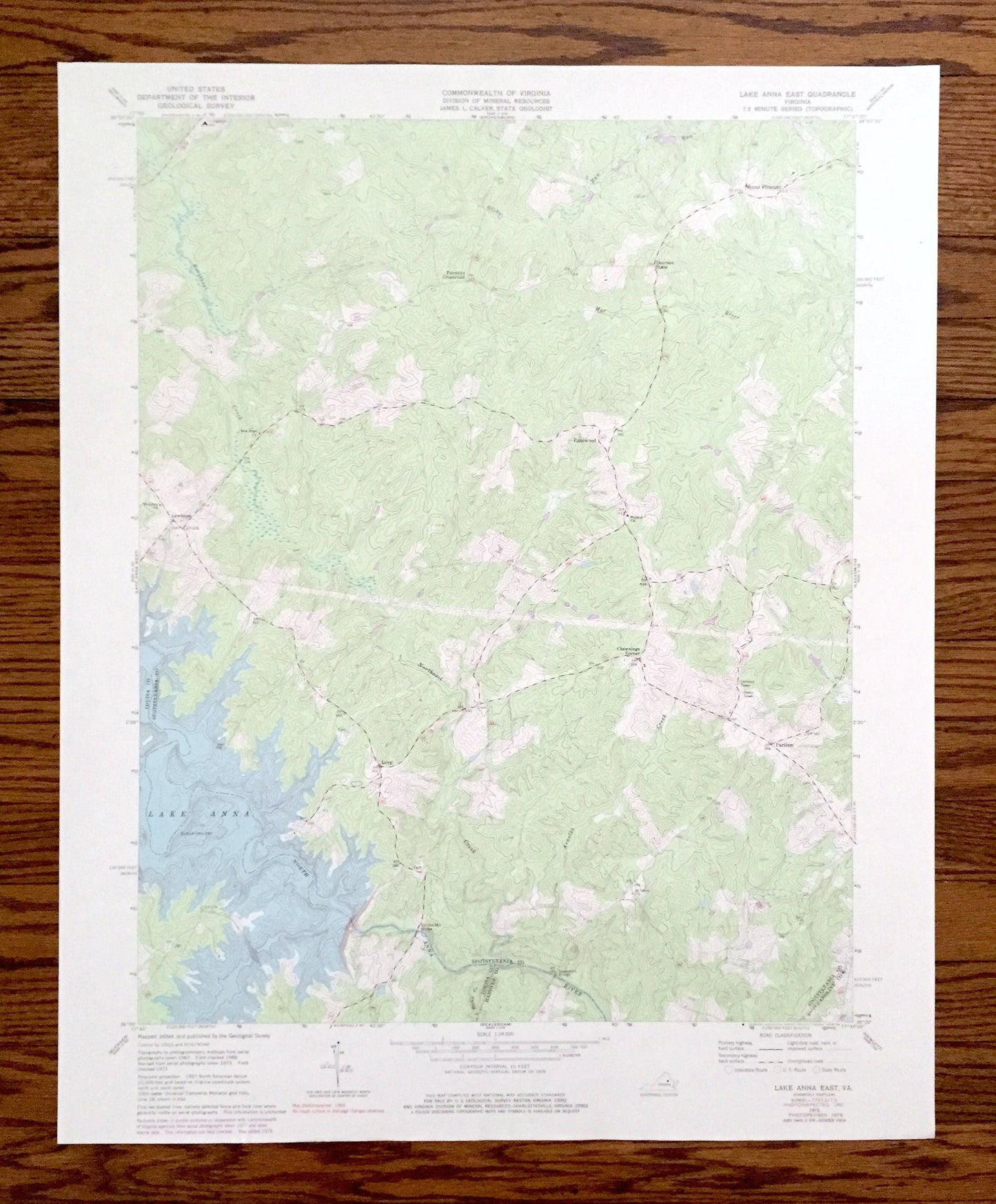
Antique Lake Anna East, Virginia 1973 US Geological Survey Topographic Map – Louisa, Spotsylvania County, Lewiston, Partlow, Chewnings, VA
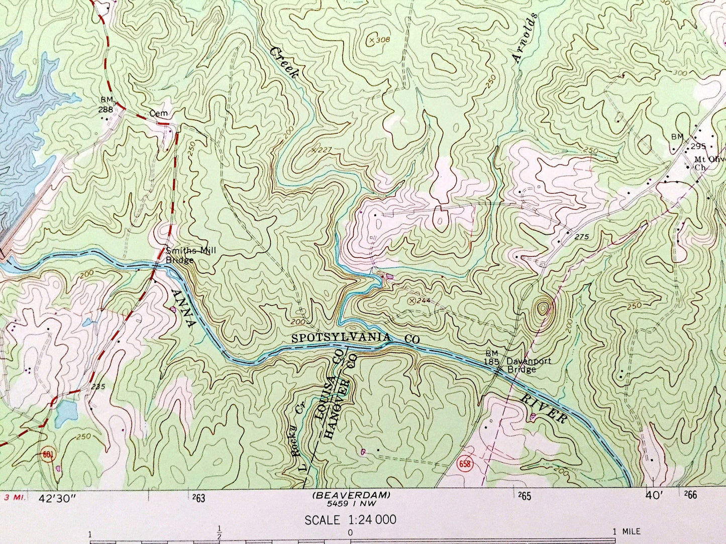
Antique Lake Anna East, Virginia 1973 US Geological Survey Topographic Map – Louisa, Spotsylvania County, Lewiston, Partlow, Chewnings, VA
Beautiful, antique map of Lake Anna, Virginia and surrounding Louisa County & Spotsylvania County area. This is an authentic 1973 edition, 1984 print from the U.S. Geological Survey and NOT a computer reproduction.
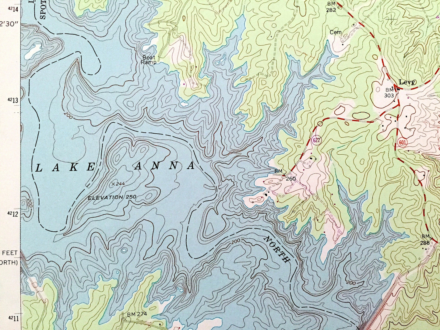
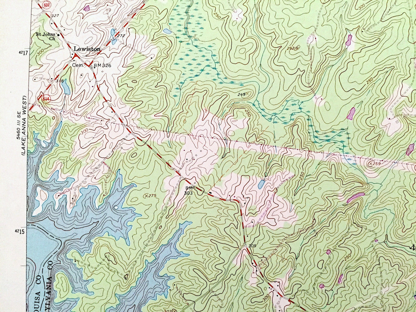
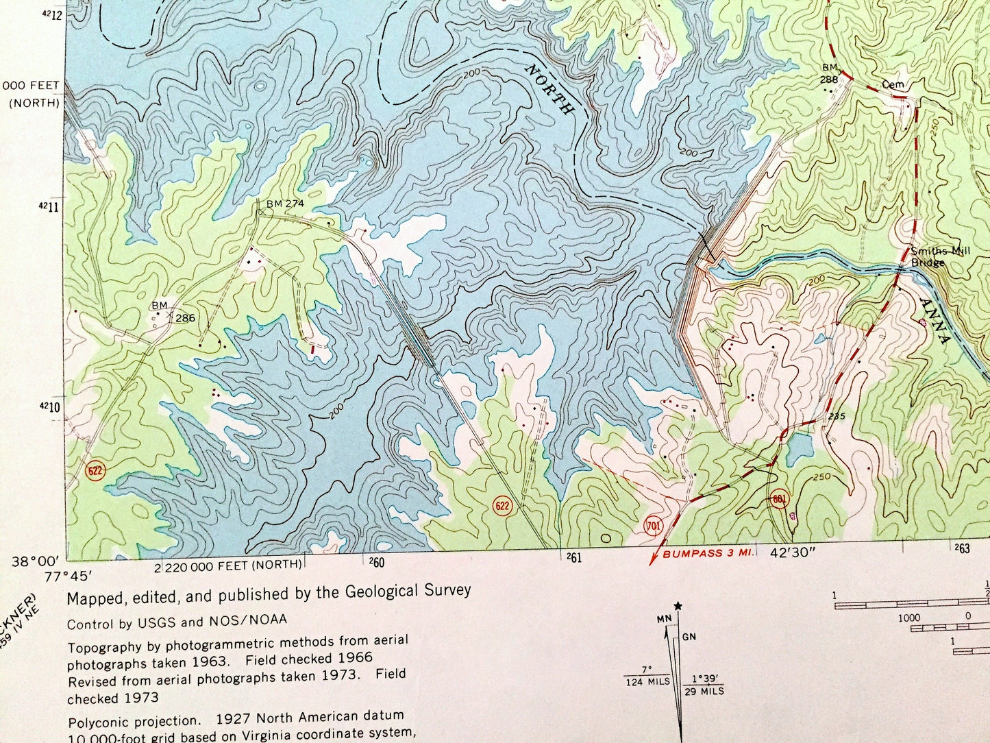
See what Virginia looked like over 45 years ago. Lots of intricate details and geological contours. Map even has little squares for every house that existed at the time. The USGS cartographers were very thorough back then!
Perfect for the historian, map-lover, the curious or just as a conversation starter. Wonderful and rare. Vintage maps such as these make great gifts.
Edition of 1973, printed 1984
Dimensions: 22" width x 27" height
----
Features
Cities & Towns: Lewiston, Gatewood, Mount Pleasant, Duerson Store, Chewnings Corner, Partlow, Levy, Penneys Crossroad.
Points of Interest: Louisa County, Spotsylvania County, Hanover County, Caroline County, Lake Anna, North Anna River, Smiths Mill Bridge, Davenport Bridge, Bluff Run, Arnolds Creek, Northeast Creek and many more hills, streams, ponds, houses, farms, schools, churches and roads.
Condition: Good Vintage condition, commensurate with age. This map is in great shape for being over 40 years old. Has light wear but this will add to vintage character when framed.
----
We will happily adjust shipping price for multiple purchases. Maps are rolled up and shipped in sturdy mailing tubes, never folded.
Couldn't load pickup availability
Share