My Store
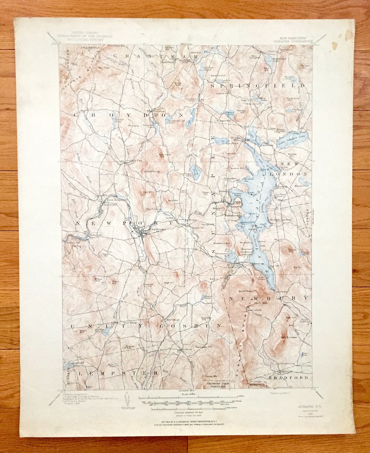
Antique Lake Sunapee, New Hampshire 1905 US Geological Survey Topographic Map – Newport, Newbury, Goshen, New London, Cornish, Croydon, NH
Antique Lake Sunapee, New Hampshire 1905 US Geological Survey Topographic Map – Newport, Newbury, Goshen, New London, Cornish, Croydon, NH
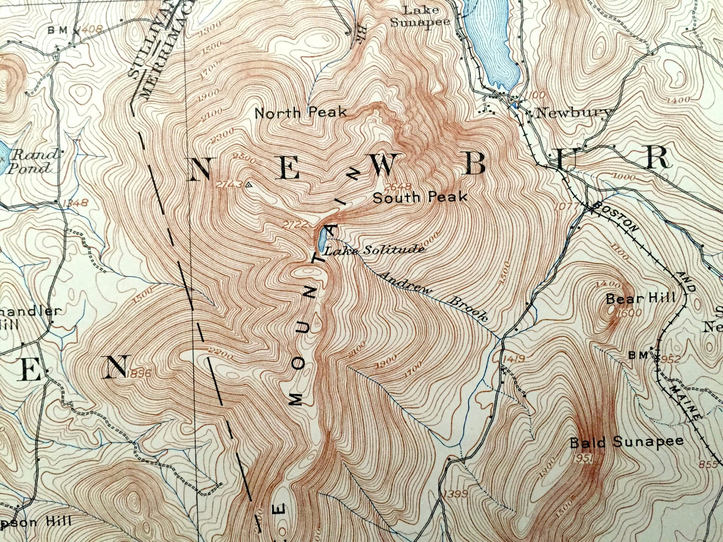
Beautiful, antique map of Lake Sunapee, New Hampshire (here written as Sunapee Lake), including surrounding Sullivan County & Merrimack County area. This is an authentic 1905 edition, 1947 print from the U.S. Geological Survey and NOT a computer reproduction.
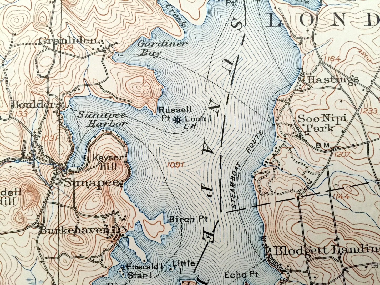
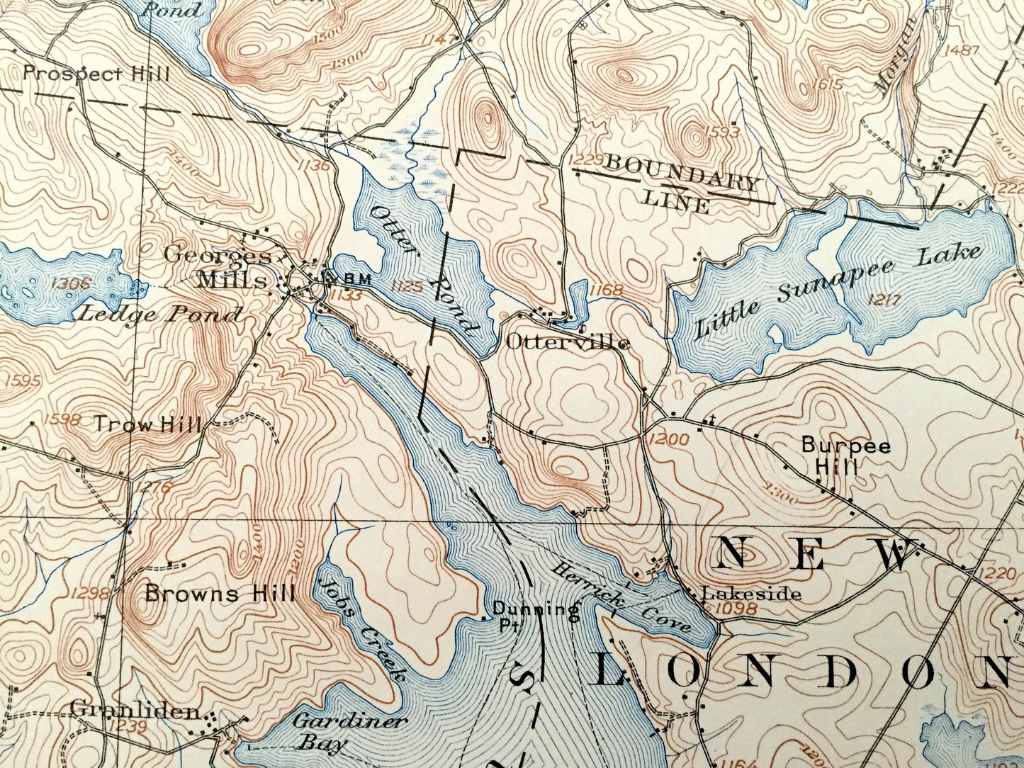
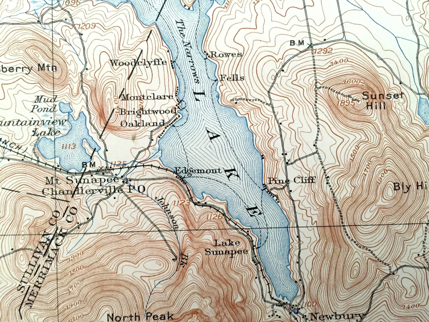
See what the Lakes Region of New Hampshire looked like over 115 ago. Lots of intricate details and geological contours. Map even has little squares for every house that existed at the time. The USGS cartographers were very thorough back then!
Perfect for the historian, map-lover, the curious or just as a conversation starter. Wonderful and rare. Maps such as these make great gifts.
Edition of 1905, printed 1947
Dimensions: 17" width x 21" height
----
Features
Cities & Towns: Cornish, Plainfield, Grantham, Croydon, Springfield, Newport, Sunapee, New London, Unity, Goshen, Newbury, Acworth, Lempster, Washington, Bradford, Croydon Flat, Georges Mills, Otterville, North Newport, Northville, Kelleyville, Granliden, Boulders, Wendell, Burkehaven, Hastings, Soo Nipi Park, Blodgett Landing, Pine Cliff, East Unity, Mill Village, Lake Sunapee, South Newbury, Hoyts Corner.
Points of Interest: Lake Sunapee, Little Sunapee Lake, Otter Pond, Mountainview Lake, Baptist Pond, Long Pond, Perkins Pond, Messer Pond, Kolelemook Lake, Stocker Pond, Sanborn Pond, Rockybond Pond, Spectacle Pond, Sucker Pond, Crescent Lake, Gilman Pond, Rand Pond, Sugar River, Croydon Mountain, Sunapee Mountain, Pillsbury State Forest Reservation, Croydon Peak, Sanborn Hill, Baltimore Hill, cakes Hump, Browns Hill, Coit Mountain, Bald Mountain, The Pinnacle, Blueberry Mountain, Sunset Hill, Bly Hill, Wilcox Hill, Pikes Hill, Mt. Tug, Page Hill, Potato Hill, Blaisdell Hill, Bald Sunapee, Bear Hill, South Peak, The Narrows, Melrose Island, Fishers Bay, Sunapee Harbor, Gardiner Bay, Herrick Cove, Boston & Maine Railroad (Claremont Branch) and lots more hills, mountains, streams, ponds, marshes, camps, houses, islands, coves, roads, railroads.
Condition: Good Vintage condition, commensurate with age. This map is in good shape for being more than 75 years old. Has edge-wear and coloring in margins, but this will all read as vintage character when framed.
----
We will happily adjust shipping price for multiple purchases. Maps are rolled up and shipped in sturdy mailing tubes, never folded.
Couldn't load pickup availability
Share