My Store
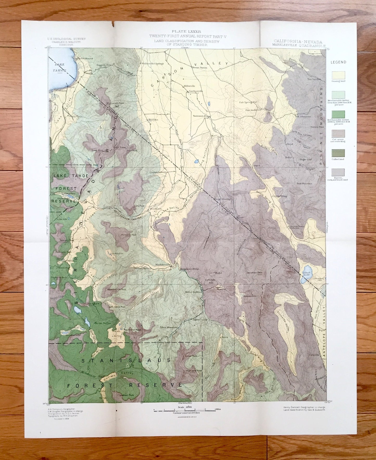
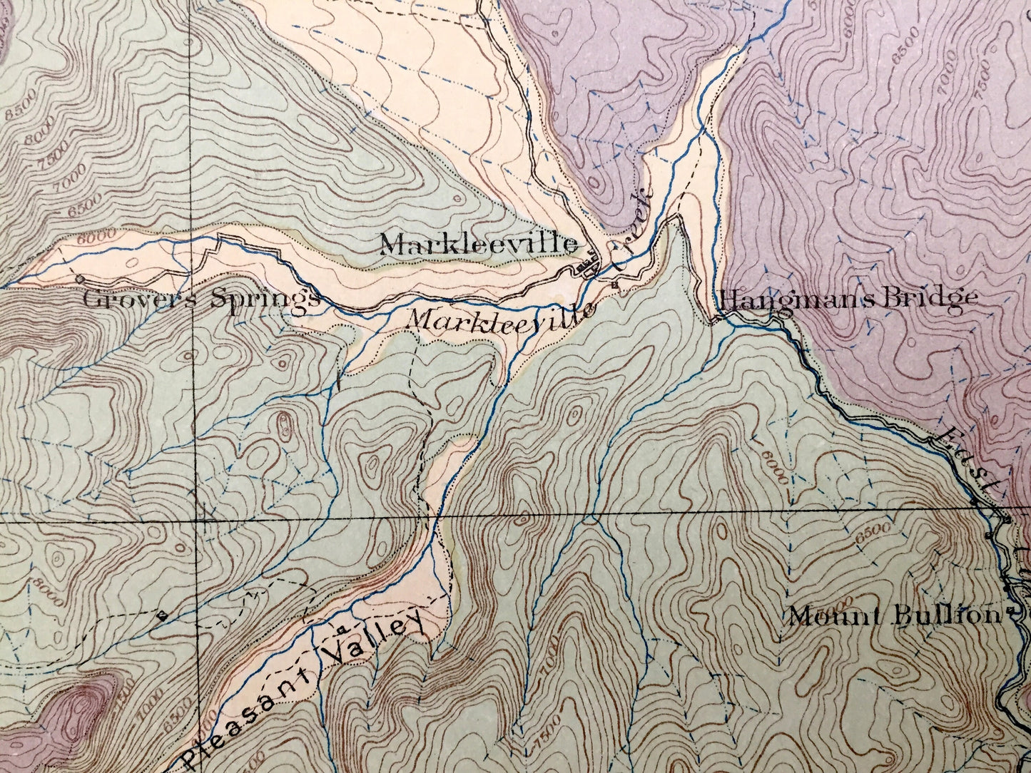
Antique Lake Tahoe, California 1889 US Geological Survey Topographic Map – Douglas, Eldorado, Alpine County, Nevada, Markleeville, Carson NV
Antique Lake Tahoe, California 1889 US Geological Survey Topographic Map – Douglas, Eldorado, Alpine County, Nevada, Markleeville, Carson NV
Beautiful, antique map of Markleeville & Lake Tahoe, California & Nevada and surrounding Douglas, Eldorado, Mono & Alpine County area. This is an authentic 1889 print from the U.S. Geological Survey and NOT a computer reproduction.
See what California looked like more than 130 years ago in the late 1800s. Lots of intricate details and geological contours. Map even has little squares for every house that existed at the time. The USGS cartographers were very thorough back then! This is one of the rare maps with the map legend on the front.
Perfect for the historian, map-lover, the curious or just as a conversation starter. Wonderful and rare. Vintage maps such as this make great gifts.
Edition of 1889, printed 1889
Dimensions: 16 1/2" width x 20 1/2" height
----
Features
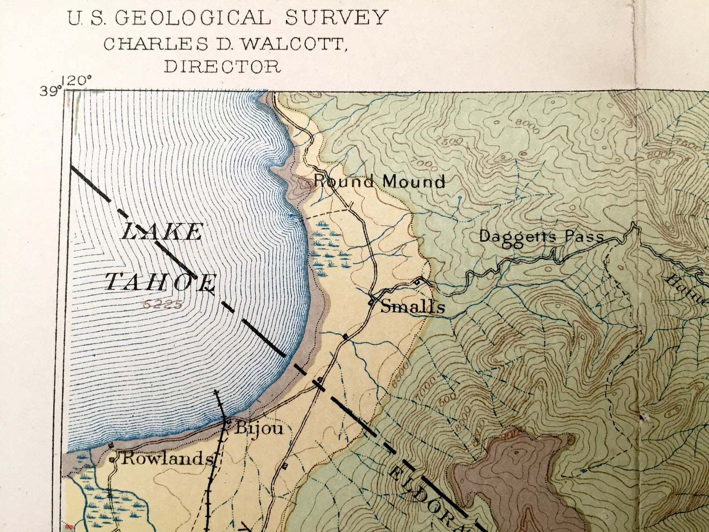
Cities & Towns: CALIFORNIA: Rowlands, Bijou, Sierra House, Williams, Grovers Springs, Woodfords, Markleeville, Hangmans Bridge, Mogul, Silver Mountain, Mount Bullion, Monitor, Berry, Coleville.
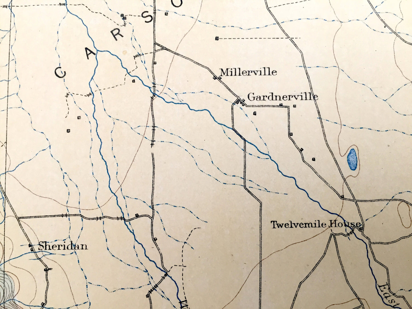
NEVADA: Smalls, Sheridan, Walleys Hot Springs, Millersville, Gardnerville, Twelve Mile House, Tim Smith, Peter Anderson, Bill Johnsons, Boyd, Bells, Carters, Rileys.
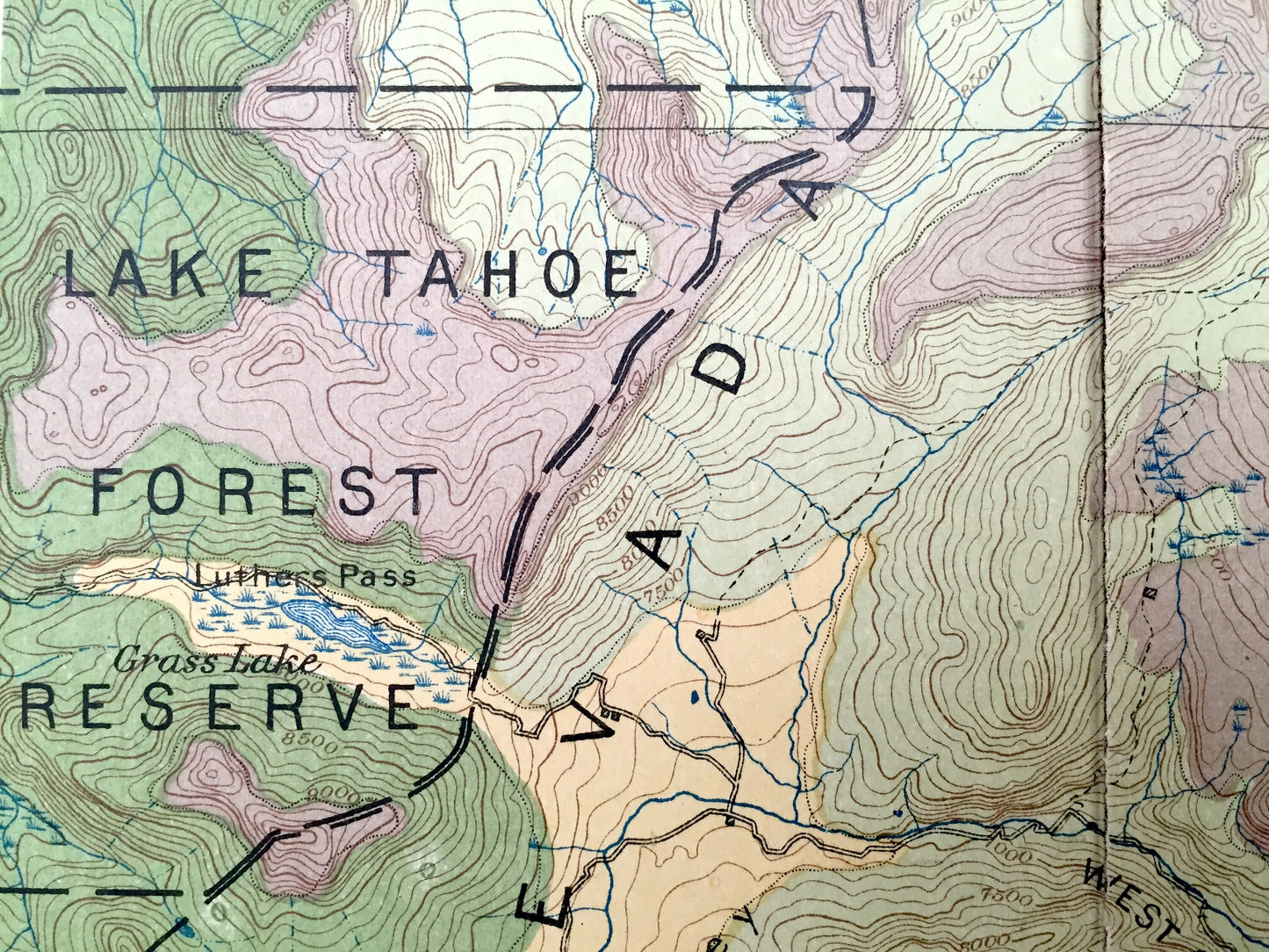
Points of Interest: Douglas County, Eldorado County, Mono County, Alpine County, Lake Tahoe, Carson Valley, Sierra Nevada Mountains, Pine Nut Mountains, Antelope Valley, Monument Peak, Jobs Peak, Freel Peak, Lake Valley, Upper Truckee River, Daggers Pass, Bald Mountain, Double Spring Flat, Alkali Lake, Charity Valley, Hermit Valley, Raymond Peak, Silver Peak, Highland Peak, Indian Valley, Youngs Crossing, and many more small towns, springs, train tracks, valleys, hills and creeks.
Condition: Good Vintage condition, commensurate with age. This map is in incredible shape for being over 130 years old. Has light edge-wear, toning, folds as-issued and some repaired separations at folds, all of which will read as vintage character when framed. There is a small chance folds may separate more in transit, but this is easily repaired.
----
We will happily adjust shipping price for multiple purchases. Maps are rolled up and shipped in sturdy mailing tubes, never folded.
Couldn't load pickup availability
Share