My Store
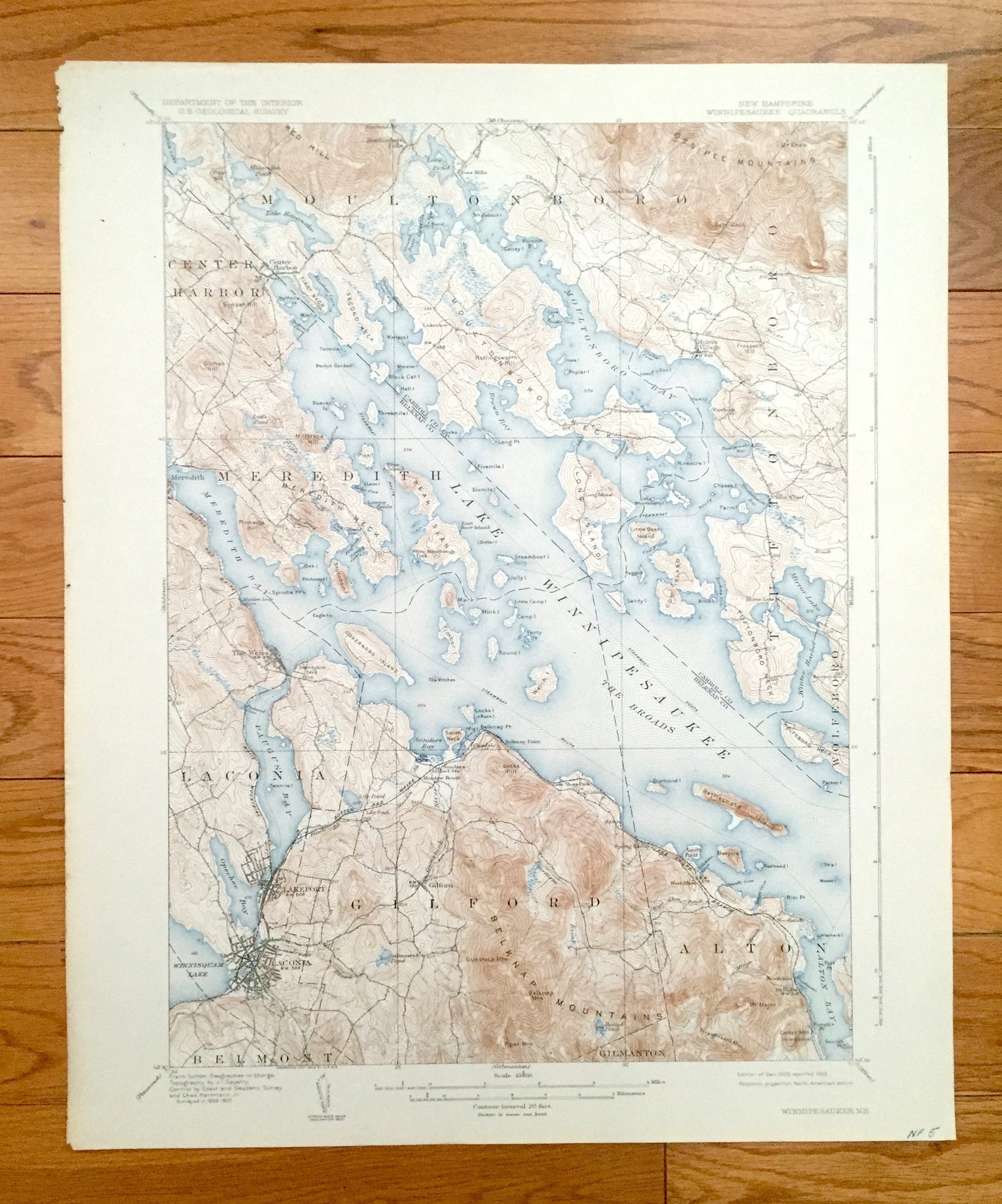
Antique Lake Winnipesaukee, New Hampshire 1909 US Geological Survey Topographic Map – Laconia, Gilford, Alton, Meredith Moultonboro Weirs NH
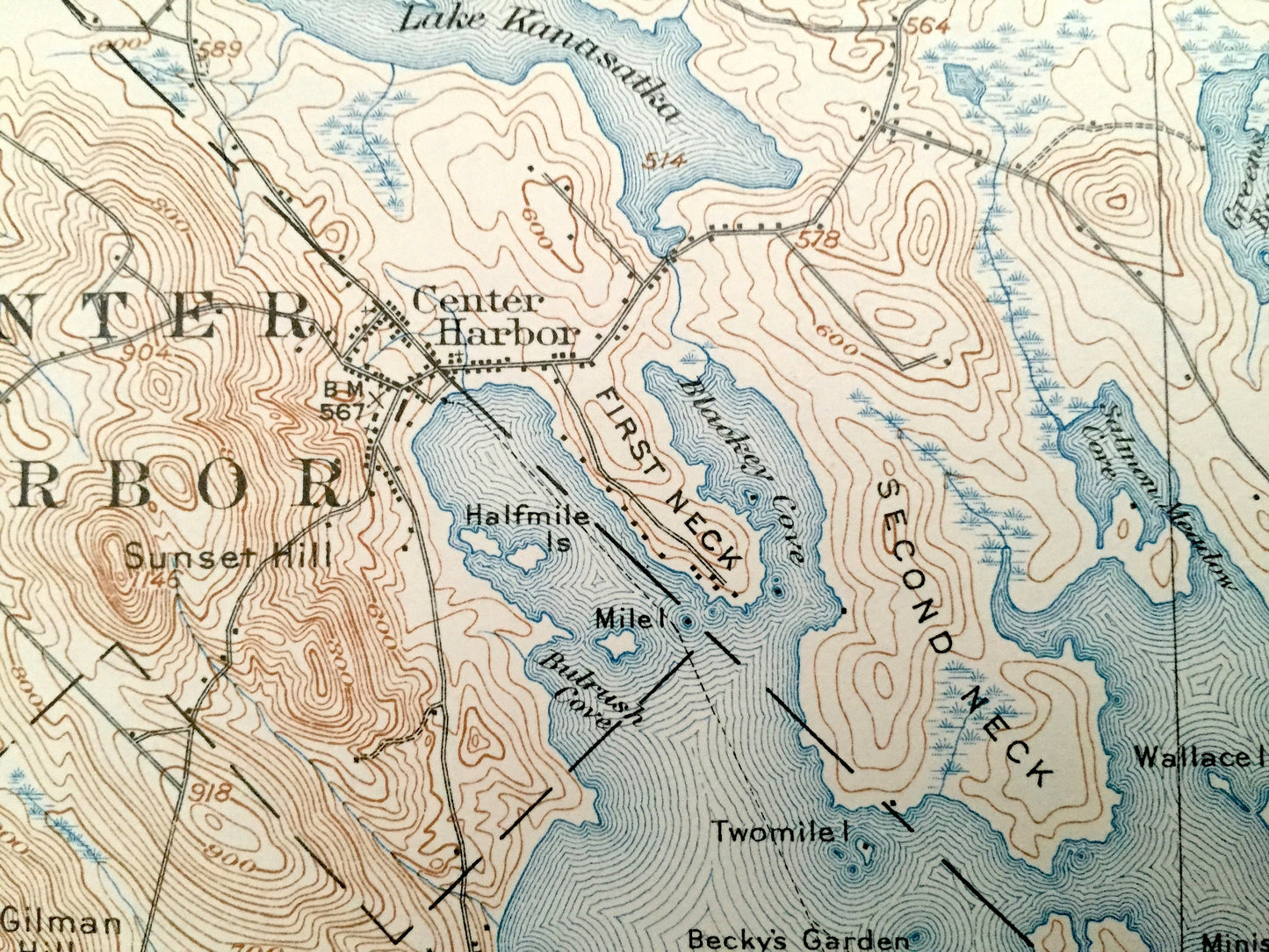
Antique Lake Winnipesaukee, New Hampshire 1909 US Geological Survey Topographic Map – Laconia, Gilford, Alton, Meredith Moultonboro Weirs NH
Beautiful, antique map of Lake Winnipesaukee, New Hampshire and surrounding area. This is an authentic 1909 edition, 1935 print from the U.S. Geological Survey and NOT a computer reproduction.
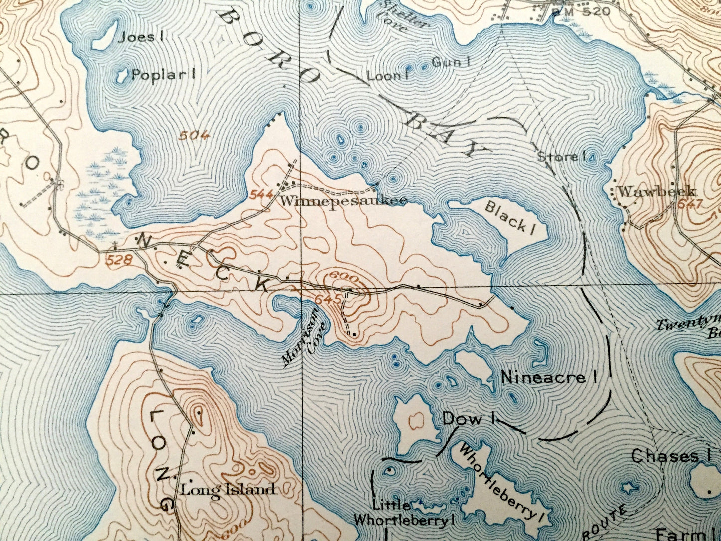
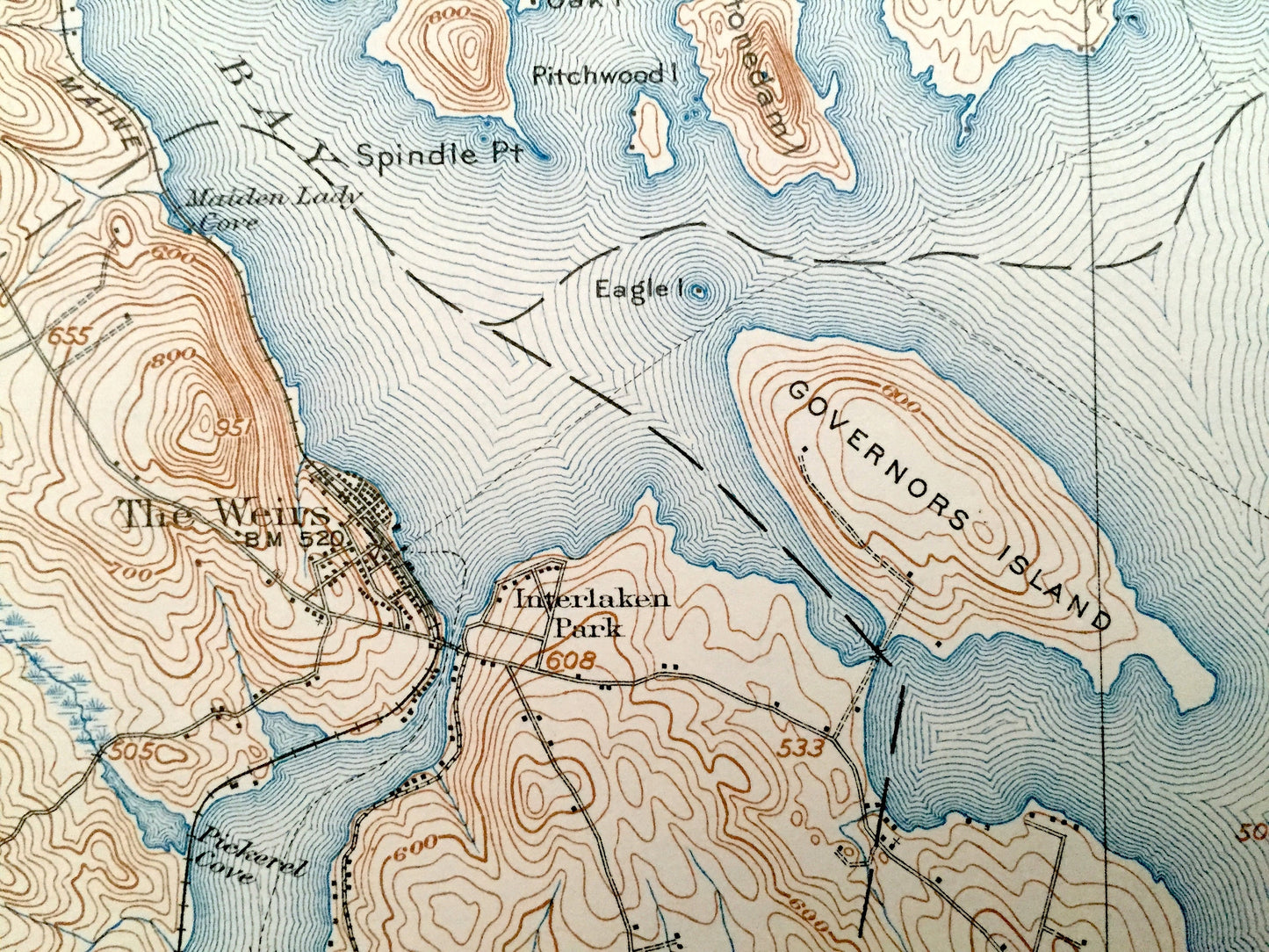
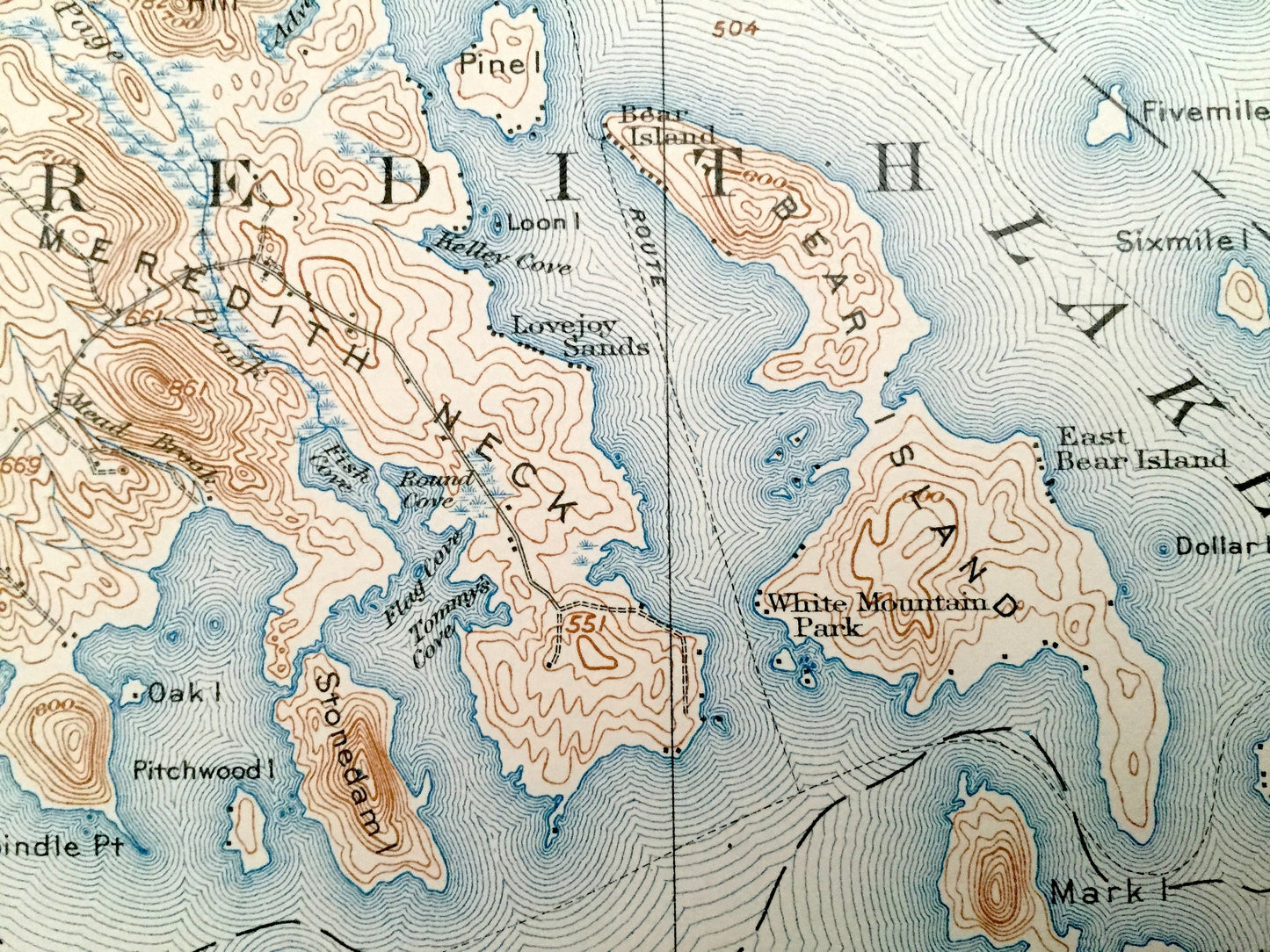
See what Lake Winnipesaukee, Belknap County and Carroll County looked like more than 110 years ago. Lots of intricate details and geological contours. Map even has little squares for every house that existed at the time. The USGS cartographers were very thorough back then! On the back is a description of topographic symbols and map guide.
Perfect for the historian, map-lover, the curious or just as a conversation starter. Wonderful and rare. Vintage maps such as these make great gifts.
Edition of 1909, printed 1935
Dimensions: 16 1/2" width x 20" height
----
Features
Cities & Towns: Center Harbor, Moultonboro, Tuftonboro, Meredith, Laconia, Belmont, Gilford, Wolfeboro, Alton, Gilmanton, Moultonboro Falls, Lees Mills, Winnipesaukee, Melvin Village, Wawbeek, Lovejoy Sands, Bear Island, The Weirs, Interlaken Park, White Mountain Park, Glendale, Belknap Point, Long Island, Union Wharf, Mirror Lake, Keewayden, Lakeport, Sanders, Meadow Brook, Lake Shore Park, Log Cabin, Spring Haven, West Alton, Woodlands, Brookdale, Mt. Major, Brookhurst, Ossipee Park, Lakeview, East Bear Island.
Points of Interest: Belknap County, Carroll County, Lake Winnipesaukee, Squam Lake, Winnisquam Lake, Mirror Lake, Lake Kanasatka, Wakondah Pond, Lees Pond, Lily Pond, Round Pond, Opechee Bay, Paugus Bay, Sanders Bay, The Broads, Meredith Bay, Moultonboro Bay, Winter Harbor, Alton Bay, Governors Island, Bear Island, Rattlesnake Island, Long Island, Cow Island, Stonedam Island, Timber Island, Mark Island, Mink Island, Steamboat Island, Jolly Island, Camp Island, Lockes Island, Welch Island, Belknap Mountains, Red Hill, Ossipee Mountains, Gunstock Mountain, Piper Mountain, Mt. Major, Lockes Hill, Straightback Mountain, Cedar Mountain, Bald Knob, Mt. Shaw, Pine Hill, Sunset Hill, Gilman Hill, Millstone Hill, Meredith Neck, Moultonboro Neck, Tuftonboro Neck, Smith Neck (Varney Point), Smith Cove, Maiden Lady Cove, Pumpkin Point, Woodmans Cove, Gunstock River, Minge Brook, Jewett Brook, Shannon Brook, Pickerel Cove, Boston & Maine Railroad and lots more hills, mountains, streams, ponds, marshes, camps, roads, coves and islands.
Condition: Good Vintage condition, commensurate with age. This map is in incredible shape for being over 85 years old. Map has light edge-wear, toning and pencil in margins, all of which will read as vintage character when framed.
----
We will happily adjust shipping price for multiple purchases. Maps are rolled up and shipped in sturdy mailing tubes, never folded.
Couldn't load pickup availability
Share