My Store
Antique Lake Winnipesaukee, New Hampshire 1928 US Geological Survey Topographic Map – Wolfeboro, Alton, Wentworth Tuftonboro Sanbornville NH
Antique Lake Winnipesaukee, New Hampshire 1928 US Geological Survey Topographic Map – Wolfeboro, Alton, Wentworth Tuftonboro Sanbornville NH
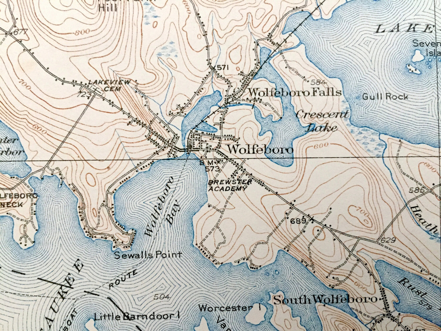
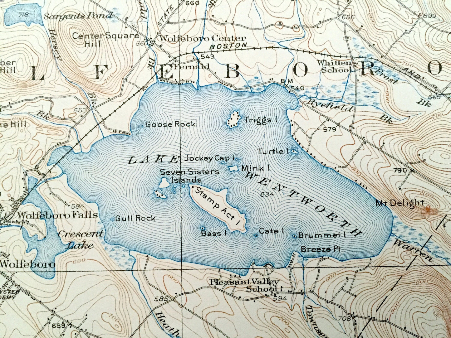
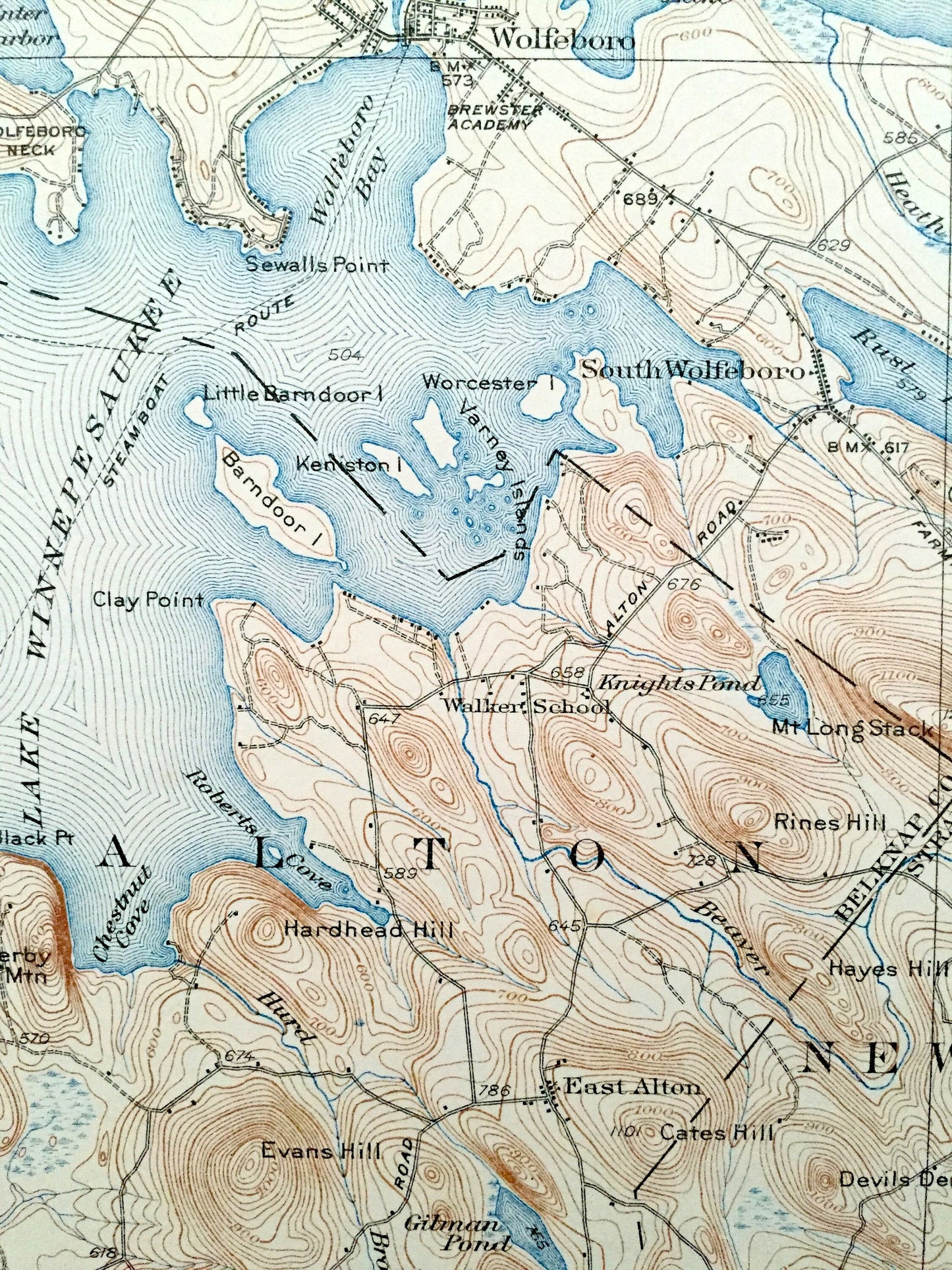
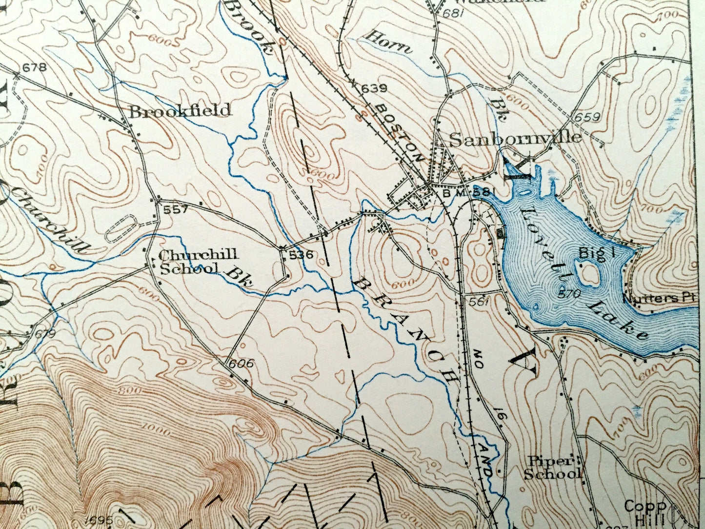
Beautiful, antique map of Lake Winnipesaukee and Lake Wentworth, New Hampshire, including surrounding Belknap, Carroll and Strafford Counties. This is an authentic 1928 edition, 1931 print from the U.S. Geological Survey and NOT a computer reproduction.
See what the Lakes Region of New Hampshire looked like over 90 years ago, centered around Wolfeboro, the nation's first resort town and home of Brewster Academy. Lots of intricate details and geological contours. Map even has little squares for every house that existed at the time. The USGS cartographers were very thorough back then! On the back is a description of topographic symbols and map guide.
Perfect for the historian, map-lover, the curious or just as a conversation starter. Wonderful and rare. Vintage maps such as these make great gifts.
Edition of 1928, printed 1931
Dimensions: 16 1/2" width x 20" height
----
Features
Cities & Towns: Tuftonboro, Ossipee, Effingham, Wolfeboro, Brookfield, Wakefield, Alton, New Durham, Middleton, Water Village, Pine River, Center Effingham, Granite, Grape Corner, Leighton Corners, Center Tuftonboro, Wolfeboro Center, Wolfeboro Falls, North Wolfeboro, East Wolfeboro, North Wakefield, East Wakefield, Stoneham Corners, South Wolfeboro, East Alton, Sanbornville, New Portsmouth, Fernald, Roland Park.
Points of Interest: Lake Winnipesaukee, Lake Wentworth, Rust Pond, Shaws Pond, Lovell Lake, Pine River Pond, Province Lake, Dan Hole Pond, Lower Beech Pond, Upper Beech Pond, Duncan Lake, White Pond, Sargents Pond, Ossipee Mountains, Moose Mountains, Pine River, Wolfeboro Bay, Winter Harbor, Wolfeboro Neck, Barndoor Island, Brewster Academy, Crescent Lake, Stamp Act Island, Seven Sisters Islands, Triggs Island, Canaan Mountain, Sentinel Mountain, Oak Hill, Eldridge Hill, Pocket Mountain, Moody Mountain, Whiteface Mountain, Ballards Ridge, Center Square Hill, Mt. Long Stack, Copple Crown Mountain, Phoebes Nable Mountain, Union Meadows, Copp Hill, Boston & Maine Railroad, and lots more hills, mountains, streams, ponds, marshes, camps, houses, islands, coves, roads, railroads.
Condition: Very Good Vintage condition, commensurate with age. This map is in great shape for being almost 90 years old. Map has light edge-wear, but this will read as vintage character when framed.
----
We will happily adjust shipping price for multiple purchases. Maps are rolled up and shipped in sturdy mailing tubes, never folded.
Couldn't load pickup availability
Share