My Store
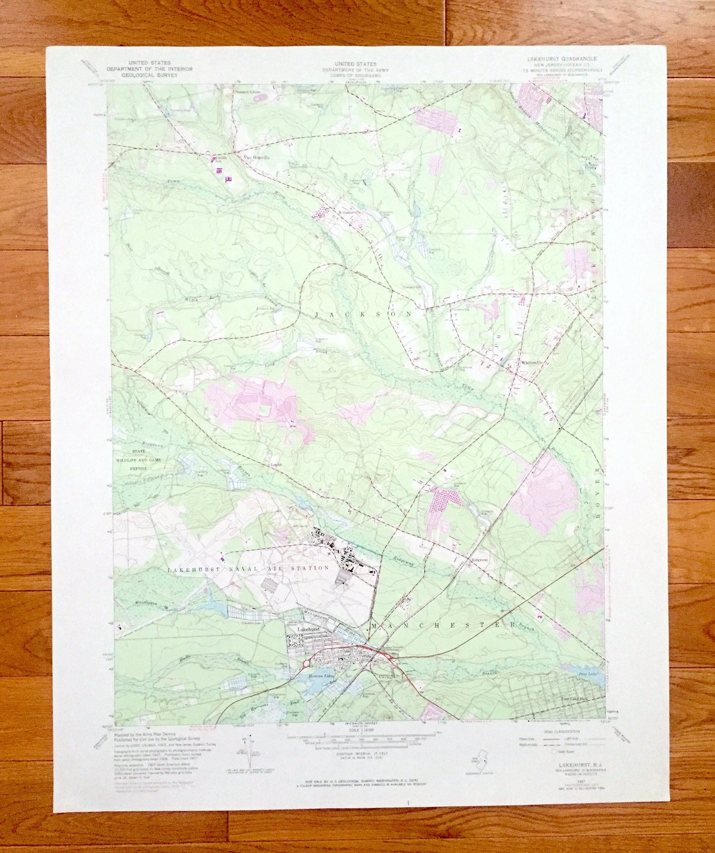
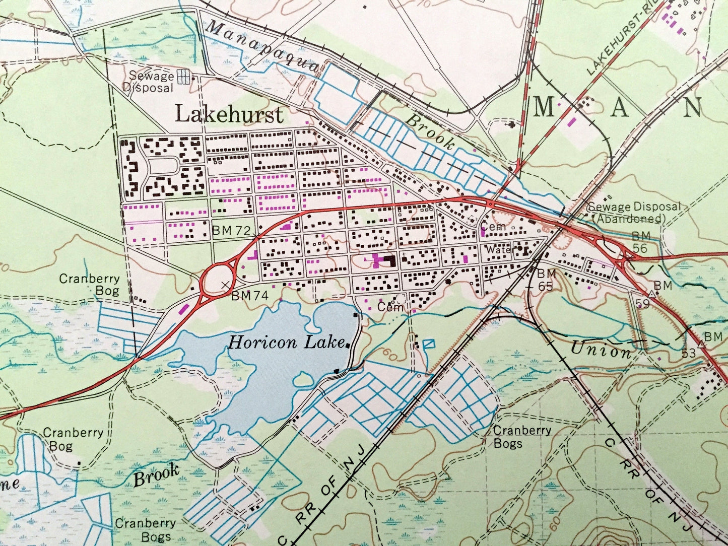
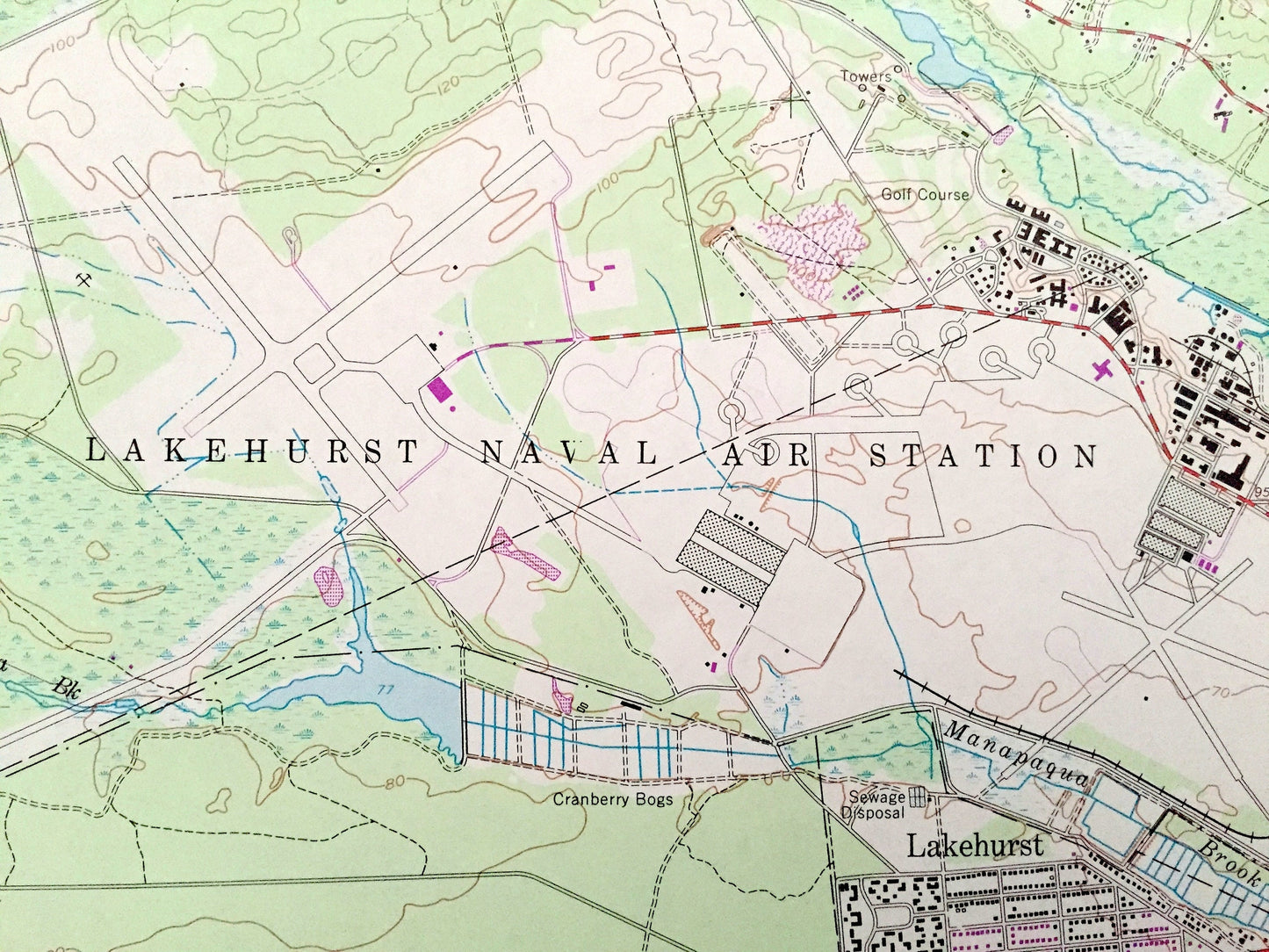
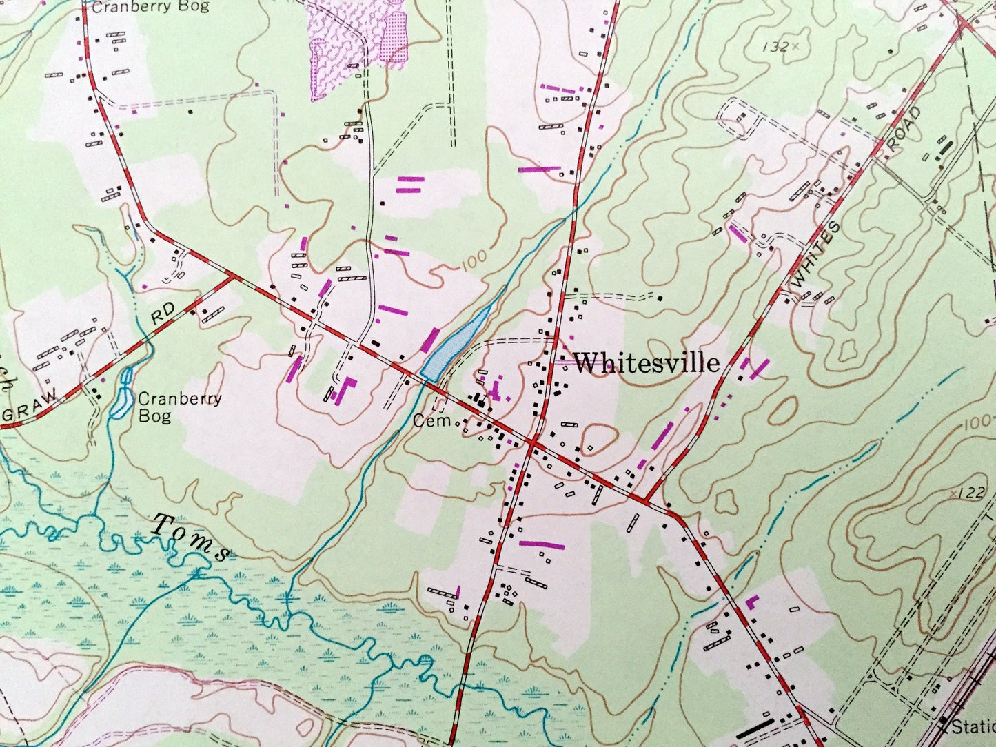
Antique Lakehurst, New Jersey 1957 US Geological Survey Topographic Map – Jackson, Whitesville, Van Hiseville, Manchester, Holmansville, NJ
Antique Lakehurst, New Jersey 1957 US Geological Survey Topographic Map – Jackson, Whitesville, Van Hiseville, Manchester, Holmansville, NJ
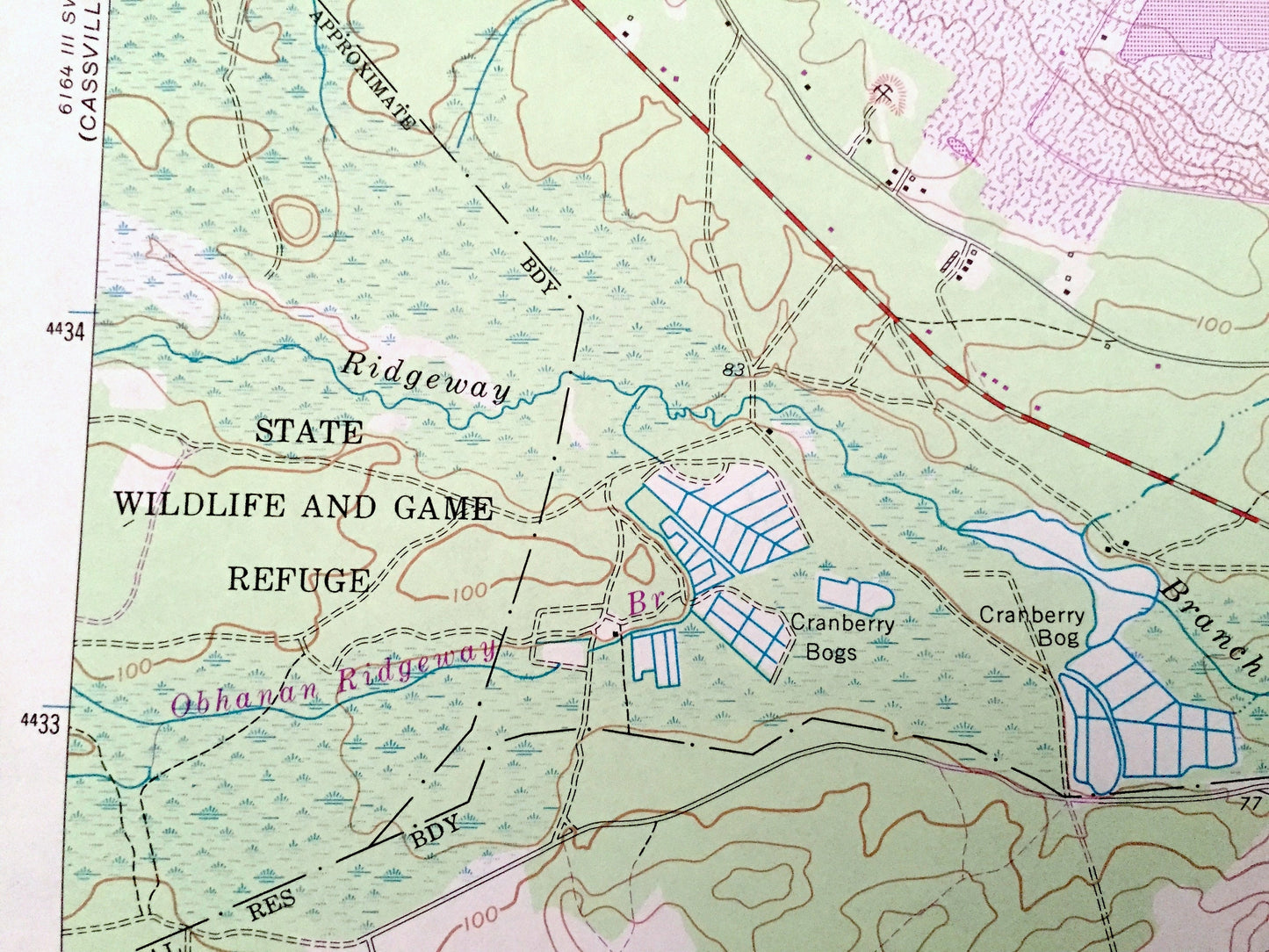
Beautiful, antique map of Lakehurst, Jackson, Whitesville, Van Hiseville and Manchester, New Jersey. This is an authentic 1972 print of 1957 survey data from the U.S. Geological Survey and NOT a computer reproduction.
See what Ocean County of New Jersey looked like 60 years ago. Lots of intricate details and geological contours. Map even has little squares for every house that existed at the time. The USGS cartographers were very thorough back then!
Perfect for the historian, map-lover, the curious or just as a conversation starter. Wonderful and rare. Vintage maps such as these make great gifts.
Edition of 1957, printed 1972
Dimensions: 22" width x 27" height
----
Features
Cities & Towns: Lakehurst, Pleasant Grove, Legler, Ridgeway, Manchester, Pine Lake Park, Lakewood, Keswick Grove, Dover.
Points of Interest: Switlik School, Cranberry Bogs, State Quail Farm, St Gabriel College, Lakehurst Naval Air Station, State Wildlife and Game Refuge, Horicon Lake, Pine Lake, Central New Jersey Railroad, Maple Root Branch, Toms River, and lots more streams, houses, schools, towns, and roads
Condition: Very Good Vintage condition, commensurate with age. This map is in great shape for being over 45 years old.
----
We will happily adjust shipping price for multiple purchases. Maps are rolled up and shipped in sturdy mailing tubes, never folded.
Couldn't load pickup availability
Share