My Store
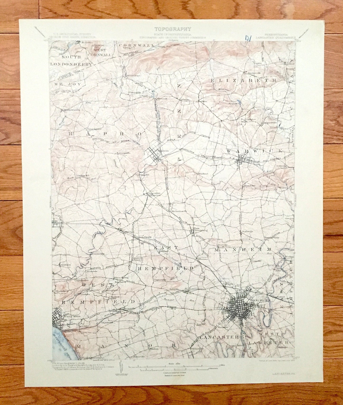
Antique Lancaster, Pennsylvania 1904 US Geological Survey Topographic Map – Hempfield, Lititz, Warwick Manheim Columbia Susquehanna River PA
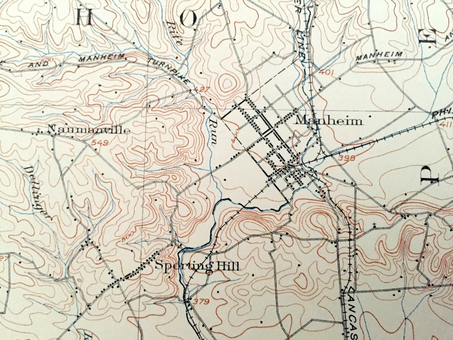
Antique Lancaster, Pennsylvania 1904 US Geological Survey Topographic Map – Hempfield, Lititz, Warwick Manheim Columbia Susquehanna River PA
Beautiful, antique map of Lancaster, Pennsylvania and surrounding Lancaster County area. This is an authentic 1904 edition, 1909 print from the U.S. Geological Survey and NOT a computer reproduction.
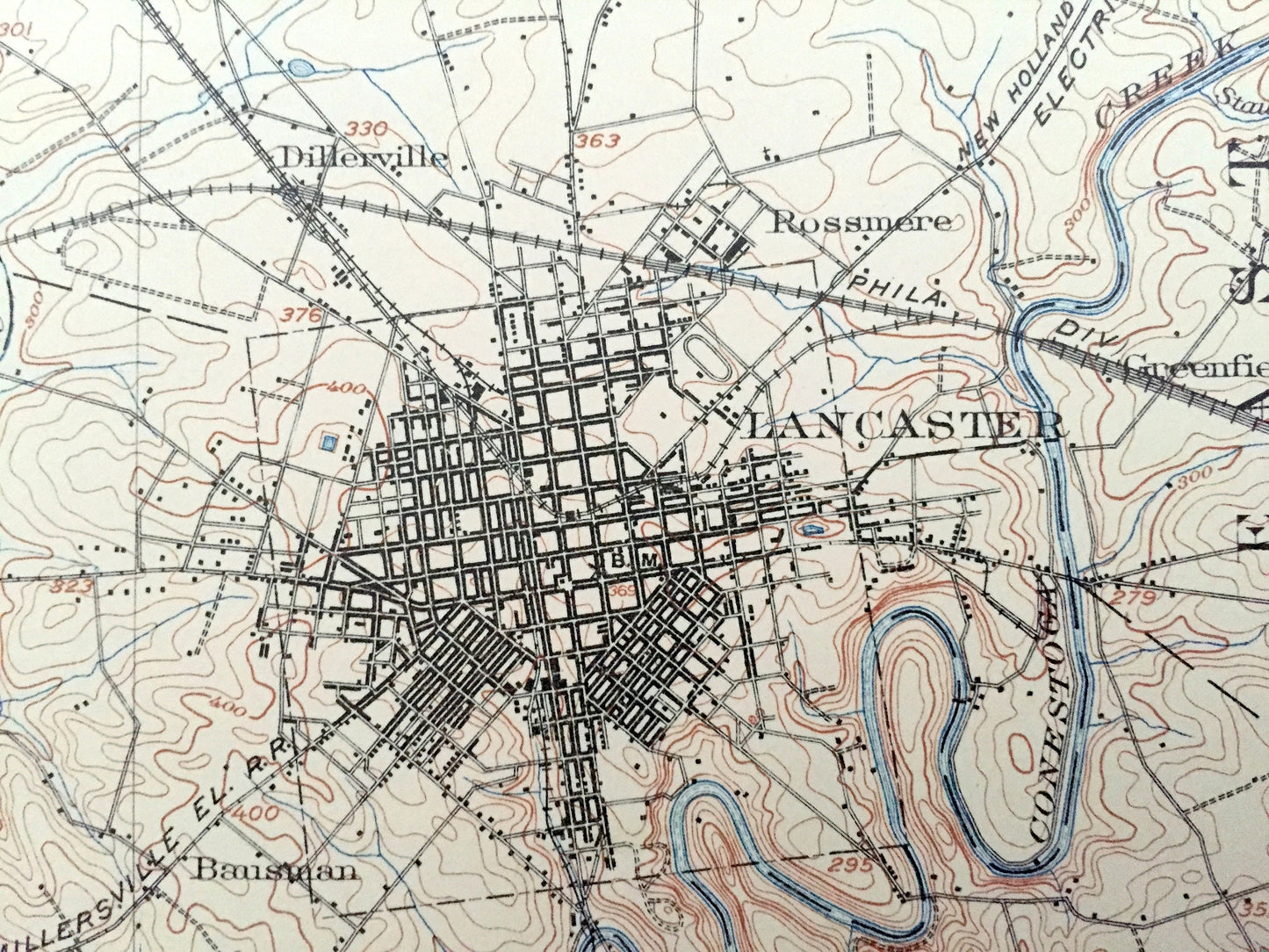
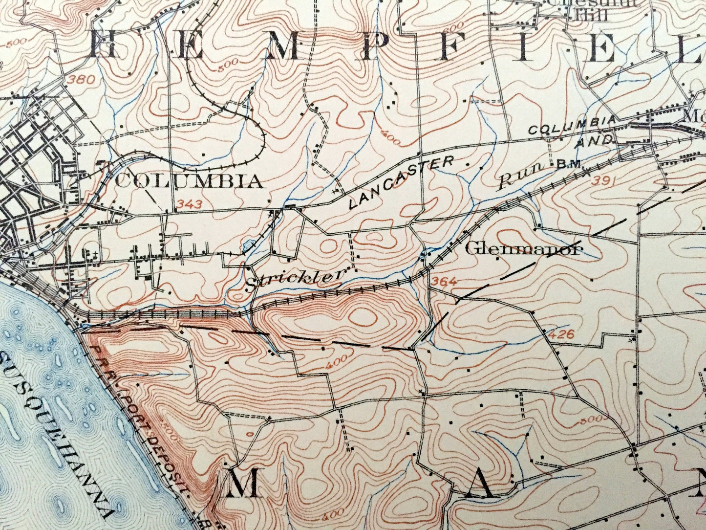
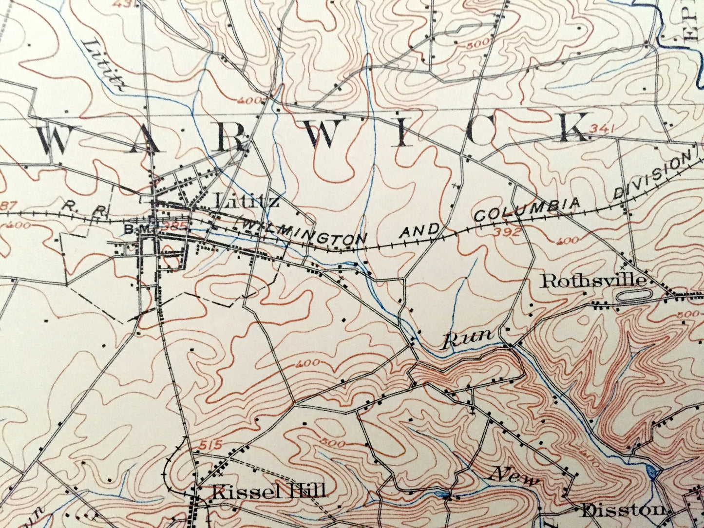
See what Pennsylvania looked like more than 115 years ago. Lots of intricate details and geological contours. Map even has little squares for every house that existed at the time. The USGS cartographers were very thorough back then! On the back is a description of topographic symbols and map guide.
Perfect for the historian, map-lover, the curious or just as a conversation starter. Wonderful and rare. Vintage maps such as these make great gifts.
Edition of 1904, printed 1909
Dimensions: 16 1/2" width x 20" height
----
Features
Cities & Towns: South Londonderry, West Cornwall, Mt. Joy, Rapho, Penn, Elizabeth, Warwick, East Hempfield, West Hempfield, Manheim, Manor, Lancaster, West Lampeter, East Lampeter, Mount Hope, Mastersonville, Elstonville, Whiteoak, Penryn, Brubaker, Lexington, Brunnerville, Hopeland, Clay, Union Square, Old Line, Naumanville, Sporting Hill, Geyers Mill, Lititz, Rothsville, Disston, Kissel Hill, Fairland, Mechanicsville, Oregon, East Peterburg, Landisville, Salunga, Centerville, Newtown, Farndale, Copenheffer, Kinderhook, Cordelia, Ironville, Chestnut Hill, Silver Spring, Columbia, Glenmanor, Mountville, Manorville, Windom, Millersville, Rohrerstown, Bamford, Shremer, Fruitville, Neffsville, Landis Valley, Binkley, Roseville, Eden, Dillerville, Rossmere, Greenfield, Bausman, Hollinger, Limerock.
Points of Interest: Susquehanna River, Lancaster County, Lebanon County, Chickies Creek, Conestoga Creek, Old Line and Manheim Turnpike, and lots more mountains, hills, small towns, roads, schools, churches and train tracks.
Condition: Very Good Vintage condition, commensurate with age. This map is in great shape for being over 110 years old. Very light edge-wear but this will read as character when framed.
----
We will happily adjust shipping price for multiple purchases. Maps are rolled up and shipped in sturdy mailing tubes, never folded.
Couldn't load pickup availability
Share