My Store
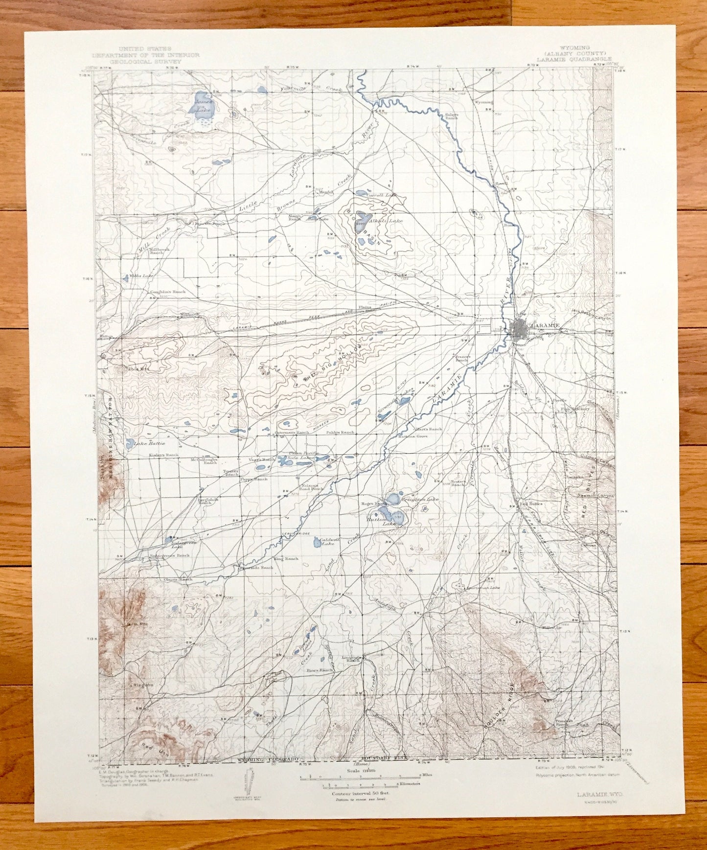
Antique Laramie, Wyoming 1908 US Geological Survey Topographic Map – Albany County, Medicine Bow National Park, Red Buttes, Jelm Mountain WY
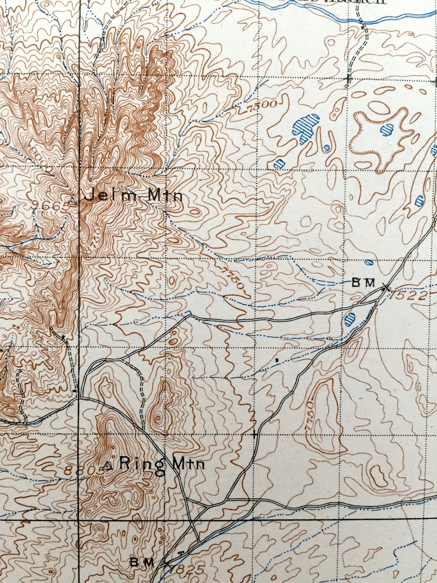
Antique Laramie, Wyoming 1908 US Geological Survey Topographic Map – Albany County, Medicine Bow National Park, Red Buttes, Jelm Mountain WY
Beautiful, antique map of Laramie, Wyoming and surrounding Albany County area. This is an authentic 1908 edition, 1941 print from the U.S. Geological Survey and NOT a computer reproduction.
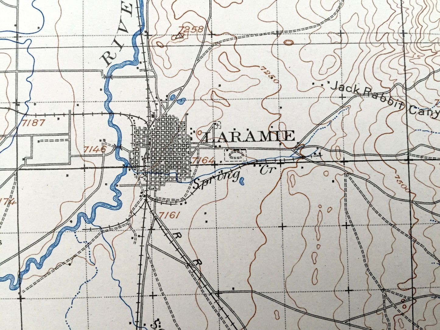
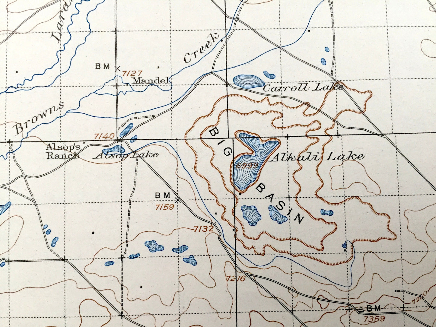
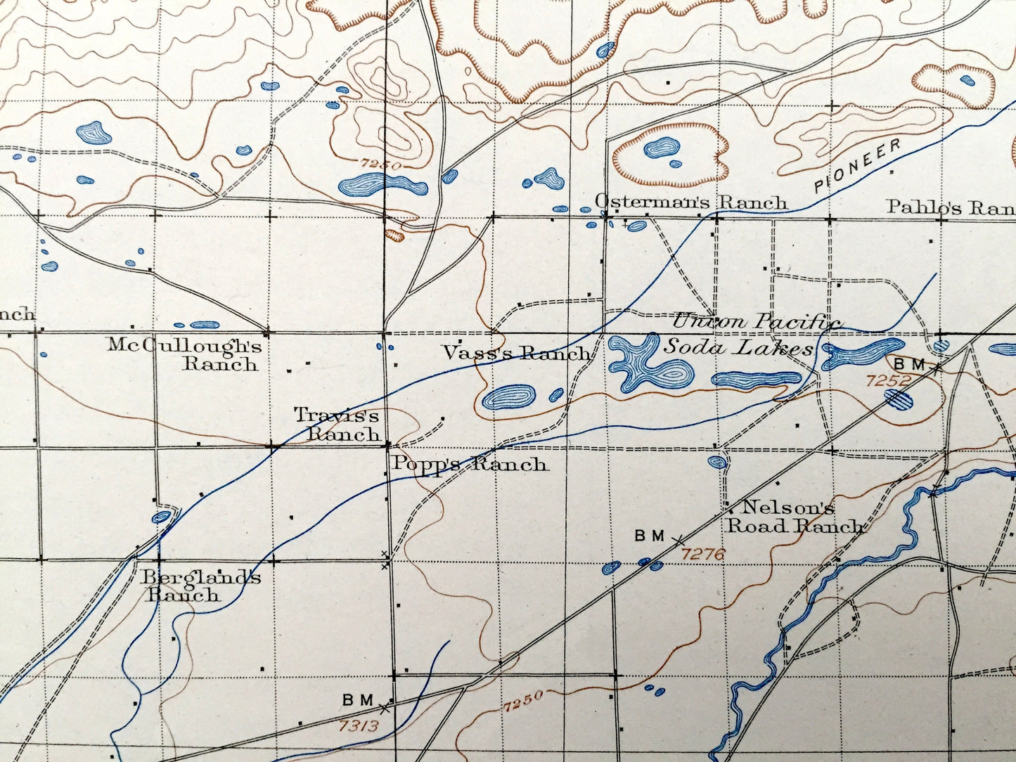
See what Wyoming looked like over 110 years ago. Lots of intricate details and geological contours. Map even has little squares for every house that existed at the time. The USGS cartographers were very thorough back then! On the back is a description of topographic symbols and map guide.
Perfect for the historian, map-lover, the curious or just as a conversation starter. Wonderful and rare. Maps such as these make great gifts.
Edition of 1908, printed 1941
Dimensions: 16 1/2" width x 20" height
----
Features
Cities & Towns: Laramie, Mandel, Howell, Wyoming, Millbrook, Hatton, Forelle, Red Buttes.
Points of Interest: Albany County, Big Basin, James Lake, Carroll Lake, Alkali Lake, Hutton Lake, Laramie River, Medicine Bow National Forest, Jelm Mountain, Red Mountain, Boulder Ridge, The Big Hollow, Red Buttes, Sawmill Canyon, Browns Creek and lots more creeks, mountains, canyons, ranges, lakes, ranches, houses and roads.
Condition: Very Good Vintage condition, commensurate with age. This map is in great shape for being over 80 years old.
----
We will happily adjust shipping price for multiple purchases. Maps are rolled up and shipped in sturdy mailing tubes, never folded.
Couldn't load pickup availability
Share