My Store
Antique Las Cruces, New Mexico 1955 US Geological Survey Topographic Map – El Paso County, Mesilla, La Mesa, Deming, Anthony, Cambray, NM TX
Antique Las Cruces, New Mexico 1955 US Geological Survey Topographic Map – El Paso County, Mesilla, La Mesa, Deming, Anthony, Cambray, NM TX
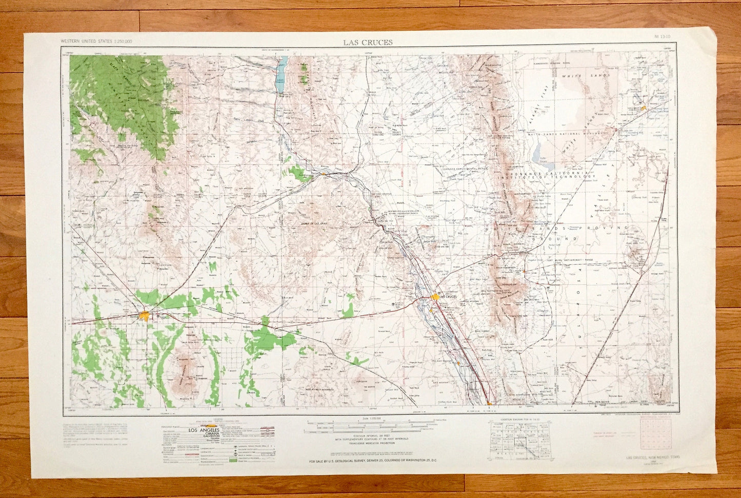
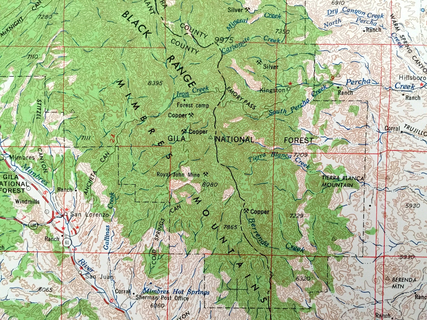
Beautiful, antique map of Las Cruces, New Mexico and surrounding Texas areas. This is an authentic 1955 edition, 1963 print from the U.S. Geological Survey and NOT a computer reproduction.
See what New Mexico and Texas looked like over 65 years ago. Lots of intricate details and geological contours. Map is incredibly large and in the grand 1:250,000 scale. The USGS cartographers were very thorough back then!
Perfect for the historian, map-lover, the curious or just as a conversation starter. Wonderful and rare. Vintage maps such as these make great gifts.
Edition of 1955, printed 1963
Dimensions: 32" width x 22 1/2" height
----
Features
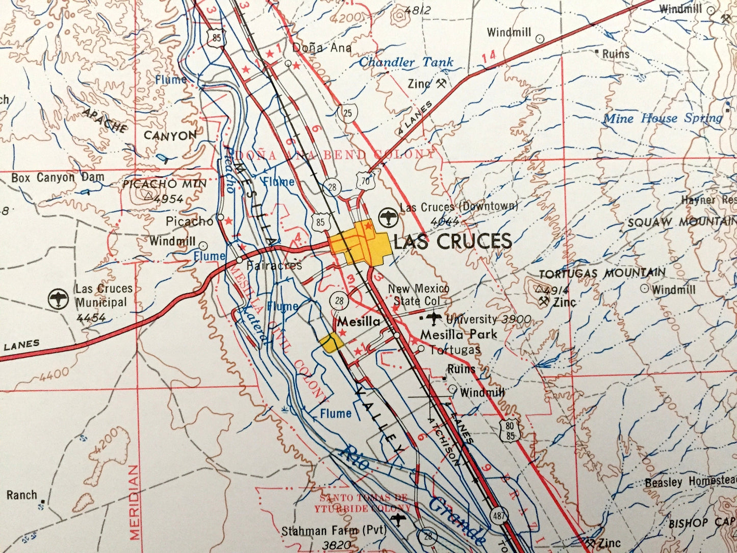
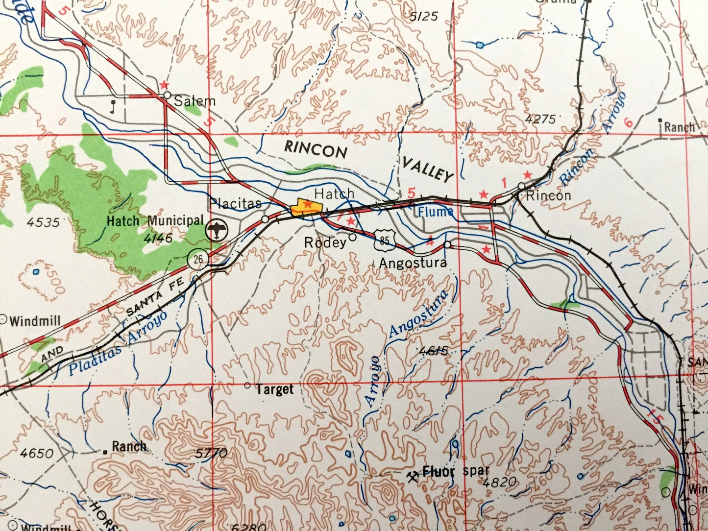
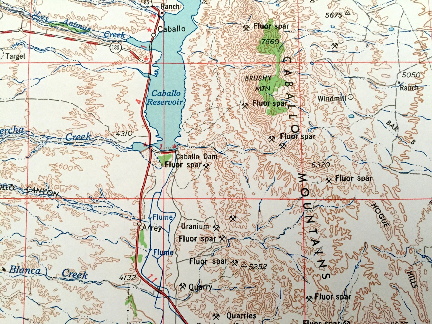
Cities & Towns: Las Cruces, Placitas, Rodey, Nutt, Hatch, Berino, Mesilla, La Mesa, Deming, Anthony, Cambray, Akela, Picacho, Organ.
Points of Interest: White Sands Roving Ground, White Sands, White Sands National Monument, Alkali Flat, Tularosa Valley, Caballo Mountains, Mimbres Mountains, Florida Mountains, West Potrillo Mountains, Organ Mountains, San Andreas Mountains, Sierra De Las Uvas, Black Range, Fort Bliss Range, Jornada Experimental Range, Ordnance California Institute of Technology, Rio Grande, Caballo Reservoir, El Paso County Texas and lots more hills, mountains, lakes, islands, bays, highways, railroads.
Condition: Good Vintage condition, commensurate with age. This map is in great shape for being over 55 years old. Has light edge-wear but this will read as vintage character when framed.
----
We will happily adjust shipping price for multiple purchases. Maps are rolled up and shipped in sturdy mailing tubes, never folded.
Couldn't load pickup availability
Share