My Store
Antique Lassen Peak, California 1882 Volcanic Activity Illustrations – US Geological Survey – Shasta, Tehama County, Lassen Forest, CA
Antique Lassen Peak, California 1882 Volcanic Activity Illustrations – US Geological Survey – Shasta, Tehama County, Lassen Forest, CA
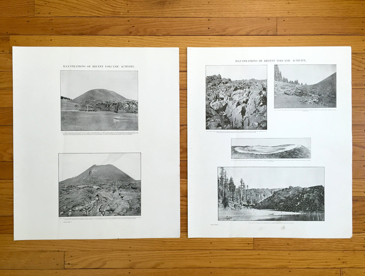
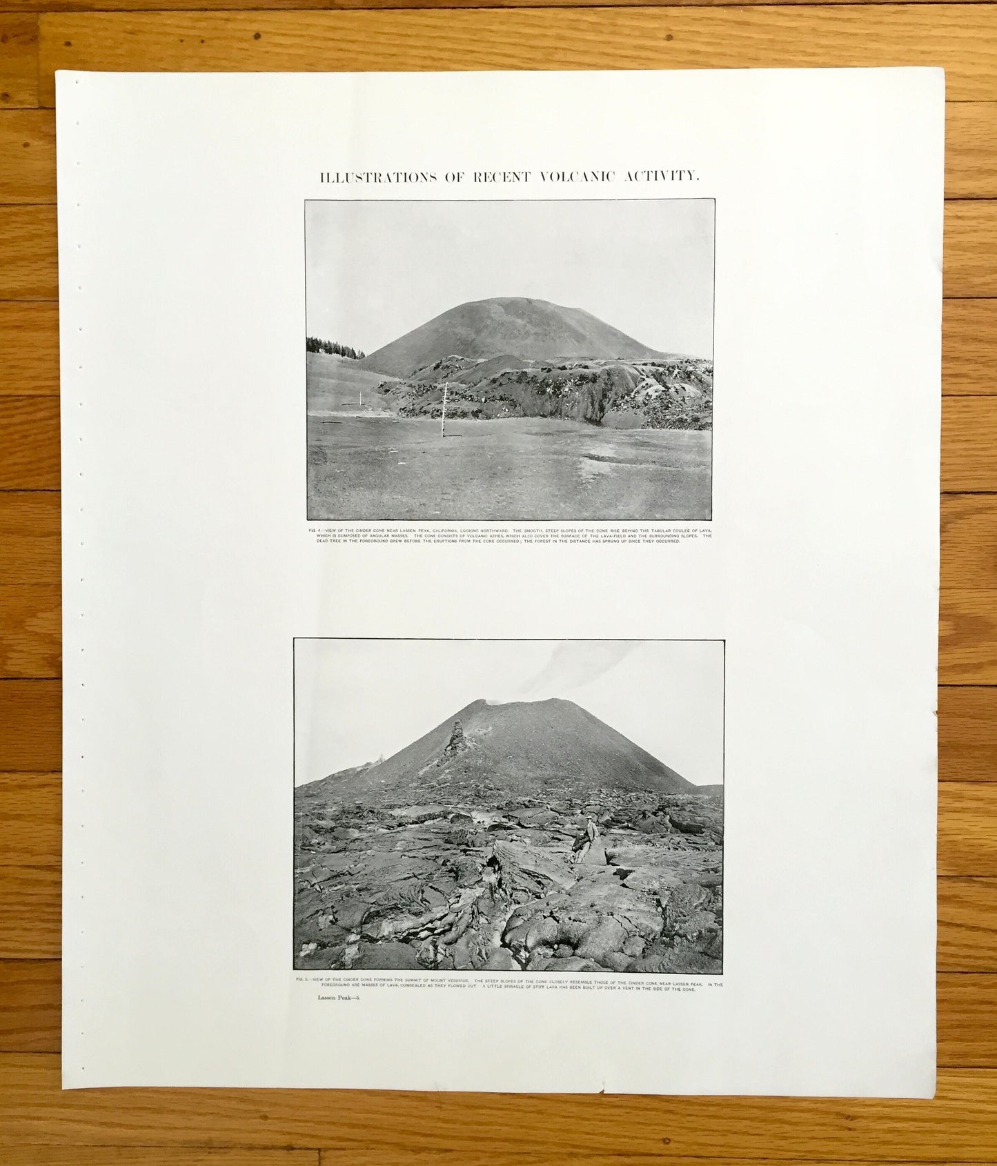
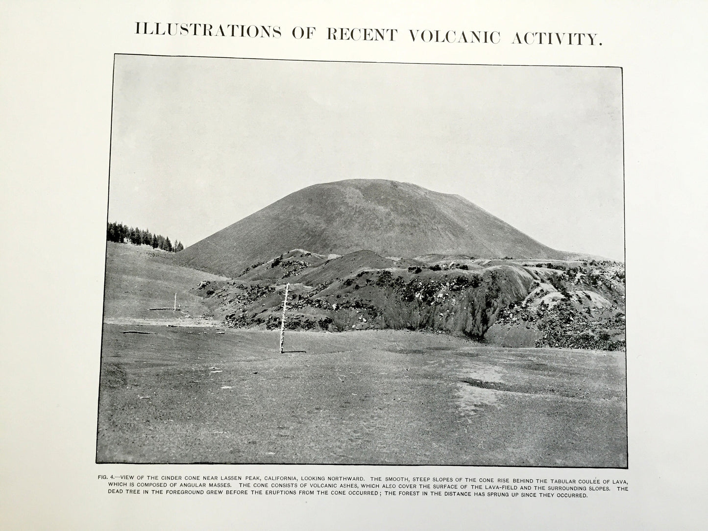
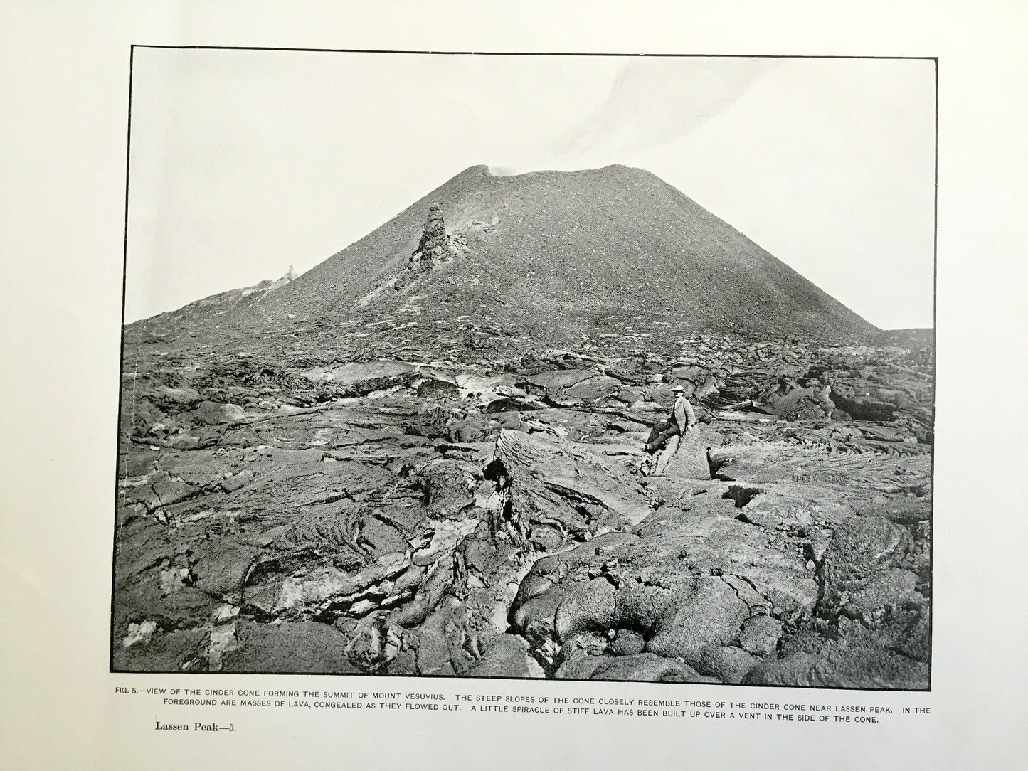
Two beautiful, antique illustrations of volcanic activity at Lassen Peak, California and surrounding Shasta & Tehama County area of Lassen National Forest. This is an authentic 1882 edition, 1882 print from the U.S. Geological Survey and NOT a computer reproduction. It is from a Geologic Atlas folio.
See what California looked like over 130 years ago. Perfect for the historian, map-lover, the curious or just as a conversation starter. Wonderful and rare.
Edition of 1882, printed 1882
Dimensions: 18 1/2" width x 22" height (2 sheets)
----
Features
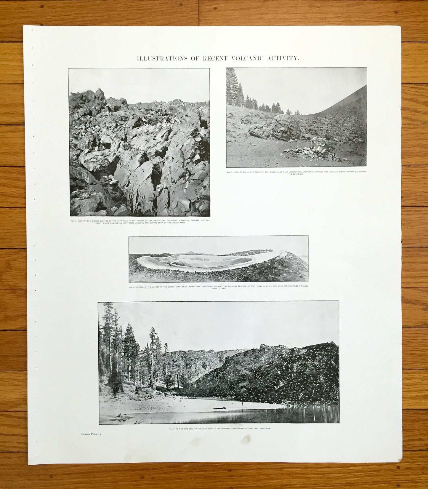
Cities & Towns: Mineral, Manton, Plateau, Shingletown, Ogburn, Eureka Mill, Burney Valley, Carbon, Montgomery Creek, Round Mountain, Great Spring, Butte Valley, Longville, Chaparral, Butte Meadows, Saw Mill, Morgan, Tyler, Belle Mill, Prattville, Lyonsville.
Points of Interest: Shasta County, Tehama County, Lassen County, Butte County, Plumas County, Dixie Valley, Goose Valley, Round Mountain, Bald Mountain, Pit River, Feather River, Lake Bidwell, Snag Lake, Lake Tillman, Juniper Lake, Lake CAribou, Mount Stover, Battle Creek, and lots more hills, mountains, canyons, creeks, houses, roads, ranches and camps.
Condition: Very Good Vintage condition, commensurate with age. This map is in great shape for being over 130 years old. Has some staple holes in margin, slight fold, small tear on the right edge but will all read as vintage character when framed. This map has REAL character!
----
We will happily adjust shipping price for multiple purchases. Maps are rolled up and shipped in sturdy mailing tubes, never folded.
Couldn't load pickup availability
Share