My Store
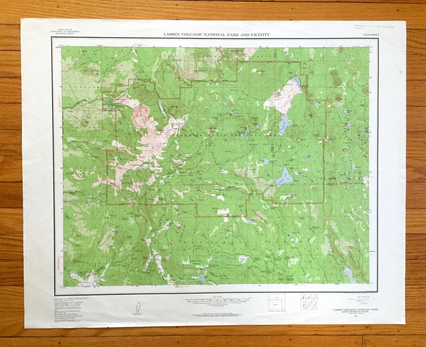
Antique Lassen Volcanic National Park, California 1957 US Geological Survey Topographic Map – Mineral, Manzanita Lake, Drakesbad, Shasta, CA
Antique Lassen Volcanic National Park, California 1957 US Geological Survey Topographic Map – Mineral, Manzanita Lake, Drakesbad, Shasta, CA
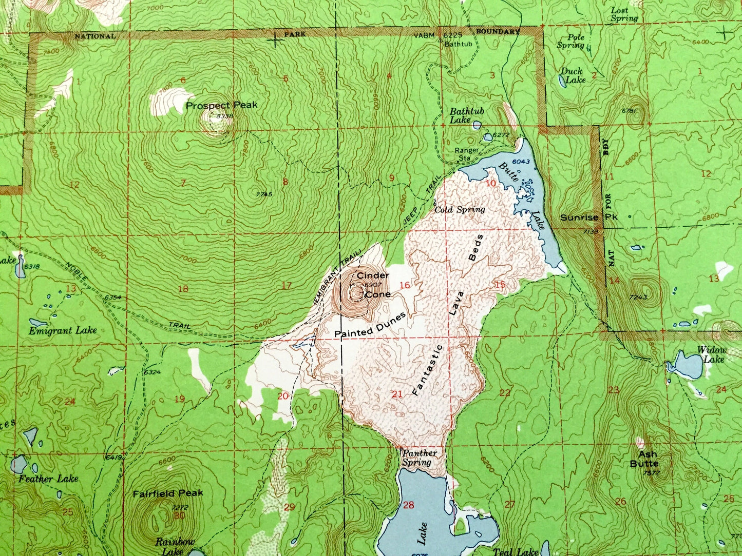
Beautiful, antique map of Lassen Volcanic National Park, California and surrounding areas. This is a 1957 edition, 1961 print from the U.S. Geological Survey and NOT a computer reproduction.
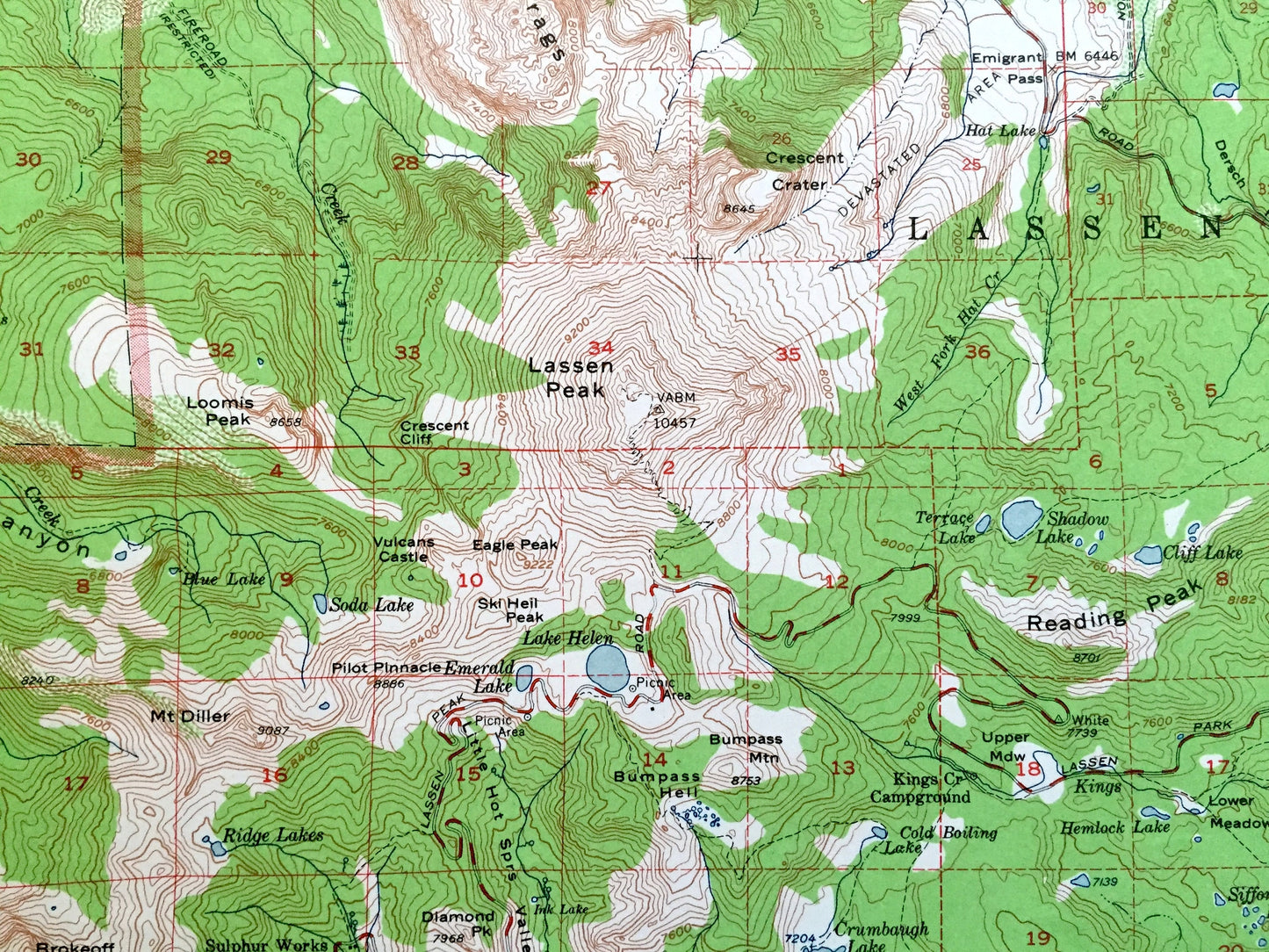
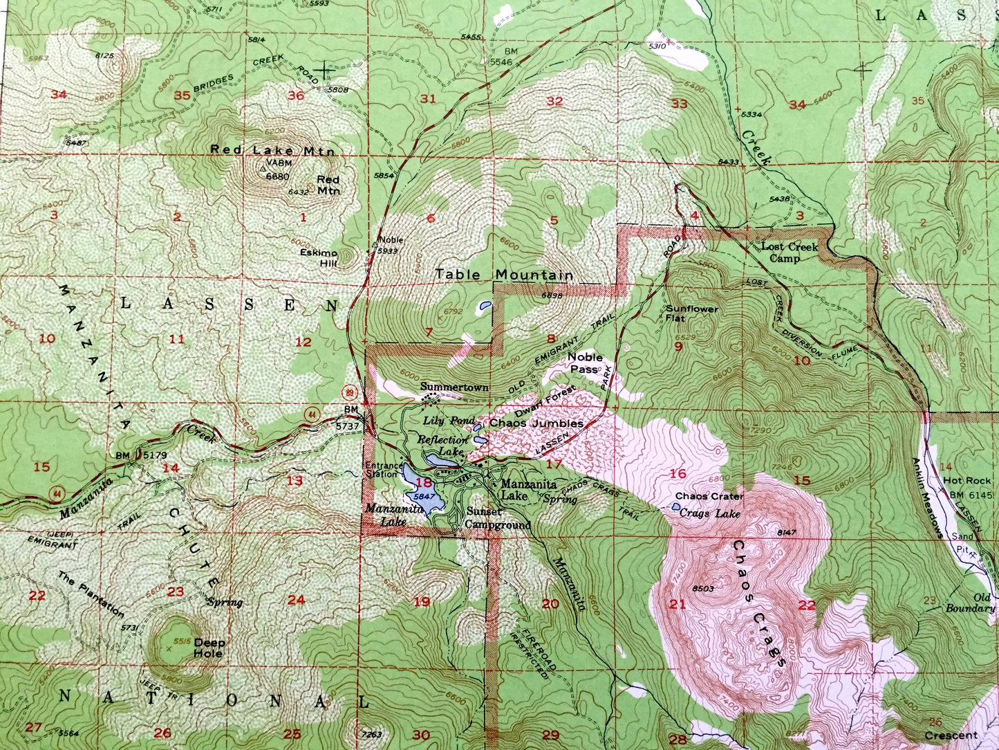
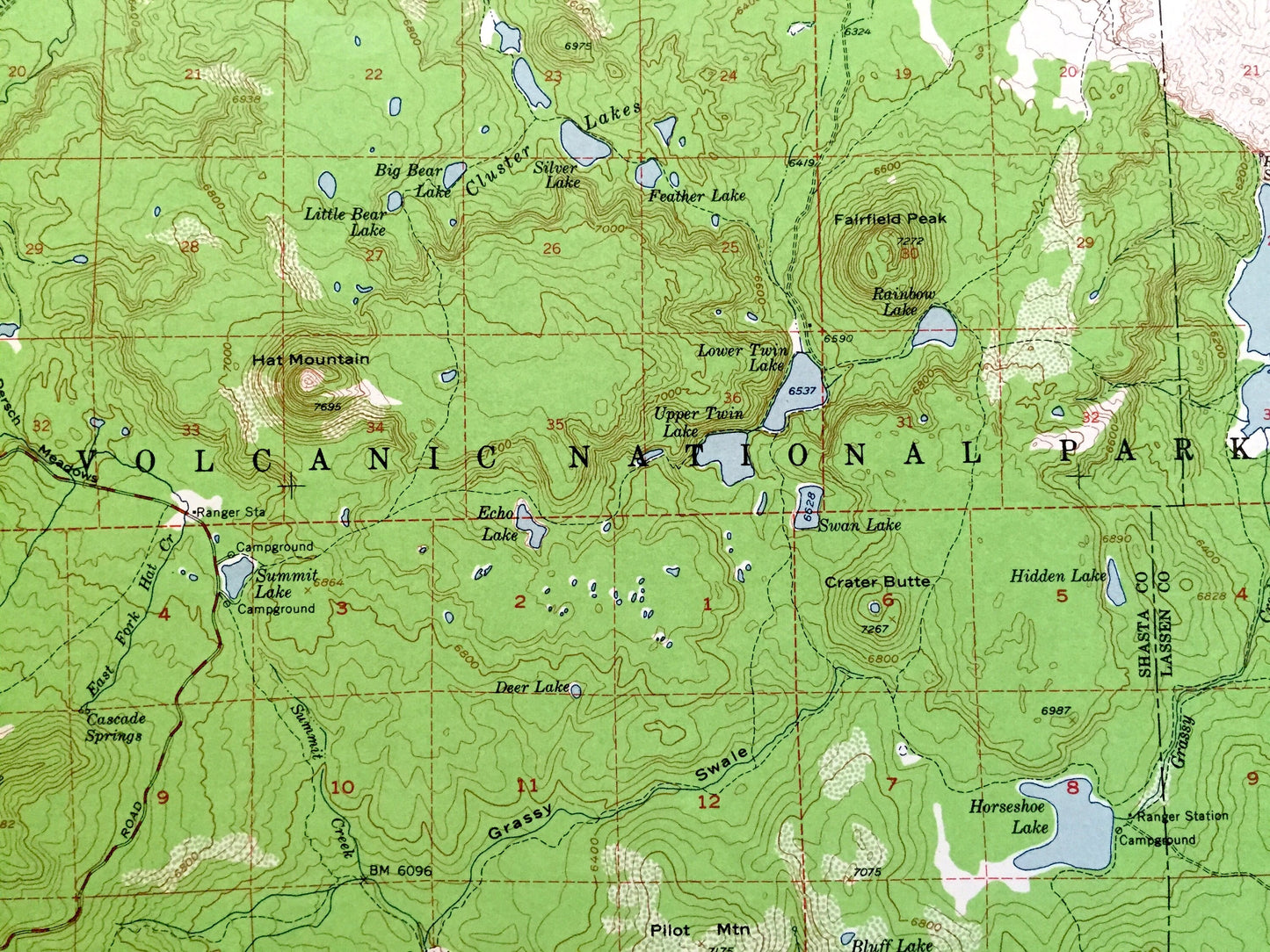
See what California looked like over 65 years ago. Lots of intricate details and geological contours. Map even has little squares for every house that existed at the time. The USGS cartographers were very thorough back then!
Perfect for the historian, map-lover, the curious or just as a conversation starter. Wonderful and rare. Vintage maps such as these make great gifts.
Edition of 1957, printed 1961
Dimensions: 30" width x 24" height
----
Features
Cities & Towns: Manzanita Lake, Summertown, Lost Creek Camp, Emigrant Ford Campground, Sulphur Works, Kings Cross Campground, Drakesbad, Warner Valley Campground, Kelly Camp, Bluff Falls Campground, Dry Lake Campground, Mineral, Morgan Springs, Childs Meadows, Camp Tehama, Willow Creek Homesite, Feather River Homesite, Rice Creek Campground, High Bridge Campground, Benner Creek Campground.
Points of Interest: Tehama County, Plumas County, Lassen County, Shasta County, Lassen National Forest, Lassen Volcanic National Park, Caribou Peak Wild Area, Lassen Peak, Chaos Crags, Fantastic Lava Beds, Saddle Mountain, Red Lake Mountain, Table Mountain, Manzanita Chute, Blue Lake Canyon, Reading Peak, Eagle Peak, Badger Mountain, Hat Mountain, Crater Butte, Flatiron Ridge, Saddle Mountain, Red Cinder, Black Butte, Caribou Peak, Black Cinder Rock, Warner Valley, Prospect Peak, Mt. Diller, Loomis Peak, Conard Meadows, Morgan Mountain, Plantation Gulch, Battle Creek Meadows, Doe Mountain, Feather River Meadows, Juniper Lake, Snag Lake, Buttle Lake, Upper Twin Lakes, Triangle Lake, Wilson Lake, Warner Creek, Battle Creek, Lost Creek, Chaos Jumbles, Dwarf Forest, Deep Hole, Manzanita Creek, and lots more hills, mountains, rivers, lakes, creeks, roads, highways and railroads.
Condition: Very Good Vintage condition, commensurate with age. This map is in great shape for being over 60 years old. Has light wear and ex-libris stamp in upper right margin, but this will all add to vintage character when framed.
----
We will happily adjust shipping price for multiple purchases. Maps are rolled up and shipped in sturdy mailing tubes, never folded.
Couldn't load pickup availability
Share