My Store
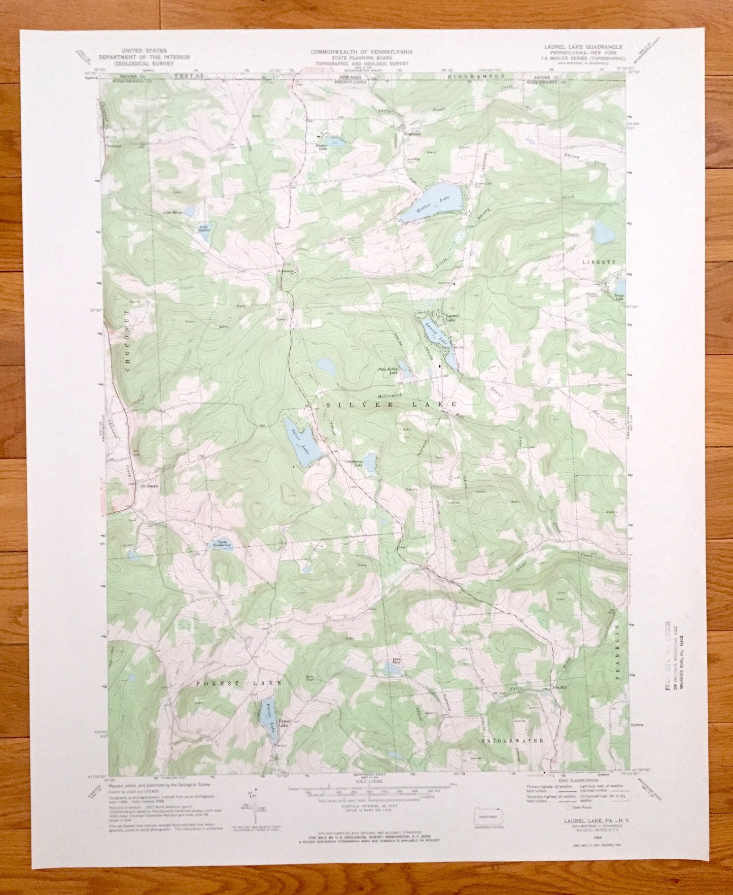
Antique Laurel Lake, Pennsylvania & New York 1968 US Geological Survey Topographic Map – Susquehanna County, Forest Lake, Choconut,Fisk Mill
Antique Laurel Lake, Pennsylvania & New York 1968 US Geological Survey Topographic Map – Susquehanna County, Forest Lake, Choconut,Fisk Mill
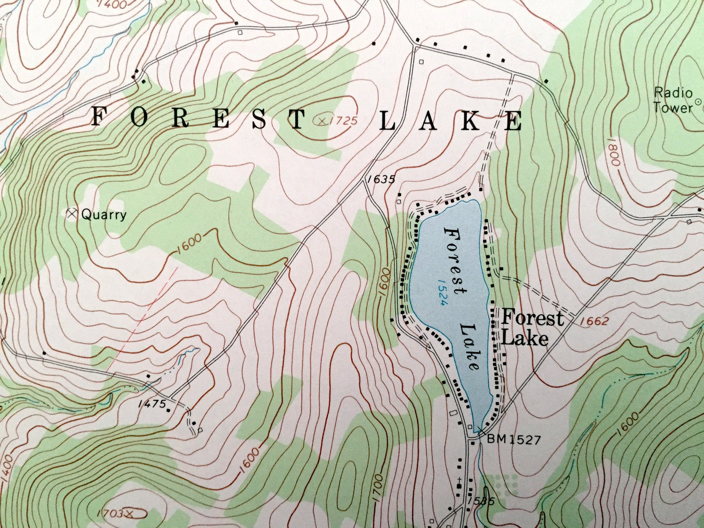
Beautiful, antique map of Laurel Lake, Pennsylvania and surrounding Susquehanna County and Broome County, New York area. This is an authentic 1968 edition, 1968 print from the U.S. Geological Survey and NOT a computer reproduction.
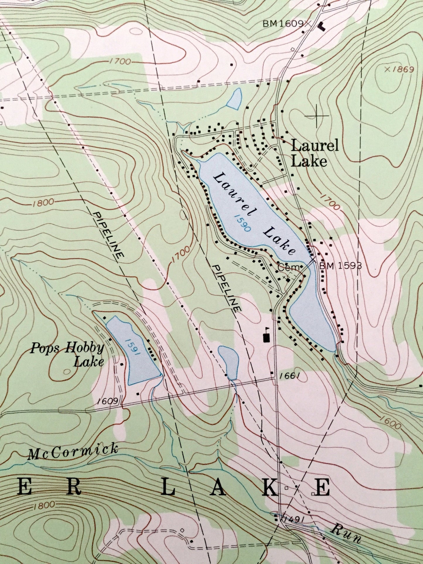
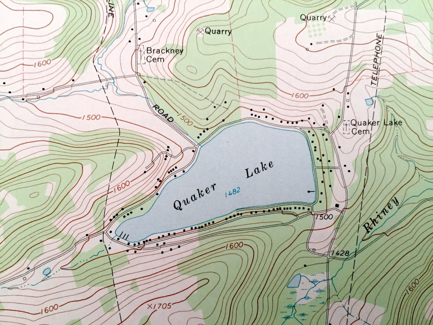
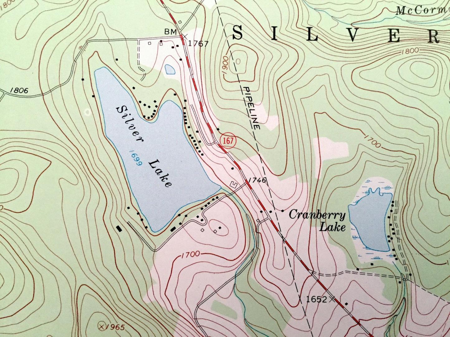
See what Pennsylvania looked like 50 years ago. Lots of intricate details and geological contours. Map even has little squares for every house that existed at the time. The USGS cartographers were very thorough back then!
Perfect for the historian, map-lover, the curious or just as a conversation starter. Wonderful and rare. Vintage maps such as these make great gifts.
Edition of 1968, printed 1968
Dimensions: 22" width x 27" height
----
Features
Cities & Towns: Laurel Lake, Brackney, Fisk Mill, Forest Lake, St. Joseph, Choconut, Choconut Township, Silver Lake, Liberty, Franklin, Bridgewater, Forest Lake, Vestal, Binghamton.
Points of Interest: Forest Lake, Radio Tower, Dora Pond, Fall Brook, Silver Creek, Cranberry Lake, Pops Hobby Lake, Laurel Lake, Tripp Lake, Quaker Lake, Little Snake Creek, Lake Marge, Lake Sophia, Silver Lake, Lake Timberline, Meeker Lake, Choconut Creek, and many more hills, streams, ponds, houses, schools, churches and roads.
Condition: Very Good condition, commensurate with age. This map is in incredible shape for being 50 years old. This map was most likely used in the field. Has light-edge wear, but this will read as vintage character when framed.
----
We will happily adjust shipping price for multiple purchases. Maps are rolled up and shipped in sturdy mailing tubes, never folded.
Couldn't load pickup availability
Share