My Store
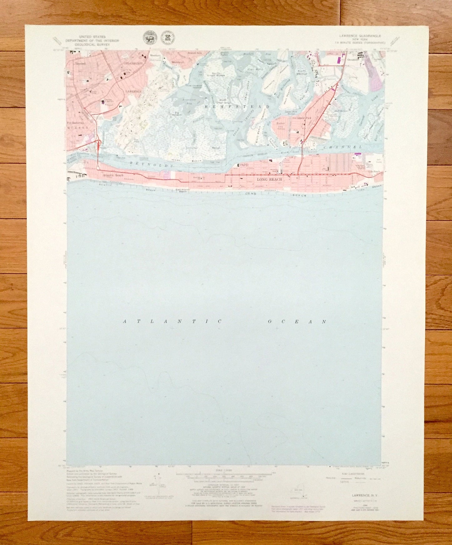
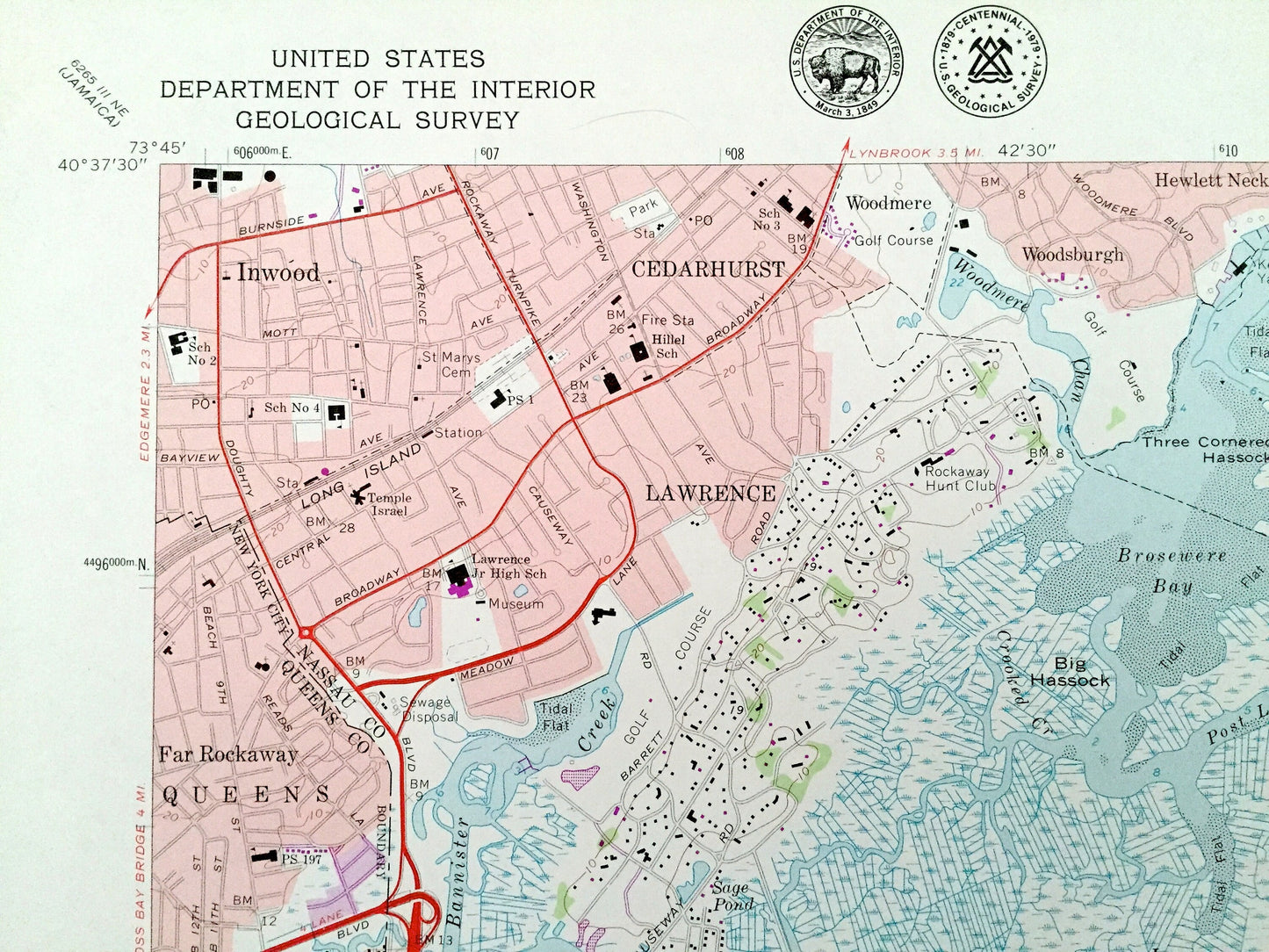
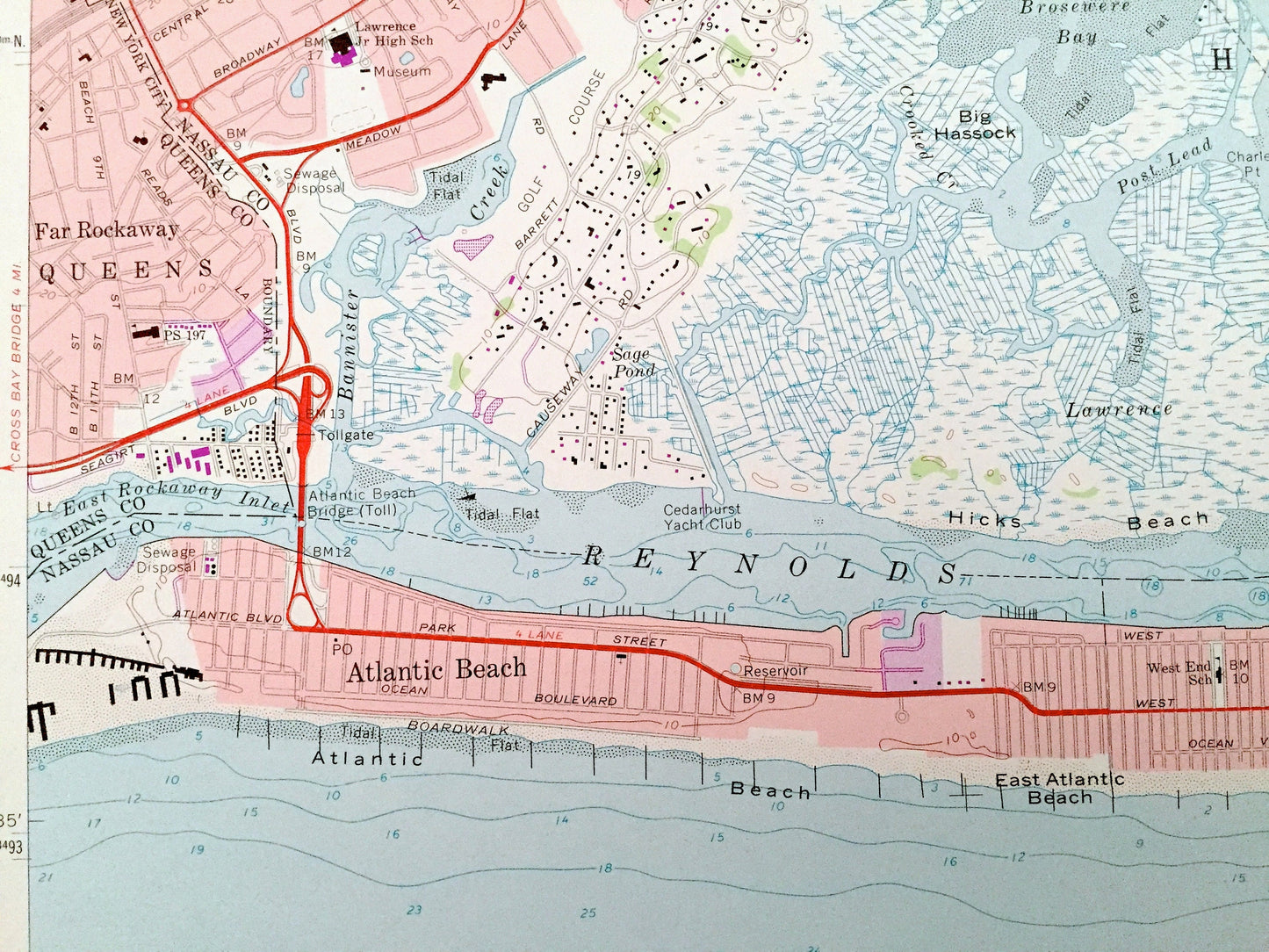
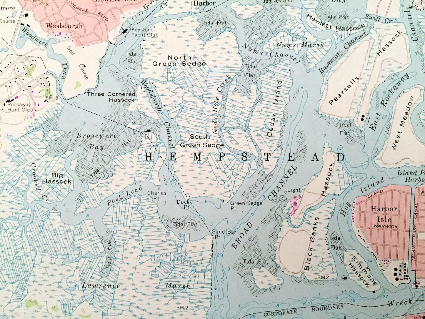
Antique Lawrence, New York 1966 US Geological Survey Topographic Map – Queens, Nassau County, Hempstead, Long Beach, Cedarhurst, Inwood, NY
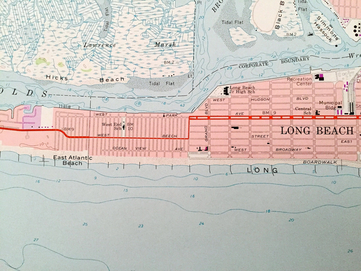
Antique Lawrence, New York 1966 US Geological Survey Topographic Map – Queens, Nassau County, Hempstead, Long Beach, Cedarhurst, Inwood, NY
Beautiful, antique map of Lawrence, New York and surrounding Queens & Nassau County areas. This is an authentic 1966 edition, 1979 print from the U.S. Geological Survey and NOT a computer reprint.
See what New York looked like over 55 years ago. Lots of intricate details and geological contours. Map even has little squares for every house that existed. The USGS cartographers were very thorough back then!
Perfect for the historian, map-lover, the curious or just as a conversation starter. Wonderful and rare. Vintage maps such as these make great gifts.
Edition of 1966, printed 1979
Dimensions: 22" width x 27" height
----
Features
Cities & Towns: Cedarhurst, Lawrence, Inwood, Queens, Far Rockaway, Woodmere, Hewlett Neck, Woodsburgh, Atlantic Beach, Long Beach, Oceanside, Hewlett Harbor, Lido Beach, Island Park, Harbor Isle.
Points of Interest: Hewlett Hassock, Pearsalls Hassock, Black Banks Hassock, East Channel Islands, Big Hassock, Hicks Beach, Atlantic Beach, East Atlantic Beach, Long Beach, Lido Beach, Bannister Creek, East Rockaway Inlet, Garrett Marsh, Reynolds Channel, Atlantic Ocean, and many more hills, streams, ponds, houses, schools, railroads, churches and roads.
Condition: Very Good Vintage condition, commensurate with age. This map is in great shape for being almost 40 years old. Has subtle edge-wear but will read as character when framed.
----
We will happily adjust shipping price for multiple purchases. Maps are rolled up and shipped in sturdy mailing tubes, never folded.
Couldn't load pickup availability
Share