My Store
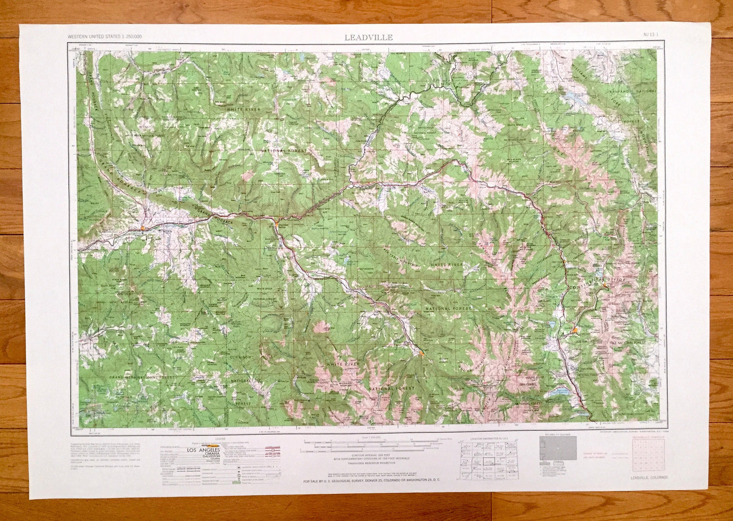
Antique Leadville, Colorado 1964 US Geological Survey Topographic Map – Aspen, Glenwood Springs, Climax, Rifle, Camp Hale, Snowmass, Gilman
Antique Leadville, Colorado 1964 US Geological Survey Topographic Map – Aspen, Glenwood Springs, Climax, Rifle, Camp Hale, Snowmass, Gilman
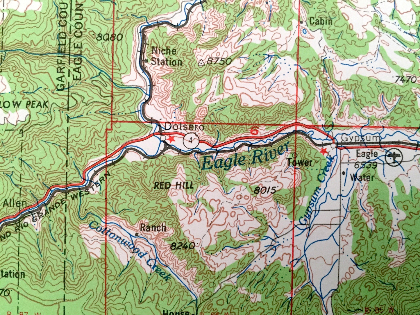
Beautiful, antique map of Leadville, Colorado and surrounding areas. This is an authentic 1964 edition, 1964 print from the U.S. Geological Survey and NOT a computer reproduction.
See what Colorado looked like over 55 years ago. Lots of intricate details and geological contours. Map is incredibly large and in the grand 1:250,000 scale. The USGS cartographers were very thorough back then!
Perfect for the historian, map-lover, the curious or just as a conversation starter. Wonderful and rare. Vintage maps such as these make great gifts.
Edition of 1964, printed 1964
Dimensions: 32" width x 22 1/2" height
----
Features
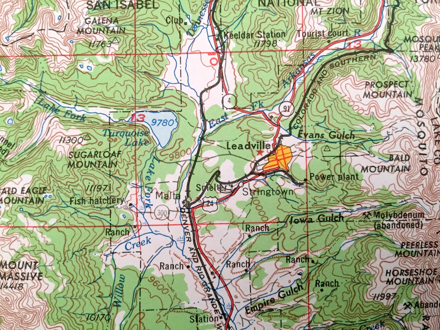
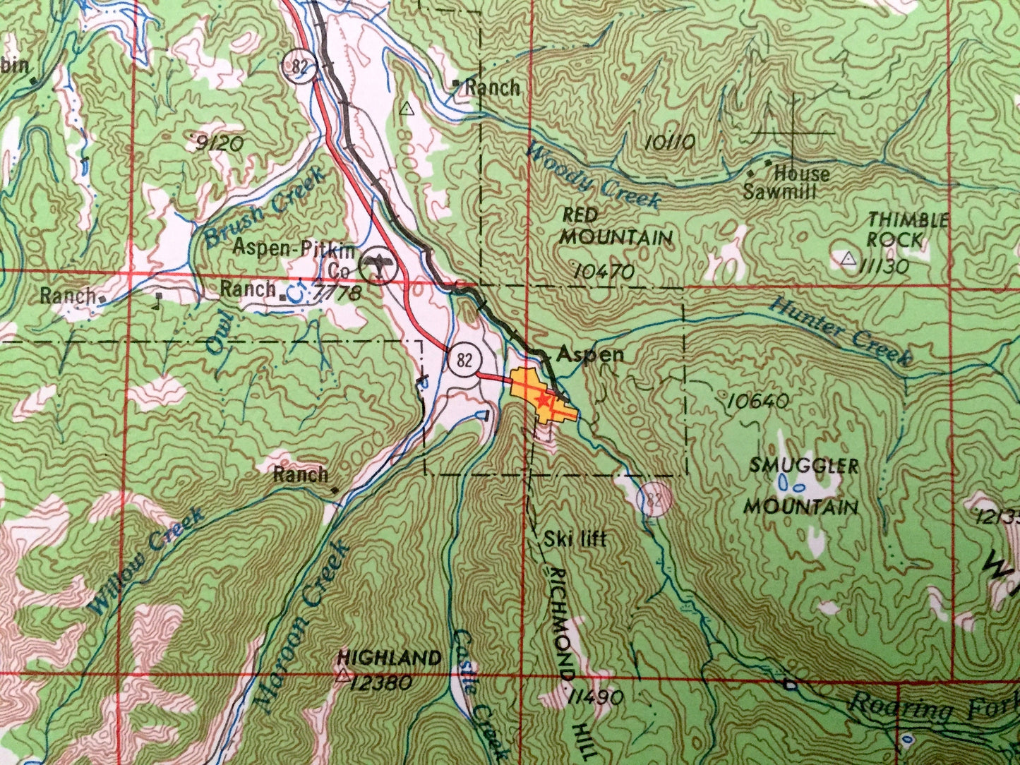
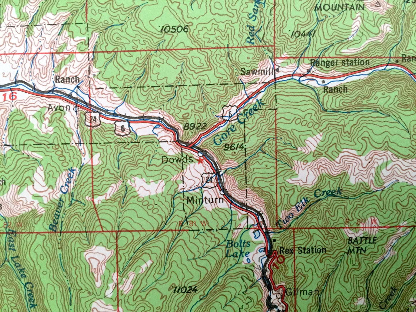
Cities & Towns: Leadville, Sweetwater, Wolcott, Carbondale, New Castle, Aspen, Glenwood Springs, Climax, Rifle, Camp Hale, Snowmass, Gilman.
Points of Interest: White River National Forest, Gunnison National Forest, Grand Mesa National Forest, Arapaho National Forest, San Isabel National Forest, Pike National Forest, Flat Tops Wilderness, Williams Fork Mountains, Big Mountain, Red Table Mountain, Snowmass Mountains, Williams Mountains, Sawatch Range, Gore Range, Grand Hogback, Continental Divide, Eagle River, Roaring Fork and lots more hills, mountains, lakes, islands, bays, highways, railroads.
Condition: Very Good Vintage condition, commensurate with age. This map is in great shape for being over 55 years old. Has light edge-wear, all of which will read as vintage character when framed.
----
We will happily adjust shipping price for multiple purchases. Maps are rolled up and shipped in sturdy mailing tubes, never folded.
Couldn't load pickup availability
Share