My Store
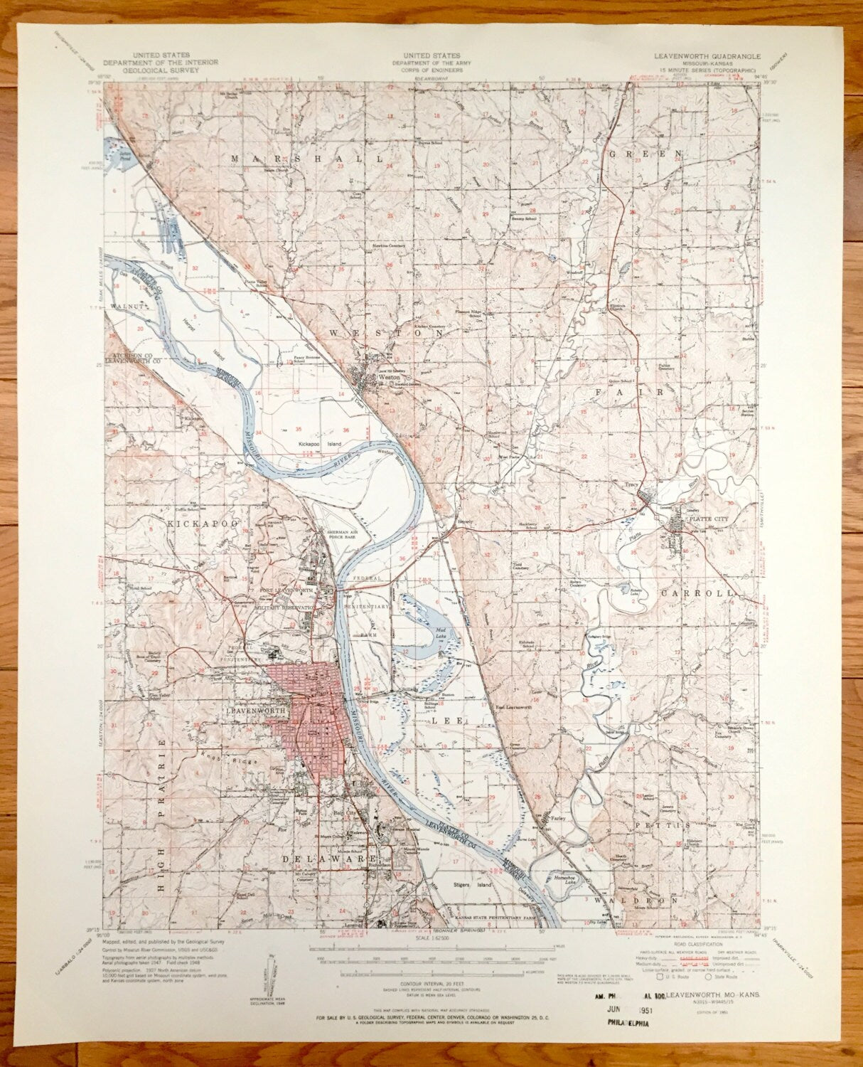
Antique Leavenworth, Kansas & Missouri River 1951 US Geological Survey Topographic Map – Kickapoo, Weston, Fair, Tracy, Platte City, Fort KS
Antique Leavenworth, Kansas & Missouri River 1951 US Geological Survey Topographic Map – Kickapoo, Weston, Fair, Tracy, Platte City, Fort KS
Beautiful, antique map of Leavenworth, Kansas, The Missouri River and surrounding area. This is an authentic 1951 print from the U.S. Geological Survey and NOT a computer reproduction.
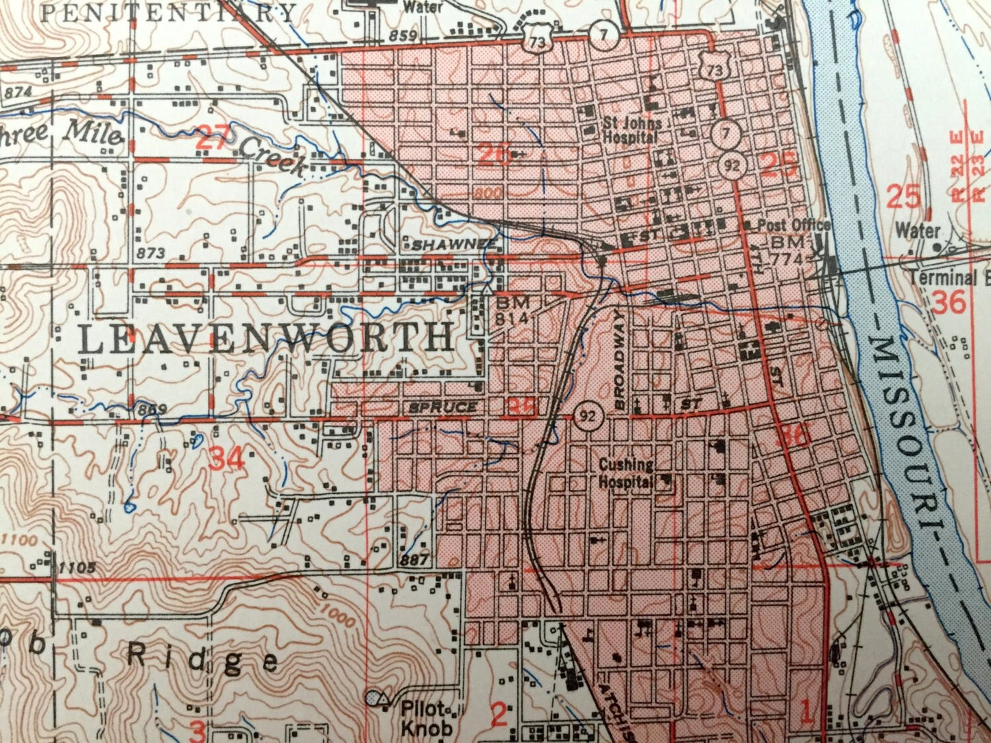
See what the Leavenworth, Kansas and Weston, Missouri looked like 70 years ago. Lots of intricate details and geological contours. Map even has little squares for every house that existed at the time. The USGS cartographers were very thorough back then!
Perfect for the historian, map-lover, the curious or just as a conversation starter. Wonderful and rare. Vintage maps such as these make great gifts.
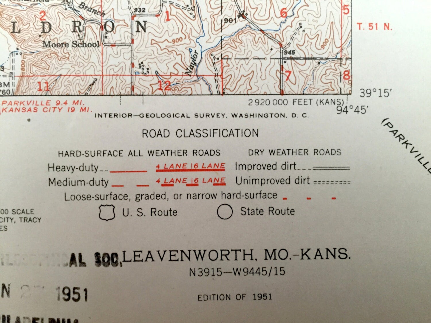
Edition of 1951, printed 1951
Dimensions: 17" width x 21" height
----
Features
Cities & Towns: Leavenworth, Kickapoo, Weston, Fair, Tracy, Platte City, Carroll, High Prairie, Delaware, Pettis, Waldron.
Points of Interest: Missouri River, Federal Penitentiary Farm, Sherman Air Force Base, Fort Leavenworth Military Reservation, Mud Lake and many, many more.
Condition: Very Good Vintage condition, commensurate with age. This map is in great shape for being over 70 years old. Light wear and library marking, but this will add to vintage character when framed.
----
We will happily adjust shipping price for multiple purchases. Maps are rolled up and shipped in sturdy mailing tubes, never folded.
Couldn't load pickup availability
Share