My Store
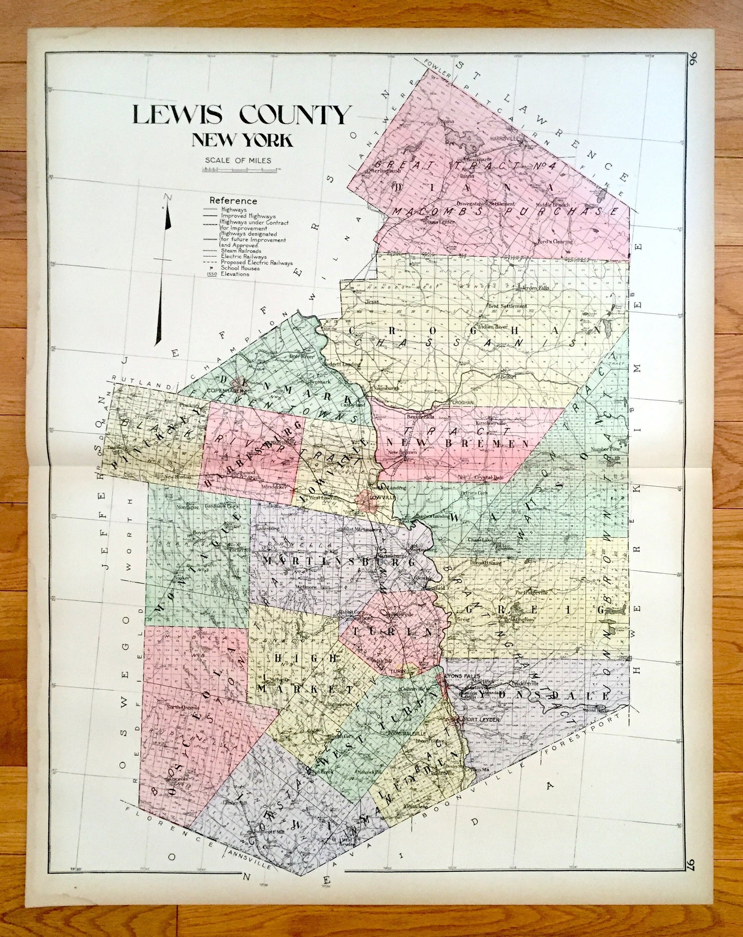
Antique Lewis County, New York 1911 New Century Atlas Map – Lowville, Port Leyden, Lyons Falls, Copenhagen, Harrisville, Croghan, Diana, NY
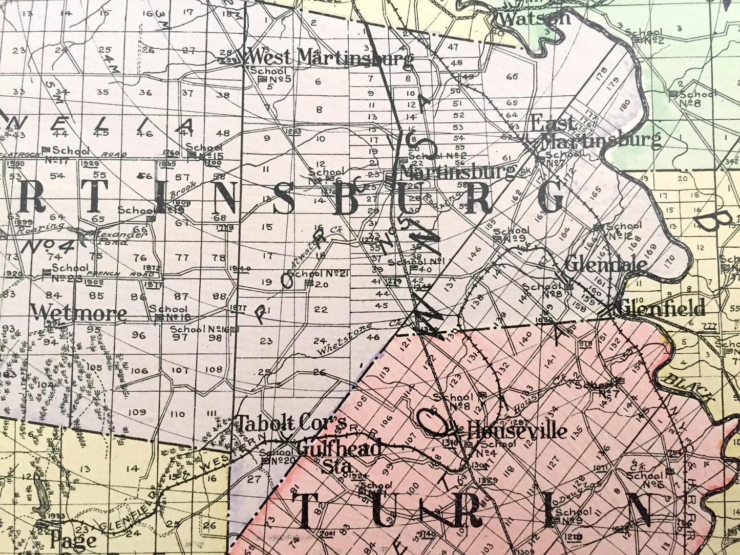
Antique Lewis County, New York 1911 New Century Atlas Map – Lowville, Port Leyden, Lyons Falls, Copenhagen, Harrisville, Croghan, Diana, NY
Beautiful, antique map of Lewis County, New York, including Lowville, Port Leyden, Lyons Falls, Copenhagen, Harrisville, Croghan & Diana Center. This is an authentic map taken from the rare New Century Atlas published in 1911 and NOT a computer reproduction.
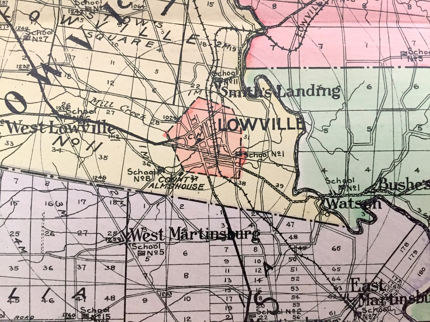
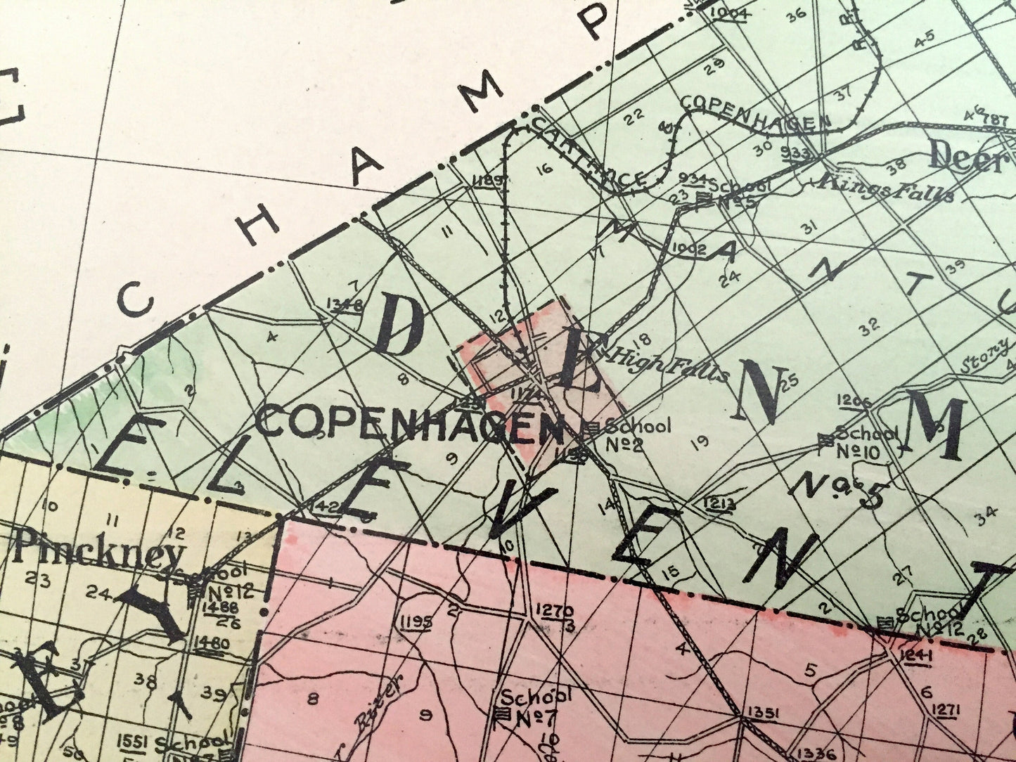
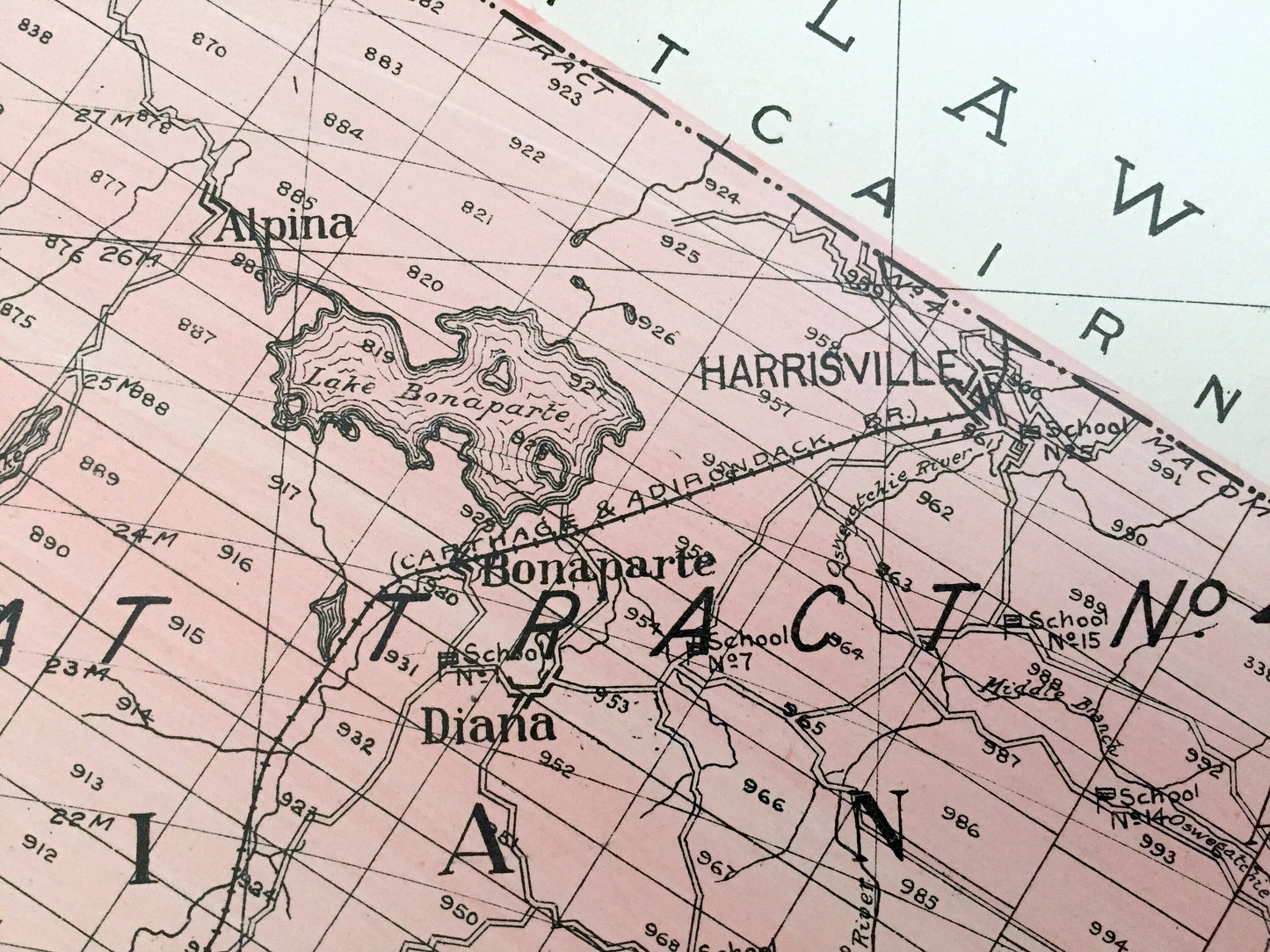
See what Lewis County looked like more than a century ago. Lots of charming, intricate details and contours, including land allotments, names of farms and manufacturing plants and geographical points of interest. It is a very large print and will be a showpiece wherever it is presented. Hand colored. Verso is blank.
Perfect for the historian, map-lover, the curious or just as a conversation starter. Wonderful and rare. Vintage maps such as these make great gifts.
Edition of 1911, printed 1911
Dimensions: 23 1/2" width x 30" height
----
Features
Cities & Towns: Diana, Pinckney, Denmark, Harpsburg, Lowville, Croghan, New Bremen, Watson, Montague, Martinsburg, Greig, Osceola, High Market, Lewis, West Turin, Leyden, Lyonsdale, Alpina, Sterlingbush, Harrisville, Copenhagen, Indian River, Bent Settlement, Jerden Falls, Blodgett Landing, Deer River, Castorland, New Boston, Windecker, Crystal Dale, Wetmore, Houseville, Dannattburg, Chase Lake, Brantingham, Michigan Mills, Fish Creek, Mohawk Hill, Lyons Falls, Pasadena, Talcotville, Port Leyden, Flowersville, Moose River, more.
Points of Interest: Black River, Lake Bonaparte, Round Lake, Fertile Valley, Pine Grove Farm, Moose River, Osceola Railroad and many more ponds, lakes, creeks, rivers, roads, highways, railroads, farms, school houses and elevations.
----
Condition: Very Good Vintage condition, commensurate with age. This map is in incredible shape for being over 100 years old. A fold, as issued, and slight edge-toning, all of which will read as vintage character when framed. (Images of New Century Atlas cover and frontispiece for information only and not included.)
----
We will happily adjust shipping price for multiple purchases. Maps are rolled up and shipped in sturdy mailing tubes, never folded.
Couldn't load pickup availability
Share