My Store
Antique Limestone, Maine 1953 US Geological Survey Topographic Map – Aroostook County, Caswell, ME, Victoria County, New Brunswick, Canada
Antique Limestone, Maine 1953 US Geological Survey Topographic Map – Aroostook County, Caswell, ME, Victoria County, New Brunswick, Canada
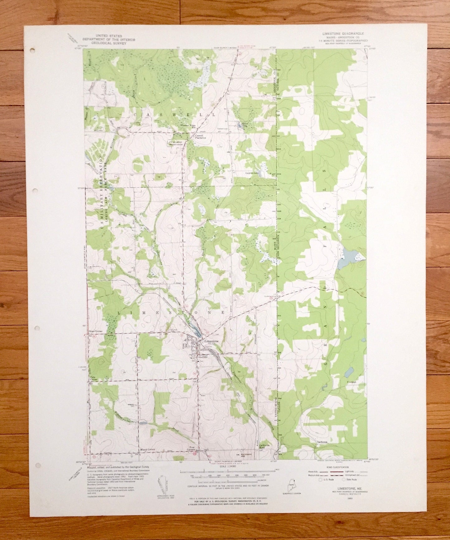
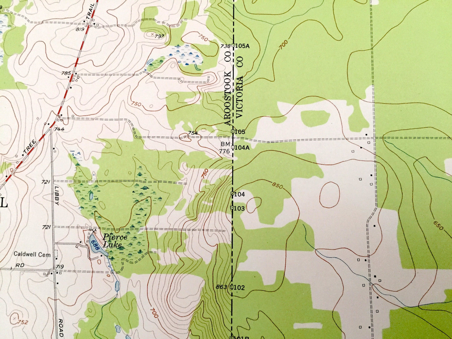
Beautiful, antique map of Limestone, Maine and surrounding Aroostook County areas, including Canada’s Victoria County. This is an authentic 1953 edition, 1955 print from the U.S. Geological Survey and NOT a computer reproduction.
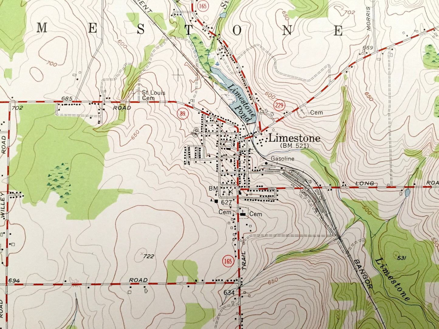
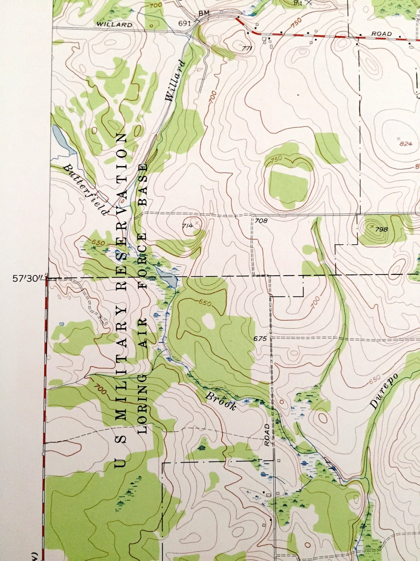
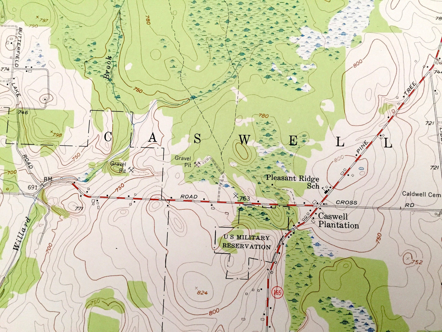
See what Maine looked like over 65 years ago. Lots of intricate details and geological contours. Map even has little squares for every house that existed at the time. The USGS cartographers were very thorough back then!
Perfect for the historian, map-lover, the curious or just as a conversation starter. Wonderful and rare. Vintage maps such as these make great gifts.
Edition of 1953, printed 1955
Dimensions: 22" width x 27" height
----
Features
Cities & Towns: MAINE: Caswell, Caswell Plantation, Grass Corner, Cote Corner, Morris Corner, California Road.
CANADA (NEW BRUNSWICK): Grand Falls, California, Costigan.
Points of Interest: US Military Reservation (Loring Air Force Base), Pierce Lake, Layton Lake, Limestone Pond, Limestone Stream, Webster Brook, Durepo Brook, Willard Brook, Kennison Road, and many more hills, streams, ponds, houses, schools, railroads, churches and roads.
Condition: Very Good Vintage condition, commensurate with age. This map is in great shape for being over 65 years old. Has subtle edge-wear and a four-hole-punch on the left hand margin, all of which will read as character when framed.
----
We will happily adjust shipping price for multiple purchases. Maps are rolled up and shipped in sturdy mailing tubes, never folded.
Couldn't load pickup availability
Share