My Store
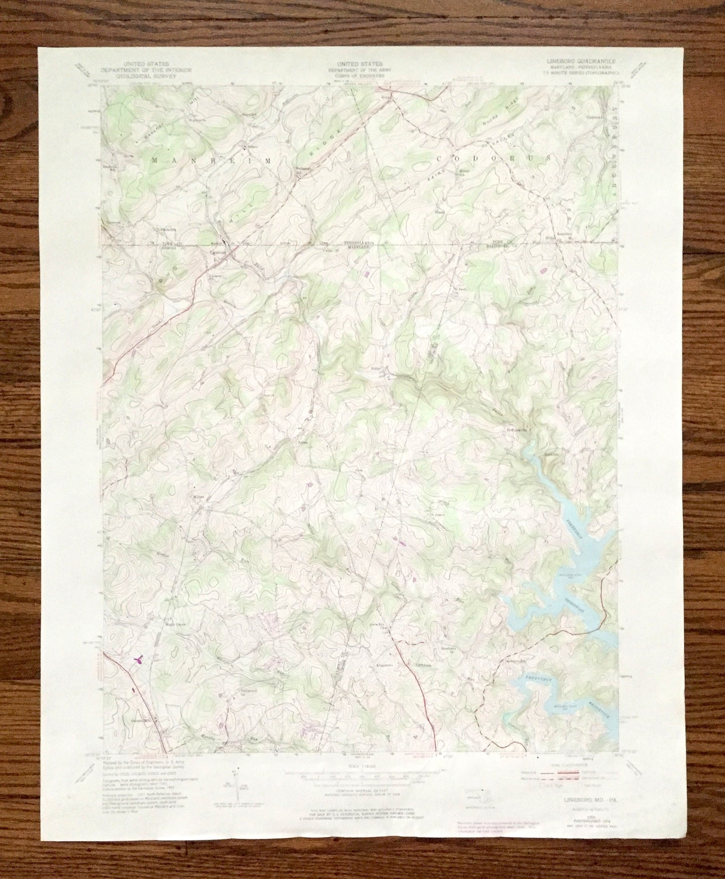
Antique Lineboro, Maryland 1953 US Geological Survey Topographic Map – Carroll County, York, Prettyboy Reservoir, Manheim Pennsylvania MD PA
Antique Lineboro, Maryland 1953 US Geological Survey Topographic Map – Carroll County, York, Prettyboy Reservoir, Manheim Pennsylvania MD PA
Beautiful, antique map of Lineboro, Millers, Maple Grove and Albantown, Maryland including Codorus and Manheim, Pennsylvania. This is an authentic 1953 edition, 1975 print from the U.S. Geological Survey and NOT a computer reproduction.
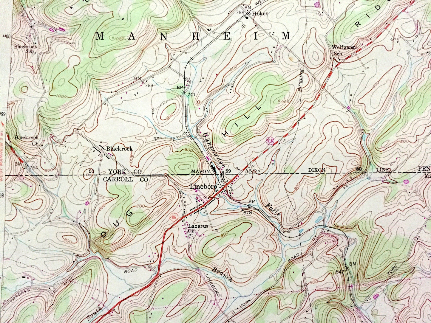
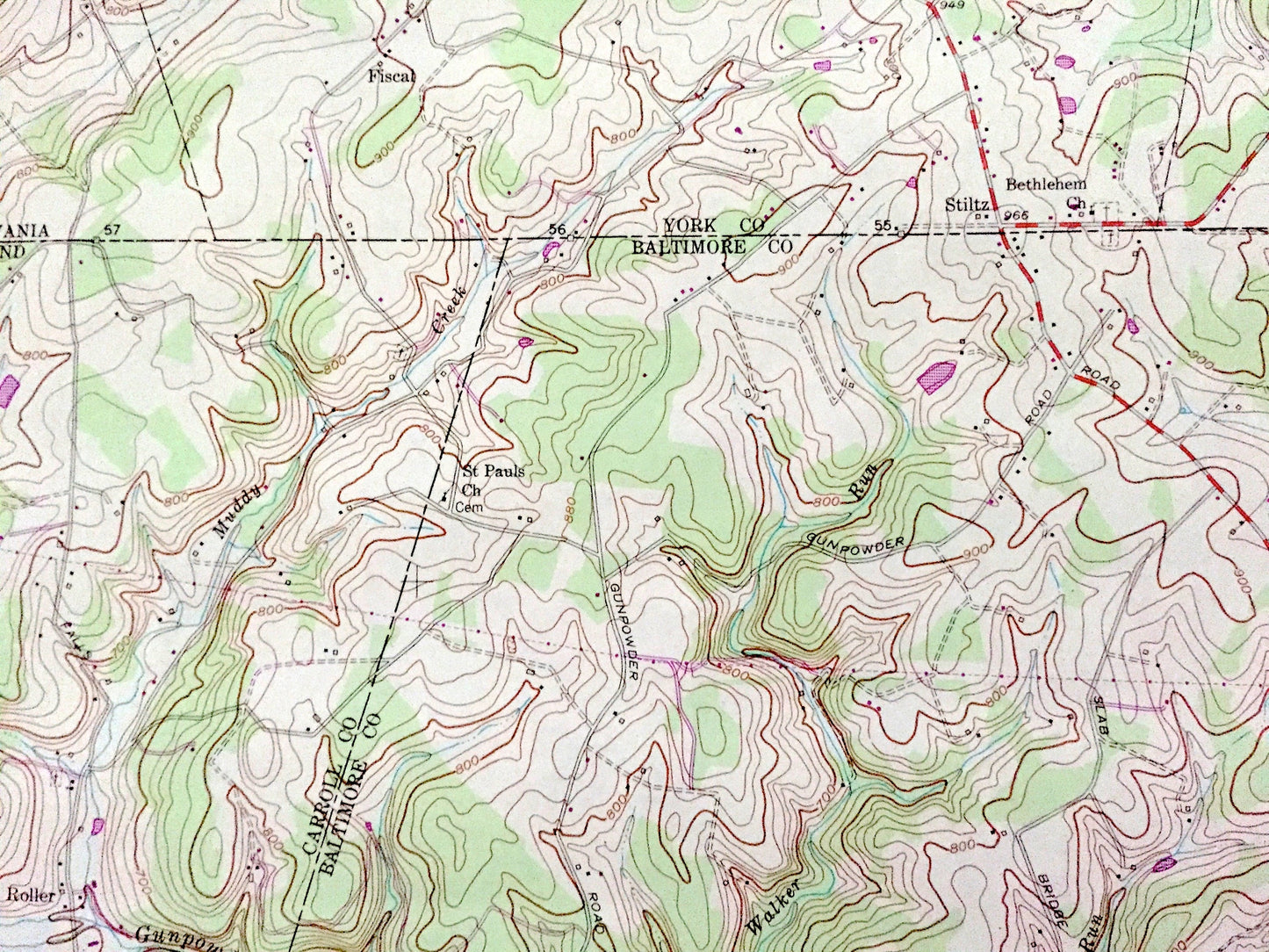
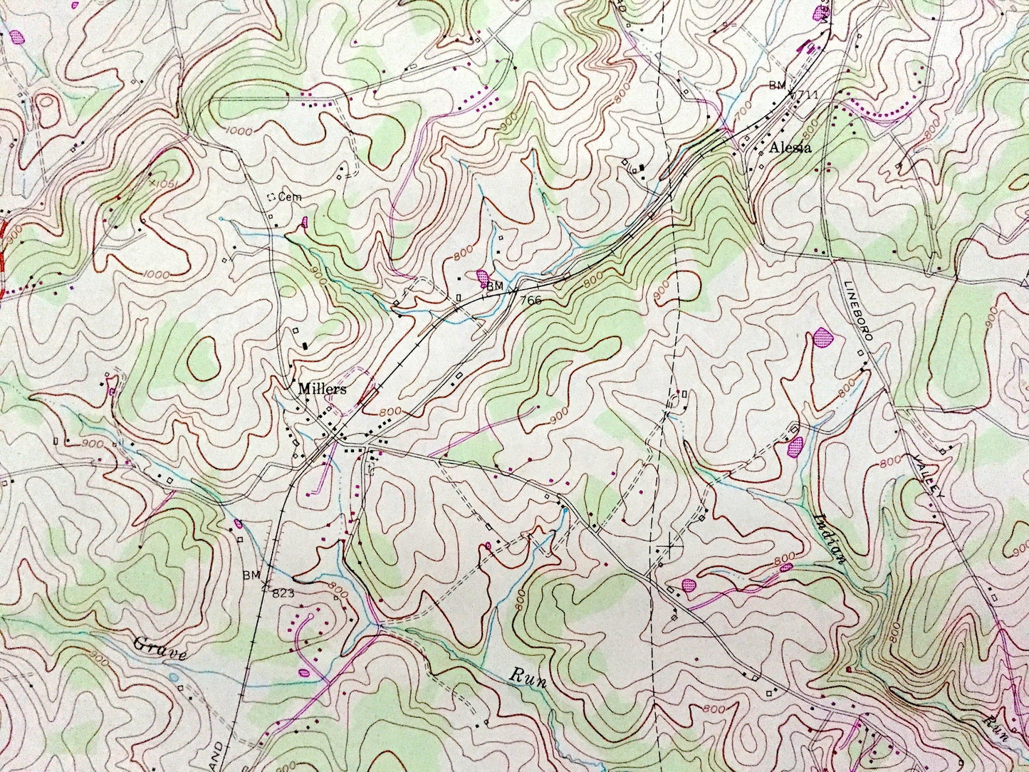
See what Baltimore and Carroll Counties of Maryland and York County of Pennsylvania looked like almost 70 years ago. Lots of intricate details and geological contours. Map even has little squares for every house that existed at the time. The USGS cartographers were very thorough back then!
Perfect for the historian, map-lover, the curious or just as a conversation starter. Wonderful and rare. Vintage maps such as these make great gifts.
Edition of 1953, printed 1975
Dimensions: 22" width x 27" height
----
Features
Cities & Towns: MARYLAND: Roller, Lineboro, Millers, Maplegrove, Albantown, Beckleysville, Hoffmanville, Greenmount.
PENNSYLVANIA: Manheim, Blackrock, Hokes, Codorus, Stiltz, Hildebrand.
Points of Interest: Beecher Hill, Dug Hill Ridge, Fairs Valley, Millers School, Lazarus Church, Gunpowder Falls, Prettyboy Reservoir, Western Maryland Rairlorad, and lots more streams, houses, churches , towns, and roads
Condition: Good Vintage condition, commensurate with age. This map is in incredible shape for being over 45 years old. Has some edge-wear and toning, but this will add to vintage character when framed.
----
We will happily adjust shipping price for multiple purchases. Maps are rolled up and shipped in sturdy mailing tubes, never folded.
Couldn't load pickup availability
Share