My Store
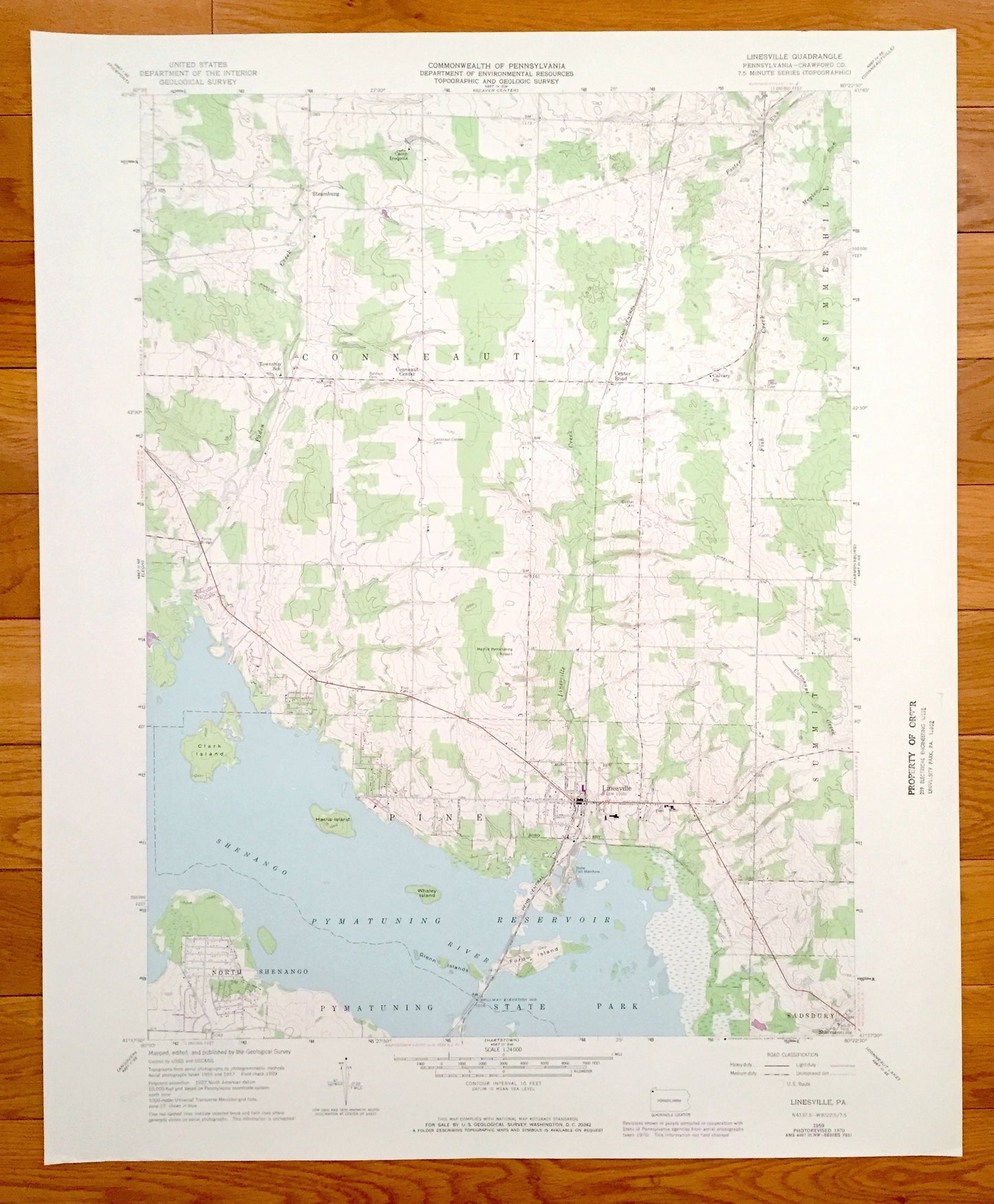
Antique Linesville, Pennsylvania 1959 US Geological Survey Topographic Map – Crawford County, Steamburg, Summit, Shenango Pymatuning Lake PA
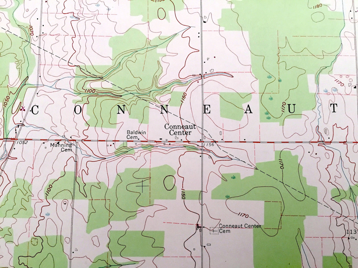
Antique Linesville, Pennsylvania 1959 US Geological Survey Topographic Map – Crawford County, Steamburg, Summit, Shenango Pymatuning Lake PA
Beautiful, antique map of Linesville, Pennsylvania and surrounding Crawford County area. This is an authentic 1959 edition, 1970 print from the U.S. Geological Survey and NOT a computer reproduction.
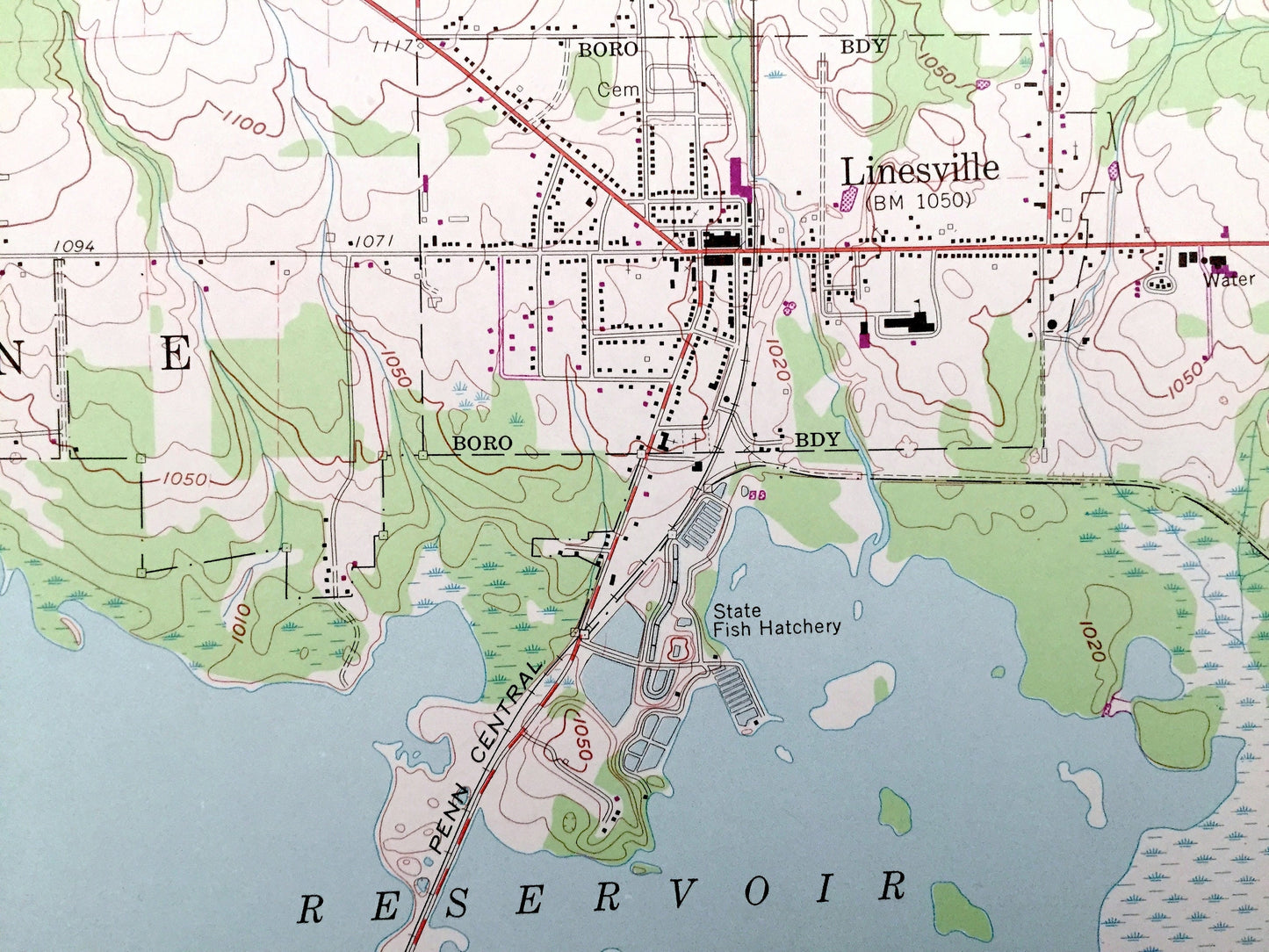
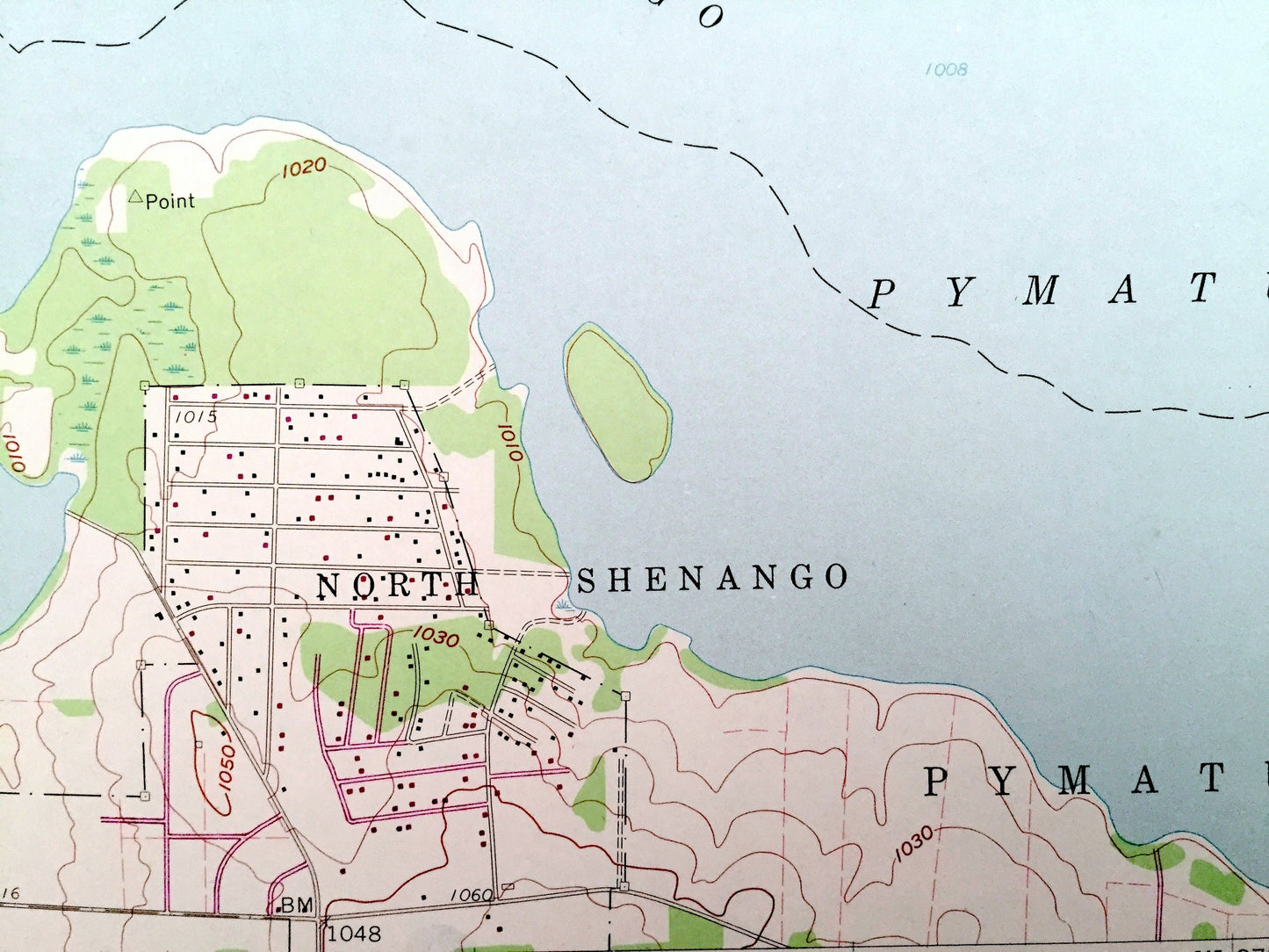
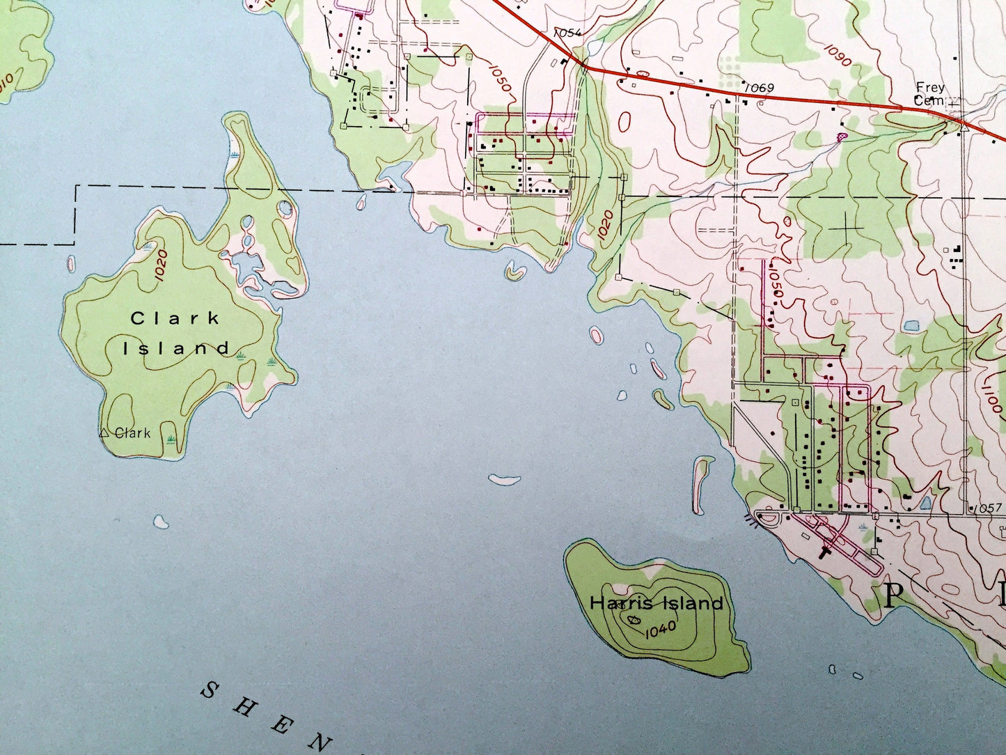
See what Pennsylvania looked like over 60 years ago. Lots of intricate details and geological contours. Map even has little squares for every house that existed at the time. The USGS cartographers were very thorough back then!
Perfect for the historian, map-lover, the curious or just as a conversation starter. Wonderful and rare. Vintage maps such as these make great gifts.
Edition of 1959, printed 1970
Dimensions: 22" width x 27" height
----
Features
Cities & Towns: Linesville, Conneaut Center, Steamburg, Camp Iroquois, Center Road, Conneaut, North Shenango, Pine, Sadsbury, Summit, Summerhill.
Points of Interest: Shenango RIver, Pymatuning Reservoir, Pymatuning State Park, Ford Island, Glenn Islands, Penn Central Railroad, Whaley Island, Harris Island, Clark Island, Merrys Pymatuning Airport, Linesville Creek, Foster Run, Old Railroad, Paden Creek, and many more hills, streams, ponds, houses, schools, churches and roads.
Condition: Very Good Vintage condition, commensurate with age. This map is in great shape for being over 50 years old. This map was most likely used in the field. Has light-edge wear, but this will read as vintage character when framed.
----
We will happily adjust shipping price for multiple purchases. Maps are rolled up and shipped in sturdy mailing tubes, never folded.
Couldn't load pickup availability
Share