My Store
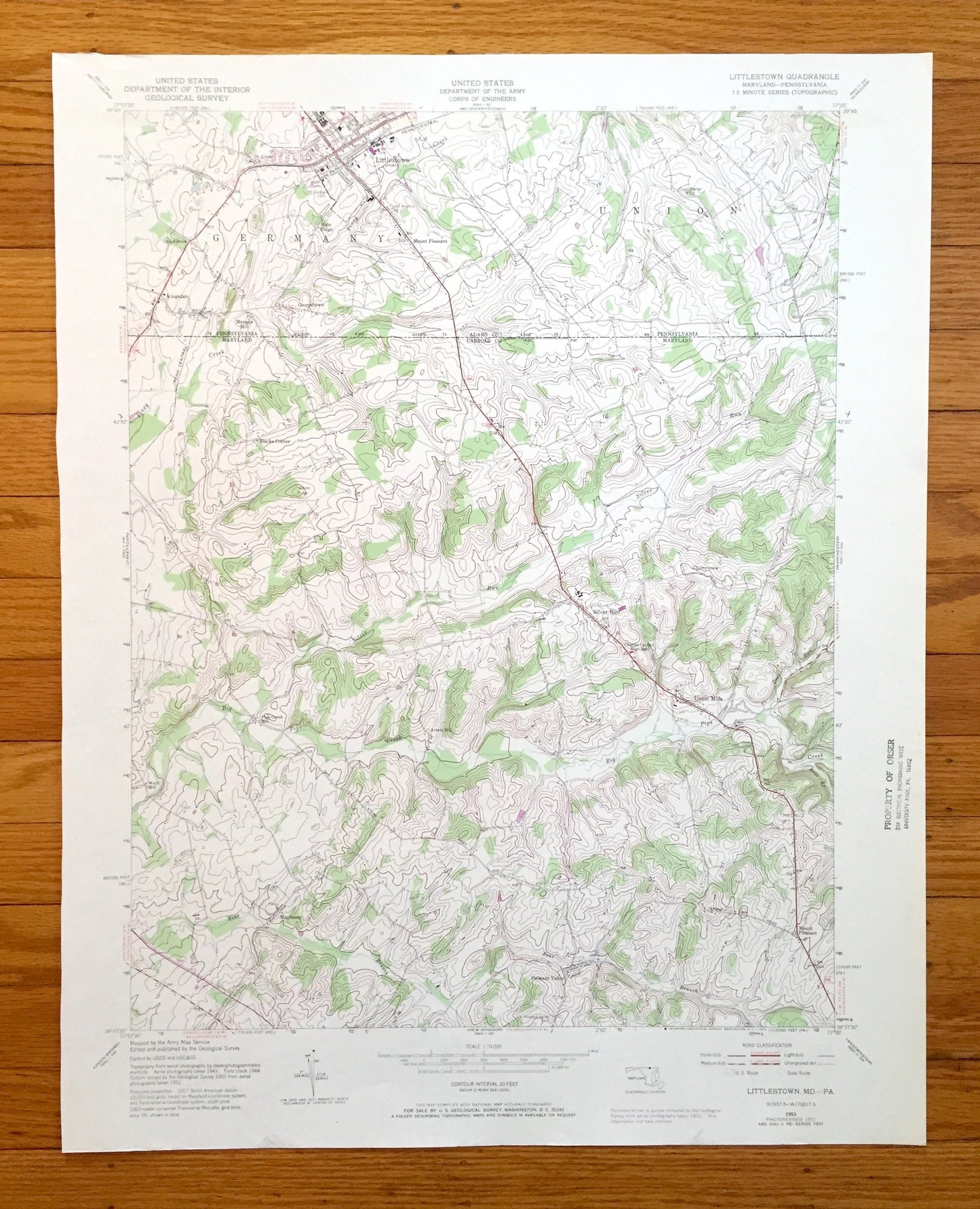
Antique Littlestown, Pennsylvania 1953 US Geological Survey Topographic Map – Adams County, Germany, PA, Carroll County, Silver Run, MD
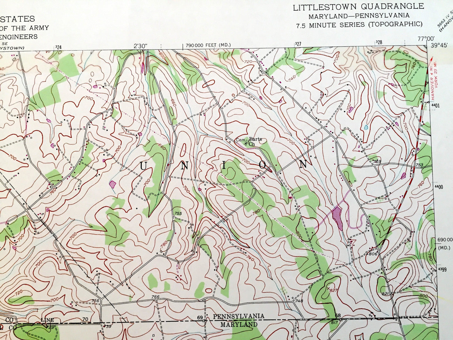
Antique Littlestown, Pennsylvania 1953 US Geological Survey Topographic Map – Adams County, Germany, PA, Carroll County, Silver Run, MD
Beautiful, antique map of Littlestown, Pennsylvania and surrounding Adams County areas, including Maryland’s Carroll County. This is an authentic 1953 edition, 1972 print from the U.S. Geological Survey and NOT a computer reproduction.
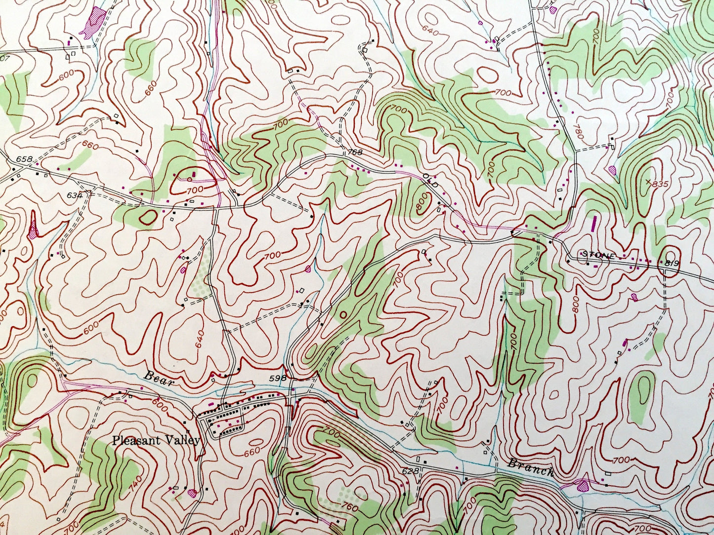
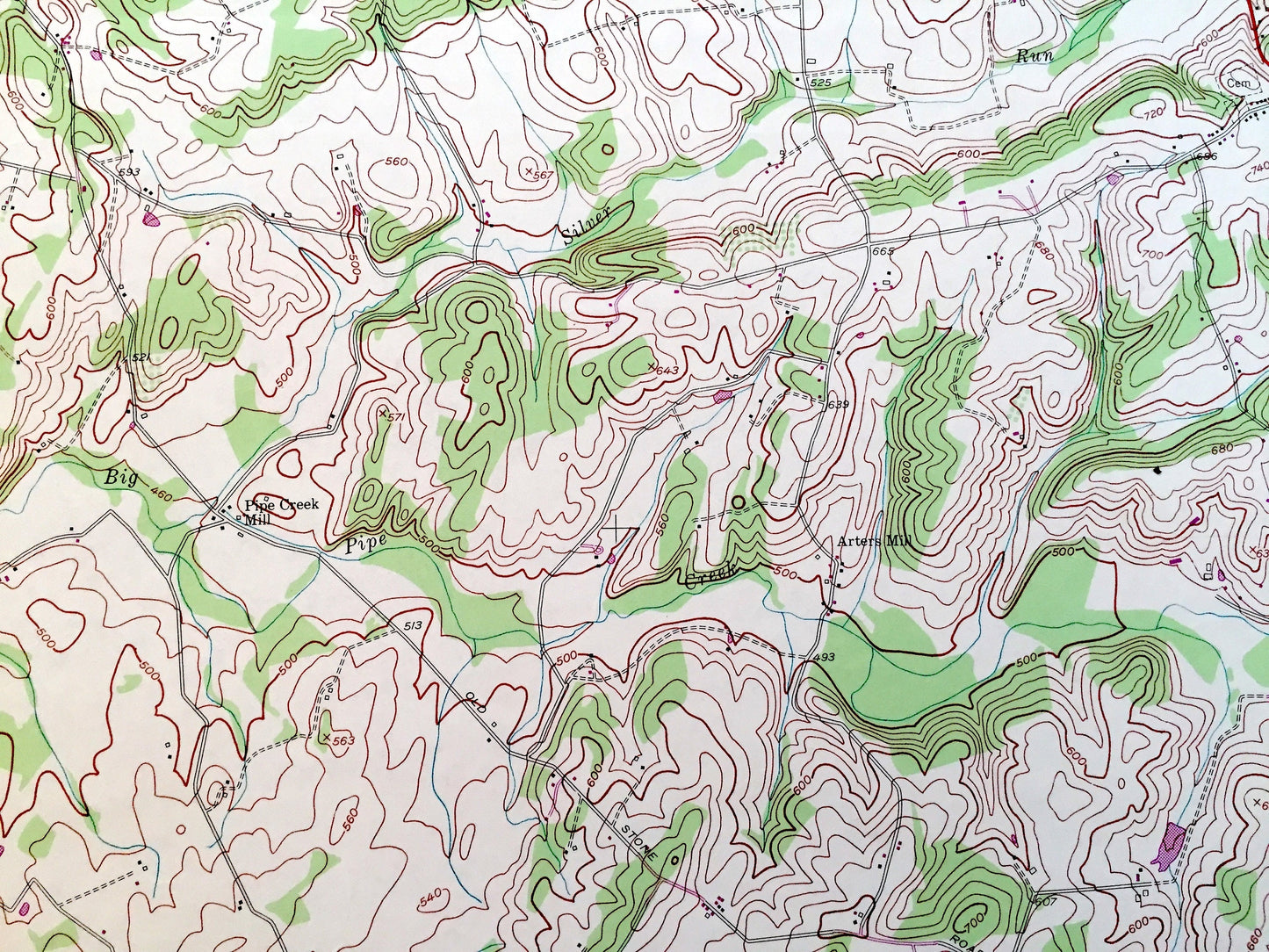
See what Pennsylvania and Maryland looked like over 70 years ago. Lots of intricate details and geological contours. Map even has little squares for every house that existed at the time. The USGS cartographers were very thorough back then!
Perfect for the historian, map-lover, the curious or just as a conversation starter. Wonderful and rare. Vintage maps such as these make great gifts.
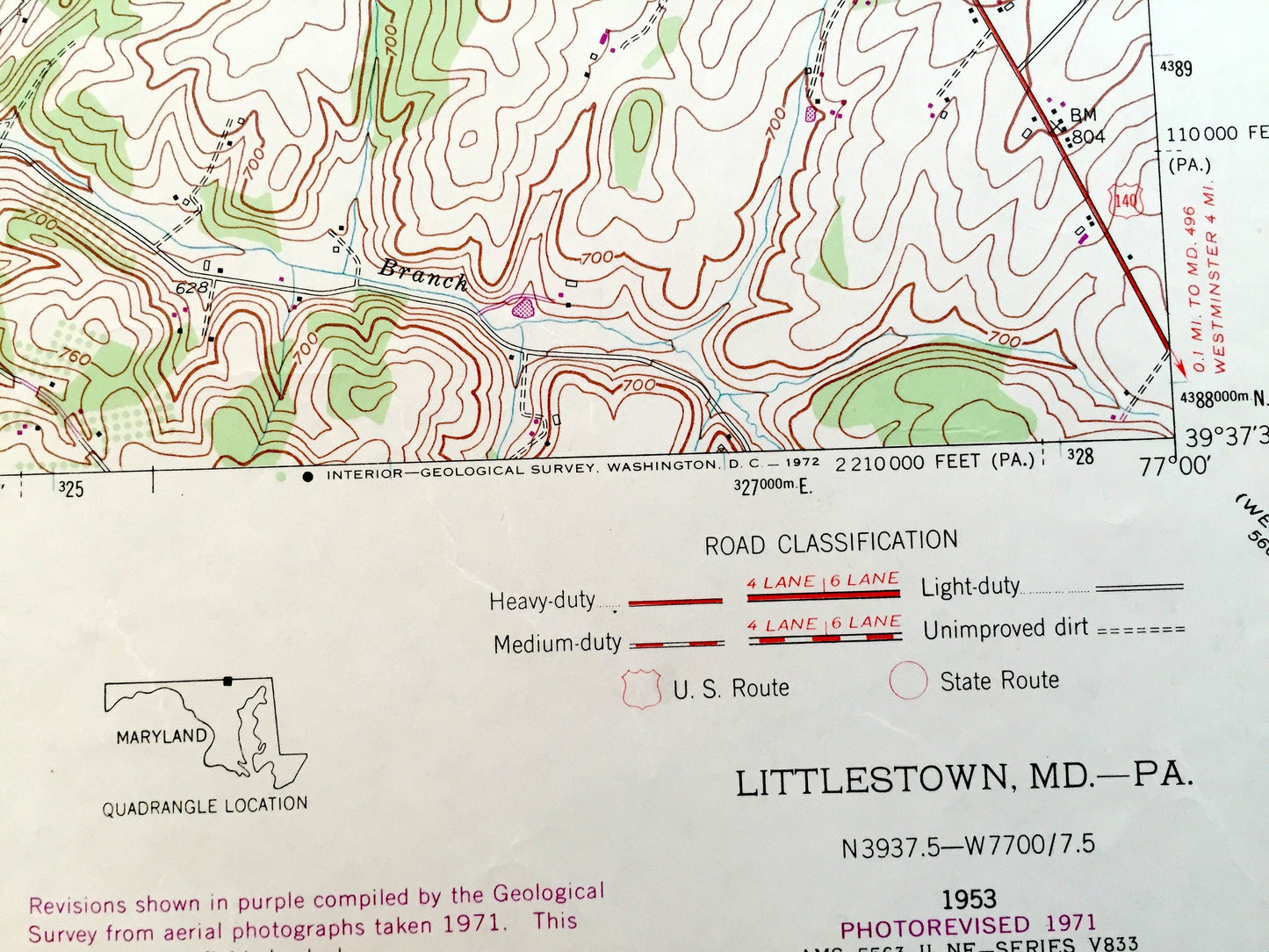
Edition of 1953, printed 1972
Dimensions: 21 1/2" width x 27" height
----
Features
Cities & Towns:
PENNSYLVANIA: Germany, Union, Oak Grove, Kingsdale, Menges Mill, Mount Pleasant, Slate Ridge, Georgetown.
MARYLAND: Silver Run, Union Mills, Cherrytown, Mayberry, Pleasant Valley, Mount Pleasant, Wolfs Mill.
Points of Interest: Mason and Dixon Line, Piney Creek, Silver Run, Big Pipe Creek, Bear Branch, and many more hills, streams, ponds, houses, schools, railroads, churches and roads.
Condition: Very Good Vintage condition, commensurate with age. This map is in great condition for being over 50 years old. Has subtle edge-wear and few pieces if tape but will read as character when framed.
----
We will happily adjust shipping price for multiple purchases. Maps are rolled up and shipped in sturdy mailing tubes, never folded.
Couldn't load pickup availability
Share