My Store
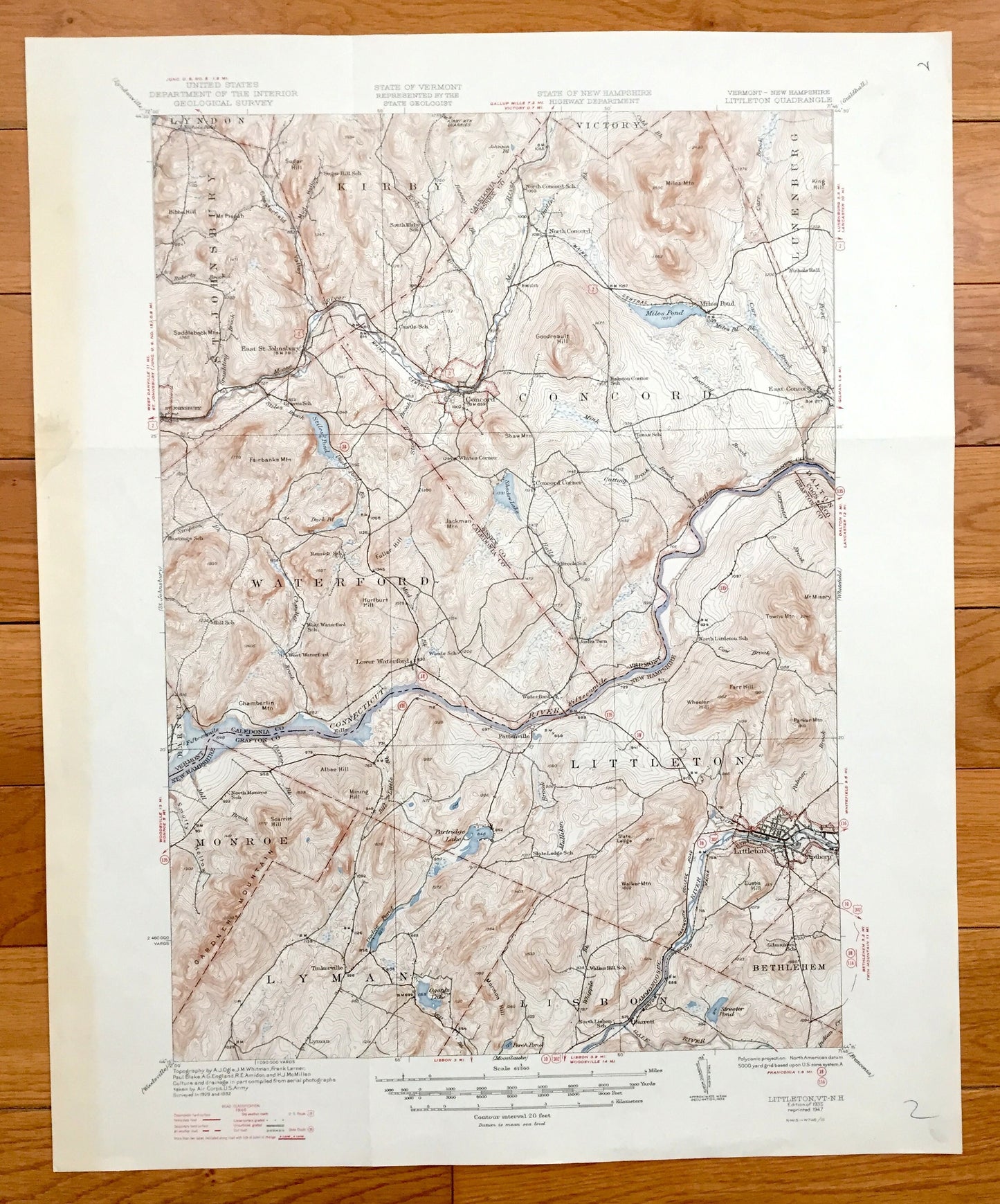
Antique Littleton, New Hampshire 1935 US Geological Survey Topographic Map – Lisbon, Waterford, Monroe, Lyman, Apthorp Concord Vermont NH VT
Antique Littleton, New Hampshire 1935 US Geological Survey Topographic Map – Lisbon, Waterford, Monroe, Lyman, Apthorp Concord Vermont NH VT
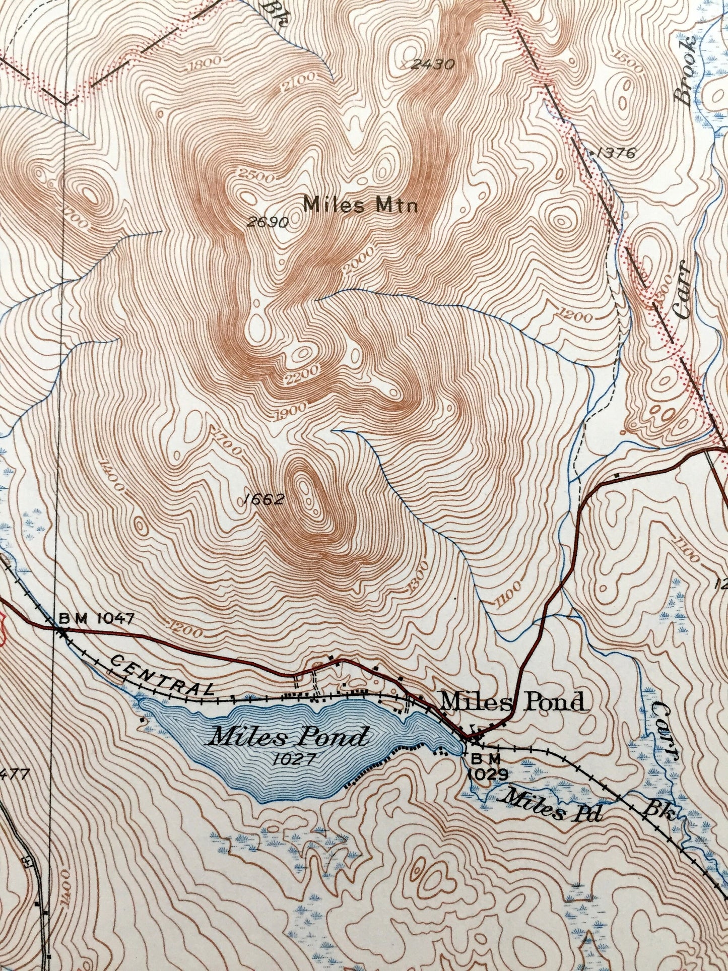
Beautiful, antique map of Littleton, New Hampshire and Concord, Vermont and surrounding Grafton County, NH and Caledonia and Essex County, VT area on the Connecticut River. This is an authentic 1935 edition, 1947 print from the U.S. Geological Survey and NOT a computer reproduction.
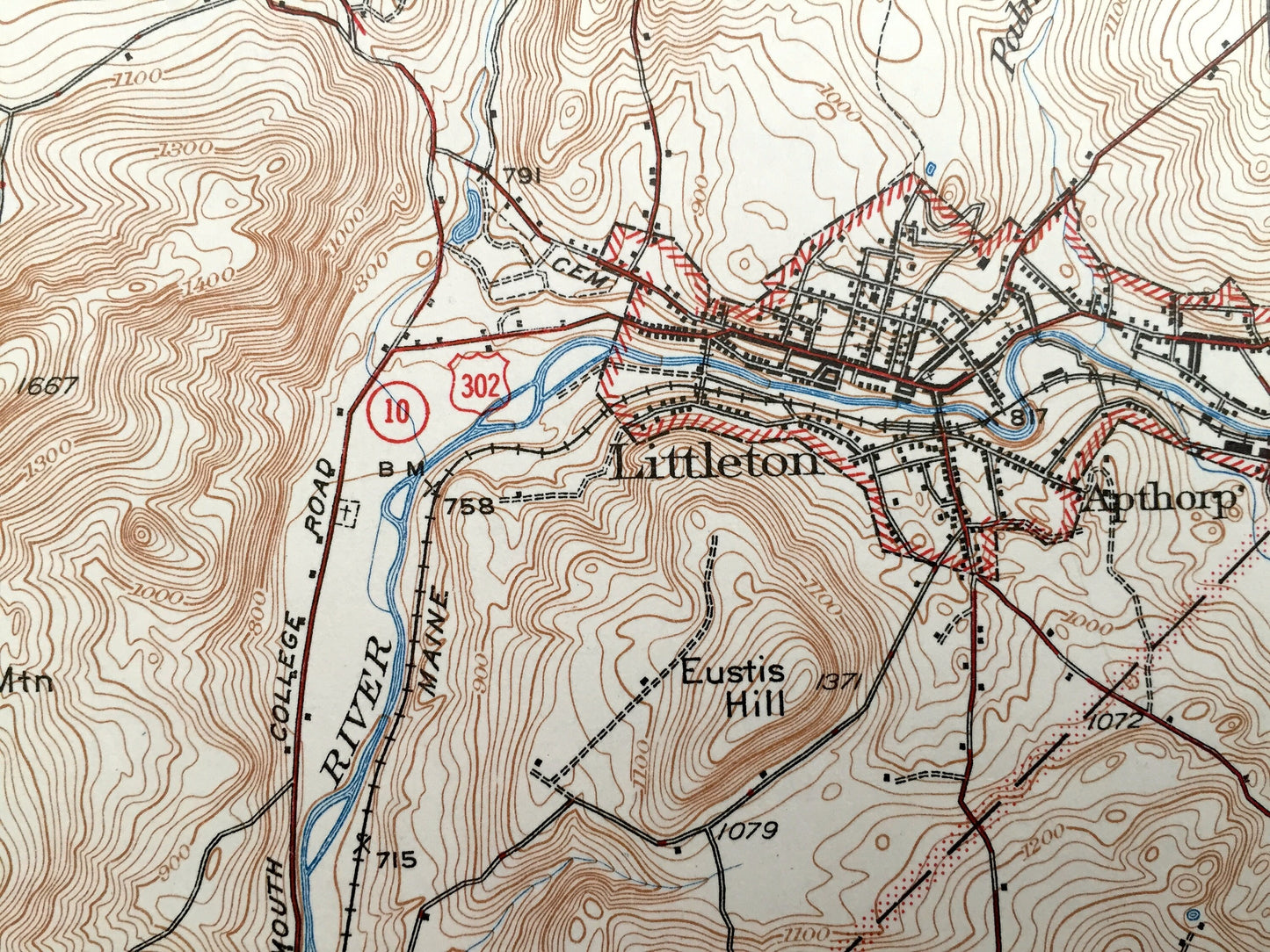
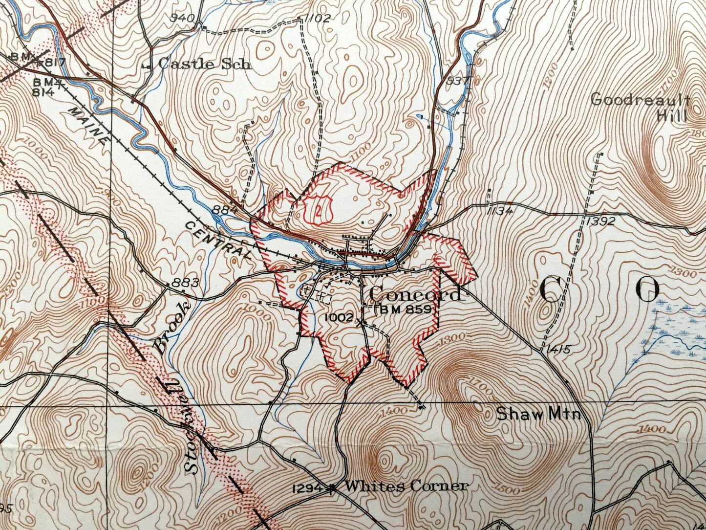
See what Littleton looked like over 85 years ago. Lots of intricate details and geological contours. Map even has little squares for every house that existed at the time. The USGS cartographers were very thorough back then! On the back is a description of topographic symbols and map guide.
Perfect for the historian, map-lover, the curious or just as a conversation starter. Wonderful and rare. Vintage maps such as these make great gifts.
Edition of 1935, printed 1947
Dimensions: 17" width x 21" height
----
Features
Cities & Towns: VERMONT: Lyndon, St. Johnsbury, Kirby, Victory, Concord, Lunenburg, Waterford, East St. Johnsbury, North Concord, Miles Pond, East Concord, West Waterford, Barnet, Lower Waterford, Concord Corner, Joslin Turn.
NEW HAMPSHIRE: Monroe, Lyman, Lisbon, Littleton, Bethlehem, Tinkerville, Pattenville, Apthorp, Dalton.
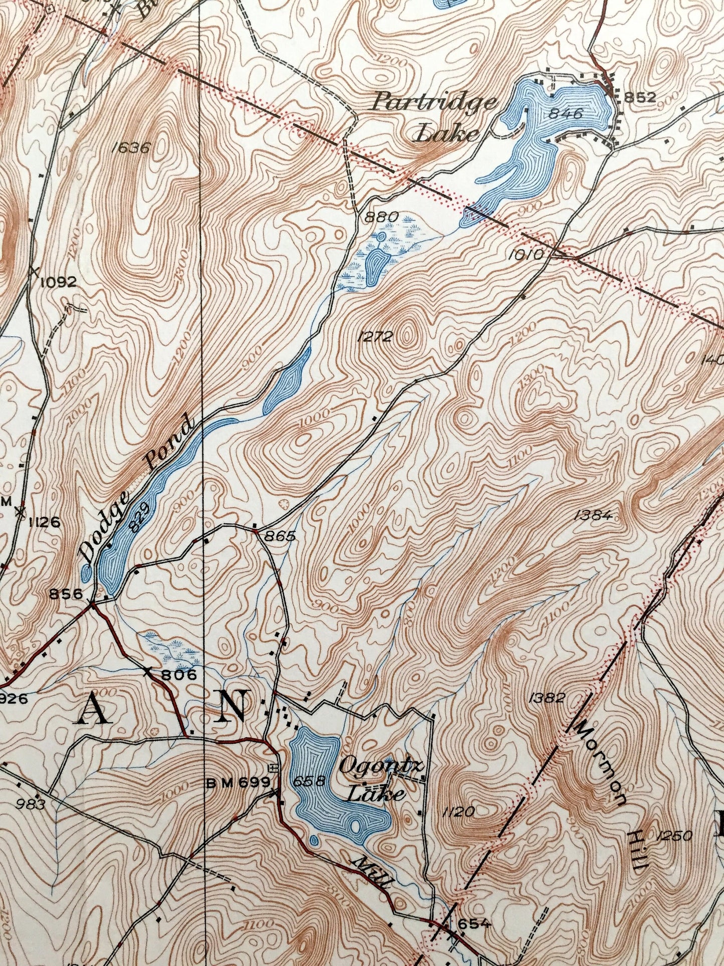
Points of Interest: Connecticut River, Miles Pond, Partridge Lake, Ammonoosuc River, Stiles Pond, Shadow Lake, Moose River, Miles Mountain, Chesterfield Valley, Fairbanks Mountain, Jackman Mountain, Mount Misery, Gardner Mountain, Halls Brook, Faribanks Mountain, Frank D. Comerford Hydro-Electric Plant, Fifteenmile Falls, Parker Mountain, Hunt Mountain and many more roads, houses, schools, streams, ponds, mountains and hills.
Condition: Good Vintage condition, commensurate with age. This map is in great shape for being over 70 years old. Map has light wear, foxing, a coloring along left margin and folds as-issued, but these will flatten easily and all will read as vintage character when framed.
----
We will happily adjust shipping price for multiple purchases. Maps are rolled up and shipped in sturdy mailing tubes, never folded.
Couldn't load pickup availability
Share