My Store
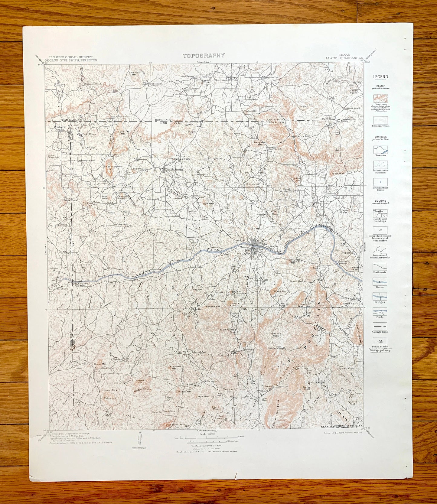
Antique Llano, Texas 1911 US Geological Survey Topographic Map – San Saba, Mason County, Cherokee, Pontotoc, Taylorsville, Lone Grove TX
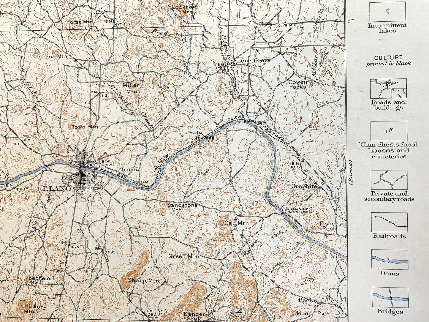
Antique Llano, Texas 1911 US Geological Survey Topographic Map – San Saba, Mason County, Cherokee, Pontotoc, Taylorsville, Lone Grove TX
Beautiful, antique map of Llano, Texas and surrounding Llano County, San Saba County & Mason County area. This is an authentic 1909 edition, 1911 print from the U.S. Geological Survey and NOT a computer reproduction.
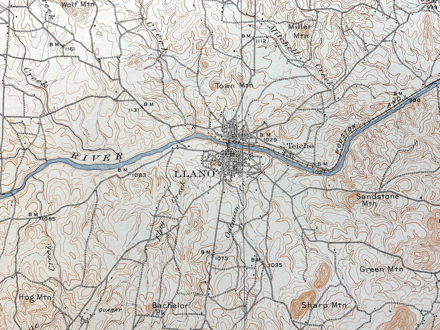
See what West Austin looked like over 110 years ago. Lots of intricate details and geological contours. Map even has little squares for every house that existed at the time. The USGS cartographers were very thorough back then!
Perfect for the historian, map-lover, the curious or just as a conversation starter. Wonderful and rare. Vintage maps such as these make great gifts.
Edition of 1909, printed 1911
Dimensions: 18 1/2" width x 22" height
----
Features
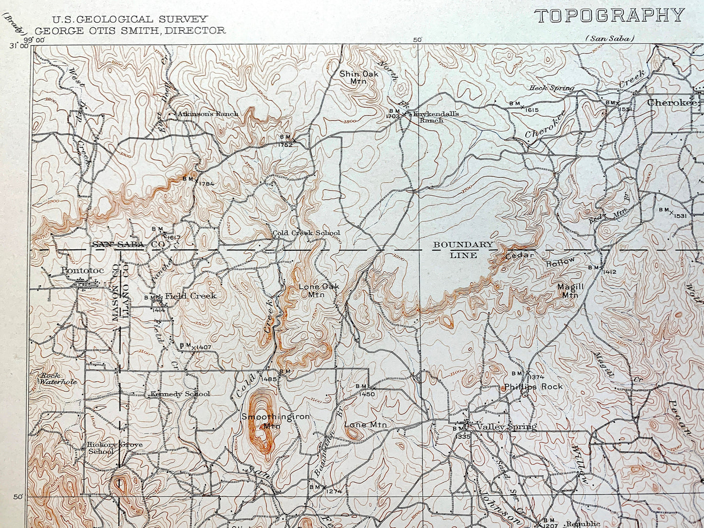
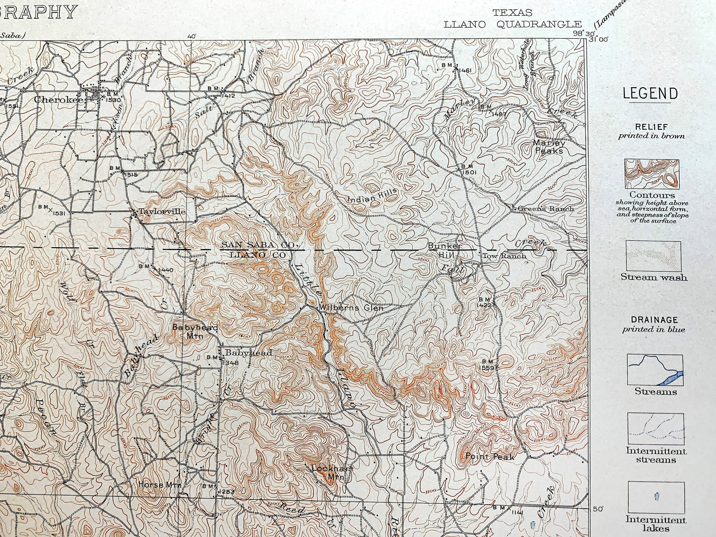
Cities, Towns & Neighborhoods: Llano, Cherokee, Pontotoc, Taylorsville, Lone Grove, Oxford, Click, Sixmile, Starkes, Castell, Esbon, Valley Spring, Babyhead, Republic, Teiche, Graphite.
Points of Interest: Llano County, San Saba County, Mason County, Llano River, Riley Mountain, Dancer Peak, Cedar Mountain, Honey Creek, Hickory Bluff, Marley Peaks, Indian Hills, Bullhead Mountain, and lots more hills, creeks, towns, schools, churches, roads and train tracks.
Condition: Very Good Vintage condition, commensurate with age. This map is in great shape for being over 110 years old. Has light edge-wear and staple holes in the margin, but this will add to vintage character when framed.
----
We will happily adjust shipping price for multiple purchases. Maps are rolled up and shipped in sturdy mailing tubes, never folded.
Couldn't load pickup availability
Share