My Store
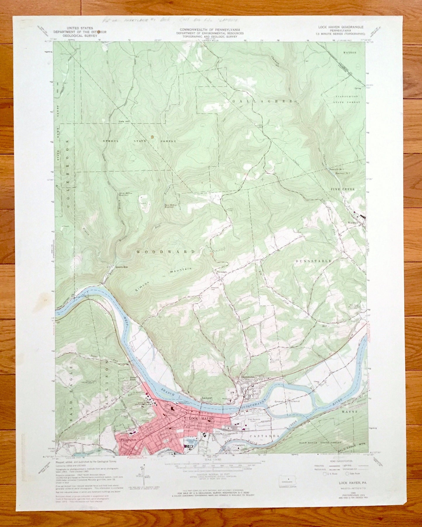
Antique Lock Haven, Pennsylvania 1965 US Geological Survey Topographic Map – Clinton County, Flemington, Woodward, Gallagher, Dunnstable, PA
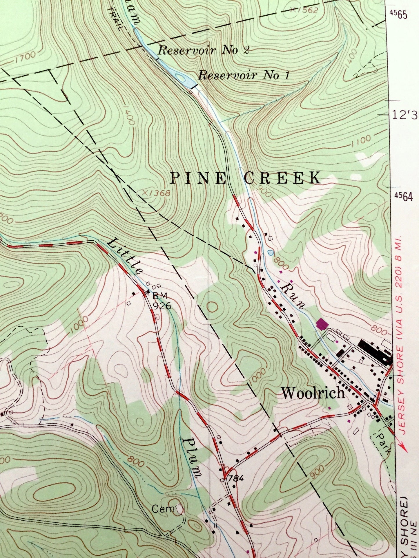
Antique Lock Haven, Pennsylvania 1965 US Geological Survey Topographic Map – Clinton County, Flemington, Woodward, Gallagher, Dunnstable, PA
Beautiful, antique map of Lock Haven, Pennsylvania and surrounding Clinton County area. This is an authentic 1965 edition, 1973 print from the U.S. Geological Survey and NOT a computer reproduction.
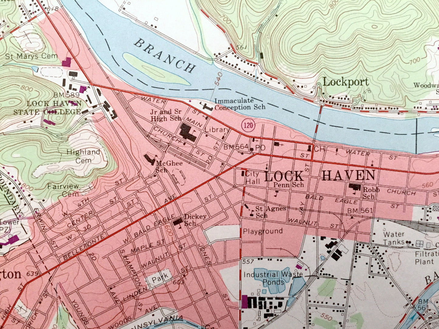
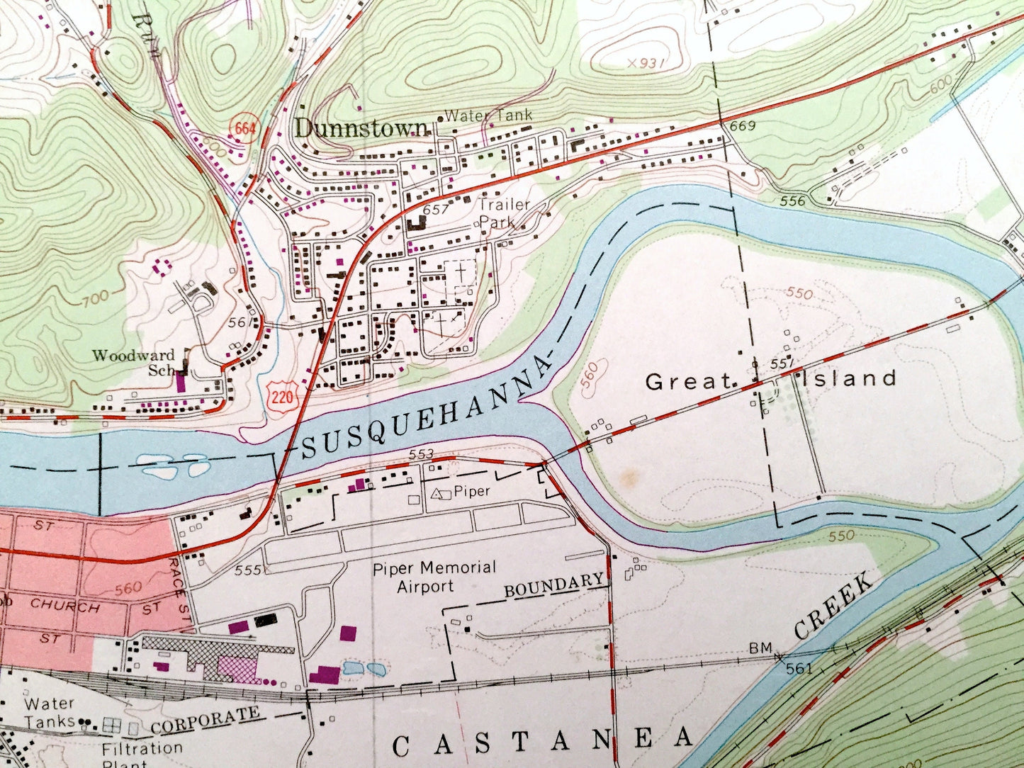
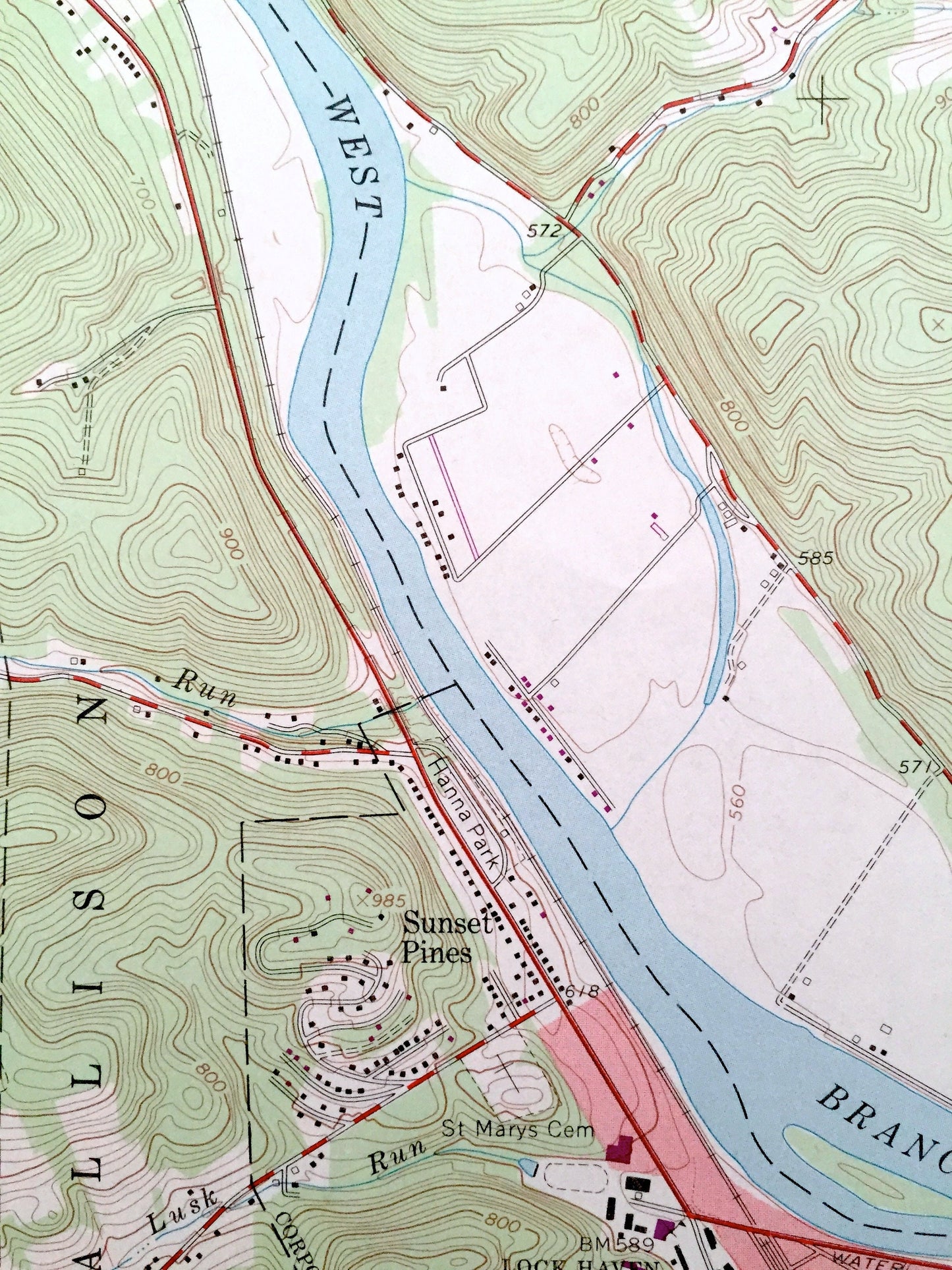
See what Pennsylvania looked like almost 60 years ago. Lots of intricate details and geological contours. Map even has little squares for every house that existed at the time. The USGS cartographers were very thorough back then!
Perfect for the historian, map-lover, the curious or just as a conversation starter. Wonderful and rare. Vintage maps such as these make great gifts.
Edition of 1965, printed 1973
Dimensions: 22" width x 27" height
----
Features
Cities & Towns: Lock Haven, Flemington, Sunset Pines, Dunnstown, Lockport, Queens Run, Swissdale, Woolrich, Castanea, Wayne, Allison, Bald Eagle, Woodward, Dunnstable, Pine Creek, Gallagher, Colebrooke.
Points of Interest: West Branch Susquehanna River, Bald Eagle Creek, Bald Eagle State Forest, Bald Eagle Mountain, Penn Central Railroad, Great Island, Piper Memorial Airport, Lock Haven State College, Sugar Run, Radio Towers, Simcox Mountain, State Game Lands, Jeep Trails, Sproul State Forest, Cole Hill, Tiadaghton State Forest, Chatham Run, Ram Hollow Reservoir, Jerry Hollow Reservoir, and many more hills, streams, ponds, houses, schools, churches and roads.
Condition: Good Vintage condition, commensurate with age. This map is in great shape for being 50 years old. This map was most likely used in the field. Has light-edge wear and pencil markings, but this will read as vintage character when framed.
----
We will happily adjust shipping price for multiple purchases. Maps are rolled up and shipped in sturdy mailing tubes, never folded.
Couldn't load pickup availability
Share